I won’t be posting tomorrow so I will take this opportunity to wish you all a Merry Christmas and safe travels.
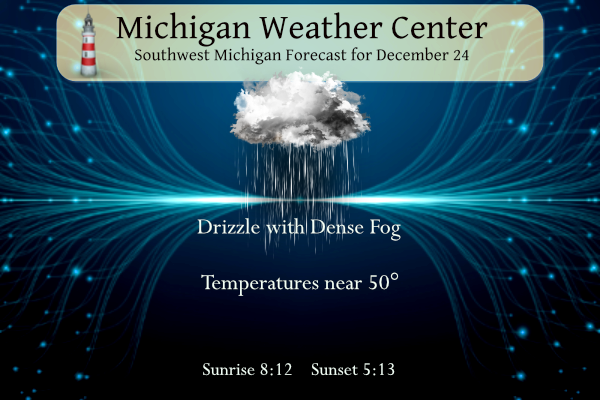
We have a dense fog advisory in place for much of the state which is set to expire at 11:00 am this morning. Fog and clouds will persist for much of today with some drizzle possible. Temperatures will be well above normal with highs in the upper 40s to lower 50s. Rain will arrive later in the day on Christmas. This will be followed by colder temperatures for the latter part of the week with a chance for snow.
Forecast
Weather History
1993: A Christmas Eve snowstorm drops from 3 to 8 inches of snow across Lower Michigan and ushers in several weeks of severe winter weather.
On December 24, 2017, a storm strengthened and pulled in cold air as it moved from west to east across the area. Snow totals ranged from 2-4″ west of US-23 to 4-7″ to the east. Peak measurements of 6.1″ and 6.8″ were made in Macomb County.
Also, December 24, 1983, was a very cold day across Southeast Michigan. Detroit only had a high temperature of 3 degrees above zero, and the low was 9 degrees below zero. Flint and Saginaw were not much warmer with respective highs of 6 and 7 degrees, and lows of 5 below and 3 below zero. December 1983 was the 5th coldest December for Detroit and Flint, and it was the 3rd coldest December for Saginaw.
Forecast Discussion
- Widespread dense fog this morning -

Trends in sfc obs from across our area early this morning indicate
that fog continues to become more dense and widespread. A
consensus of latest higher res guidance progs for sfc visbys
corroborated by trends the past several hours indicate fog will be
or become dense and widespread through late morning.

The dense fog advisory headline hoisted by the eve shift
yesterday looks excellent and will remain unchanged. KGRR radar
trends also indicate patchy drizzle which will linger today as
well as a result of abundant low level moisture but an unsaturated
dgz.

- Fairly tranquil weather this afternoon through Monday -

Conditions will gradually improve this afternoon as se winds
increase a bit and help to mix out the areas of fog. High temps
today will range from the mid 40s over our ne fcst area to the
lower 50s near to south of the I-96 corridor.

Tranquil wx is forecast tonight through Monday morning and fog
won`t be nearly as prevalent or dense tonight given a significant
increase in boundary layer mixing. Increasing southeast to
southerly winds will help to boost high temps well into the 50`s
on Monday. Some warm air advection rain showers will gradually
move in from the south in the afternoon.

.LONG TERM...(Monday night through Sunday)
Issued at 300 AM EST Sun Dec 24 2023

- Warm, wet, unsettled into Wednesday -

No changes to previous forecast thinking. Confidence is high that
persistent rain can be expected. This confidence is based on strong
agreement among the Canadian, GEFS, and ECMWF ensembles; this is
illustrated by nearly identical weighting and precipitation
forecasts among the clusters. There is a weak signal for a brief
cessation of precipitation Wednesday morning over far southern Lower
Michigan associated with dry slotting aloft behind an exiting
deformation area, but that`s about the only detail of note that
stands out at this time.

- Colder with lake effect snow possible Thursday through Sunday -

Overall, expectations about the prospects for accumulating snow
haven`t changed since the previous discussion. There is a continued
weak to moderate signal for lake effect snow in the Thursday through
Sunday timeframe, with any accumulations mostly close to the
lakeshore. Impacts are not expected to be significant.

Ensemble solutions do become more disparate beginning Thursday. The
most plausible scenario is for a deep and open upper trough to
persist over the Great Lakes region during this time, which would
favor lake effect snow given colder air and deep cyclonic flow.
However, other clusters develop a cutoff low over the southeast
United States, resulting in less phasing of flow aloft and reducing
the prospects for cold air incursion into the area and lake effect
snow.

For Friday evening, an uptick in lake effect snow looks plausible
based on the general tendency of the ensembles to drop an upper
trough southward across the western Great Lakes. This of course
could affect weekend holiday travel and will need to be watched.

After this, we see continued northwest flow aloft over the weekend.
Solution differences among the clusters appear to be chiefly related
to timing disparities in the passage of minor shortwave troughs in
the flow.
A slow start to Winter makes a wonderful Christmas gift. Warm holiday wishes to all.
I could not disagree more! A cold, snowy Christmas is always a better gift! Bring it!
It’s wild when the low temp is 10 degrees warmer than the average high.
Merry Christmas to all of my ‘friends’ here. I pray you all have a wonderful day and for those that are missing some special people this Christmas, I am sending you a virtual hug!
Merry Christmas everyone!
I will do a short post tomorrow.
Slim
The official H/L yesterday at Grand Rapids was 46/40 that low of 40 is the 4th warmest minimum for any December 23rd at GR. There was 0.18” of rain fall. There was no sunshine. For today the average H/L is 34/23 the record high of 59 was set in 2015 and the record low of -9 was set in 1944. The wettest was 1.79” in 1979. Last year had the most snowfall of 10.5” with a H/L of 17/6 there was 14” of snow on the ground the most snow on the ground was in 1951 with 19”
Slim
Merry Christmas, friends! Extremely foggy here. Looks like our warmest minimum temp record is in jeopardy. I hope everyone has a wonderful time with family.
For Christmas the current record warmest minimums are 43 at Grand Rapids. 42 at Lansing, 41 at Muskegon. The record of 50 at Holland should be safe.
Slim
GREAT NEWS…. All signs point towards the above normal temp pattern breaking in a few days! Get ready for tons of cold and snow! A real winter pattern is about ready to rock n roll! Incredible news! Who would have thought?
It looks like after a very warm start to the week there is a chance of temperatures dropping down to near average and with that drop there is a chance of some lake effect. At this time it don’t look to be all that much by Michigan standards. By mid week Grand Rapids will be well over 20″ bellow average for the season this year it now looks like it might be hard to reach even 50″ for the season
Slim
Earlier you said you did not think GR would even see 40 inches of snow this season and I am still willing to bet you GR will definitely see over 40 inches of snow this season! Mark it down and take it to the bank! It could be wild!