
Most of the leaves are off the trees around my small neighborhood. I have them mulched for the most part. Yesterday we reached 52° with a morning low of 35°. We have 43° at 6 this morning.
Skies will generally be mostly cloudy today with a few showers possible this afternoon across Central Lower Michigan. Look for highs in the lower 50s with a breezy southwest wind. We have a 40% chance of rain overnight.
Forecast
U.S.A and Global Events for November 3rd:
1927: Historic flooding occurred across Vermont from November 2nd through the 4th. The flood washed out 1285 bridges, miles of roads and railways, and several homes and buildings. Eighty-four people were killed in the flooding, including Lt. Governor S. Hollister Jackson.
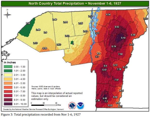
The image above is from the NWS Office in Burlington, Vermont.
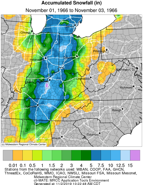
1966: An early season snowfall, which started on the 2nd, whitened the ground from Alabama to Michigan. Mobile, Alabama, had its earliest snowflakes on record. Louisville, Kentucky measured 13.1 inches, Nashville; Tennessee reported 7.2 inches, and Huntsville, Alabama, had 4 inches of snow.
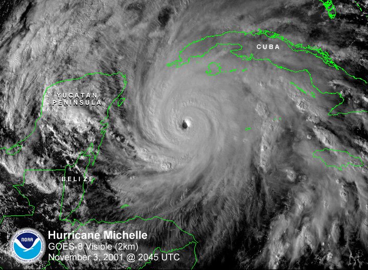
2001: Hurricane Michelle reached peak intensity on this day as a Category 4 storm. Michelle made landfall on November 4-5, between Playa Larga and Playa Giron, Cuba, as a Category 4 hurricane, the strongest to strike the country since 1952’s Hurricane Fox. The storm caused an estimated $2 billion US dollars in damage to Cuba.
2002: A Magnitude 7.9 earthquake struck central Alaska. The quake is the 9th largest to be recorded in the US.
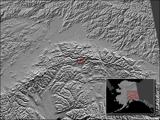
The image above is courtesy of NASA’s Earth Observatory.
2007: Dense fog in the early morning hours resulted in a 100-vehicle pile-up just north of Fowler, CA on I-99. Two people were killed, and 41 others were injured. The thick seasonal fog is known as “Tule fog” and typically occurs in Central California in late fall and winter. Click HERE for more information from CBS News.
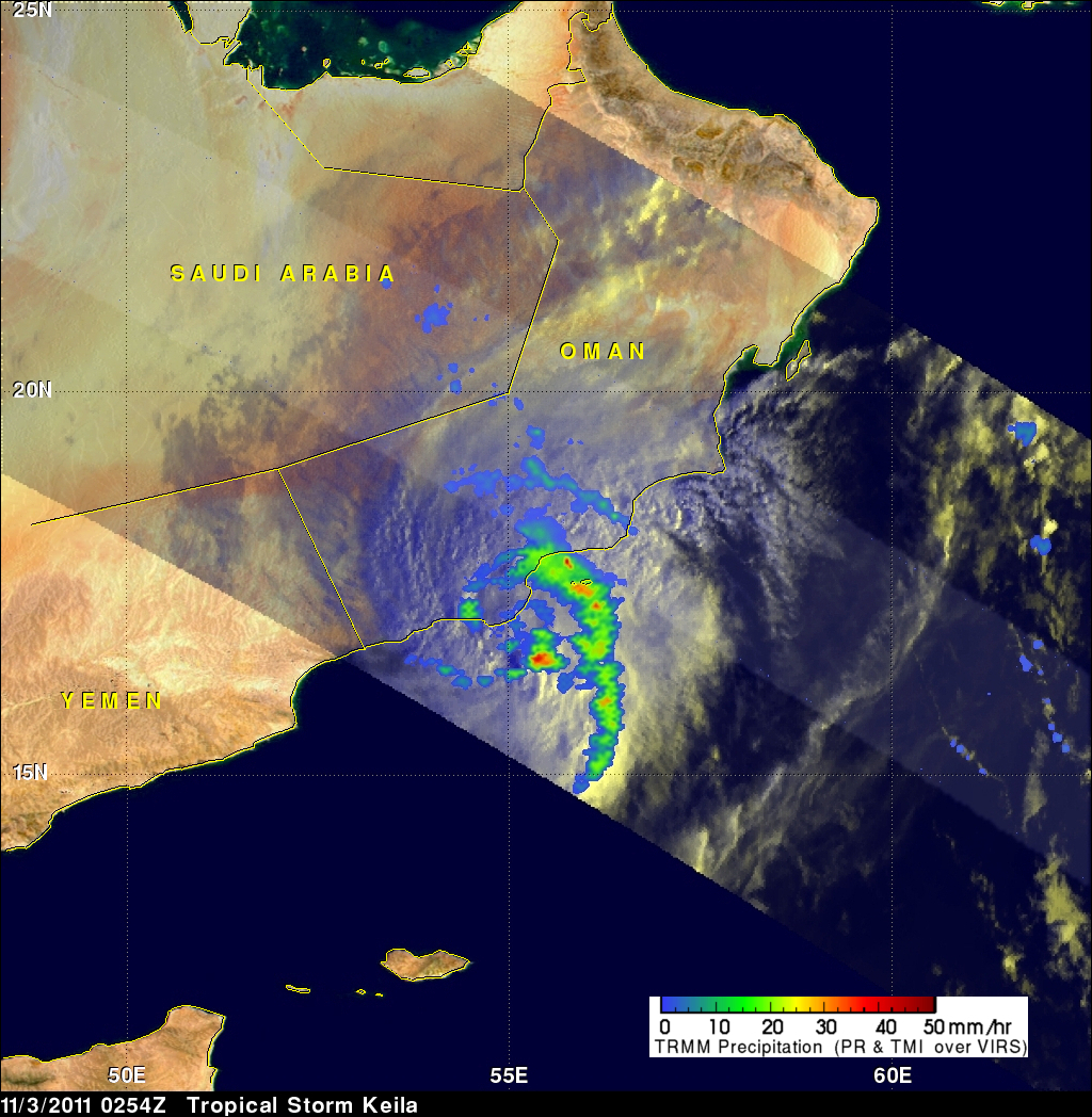
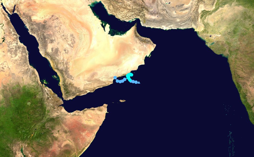
2011: Floodwaters by Tropical Depression Keila’s heavy rainfall was responsible for several deaths in Oman.
2013: The town of Arnhem in the Netherlands was hit with several tornadoes.
Forecast Discussion
Rather tranquil wx will continue through the short term fcst
period. Forcing associated with a weakening cold front will bring
scattered light rain showers mainly north to northwest of KGRR later
this morning through the afternoon as suggested by latest sref
pops.

A few light rain showers are then expected across most of
our area this evening. However moisture with this weakening
front is fairly limited and dry wx will prevail the majority of
the time today and tonight.

Fair wx will return after fropa and through the day Saturday as
a high pressure builds in from the northwest. High temps today and
tomorrow will generally range from around 50 to 55 degrees with
mins tonight mainly in the 30s to around 40 degrees.

No significant changes in the long term period from last night`s
thinking. Aloft the flow is essentially zonal through the forecast
period (Saturday night - Thursday) with shortwave`s working into our
area every 48hrs. The two main waves we are focused on slide through
on Monday and Wednesday. At the surface, the Monday system is the
strongest of the 7 day forecast with low deepening to around 990mb`s
Monday evening. Overall pretty typical weather for the fall which
usually features active weather.

Regarding the details, Saturday night into Sunday evening we should
be dry as high pressure slides through the region at the surface.
Sunday night we quickly move into the warm sector of the Monday
system. Monday morning wind speeds in the lower levels of the
atmosphere (2000-3000 feet) reach 50 knots. Warm air advection will
obviously be strong and we expect precipitation both late Sunday
night and on Monday. The system will be quick moving with the better
dynamics off to our north. We are expecting only light amounts of
rain towards I-94 increasing to around a third of an inch along U.S.
10. So, overall not a heavy rain producer despite the stronger low.

Another quiet period sets up for Monday night through Tuesday night
with some shortwave ridging moving through aloft. A shortwave trough
aloft moves in for Wednesday as does two areas of low pressure from
the Plains. Best chances for rain with this system will be Wednesday
and Wednesday night. A slightly wetter system is expected with
rainfall amounts of a quarter to a half inch. Troughing and chances
for light rain will linger into Thursday.

As for temperatures a very up and down period with warmer weather
expected as the system approaches with southerly winds on Monday
(near 60). We cool down with precipitation and clouds into mid week
(40s).
Nice fall day. More sun than I anticipated. Lots of golfers out today. I’m going to run the riding mower over the leaves one more time and hopefully, I can winterize it.
I remember the snowstorm of 1966 I lived in Bay City at that time and while many schools in the area did not have school we did have school in Bay City. There were a lot of piles of leaves and snow at the same time. I also remember the record snow fall of over 10″ in 1991 as well.
Slim
The official H/L yesterday at Grand Rapids was 52/36. There was no rain or snow. The highest wind gust was 29 MPH out of the S. The sun was out 47% of the possible time. For today the average H/L is 53/37 the record high of 76 was set in 1938/ and 2015 the record low of 17 was set in 1951. The record rain fall of 2.17” was in 1935. The record snow fall of 10.4” was in 1991 the record snow on the ground was 6” in 1996. Last year it was a warm 71-48.
Slim
Interesting that the record high was set in 2015. I believe that was a record warm November and during the strong El Niño
2015/16 had a very strong El Nino and November was the 3rd warmest and December was the month with the record warmest. January and February were also warm but not records. March was above average but April was below average the season had 61.1″ of snow fall.
Slim
Thanks for the stats slim, definitely was a warm winter. I’m thinking we will get around 60 inches this year, mainly from lake effect during random cool spells (as the storm track in an El Niño usually passes south of us)