We now have just 3 weeks of meteorological summer left so I will look at how this summer has played out so far. Here is where west Michigan stands so far as to how many days, we have had of highs 90 or better. At Grand Rapids so far there have been 9 days in the last 30 years the average for the summer season (May thru September) is 9. At Lansing there also have been 9 and their average summer season is also 9. At Holland there have been 7 so far and their summer season average is 8. At Muskegon they have seen 10 so far this year and their average is just 4. And down at Kalamazoo they have had 11 so far this year and their average is 13 for the summer season. There have not been very many very warm nights this summer. At this point Grand Rapids Lansing and Holland have only had one night when the low was 70 or better the 30 year average is 9 at Grand Rapids and Holland and 7 at Lansing and if this holds it will be the fewest since 2000. Muskegon where it has been warmer this year they have had 4 nights of 70 or better their average for a summer season is also 9. The monthly mean for June was 68.8 at Grand Rapids and Lansing. 68.9 at Muskegon and 68.1 at Holland. For July it was 71.9 At Grand Rapids, 72.8 at Lansing, 72.5 at Muskegon and 70.8 at Holland. So far in August it is 70.8° at Grand Rapids, 71.5° at Lansing, 72.2° at Muskegon and 70.4° at Holland. The summer started off very dry but has since turned wet with a summer total so far of 8.06” at Grand Rapids, 7.65” at Lansing, 5.16” At Muskegon and 6.23” at Holland. The one thing that stood out this summer so far was the amount of smoke and the number of days with a milky white sky. Also of note it that there have been very few thunderstorms this summer as well. Over all this summer has been a rather nice summer season with a good amount of sunshine (although there was a lot of smoke) mostly low dew points and that has led to the very low number of very warm overnight lows. With fall and then winter coming and a El Nino in force what will we see in the months ahead? Could this winter be a record warm one? We shall see.
Most of the storms were well to the east of Grand Rapids area yesterday. Here in MBY I only had a few sprinkles and then the sun came out.
The official H/L yesterday at Grand Rapids was 83/57 There was a trace of rain fall (here in MBY I had a whopping total of 0.02” of rain fall) there was some lightning in the distance last night. There were 0 HDD’s and 5 CDD’s the sun came out later in the day and there was 37% of sunshine. The highest wind gust of 28MPH was out of the SW. For today the average H/L is 81/62 the record high of 95 was set in 1988 and the record low of 45 was set in 1954. The most rain fall was 2.61” in 2016. Last year the H/L was 80/52 and there was no rain fall.
AREA FORECAST DISCUSSION
NATIONAL WEATHER SERVICE GRAND RAPIDS MI
346 AM EDT SAT AUG 12 2023
LATEST UPDATE…
SHORT TERM/LONG TERM/MARINE
SHORT TERM
(TODAY THROUGH SUNDAY)
ISSUED AT 309 AM EDT SAT AUG 12 2023
– POTENTIAL FOR A FEW LINGERING/REFORMING RW/TRW THIS AM
SOME INSTABILITY WILL PERSIST TO START THE DAY OVER SOUTHERN
ZONES. MU CAPE VALUES OF 500-1000 J/KG ARE SEEN ON THE LATEST
HRRR. THAT MODEL IS SHOWING SCATTERED CONVECTION DEVELOPING PRIOR
TO THE FRONT SLIPPING SOUTH OF THE CWA THIS MORNING, MAINLY SOUTH
OF I-96. WE WILL FEATURE LOW POPS IN THAT REGION TO START THE DAY,
BUT THE AFTERNOON LOOKS DRY AS DEWPOINTS DROP OFF AND THE
ATMOSPHERE STABILIZES.
– DISSIPATING EVENING RW CROSSING LAKE MI
THIS EVENING SEVERAL MODELS WERE TRYING TO SHOW SOME SHOWERS
CROSSING LAKE MI AND POSSIBLY REACHING WESTERN ZONES. OVERALL THIS
RISK LOOKS TOO LIMITED TO ADD PRECIPITATION TO THE FORECAST.
SCATTERED TO BROKEN CLOUDS COULD MOVE IN THOUGH. WE DID BUMP UP
THE CLOUD COVER A FEW TENTHS, AND WILL NEED TO MONITOR TRENDS.
LONG TERM
(SUNDAY NIGHT THROUGH FRIDAY)
ISSUED AT 309 AM EDT SAT AUG 12 2023
– RISK FOR EXCESSIVE RAIN MONDAY INTO MONDAY NIGHT
A POTENT MID LEVEL WAVE DIGS INTO THE GREAT LAKES REGION DURING
THIS TIME. THIS SYSTEM DRAWS UP ABUNDANT MOISTURE FROM THE
SOUTH WITH PWAT VALUES EXPECTED TO TOP 1.75 INCHES. FORECAST
SOUNDINGS SHOW DEEP MOISTURE. THERE COULD EVEN BE SOME ADDED
MOISTURE FROM THE GREAT LAKES WITH WATER TEMPS TOPPING 70 DEGREES
IN MANY LOCATIONS AND COOLER AIR ADVECTS IN. LOW LEVEL CONVERGENCE
PERSISTS MONDAY INTO MONDAY NIGHT WAS THE SURFACE WAVE TRACKS
THROUGH WHICH WILL HELP TO PRODUCE A LONG DURATION AND WIDESPREAD
RAIN EVENT. ENSEMBLE QPF TOTALS ARE ON THE RISE WITH AN UPWARD
TREND IN THE AMOUNTS. ITS LOOKING LIKELY THAT MUCH OF THE AREA
WILL SEE AT LEAST AN INCH WITH A SWATH OF 2 INCHES PROBABLE
SOMEWHERE IN THE CWA. THESE KIND OF BASIN AVERAGE VALUES ARE
EXPECTED TO LEAD TO STRONGER RISES ON THE RIVERS. WE WILL CONTINUE
TO FEATURE HIGH POTENTIAL FOR RAIN IN THE FORECAST.
Detailed Forecast for Grand Rapids
Overnight
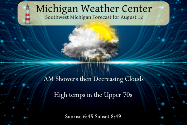
A 50 percent chance of showers and thunderstorms. Mostly cloudy, with a low around 67. West southwest wind around 8 mph.
Saturday
A 30 percent chance of showers and thunderstorms, mainly before 7am. Mostly sunny, with a high near 79. West wind 7 to 14 mph.
Saturday Night
Partly cloudy, with a low around 61. West northwest wind 5 to 7 mph becoming calm after midnight.
Sunday
Mostly sunny, with a high near 81. Northeast wind 5 to 7 mph becoming northwest in the afternoon.
Sunday Night
A 30 percent chance of showers after 2am. Mostly cloudy, with a low around 63. North wind 6 to 8 mph becoming east after midnight.
Monday
Showers likely, then showers and possibly a thunderstorm after 2pm. High near 73. Chance of precipitation is 90%.
Monday Night
Showers and possibly a thunderstorm before 2am, then a chance of showers and thunderstorms between 2am and 5am, then a chance of showers after 5am. Low around 59. Chance of precipitation is 80%.
Detailed Forecast for Lansing
Overnight
A 50 percent chance of showers and thunderstorms. Mostly cloudy, with a low around 66. West southwest wind around 10 mph.
Saturday
A 30 percent chance of showers and thunderstorms, mainly before 11am. Mostly cloudy, then gradually becoming sunny, with a high near 81. West wind 8 to 13 mph.
Saturday Night
Mostly clear, with a low around 61. West northwest wind 5 to 11 mph.
Sunday
Sunny, with a high near 81. Calm wind becoming northwest around 6 mph in the afternoon.
Sunday Night
A 20 percent chance of showers after 3am. Mostly cloudy, with a low around 63. North wind around 7 mph becoming east after midnight.
Monday
Showers and possibly a thunderstorm, mainly after 3pm. High near 73. Chance of precipitation is 90%.
Monday Night
Showers and possibly a thunderstorm, mainly before 3am, then a chance of showers and thunderstorms after 3am. Low around 60. Chance of precipitation is 90%.
Tuesday
A chance of showers before 9am. Partly sunny, with a high near 74.
Tuesday Night
Mostly clear, with a low around 55.
Saw a glimpse of a rainbow this morning…not a bad way to start the day!!!
Thanks Slim. It’s been a rather odd Summer with all the smoke and haze, but otherwise a lot of sunny days. Yesterday was another bad forecast for our area. We had a lot of outdoor painting to do but we cancelled early in the morning because of the forecast. Never rained at all. That’s the second or third badly forecast day here in the past week.
We rescheduled the painting for today and now there’s rain that just popped up heading straight for us?
Yup. It has rained here a couple times this morning. Right now it’s raining.
I think the not so hot nights were due to the lack of clouds. This is one of the sunniest summers we’ve had here in a very long time.
Over here this is one of the cloudiest, I still haven’t had a clear night to see meteors. Probably why Lansing has been 1-2 degrees warmers (overall) than GR this summer
Check out this tornado video from Perry. WOW! I saw this incredible structure with a lowering and no doubt that lowering was the tornado I was seeing just couldn’t see ground contact with all the trees where I was.
https://www.sfweekly.com/news/national/us-state-of-emergency-declared-as-tornado-touches-down-in-perry-mi/video_a0681a10-20d3-50f2-9fbb-8aeb65eada72.html
Wow! Don’t see many videos like that in Michigan.
The damage in Perry is pretty significant. A state of emergency has been declared there. The cloud structure was classic when I was driving on I-69. Like I said I had no intention of chasing I was actually driving back from northern detroit and happen to be in the area at the time.
Please pray for the people there. Lots of damage to clean up.
Well the NWS is going to try their luck again! After a total fail for rainfall prediction for GR they are saying heavy rain for Monday. Prediction is for 1 to 2 inches of rain! Hopefully this will not be a total fail again! Incredible!
The NWS nailed the forecast here yesterday. The rain and lightning started about 4pm, as predicted. The tornado warnings occurred precisely in the area forecasted.
good for you , because it was a 100% failed forecast here in the GR area!