We have -2° at 6 am for our coldest morning thus far this season. Yesterday’s high was 20° and the low was 11°. Areas of lake-effect snow are expected later today and into Saturday morning, most snow will occur between 5 PM today and daybreak tomorrow. One to three inches can be expected along the lakeshore counties with less than an inch elsewhere.
Weather History for SW Michigan
January 30
1951: A huge arctic high-pressure center moves south from Canada all the way to the Gulf of Mexico and brings snow to Florida. Temperatures fall to record lows in Lower Michigan. Grand Rapids sets their all-time record January low of 22 degrees below zero. Baldwin, Michigan plunges to 37 below zero.
2008: Rain changes to snow as an arctic cold front brings a flash freeze to lower Michigan during the night of the 29th, leaving a sheet of ice on the roads. Temperatures fall from the upper 40s to the single numbers, with occasional blinding white-out conditions in falling and blowing snow. There were numerous traffic accidents and some roads were closed for a time. School and event cancellations were widespread, and there were also sporadic power outages.
2019: Arctic air combined with strong winds gusting over 30 mph to bring dangerously cold wind chill temperatures of 20 to 40 below zero. Actual air temperatures remained below zero through the entire day across much of Lower Michigan with a 2 pm temperature of 12 below zero at Kalamazoo.
January 31
1914: A snowstorm drops from 6 to 14 inches of snow across southern Lower Michigan.
1977: One of the coldest months on record comes to a close with yet more arctic air and lake effect snow. High temperatures are only in the teens during the last week of the month with 2 to 4 feet of snow piled up along the Lake Michigan snow belts.
February 1
1918: February opens on a frigid note during one of the most severe winters in history across the central and eastern United States. Muskegon tumbles to a record cold 22 degrees below zero and Lansing also sets a record with 16 below.
February 2
1868: It is a chilly Groundhog Day as Lansing sets their all-time record low with a reading of 37 below zero.
February 3
2007: Blizzard conditions prevail across southwest Lower Michigan as an arctic blast of frigid air moving over Lake Michigan produces thundersnow and whiteout conditions. Grand Rapids sets a record for snowfall for any February day with 11.3 inches of snow.
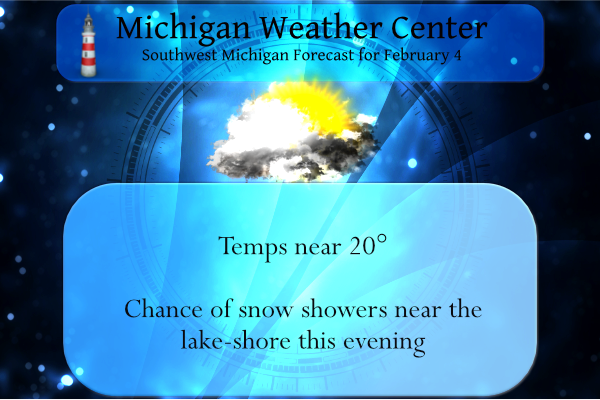
February 4
1838: An ice jam on the Grand River causes flooding of much of Grand Rapids during early February. Several people had to be rescued from flooded neighborhoods and at the fur trading post.
1996: One of the coldest arctic outbreaks of the 20th century sends the thermometer down to 17 below zero at Grand Rapids and 19 below at Muskegon, both records for the date.
February 5
1890: Temperatures more like April than February prevail during one of the mildest winters on record in Lower Michigan. Lansing sets a record high of 61 degrees for the second day in a row.
1918: Frigid weather holds on across Lower Michigan with the temperature falling to record lows of 16 below zero at Muskegon and 21 below at Lansing.
Weather History for SE Michigan
January 30
On January 30, 2019, a record cold snap began across the region with Detroit, Flint, and Saginaw seeing high temperatures of 1, 2, and 4 respectively, which broke the daily low maximum temperature records at each site. Temperatures bottomed out well into the negative teens overnight.
On January 30, 2014, the last accumulating snow of the month fell. Amounts were less than one inch, but it pushed the record monthly snowfall totals to 39.1 inches in Detroit and 32.9 inches in Flint. It was the snowiest single month on record for both locations. The monthly total in Saginaw was 15.6, which was still good for its 20th snowiest January.
Also on January 30, 2012, all three Southeast Michigan climate sites saw temperatures soar to new daily record high temperatures. Saginaw, Flint, and Detroit respectively recorded highs of 56, 58, and 62 degrees.
Also on January 30, 1951, Flint had a record low of -16 degrees for this day.
January 31
On January 31, 2019, record cold lingered across the region. Detroit and Flint each experienced a high temp of 3 degrees and a low temp of -14 degrees which easily beat the respective previous records. Both sites spent 36 consecutive hours below 0 degrees during this cold snap. Wind gusting over 35 mph at times resulted in wind chills near or below -35 degrees for numerous hours.
A snowstorm in 1982 brought our 13th biggest snowstorm to the metro Detroit Area. The snow began late on the 30th and continued throughout much of the 31st. When it ended, nearly a foot /11.8″/ was officially measured at Detroit Metro Airport.
February 1
On February 1, 2015, a snowstorm for the record books blanketed the Great Lakes Region in snow. Light snow began in the predawn hours and gradually intensified until accumulation rates reached one inch per hour in the early afternoon and persisted into the evening.
As snow tapered off late that night into the following morning, amounts at Detroit had reached 16.7 inches, its third-biggest snowstorm on record. In Flint, the total of 9.2 inches was its 22nd biggest snowstorm while the 11.2 inch total at the NWS White Lake was the 8th biggest in its rather abbreviated climate record.
Also, on February 1, 2014, a general 3 to 6 inches of snow fell across Southeast Michigan, including 4.1 inches in Detroit, 3.5 in Flint, and 3.6 in Saginaw. Port Huron measured the greatest accumulation of 7.5 inches.
Also, on February 1, 1881, a two-day snowstorm dropped 12.5 inches of snowfall on Detroit!
February 2
On February 2, 2011, the Groundhogs Day Blizzard affected a large area of the country from Oklahoma to the New England States, including southeast Michigan. The snow started during the evening hours of the 1st and continued into the 2nd. Snowfall accumulations generally ranging from 6 to 12 inches. Isolated higher amounts were recorded across the Thumb and Tri-Cities Region. Northeast winds gusting between 25 to 35 mph caused some blowing and drifting of snow. Frequent wind gusts to 35 mph came off Lake Huron and Saginaw Bay, leading to blizzard conditions north of the I-69 corridor. Some of the higher snowfall reports across the area included: Pigeon 14 inches; Port Huron 14 inches; Lapeer 13.6 inches; Lexington 13.5 inches; Bridgeport 13 inches; Mayville 13 inches; Pinconning 12 inches; Flushing 11 inches; Lake Orion 10 inches; and Romulus 9 inches.
Also on Groundhog Day in 1967, Flint measured 9.3″ of snow from another snowstorm that occurred February 1st-2nd. The groundhog probably had trouble getting out of his burrow that morning, let alone see his shadow.
Also, on the 2nd back in 1936, this marked the last day of a streak of 11 days (Jan 23-Feb 2, 1936) with daily temperatures colder than 19 degrees!
February 3
On February 3, 1985, the overnight temperature dropped to a freezing -15 degrees in Detroit!
February 4
On February 4th 2018, a period of accumulating snow spanning two days came to an end. Most of Southeast Michigan saw 4-6″ with a peak observation of 6.1″ near the town of Peck.
Also on February 4, 2006, the city of Fairgrove in Tuscola County received 10.0 inches of snow. The snowstorm lasted from the 4th to the 5th.
Also on February 4, 2007, arctic air plunged over the Great Lakes Region on strong winds. The high temperature at Detroit was only 8, Flint was 4 and Saginaw was 5 above zero. The arctic air mass remained in place through the 6th.
February 5
On February 5, 2014, a winter storm 6 to 8 inches of snow to Southeast Michigan. The highest accumulations were measured in Wayne, Washtenaw, and Monroe counties including 8 inches in Detroit. Flint recorded 5.8 inches while Saginaw recorded only 4 inches.
Also on February 5, 1918, the overnight temperature dropped to -23 degrees in Saginaw. This is the record low for this city!
MichaelV
Have received a light dusting of snow on my deck so far. Down to 13 degrees at my house. Going to be another cold night.
Snowing as we speak! Incredible!
The latest CPC Rocks! Can you say cold and snow for weeks on end? Rock n roll will never die!
This latest storm was great especially for those of us East of M-66 that can get the snowmobiles out! Don’t get to do that as often here compared to those from Kent County to the lakeshore. Incredible storm!
Yes and you don’t get much lake effect over there!
If you think January was a good month for winter weather, then February could be better! We should see more snow in February than we did in January! Who would have thought? Bring on multiple clippers, lake enhanced snow events, lake effect and synoptic storms! Incredible! Who wouldn’t love winter in MI?
Great Scotty ….lets go for 60+ days with snow on the ground why not ….InDY
At this time there have been 53 days with 1″ of snow on the ground. there has been at least 1″ on the ground at Grand Rapids now for the last 40 days. The current 30 year average of the number of days with 1″ or more on the ground is 67 with in that 30 years the range has been from 34 in 2011/12 to 109 in 2013/14 the all time record high is 124 in 1903/04. so Grand Rapids will make that 60 days + we will see if it can make 60 days in a row or… Read more »
0* out in my area this morning im thinking GR only averages 3 times 0 or below during the Winter season im thinking this is my 4th time being at 0 or below now another record broken this COLD Winter and its only February….Wow! INdY
The current 30 year average of days with a low of 0 or below at Grand Rapids is 4. So far this winter season Grand Rapids has officially only had 1 day with a low of 0 or below. It has to happen at GRR for it to be official.
Slim
The next 2 weeks are looking pretty chilly in the Great Lakes. That takes us to about Feb 18… it will be interesting to see if we get a pattern change around that time or if it continues to stay cold. Obviously way too early to tell, but you’d think the worst of winter would be over by then either way.
In the last hour the temperature has dropped from +2 to 0° there remains 5″ of snow on the ground. Officially at the airport there is 6.0″ reported on the ground. For February since 1894 the average snow depth at Grand Rapids is 4.9″ In that time there have been only 8 years with no snow on the ground the last time was in 2020. The most on the ground on February 4th is 20″ and that was in 1959. There was 18″ on the ground on this date in 2014 and 2011 and 1904. Last year there was 2″… Read more »
“ February 2
1868: It is a chilly Groundhog Day as Lansing sets their all-time record low with a reading of 37 below zero.”
Sheesh! Makes me wonder how accurate their equipment was back then.
Records go back to 1863 at Lansing one of the earliest in the great lakes area. Not sure how accurate the equipment was then but remember that was towards the end of the mini ice age. And at that time Lansing was a very small city to say the least. Do you wonder why most all time state records are at small rural areas.
Slim
let it snow, let it snow, let it SNOW!