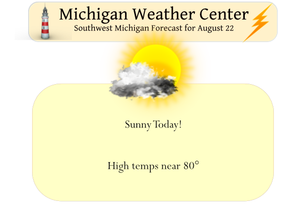
Yesterday we had a high of 78° with a few peeks of the sun and just a trace of rain, the low was 63°. The rain moved just east of the Otsego area. We will see more sun today with highs around 80°, fairly typical for this time of year. Mainly dry weather is expected for the coming work week. Isolated showers are possible Mon afternoon/evening, mainly east of US-131. Chances for hit-or-miss showers are in the forecast for Wed–Fri, with otherwise partly to mostly sunny skies. Highs will be near 80 and lows near 60°.
Sunrise today is 6:58 and sunset is 8:36 pm.
Hurricane update
All is relatively quiet in both the Pacific and Atlantic Oceans. This is expected to change over the next couple of weeks.
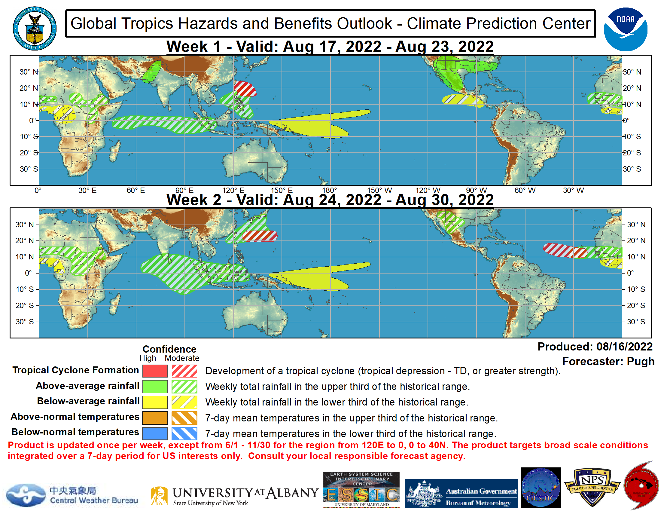
The MJO remains incoherent but is beginning to show signs of a more wave-1 structure. The GFS and ECMWF ensemble means are consistent that the MJO strengthens over Africa with an eastward propagation to the Indian Ocean during late August. In the wake of the predicted enhanced phase of the MJO, there is likely to be a favorable large-scale environment for easterly waves to emerge off the coast of Africa. Also, a Kelvin Wave is currently crossing the Date Line and is forecast to rapidly shift eastward to the Caribbean Sea and tropical Atlantic. The evolving MJO pattern, passage of a Kelvin Wave, and climatology favor maintaining a moderate confidence for tropical cyclone (TC) development across the Main Development Region of the Atlatnic from Aug 24-30. Meanwhile, a broad area of low pressure is located over the Bay of Campeche. As of 2pm EDT on Aug 19, the National Hurricane Center states that there is a 70 percent chance of TC formation before it moves inland into northeastern Mexico. Regardless of development, heavy rain could spread northward to the lower Rio Grande Valley. The Joint Typhoon Warning Center is monitoring the potential for TC development over the West Pacific, to the east of the Philippines. Moderate confidence of TC formation exists in this region through Aug 23. During the following week, model solutions continue to feature TC development at a relatively high latitude of the West Pacific.
Forecast Discussion
Patches of stratus clouds a few hundred feet above the ground are
expected to mix out by late in the morning as moisture is quite
shallow and drier air above the near-surface inversion layer will
be available to mix down. Weak ridging and subsidence in the mid-
upper levels today should inhibit deep convection but kept slight
chance of showers in areas east of US-127 which is still on the
back side of the departing low.

Forecast remains on track with near-normal temperatures and a
hint of humidity (not unreasonable for August) this week.
Temperatures will increase slightly each day through Wednesday.
Here between the polar and subtropical jets with weak flow and
weak surface high pressure, not much impactful weather besides
morning fog is expected the next few days. Our upper level flow
becomes gradually more cyclonic as a trough digs into Ontario
midweek, sending a weak cold front through our area on Thursday
and possibly touching off some showers. Ensembles are favoring a
mostly dry weekend with rebounding temperatures, then the next
best chance of rain arrives on Monday.
Great summer, with no heat waves and plenty of near to below normal temps! Wow, just wow!
NWS hinting at a strong system around the first week of September pulling down some fall like air for the first week of September. Could be a little stormy before that gets here. We shall see!
Best summer I can recall having here in Lower Michigan. Steady summertime warmth and plenty of sunshine.
The official H/L yesterday at Grand Rapids was 81/63 there was a trace of rain fall and 43% of possible sunshine. The overnight low here in MBY was 63 and at the current time it is sunny and 68. For today the average H/L has now dropped to 80/61 the record high of 98 was set in 1936 and the record low of 44 was set in 1894,1897 and 1923.
Slim
Back to cutting the grass once a week with all this rain we are having the yard is as green and thick as late April early May knowing we are going into September makes cutting the grass even better though soon we will be putting away the rider for the snowblower tune it up… INDY
I needed to mow 3x (Monday, Thursday, yesterday) in the past week. It’s growing crazy fast.