Yesterday’s rain showers were confined to the north of Big Rapids and on the east coast of Wisconsin and around Chicago. Showers could develop along the lake breeze boundary this afternoon however chances are low (20 to 30%. ) Temperatures will once again be in the low 90s.
...Air Quality Alert for Thursday June 1st...

The Michigan Department of Environment, Great Lakes, and Energy
has declared Thursday June 1st to be an Action Day for elevated
levels of ozone. An Action Day also remains in effect for today.
Pollutants are expected to be in the unhealthy for sensitive groups
range.

The Action Day is in effect for the following Michigan counties...

Mason, Oceana, Muskegon, Ottawa, Kent, Allegan, Van Buren,
Kalamazoo, Ionia, Clinton, Barry, Eaton, Ingham, Calhoun, and
Jackson.

People and businesses are urged to avoid activities which lead to
ozone formation. These activities include refueling vehicles or
topping off when refueling, using gasoline powered lawn equipment,
and using charcoal lighter fluid. Positive activities include car
pooling, biking to work, delaying or combining errands, and using
water based paints.

It is recommended that active children and adults, and persons
with respiratory diseases such as asthma, limit prolonged
outdoor exertion.
U.S.A and Global Events for June 1st:
1903: During the early afternoon, one of the most destructive tornadoes in the history of Georgia up to this time, struck the outskirts of Gainesville. The track of the storm was about four miles in length and varied between 100 to 200 feet in width. The tornado touched down about one-mile southwest of Gainesville, striking a large cotton mill at 12:45 pm, Eastern Time, just 10 minutes after 750 employees filed into the great structure from dinner. On the top floor of the mill were employed 250 children, and it was here that the greatest loss of life occurred. Click HERE for more information from the Monthly Weather Review.
1919: Snowfall of almost a half-inch fell at Denver, Colorado. This storm produced their greatest 24-hour snowfall recorded in June. Two temperature records were set: The low temperature of 32 degrees was a record low for the date, and the high of only 40 degrees was a record-low maximum. Cheyenne, Wyoming recorded 1.6 inches of snow, which is one of only six times that at least one inch of snow has fallen at Cheyenne in June.
1934: June started off on a warm note as high temperatures surpassed the century mark across parts of the Midwest. Several locations tied or set record high temperatures for June including Rockford, IL: 106°, Mather, WI: 105°, Hatfield, WI: 103°, Mondovi, WI: 102°, Chicago, IL: 102° and Grand Rapids, MI tied their June record high with 102°.
1999: A tornado with an intermittent damage path destroyed 200 homes, businesses, and other buildings in the southern portion of St. James, Missouri. Of these, 33 homes were destroyed along with the St. James Golf Course clubhouse and two Missouri Department of Transportation buildings. The tornado then moved east, south of the downtown St. James area and intensified. F2 to F3 damage occurred with a 200 to 300-yard damage path. Several homes and farm buildings were severely damaged or destroyed. Further north, severe thunderstorms produced many tornadoes around central Illinois. The most intense tornado touched down in Montgomery County south of Farmersville and moved into southwest Christian County. One person was killed when a semi-trailer overturned at a rest area on I-55. Across eastern parts of the state, high winds up to 70 mph caused damage to trees, power lines, and some buildings. The Mattoon area also reported flooding from these storms, producing $3 million dollars in damage.
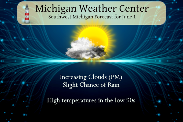
Grand Rapids Forecast
6 1 grrForecast Discussion
.SHORT TERM...(Today through Friday)
Issued at 328 AM EDT Thu Jun 1 2023

We are looking at somewhat of a repeat of the weather this afternoon
as compared to yesterday afternoon in the form of a few showers and
isolated storms mid afternoon-early evening. There will be a small
difference in that the hi-res models are in good agreement that
there will be development further south along the lake breeze
compared to Wednesday.

The interesting thing is that there are some moist dew points in
place over the western half of the area. Then further east, dew
points are dropping off pretty good with the easterly flow bringing
the drier air in. Models indicate that up around 1,000 J/kg of ML
CAPE is likely along the lake breeze boundary. The better
instability is shown to be further south, thus the reason the better
chance today of showers/storms south.

Severe weather is once again not likely, but can not be ruled out
like the stronger storm over Lake County on Wednesday. Some small
hail and wind gusts to 40 mph are the most likely given the CAPE,
decent mid level lapse rates, and an inverted V sounding giving the
gust potential. Deep layer shear staying below 25 knots will keep
the storms from becoming too organized, and more of the pulse type
variety.

The chance of rain then diminishes on Friday, even with warmer sfc
temps. The 60F dew points will get pushed out of the area in favor
of the 40s and 50s dew points moving overhead. The limited moisture
will make it more difficult for the cumulus to grow vertically.

.LONG TERM...(Friday night through Wednesday)
Issued at 328 AM EDT Thu Jun 1 2023

Michigan will be between a retrograding upper level high situated
over the upper mid west and a large upper level low moving southward
along the east coast. The interaction between these systems will
dominate our weather through the long term. As the large upper level
low moves southward along the east coast it will bring several cold
fronts through the Great Lakes and the mid Atlantic regions. The
first cold front will trek through the area on Saturday. While the
warm dry air mass that is entrenched over us will stifle any
convection, there will be a slight chance for precipitation and
potentially some thunderstorms, especially along the boundary
created by the sfc easterly flow and the lake breeze.At the very
least that cold front will drop the highs from 10 to 20 degrees
above normal to 5 to 10 degrees above normal by Sunday.

Another cold front will swing through Monday into Tuesday with the
GEFS showing a slightly better chance for precipitation.  The caveat
to all of this is that the low level northeast flow should keep
lower surface dewpoints with dry air dominating the pattern and
making any precipitation difficult with the dry pattern expected to
continue through next week. The second cold front should drop highs
back down to normal and put an end to this heat wave, though high
temperatures will still be in the upper 70s to low 80s through mid
next week.
Enjoy the warmth…this might be our MI summer this week. Clearwater, FL is pegged at 88, with a weeks worth of punishing downpours/hail, from the Low stuck in the Gulf. But hey…it’s FL. The real heat arrives next month 😉 Hope to be back home by then.
Loving the 70’s next week and lows in the 50’s still have the hoodie hanging on the hook may need it around the bon fire yeahhhh INDY
What? No extended so called heat wave?
Had a 10 minute downpour downtown Zeeland this afternoon. Temp dropped from 92 to 73 almost instantly, then the sun came out and jumped right back to 90 only far more humid with everything being wet. Heat wave 2023.
And 4 miles away at home not a drop.
I’m jealous
That precip is so close, yet so far away….
With the current reading of 90 at GR it’s officially a “heat wave”. Tomorrow looks like it could be even hotter than today. NWS point click forecast says 94.
Once again the heat index is less than the actual temperature! Wow just wow!
Interesting fact from the NWS:
“Outside of our lakeshore region, inland sites have been experiencing wind with an easterly component (NE/E/SE) since May 24. The extended forecast calls for this to basically continue unabated for most locations”
“Looking at June`s climatological wind rose data for Grand Rapids (a graphic that shows over 40 years of observed wind speed and direction at Grand Rapids), it is climatologically unusual to get a wind direction dominated by some easterly component for this time of year.”
Have I not been talking about the easterly wind? Thanks for the confirmation. 🙂
Eastern St. Joseph IN-Western St. Joseph IN-Northern La Porte IN- Southern Berrien MI- 225 PM EDT Thu Jun 1 2023 …Clusters of scattered thunderstorm will impact portions of St. Joseph, northeastern La Porte and southeastern Berrien Counties through 315 PM EDT/215 PM CDT/… At 220 PM EDT/120 PM CDT/, Doppler radar was tracking clusters of storms in the general area of South Bend and southwest Michigan. The storms may produce a brief period of small hail. The storms are moving northwest at 5 to 10 mph. HAZARD…Pea size hail. SOURCE…Radar indicated. IMPACT…Minor damage to fragile outdoor objects is possible. Move… Read more »
Allegan-Van Buren-
Including the cities of Holland and South Haven
214 PM EDT Thu Jun 1 2023
…Scattered thunderstorms may produce locally gusty winds and small
hail through this afternoon…
Doppler radar indicated a few thunderstorms developing across Allegan
and Van Buren Counties this afternoon with very localized small hail
to around a half inch. A few wind gusts to 40 mph or greater are
possible in the strongest storms through this afternoon. Cloud to
ground lightning will be a threat with any storms that form. Severe
weather is unlikely but continue monitoring conditions throughout the
day.
Accuweather GR Real Feel is up to 100 degrees!
This is a bogus number used for hyping warm weather!
I dont mine high 80’s with no humidity it is June now nothing new around west Michigan just keep the humidity and mid 90’s away my sun tan is looking beautiful and the sprites are cold today we are getting ready for a pleasant weekend good bon fire weather at night Summer loving….INDY
Lake Michigan water temps are about 4 degrees above average right now and climbing quickly.
With many sunny days and the very warm air temperatures I would think that the lakes would continue to get warmer. Also there was not much ice on the lakes this past winter so there was not a lot of ice to melt.
Slim
No bickering about it, it’s downright HOT! Haven’t had much time to comment lately, things are finally moving ahead:
https://www.hollandsentinel.com/story/business/2023/06/01/rebuild-now-underway-at-zeelands-community-restaurant/70267477007/
Good to see things are moving along Barry! I’ll have to swing by for a bite to eat once it’s officially open.
Glad things are moving along now. Good luck
Slim
Awesome Barry! Praying that everything goes smoothly in the rebuild!
That’s really great, Barry. Any idea when you’ll be open for business?
November…Decemberish…I’m fully expecting more delays so not really setting a date in my mind. When it’s done it’s done and I’ll be ready!
Sooner the better, no doubt. I wish you continued good luck. Hadn’t seen you around here lately, so I figured you were busy with the restaurant.
Glad to see things are moving along.
Slim
Glad to hear things are moving ahead. Congratulations!!!
When looking at the drought monitor map, one would think West MI has no worries when it comes to dry conditions. I for one disagree with this latest map. One of my dads friends is a big farmer up in Sand Lake and he is getting a bit concerned with this dry pattern.
https://droughtmonitor.unl.edu/CurrentMap/StateDroughtMonitor.aspx?MI
Much of the year so far has been wet that is the main reason for the drought map. If it stays dry that will change.
Slim
I completely disagree with this map. It is drier then it was last year when we were in an official drought. Ground moisture is gone, ponds are drying, and there are significant impacts on crops already.
Five 90+ days in a row? And no cool air in sight. Wow!
There has been some talk on here re: Lake Michigan water temps. Here is a good resource for historical averages:
https://www.seatemperature.org/north-america/united-states/lake-michigan-june.htm
Good to know! So the current temp in the upper 50’s is above average.
Once again heat indexes will be lower than the actual air temps this afternoon! Keep the lower dew-points coming! Incredible!
Grand Rapids has seen below normal temps in 2 out of the last 3 months! The pattern just keeps rocking!
We don’t follow GR averages anymore
You mean you don’t use Grand Rapids averages. For May all major reporting stations on east side of Michigan were below average. But remember no matter what you think the reading taken at GRR are the official readings for Grand Rapids.
Slim
Not since GR acknowledged issues in their reporting of averages
Lake Michigan Water Temps are heading upwards too! Should be great swimming weather for everyone this weekend. Pretty crazy for this early in the season! Including the beaches of Grand Haven State Park and Holland State Park 410 AM EDT Thu Jun 1 2023 .TODAY… Swim Risk*………………Low. Wave Height……………..1 foot or less. Wave Period……………..2 seconds. UV Index………………..Very High. Water Temperature………..In the upper 50s. Weather…………………Mostly sunny. A slight chance of showers and thunderstorms. High Temperature…………In the upper 70s. Winds…………………..Southwest winds around 10 mph becoming northwest in the afternoon. Sunrise…………………6:08 AM. Sunset………………….9:17 PM
I’ll be heading to Holland State Park this weekend. With the calm winds and warmers temps the water will continue to warm and will be great boating weather.
Here is a quick look at how May 2023 played out across southern lower Michigan. At Grand Rapids the mean was 58.9 that was a departure of -0.3. the high was 90 on the 30th and 31st and the low was 36 on the 1st There was just 0.84” of rain fall that is the 2nd lowest rain fall for any May. At Lansing the mean was 59.1 that was +0.7 the high was 90 and the low was 36 there was 0.96” of rain fall that was the 5th driest May on record. At Muskegon the mean there was… Read more »
GR temp averages are such a joke
On the east side of the state Detroit had a mean of 59.7 that is a departure of -0.6 the high for the month was 86 and the low was 37 They had 0.92” of rain fall that was the 5th lowest for any May. At Flint the mean was 57.1 for a departure of -0.3 their high for the month was 89 and the low was 32 they had 1.08” of rain fall that was the 11th least for any May. And at Saginaw the mean there was 57.4 a departure of -0.8 they had 0.80” of rain fall… Read more »
The one item that stands out is that May 2023 was dry across southern lower Michigan. The month started out cold and many locations seen a trace of snow early in the month. The end of the month had became very hot (by Michigan standards) and very dry (by Michigan standards) The month ended at most locations less than a degree above or below average. All of the east side of the state was cooler than average.
Slim
Drought monitor map out today and it looks like SW MI doesn’t meet the criteria for drought conditions. I might disagree.
https://droughtmonitor.unl.edu/CurrentMap.aspx
Head to Grand Haven currently water temp is 49 degrees pretty cold for June standers but refreshing as heck ….we are officially enjoying the longest days of the year less then a month days will be getting shorter all ready love it ….INDY
Gaylord shattered the daily record by 6 degrees and set a new all time monthly maximum temp. Impressive heat!
From NWS Gaylord:
Record highs set on May 31st, 2023:
Pellston: 90°F (previous: 88 on May 31st, 2011)
Gaylord: 93°F… breaks the previous daily record of 87°F set in 2011, along with the all-time May monthly maximum temperature of 92°F set on May 25, 2010.
Very inpressitive, but remember record only go back to 1998 at Gaylord. If it stays dry that area can have some really big temperature swings.
Slim
Good point
Welcome to meteorological summer! It has kind of felt like summer now for the last 5 days or so. The official H/L at Grand Rapids yesterday was 90/64 there was no rain fall and the sun was out 94% of the time. There were no HDD’s and 12 CDD’s A new record high was set at Muskegon with a high of 90
Slim
For today the average H/L is 75/54 the record high of 102 was set in 1934 and the record low of 36 was set in 1993. The record rain fall amount of 2.75” fell in 1970. The next 5 days look to stay on the hot (for Michigan) hot side. With highs in the low 90’s up to Saturday before dropping into the low to mid 80’s there are several chances of thunderstorms.
Slim
And thirteenth month in a row for warmer than normal temps for our area! Incredible!! And wow!!!
Well on our way to 14 in a row with how June is starting! BRING IT!!
Just another warmer than normal 90 degree day in GR!! Wow!! I love long summers!
Good morning, fellow weather fans. In looking over the data from May, we all know it was dry and the temps were pleasant – dare I say pretty much average (within one degree of average throughout the area). There is one thing that really stands out to me – the amount of sun. For Lansing, there were 21 sunny days, 8 partly cloudy days, and just two cloudy days. For GR, there were 7 sunny days, 20 partly cloudy days, and just 4 cloudy days.
Have a wonderful day, my friends. Remember, make someone smile. 🙂
Most of lower Michigan had near average temperatures. And much of the state had a very dry May.
And of course along with dry air comes sunshine.
Slim
Agreed. The prevailing east wind seemed to help keep it dry too. When we get a southerly to westerly wind, it tends to include gulf moisture.
I’m always leery of sunshine reporting. Lansing had 21 sunny days but GR only had 7? Yikes
I can vouch for Lansing. It’s been one of the sunniest months I can remember. I will have to defer to the westsiders for GR.
I have lived both in Grand Rapids and East Lansing (Michigan State) and I definitely noticed more sun in Lansing.
That might be a judgment call here is the NWS definition of
Sunny
When there are no opaque (not transparent) clouds. Same as Clear.
Partly Cloudy
Between 3/8 and 5/8 of the sky is covered by clouds.
Partly Sunny
Between 3/8 and 5/8 of the sky is covered by clouds. The term “Partly Sunny” is used only during daylight hours.
Cloudy
When 7/8ths or more of the sky is covered by clouds.
Slim