Our rainfall total for yesterday was .16 of an inch which brings us to a whopping .21 for the month of June. We reached 90° yesterday. Of course, we had a wide variety of rainfall totals across the area, the thing which was consistent was the humidity creating a very sultry day across the state.
The third day of hit-or-miss thunderstorms with brief heavy downpours. Many of these rain totals occurred in just an hour or less. Still some parts of Michigan haven’t had a drop this week.
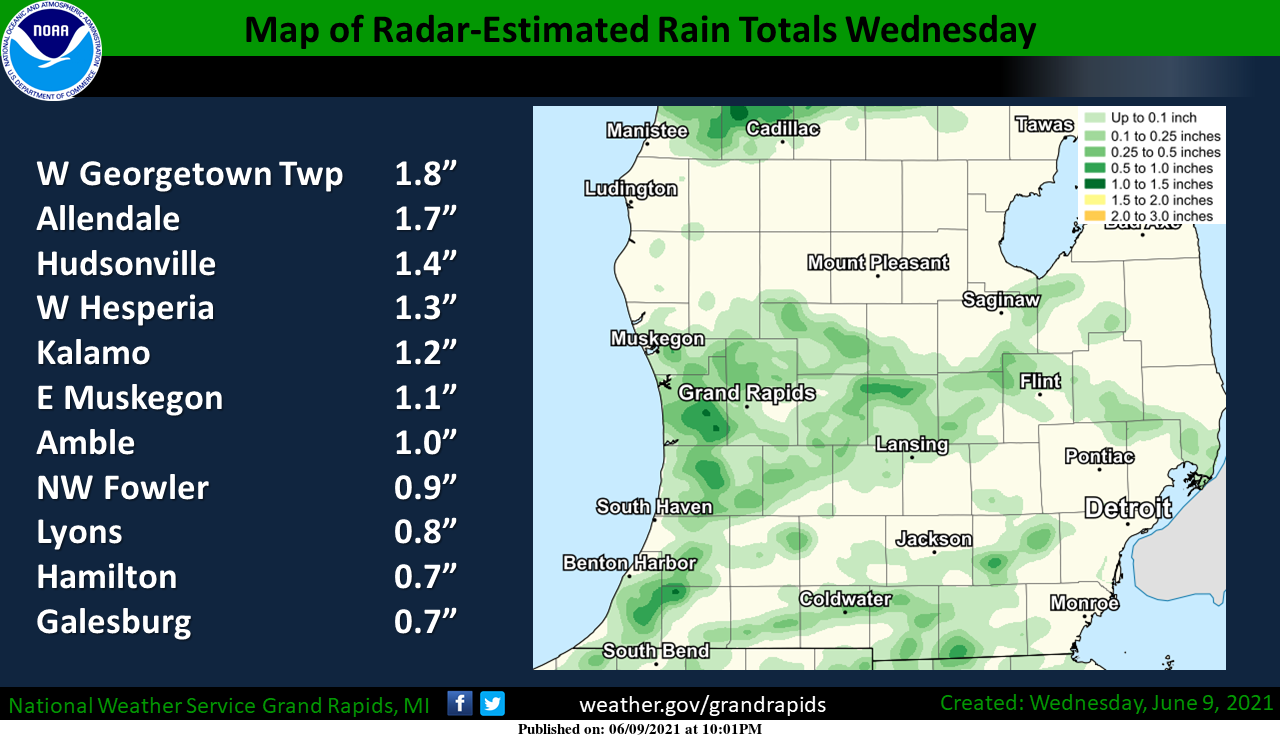
Some areas have had a month’s worth of rain this week others have been teased with just or few sprinkles or watching the pretty colors on the radar as the rain moved around them. We had heavy rain just north of Otsego to the Watson area and a few rumbles of thunder before a second cell formed and moved through our area.
Models suggest a scenario much like yesterday setting up over the lakeshore counties with lesser coverage elsewhere.
Forecast Discussion
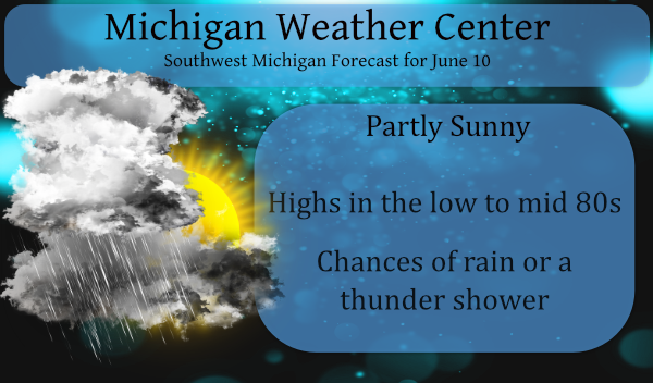
- Chances for showers and a few storms today

Not expecting as much coverage to the precipitation today, but it
should occur once again. Surface based mean CAPE values via the
SPC HREF show 1,000 to 2,000 j/kg this afternoon which should be
more than enough for scattered showers and storms. The
precipitation should be focused in a couple locations... 1)
towards the lakeshore along the lake breeze front and 2) near the
I-96 corridor where a weak boundary appears to set up. Certainly
scattered activity and it may end up being a bit more than that
in the lakeshore counties and towards Grand Rapids at times. From
roughly 100pm through 700pm we should see showers and a few
storms. There is some indication that some of this activity could
even percolate after dark for a bit. Given weak shear the storms
will be random in nature and nothing close to severe.

- Isolated/scattered chances for precipitation Friday-Saturday

Some diurnally forced showers and storms are possible once again
on Friday. The activity should be isolated/scattered once again.
The SPC HREF shows the lake breeze and Central Lower Michigan as
favored locations. The activity will fade into Friday night with
the loss of daytime heating.

A better chance for showers and storms will occur on Saturday
along and ahead of a cold frontal passage. The flow remains fairly
weak overall so not expecting anything severe even on the cold
front.

- Cooler and drier into early next week

The upper pattern trends towards a trough in the Sunday and Monday
time frame with some embedded shortwaves moving through the flow.
At this time we have a dry forecast given a very dry profile.
Tuesday into Wednesday the upper flow is northerly with surface
high pressure building in. Bottom line from Sunday through next
Wednesday is cooler, less humid and mainly dry. Highs trend back
into the 70s early to mid next week.
Heard a roll of thunder earlier….no rain… Ugh!!
Approaching 90 on the heat index once again today. What a start to summer!
Got another .25 yesterday. Total since Monday 1.77. Pasture is coming back. Started feeding hay last week.
Heat indexes in the mid 80’s before noon. Wow another HOT one!
We had some rain and thunder yesterday. We have a rain gauge from a science kit… it measures in mL. We had about 3-4 mL… Not a lot but our garden will take what it can.
I just got back from my walk. While not all that bad out it is warm and humid the current temperature here is 81 and my DP is 73.
Slim
I had a nice 0.64 of rain yesterday. Ready for more today if mother nature is feeling generous!
Me = jealous
Yesterday I put up a rain gauge by my business in town. Good timing for the hit and miss rain. Rain at my house which is 4 miles East of town the total was 0.89”, and the rain in town total was a meager 0.03”. Quite a bit of thunder as well.
Bring on the cold front Saturday I’m ready for 70’s again forget this heat …. INDY!!!
Phew! Hit 89 again yesterday. Today will be our 8th warm day in a row.
Here at my house another 0.09″ of rain fell in a brief but heavy downpour. Here everything is now nice and green my grass will need cutting again soon and the tomato plants are growing the best in years. The overnight low here was a warm 67 and at the time it is clear and 68. The DP is down to 64 this morning and in fact it feels nice out side and while my AC is on it is not running at this time.
Slim
Nice cooler morning loved it going to work!! INDY
Well I don’t know about the rest of you, but my backyard sucked up almost 1.5 inches of rain yesterday, with about 1.2 of that coming down over a period of about 30 minutes! Too much, too fast, but I guess we will take what we can get 🙂