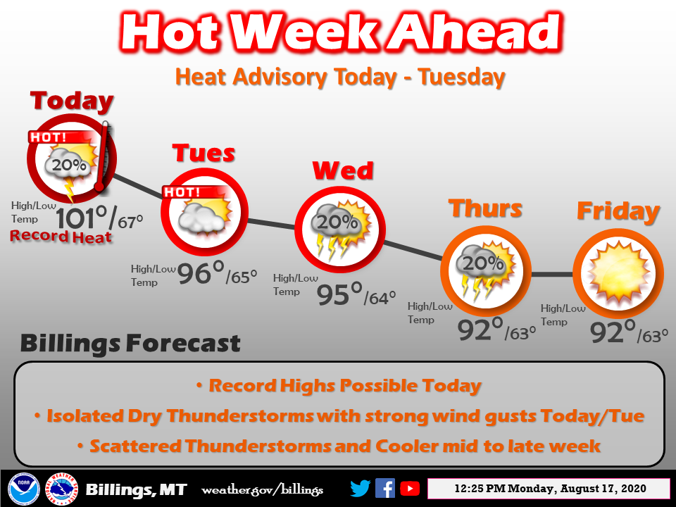
The story this summer has been the heat. We should consider ourselves lucky with high temps of “only” 90° on our hot days. All the major heat has been pushed back to the west where there is major baking going on. The SW is used to hot summers however they are reaching new records of major heat this week. Even places like Billings Montana have heat warnings in place.
Death Valley continues to break records with a low temp of 104° overnight – I can’t’ imagine trying to sleep without air conditioning or walk around barefoot and hear your feet sizzling on the ground. It is claimed it is a dry heat but still, to me intolerable…

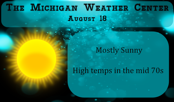
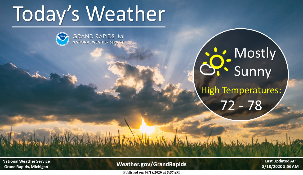
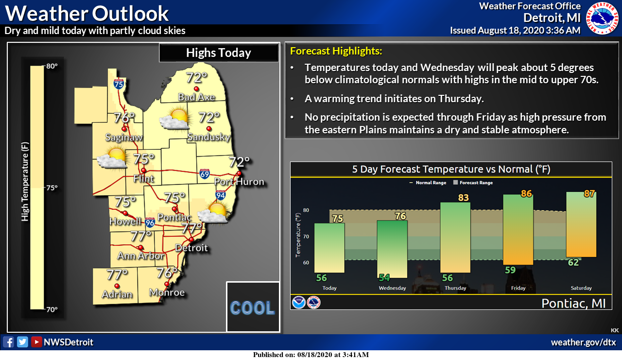
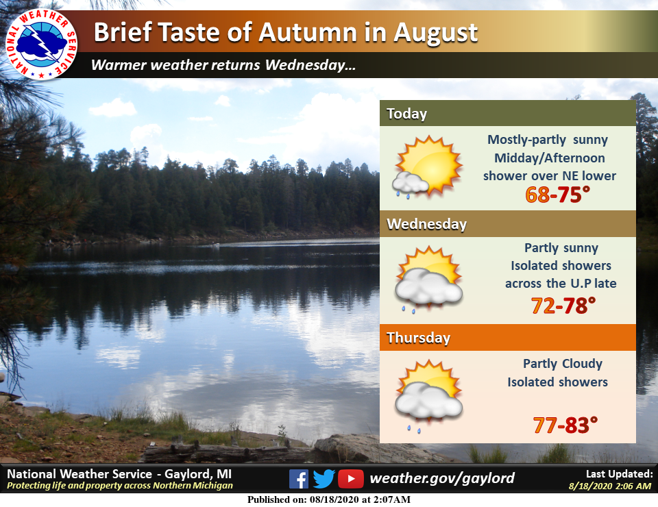
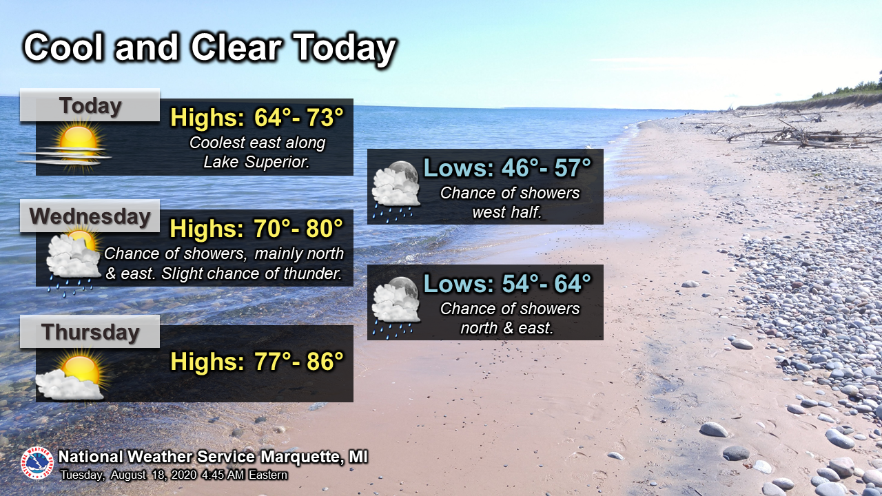
For us Michiganders, we should be near to slightly above normal temp wise. The CPC keeps flopping back and forth on rain guesses from below to slightly above normal chances.
[columns] [span6]
SW Michigan
[/span6][span6]
SE Michigan
[/span6][/columns]
[columns] [span6]
Northern Lower
[/span6][span6]
U.P.
[/span6][/columns]
Forecast Discussion
-- Prolonged stretch of dry weather lasting into next weekend --

The rest of the work week and at least into a portion of next
weekend looks dry. The bulk of the ECWMF ensembles keep us dry at
GRR at least into Saturday evening. The operational ECWMF actually
keeps our entire CWA dry into Sunday morning. Our model blends
bring a chance of showers/storms in Saturday afternoon which is
affected by a quicker and stronger wave in the GFS. We feel given
the pattern (northwest upper flow and no substantial southerly
surface flow) that the ECWMF is likely more the way to go. Bottom
line...we feel the dry pattern is going to continue with a warming
trend in temperatures. We will see 70s common for highs today and
Wednesday, but then 80s become common the remainder of the
forecast.

-- Next chance for rain not until the weekend --

The next chance for rain is far from certain, but looks to come
over the weekend in the Saturday night/Sunday time frame based on
ensemble data. The GFS looks over amplified with its upper wave
given a mid summer zonal pattern. The ECMWF is much less amplified
and the shortwave of concern is actually dampening out as it moves
through the Great Lakes. So, while we have chances for
showers/storms next weekend it will need to be monitored as the
ECWMF trend is towards a weaker system. A boundary may be in the
area early next week for small chances for showers and storms.

Overall no major systems are forecast to affect Southwest Lower
Michigan the next 7 days.
The highest temperature in Death Valley this year was 130 on August 16th. Over the last 6 days the high lows there have been. 127/104, 130/96, 126/94, 118/90 and 118/92. The mean for August is now at 105.1 average is 101.6. The coolest low so far this month is 84. Last month the high for the month was 128 and the coolest low was 87. The last time it has rained there was way back on April 20th with 0.01″ of rain fell.
Slim
Well thousands miles away in beautiful cool West Michigan this morning I was reading La Nina Jet stream could be coming this winter for Michigan that would mean colder and snower Winter ahead fantastic I had a low of 57* degrees this morning definitely could feel Fall in the air loving it have a super Tuesday ..INDY..
Wow – look at all those heat advisories for pretty much all of the states out west! Incredible!
One media outlet said Death Valley hit 130 yesterday. That’s ridiculous.
Yes, Death Valley reached a reported high of 130 on August 16th
Slim