Today we reflect not only on our feasts of turkey and ham but also on the blessings of the past year, another year of life, friendships, and families. Even though we have had times of Covid, flu, protests, foreign war, and senseless gun violence we take time to think about the blessings in our lives and families. We have food on the table, shelter, and jobs (those of you who aren’t retired) – we have much to be thankful for. One of the things I am thankful for is all my friends here on the blog at the Michigan Weather Center, may you all have a peaceful and happy Thanksgiving day!
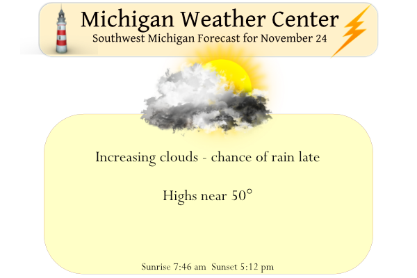
Skies will become mostly cloudy for Thanksgiving Day with showers moving through during the late afternoon and evening. Temperatures will peak in the 40s to low 50s. Rainfall totals will be light, most areas will see a tenth of an inch or less.
Forecast Discussion
-- Rain showers this afternoon into tonight --

A midlevel shortwave trough and associated vort max--currently
evident in WV imagery near ND/Manitoba--will continue
southeastward toward the Great Lakes today. Strengthening ascent
ahead of this feature, combined with PW increasing to 0.6-0.7
inches, will result in precip arriving in the forecast area this
afternoon. RAP and HRRR profiles continue to exhibit weak
conditional instability within the 850-700-mb layer, yielding
MUCAPE of 10-70 J/kg. This should contribute to some
convective/showery elements this afternoon/evening. Total rainfall
through Fri morning is expected to be 0.2 inch or less, as
supported by 00z HREF LPMM guidance.

Subsidence/drying tonight will bring an end to precip, and a brief
period of cold advection will occur following the passage of a cold
front. Clearing is expected on Fri as a low-level ridge axis
builds into the region.

-- Precip Sat night into Sun...mainly rain --

The mid/upper trough currently over the southern Rockies will
continue to dig southeastward, becoming a closed low tonight near
southern NM/western TX. This low will then eject northeastward
beginning on Fri night, spurring the development of a surface low
in eastern TX by Sat morning. The GEFS mean and deterministic GFS
have recently trended decidedly slower with the progression of
this system into Sun, and now show good agreement with the EPS
mean and ECMWF. Accordingly, PoPs in the forecast area have been
eliminated on Sat afternoon/evening to reflect a later precip
onset.

An area of steady precip is expected to approach from the south late
Sat night, maintained by deep QG forcing for ascent. Confidence
remains high that this precip will fall primarily as rain. However,
as dynamical cooling proceeds and wet-bulb zero heights fall,
rain may mix with wet snow, mainly within our northern two rows of
counties. With surface temps likely in the mid 30s, travel-
related impacts appear unlikely. Categorical PoPs will be carried
in most zones for the Sat night-Sun timeframe, with likely PoPs in
the far northwest.

-- Tue and beyond --

Global ensemble (EPS and GEFS) means remain consistent in depicting
a digging trough over the western CONUS from Sun night into Mon. At
the surface, a lee cyclone will likely develop in the high plains
during the Mon night-Tue timeframe, then approach the Great Lakes
on Tue night. Ensemble probs continue to suggest that rain
associated with this system may reach the forecast area as early
as Tue afternoon, with rain becoming likely on Tue night into
Wed.

A sizable number of EPS and GEFS members in the latest runs
depict a seasonably deep surface low passing northwest of the
forecast area around Wed morning, implying cold-frontal passage
through the area and a period of pronounced low-level cold
advection--a factor more favorable for strong winds. Indeed, a
growing number of EPS members now produce gusts of 40+ kts in the
forecast area during the Wed-Wed night timeframe. Later updates
will continue to assess this midweek system.
Happy Thanksgiving MV’s best you know who you are …. Thanks Michael and Slim for the perfect weather blog … Rocky we could already have 100 inches of snow and we would be below average nothing new this time of year lol…Happy Thanksgiving my snow and cold buddy.. INDY
Rock on! 100 inches of snow is definitely possible this year! Get ready for a wild winter!
HAPPY THANKSGIVING EVERYONE!! I hope you all are enjoying your day with those you love.
Happy Thanksgiving to everyone! Been a rough year but still much to be thankful for. Nice mild day again today, we’re heading out with the kids for some holiday Pickleball.
I see yesterday ended up as yet another day with below normal temps in GR! This despite all the hype about yesterday feleling like a nice Spring day! Incredible!
Happy Thanksgiving everyone! Hope you all enjoy your time with family!
Happy Thanksgiving everyone! It’s nice and sunny out again this morning, I’ll be going for a walk with my family this afternoon… hopefully the rain holds off
At the risk of getting philosophical… I am suffering through back pain as I write this, but it reminds me of all of the days I have had (and will have) where my back hurts, there or more days when it feels just fine. Our lives are like the weather… some days are sunny and pleasant, while others bring storms. One constant is that it is ever changing, and to be grateful for both “seasons” to help remind us that the storms are part and parcel of the human condition, but that the calm, peace and beauty are as well.… Read more »
Bernie…. your words are so true. Thank You!!!
Happy Thanksgiving to all of the weather friends here. I am thankful for Michael and all the friends here who teach me new things about weather all the time.
It is our first major holiday without my Dad so please be with those missing people this time of year. I am thankful for those who serve to protect us. Thankful for all my family!!!
Happy Thanksgiving. While I do not know if Christmas will be white this year or not. (Three of the last 4 have been green with 2020 only having one inch on the ground) Anyway we officially will have a white Thanksgiving this year as I still have 1.5” of snow on the ground. Yesterday the official H/L at Grand Rapids was 49/22 there was no rain or snow fall and there was 96% of possible sunshine. The overnight low here at my house was 25 and that is the current temperature. For today the average H/L is 44/30 the record… Read more »
In yesterday’s weather history for SE Michigan there was a report on a tornado that hit the east side of the state. Mark made the commit that this was very odd. As the date was November 20th, 1957, I did some research to see what the weather was like on that date. The becomes even more odd as here in Grand Rapids on that day the H/L was 39/31 and 3.5” of snow fell. At Lansing the H/L was 42/35 with a reported 0.5” of snow fall and even in Detroit the H/L was 44/32 with a reported trace of… Read more »
Thanks Slim. And a Happy Thanksgiving to you, Michael, and all of our friends here. Our daughter came home from college yesterday. It’s nice to have the entire flock under our roof once again. Have a great day, everyone.
Is anyone out there still predicting a below normal year for snowfall? If so, have you lost your mind or are you just delusional?
Normal snowfall this time of year is about 4 inches and we currently have a whopping 28 inches! Wow just wow! What a winter! Keep it rocking!