The true origin of the post-Thanksgiving Black Friday lies in the sense of black meaning “marked by disaster or misfortune.” In the 1950s, factory managers first started referring to the Friday after Thanksgiving as Black Friday because so many of their workers decided to falsely call in sick, thus extending the holiday weekend.
About 10 years later, Black Friday was used by Philadelphia traffic cops to describe the day after Thanksgiving because they had to work 12-hour shifts in terrible traffic. Visitors flocked to the city to start their holiday shopping and, sometimes this popular shopping day coincided with the annual Army-Navy football game. The term caught on among shoppers and merchants in Philadelphia, and from there it took off nationwide.
I have never been one to tolerate shopping on Black Friday, too many people looking for bargains which sometimes brings the worse out in them. For the last few years, I have done my Christmas shopping online which is a much more peaceful experience.
Yesterday’s high was 51° and the low 25°.
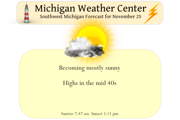
We will have excellent weather conditions today for traveling with the skies becoming mostly sunny and temps near normal with highs in the mid-40s. Conditions should be good at game time for the Michigan/Ohio State game tomorrow at noon – GO BLUE!
Forecast Discussion
-- Clearing today...dry into Sat --

A midlevel trough axis is progressing through the region as of 3 AM,
as evident in GOES WV imagery and RAP mesoanalysis. At the surface,
a cold front has recently exited the forecast area, with modest low-
level cold/dry advection underway. Upstream, GOES multispectral
imagery shows pronounced clearing steadily advancing toward the
forecast area. This clearing is expected to continue eastward
through the forecast area today as a surface ridge builds into the
region and low-level flow curvature becomes anticyclonic.
Abundant sunshine will continue into Sat, although high clouds
will likely arrive from the southwest on Sat afternoon.

-- Mainly rain on Sun...a rain/snow mix possible north --

A closed/cutoff upper low currently over NM/TX/Chihuahua will begin
to lift northeastward tonight. In response, a surface low will
consolidate over eastern TX on Sat morning. This system will then
continue northeastward on Sat night, with the surface low reaching
the vicinity of central IL by 12z Sun and the midlevel low evolving
into a negatively-tilted open wave.

Recent guidance has remained consistent in showing an area of steady
rain reaching the forecast area late Sat night. This rain will be
maintained by strong QG forcing for ascent (Q-vector convergence)
through a deep layer in advance of the mid/upper trough and the
associated surface low. Forecast profiles on Sun indicate lowering
wet-bulb zero heights during the day--likely attributable to
sustained ascent/cooling--which may support a rain/snow mix across
northern zones. The risk of slippery road conditions still
appears rather low, given expected surface temps in the mid/upper
30s.

The final cessation of precip between Sun and Sun night is somewhat
uncertain. Recent deterministic ECMWF and GFS runs have shown a
trailing shortwave impulse on Sun evening that may maintain light
precip into early Sun night. Chance PoPs will be carried in all
zones for this timeframe.

-- Precip Tue afternoon into early Thu...Strong winds possible --

The EPS and GEFS ensemble means remain consistent in showing a
deepening western CONUS trough from Sun night into Mon night. Lee
cyclogenesis is expected to commence on Mon, with a surface low
likely to emerge into the plains on Tue. Thereafter, a majority of
EPS and GEFS members indicate this low tracking northwest of the
forecast area. This scenario would be accompanied by the passage of
a cold front--mostly likely on Wed morning--with strong surface
gusts possible in the post-frontal cold-advection regime. EPS-mean
gusts continue to trend higher on Wed as more members produce gusts
over 45 mph.

Regarding precip with this midweek system, rain is possible as early
as Tue afternoon, with categorical PoPs (rain) featured on Tue
night into Wed. Thermal profiles may cool sufficiently for snow on
Wed, and a period of lake-effect snow is possible from Wed
evening into early Thu, given EPS-mean 850-mb temps falling to
-10C and deep cyclonic flow over the region.
Welcome to Black Friday. I am not sure just when it started being called Black Friday. When I was young if I recall it was called the day after Thanksgiving Day sales. And it was the night that the city of Bay City lite the city Christmas tree. Yesterday was a rather mild day and the official H/L at Grand Rapids was 46/30 there was a trace of rain fall and we had 42% of possible sunshine. The day started with a reported official 2” of snow on the ground. The overnight low here in MBY is the current reading… Read more »
I see MV did a little research in to Black Friday. I always thought the term Black was that many stores would be in the “red” for the year but with the start of the Christmas season they were able turn a profit and thus end the year in the “black”
Slim