We will continue with our uneventful weather pattern today. High temperatures for the next several days will be in the 40s to lower 50s. Some light rain or drizzle is possible late in the day on Thanksgiving and at night, with more substantial rainfall expected for Saturday night and Sunday.
Yesterday’s high was 47° and the low 15°.
Weather History for SW Michigan
November 20
1869: More than a foot of snow fell at Lansing, setting a record for the most ever recorded during the month of November.
2000: An intense lake effect snow squall dropped almost a foot of snow on Grand Rapids, setting a record for the most snow in a November day there.
November 21
1880: Bitterly cold conditions prevail across Lower Michigan. It’s the coldest November day on record at Lansing with a high of only 12 degrees. The low of four below zero is the earliest subzero temperature on record there.
1913: Record warmth prevails across Lower Michigan with high temperatures in the upper 60s and lower 70s. The 70-degree reading at Grand Rapids is a late-season record.
November 22
1866: Seven inches of snow piles up in Lansing as temperatures plunge to the single digits.
1963: President John Kennedy is assassinated in Dallas, Texas. The weather in Lower Michigan is unusually warm with morning lows around 50 degrees and afternoon highs in the 60s. The month ends up being one of the warmest November on record.
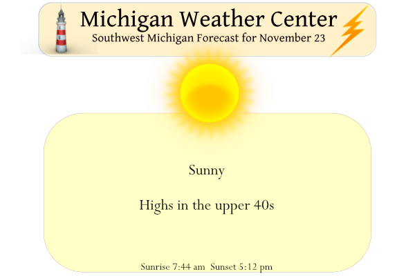
November 23
1931: A record late warm spell peaks on this date with a high of 70 degrees at Grand Rapids setting a record for the warmest temperature so late in the season. It is the warmest November on record at Grand Rapids and Muskegon.
November 24
1950: A massive storm moves through the northeast United States, producing blizzard conditions and record low pressure, and drawing extremely cold arctic air south across Michigan. The bitterly cold air results in high temperatures of only around 10 degrees, with record lows down to nine below zero at Grand Rapids.
November 25
1950: The temperature plunges to an incredible 14 below zero at Muskegon, for the coldest November temperature on record. Grand Rapids hits 10 below for their November record low.
2004: A snowstorm drops between 3 and 10 inches of snow across southwest Lower Michigan. Grand Rapids has a daily record snowfall of 9.7 inches.
November 26
1896: Record warm temperatures in the 60s occur across Lower Michigan. The warmth does not last long, though. A sharp cold front is followed by plunging temperatures for the end of the month. The high of 64 degrees at Lansing is followed by a low of 18 degrees on the next day, and a low of 8 degrees on November 30th.
1949: Lansing falls to 5 below zero, the lowest November temperature on record there.
Weather History for SE Michigan
November 20
On November 20, 1957, an F3 tornado hit Wayne county at 6:50 pm resulting in 12 injuries and 1 death and costing $250,000 in damages.
November 21
On November 21, 2015, a record-setting snowstorm hit Southeast Michigan. Snow began early in the day and gradually increased in intensity with widespread snowfall rates of 1 inch per hour. A particularly intense band brought rates upwards of 3 inches per hour to Howell, where a storm total of 16.8 inches was reported. In fact, numerous locations reported snowfall amounts between 10 and 16.8 inches in Livingston and Oakland Counties. The NWS office in White Lake measured 15.5″ making it the largest snowstorm the office has seen since it was built in 1994.
Also on November 21, 1913, Detroit experienced record highs for two days with 67 degrees on the 21st and 69 degrees on the 22nd.
November 22
On November 22, 1880, there was an exceptionally early cold wave in Detroit which commenced on the 18th and lasted 6 days all with record lows with the bottom hitting zero on the 22nd. This resulted from an arctic high pressure measuring near 31.00″ over Ohio.
Also, on this date in 1909, 2.59″ of precipitation fell in Detroit. This is the record maximum precipitation for the month of November in Detroit.
November 23
On November 23, 1880, the overnight temperature dropped to 8 degrees in Detroit, setting the record low temperature for the day. This also marked the sixth day in a row (November 18-23) of record low temperatures, including a record low of 0 degrees set on November 22, 1880, which is also the record low temperature for the entire month of November in Detroit.
November 24
On November 24, 2004, a potent storm system lifted out of the Southern Plains and moved through the Central and Eastern Great Lakes region this particular Thanksgiving Eve. The precipitation started as rain but changed to snow as the cold air filtered into the storm. Snowfall rates exceeded an inch per hour for a period, as thundersnow was reported. Due to the convective nature of the wet snow, snowfall accumulations varied significantly within and across the counties, generally ranging from 2 to 8 inches. Gusty northeast winds of 30 to 40 mph further aggravated the situation, causing scattered power outages, and reducing visibilities to a quarter of a mile or less at times. Some of the higher snowfall reports that were received included Poseyville (Midland county), 9.2 inches; Auburn (Bay county), 6.4 inches; 7 miles west of Flint (Genesee county), 8.1 inches; Fairgrove (Tuscola county), 5.0 inches; Elba Township (Lapeer county), 5.7 inches; Howell (Livingston county), 5.5 inches; Saginaw (Saginaw county), 8.2 inches; Bennington (Shiawassee county), 6.5 inches.
Also on November 24, 1950, the high temperature for the day only reached 15 degrees in Flint. This is the record lowest maximum temperature for the month of November in Flint.
November 25
On November 25, 1950, it was a very cold and snowy day. A snowstorm hit on this date and continued into the early morning hours of November 26. Total accumulations are 6.2 inches in Saginaw, 8.1 inches in Flint, and 6.3 inches in Detroit. Also during the same time period in 1950 Detroit, Flint, and Saginaw all experienced record lows for 2 or 3 days. Temperatures in Detroit were 7 degrees on the 24th and 10 degrees on the 25th. In Flint, temperatures were 5 degrees on the 24th and 9 degrees on the 25th, and in Saginaw, temperatures were 7 degrees on the 23rd, 0 degrees on the 24th, and 7 degrees on the 25th.
November 26
On November 26, 2018, a low-pressure system with a history of producing more than a foot of snow and blizzard conditions over the central Plains moved into the Great Lakes. Locations in Saginaw and Tuscola Counties saw over 7 inches of snow, while locations in Sanilac, St. Clair, and Macomb Counties only saw a trace of snow or none at all. Flint did break their daily snowfall record for the day with 4.2 inches.
On November 26, 2002, heavy lake effect snow developed over Lake Huron as cold north-northeasterly winds passed over the relatively warm waters of the lake. A lake effect snow band moved onshore in eastern St Clair county and far southeastern Sanilac county on the afternoon of the 26th. The band then remained nearly stationary through the rest of the afternoon and into the early morning hours of the 27th. The snow was the heaviest and persisted the longest in the city of Port Huron. By the morning of the 27th, 12-hour snowfall totaled 17 inches across the northern half of the city of Port Huron, while the south half reported amounts of around 13 inches. In Sanilac County, 12-hour snowfall amounts were reported as; 8 inches in Lexington, Crosswell, and Applegate.
On November 26, 1977, the snow continued to fall as cold air filtered into Southeast Michigan. The snow started on November 25 and continued into November 27. By the time it stopped snowing Detroit had 5.6 inches of new snow, Flint received 2.9 inches, and Saginaw recorded 6.0 inches.
Also on November 26, 1949, the overnight temperature dropped to a freezing -7 degrees in Flint! This is the record minimum temperature for the month of November in Flint.
Forecast Discussion
-- Dry today and tonight --

Latest GOES imagery reveals mostly clear skies over the forecast
area. Aloft, a ridge axis extends from the Dakotas into Manitoba,
with broad subsidence apparent in WV imagery downstream of this
feature. Given fairly dry boundary-layer profiles, only passing
high clouds are expected today, allowing for plentiful sunshine.
Patchy freezing fog is noted in recent surface obs, and some slick
spots will be possible on roadways from black ice through the
morning. Favorable radiational cooling conditions tonight may lead
to patchy fog again into Thu morning.

Farther upstream, models indicate that a mid/upper ridge will build
over the Pacific NW and southwestern Canada today and into Thu.
Meanwhile, a vigorous trough--currently depicted in WV imagery over
ID and western MT--will dig southeastward across the Rockies
through Thu, evolving into a closed low near TX/NM by Thu night.

-- Rain showers Thu afternoon into night --

As the closed low settles into the southern high plains, a shortwave
trough will approach Lower MI on Thu evening. QG forcing for ascent
ahead of this feature, along with deepening moisture (PW of 0.6-0.7
in) should be sufficient for precip as early as Thu afternoon,
continuing into the night. Forecast profiles exhibit some shallow
conditionally unstable layers, yielding modest MUCAPE (< 50
J/kg)--suggesting that precip may have convective/showery
elements. Thermal profiles continue to support entirely rain, with
fairly light amounts expected--generally 0.2 in or less. PoPs
will be carried in all zones--likely south (near I-94), with
chance elsewhere.

-- Precip Sat afternoon/evening into Sun...mainly rain --

The EPS and GEFS means have lately shown better agreement in
ejecting the aforementioned southern plains midlevel low
northeastward beginning on Fri night. The remaining forecast
uncertainty for the Sat-Sun period is primarily related to overall
precip timing, with the GEFS mean and GFS being somewhat faster with
the progression of this system than the EPS mean and ECMWF. These
differences aside, all EPS members produce precip over the southern
forecast area from Sat night into Sun, with a sizable and growing
majority of GEFS members doing the same. Thermal profiles in
deterministic runs--along with ensemble-member p-type
diagnostics--continue to support predominately rain, but some wet
snow cannot be ruled-out late Sat night and Sun as wet-bulb zero
heights fall. Likely or categorical PoPs (highest south) will be
carried in all zones for this timeframe.

-- Mon and beyond --

Farther ahead, EPS and GEFS means show broad consensus that a
western CONUS trough will deepen on Mon, with downstream height
rises over the eastern CONUS into Tue. The western trough will
likely facilitate cyclogenesis in the lee of the Rockies by Tue,
with precip possibly reaching the Great Lakes by midweek.
A white Thanksgiving! Now that is incredible! Just a sign of things to come!
Another fantastic day today. Feels like early March with the sun and melting snow
52 and sunny here. I think I’m going to out and hang our Christmas lights. 🙂
“On November 20, 1957, an F3 tornado hit Wayne county at 6:50 pm resulting in 12 injuries and 1 death and costing $250,000 in damages.”
That late in the year? That’s crazy.
Yesterday was a rather pleasant late November day there was 80% of possible sunshine there was no snow or rain fall and the official H/L was 42/18. The day started out with 4” of snow on the ground. The overnight low and current temperature here at my house was(is) 19. There is now just 3” of snow on the ground here at my house. For today the record high is 70 set in 1931. At the current time this is the latest high of 70 or better until March 3rd so it is safe to say we should not see… Read more »