We are now deep enough into October when in the past there have been some years when Grand Rapids had its first measurable snow fall. Here are some of the years of those early snow falls that occurred during October 12 thru the 20th Note that since 1950 several of the years of early October snow falls were El Nino years.
October 12 2006: A record early season snowstorm brings up to eight inches of snow to southwest Lower Michigan. Tree damage and power outages were extensive around Hastings in Barry County as the wet, heavy snow clings to the tree branches, which still had leaves on them. Some snow fall amounts were Hastings 6.5”, Lowell 4.0” Grand Rapids 2.1” Lansing 1.5” On the east side of the state Flint had 2.3” Saginaw had 0.3” and Detroit had 0.2” That winter was a weak El Nino. The winter had a mean of 27.0° there was a season total of 83.3” of snow fall. February was the coldest and snowiest month with a mean of 18.3° and 33.6” of snow fall.
October 16, 1943: A snowstorm drops an inch or two of slushy snow across southwest Lower Michigan. The high temperature at Grand Rapids and Lansing is only 39 degrees. While the history write up says 1 or 2 inches most locations is SW Michigan only had a trace of snow on that date. Lansing did have 1.7” There are reports that winter was a strong La Nina winter. The meteorological winter mean at Grand Rapids that winter was 27.2. the total snowfall was just 35.7” with March not only cold 29.8 but had the most snowfall at 16.3”.
October 17, 1952: After a frosty morning with lows in the 20s, snowflakes fly across western Lower Michigan. An inch of snow accumulates at Muskegon. There is no reported snow at Grand Rapids, Lansing reported a trace. The winter was a weak El Nino The meteorological winter mean was 29.0° there was just 39.7” of snow fall.
2002: Cold weather arrives across western Lower Michigan with high temperatures only around 40 degrees and periods of wet snow mixing in with cold rain. There was only a trace of snow fall that day. The meteorological winter was a Moderate El Nino. It was a cold (25.9 mean) and snowy 88.0” winter.
October 18, 1972: It is an early taste of winter as a snowstorm hits Lower Michigan. The storm drops 4.6 inches of snow at Muskegon, the heaviest snow on record for so early in the season there. That day Grand Rapids has 0.9” of snow fall. There was just a trace at Lansing. The meteorological winter mean was 25.5 there was a total of 65.5” of snow fall it was a strong El Nino
October 19. 1989: Four to five inches of snow falls across Lower Michigan as a record early season snowfall causes power outages and travel delays. Just 4 days after having back to back days with highs of 80. Grand Rapids had 4.5” of snow on the night of the 19th and another 1.3” after midnight for a storm total of 5.8”. Lansing had 3.9” Muskegon had 4.1” Hastings had 4.7” I was working 3rd shift at the time and there was also a lot of thunder and lightning with that snow even. The meteorological winter had a mean temperature of 25.7° that winter with December being just 17.1° and that is the coldest December at Grand Rapids December also had 25.2” of snow and February had 23.8” Even May has 0.02” that fell on May 10th 1990. The winter season had 89.8”and it was a weak El Nino winter.
October 20, 1992: One to three inches of snow blankets southwest Lower Michigan at the culmination of three days of wintry weather with lows around 30 degrees and highs in the lower 40s. After the cold summer of 1992 that October had a early snow fall when on the 20th 2.2” fell at Grand Rapids, 1.2” at Lansing and 1.2” at Hastings. That winter the meteorological winter mean at Grand Rapids was 25.4° March 1993 was also cold with a mean of 30.9 The winter season had 65.3” of snow fall. That winter was neutral.
Of the winters that had some of the earliest first snow falls in west Michigan, most of them were El Nino winters.
The official H/L yesterday at Grand Rapids was 49/47. There was 0.71” of rain fall for the month GR is at 3.01” There were 17 HDD’s for the month GR is now at 127. There were 0 CDD’s and for the month the total remains 27. The highest wind gust was 33 MPH out of the E. There was 0% of possible sunshine. For today the average H/L is 62/43 the record high of 83 was set in 1892, 1897 and 1975 the record low of 29 was set in 1937. The record rain fall amount of 1.82” fell in 2017 the record snow fall was a trace in several years the last time was in 2006. Last year the H/L was 53/38 and there was 0.18” of rain fall.
There will a partial eclipse of the sun today but it will be way too cloudy to see anything here in GR. It will start at 11:41 AM reach maximum at around 1 PM (around 25%) and end at 2:22 PM.
AREA FORECAST DISCUSSION
NATIONAL WEATHER SERVICE GRAND RAPIDS MI
332 AM EDT SAT OCT 14 2023
LATEST UPDATE…
SHORT TERM/LONG TERM/MARINE
SHORT TERM
(TODAY THROUGH SUNDAY)
ISSUED AT 332 AM EDT SAT OCT 14 2023
– RAIN CONTINUES TODAY, STEADIEST NEAR/SOUTH OF I-96
BOTH THE UPPER LOW AND SURFACE LOW WILL TRACK JUST SOUTH OF THE
MI/IN BORDER TODAY. THE NAM AND GFS INDICATE THE FN VECTOR
CONVERGENCE AT THE 850-700MB AND 700-600MB LAYERS IS MAXIMIZED NEAR
AND SOUTH OF I-96, THUS THIS IS WHERE CHANGES IN MAGNITUDE OF THE
THERMAL GRADIENT ARE GREATEST AND WHERE VERTICAL MOTION IS
MAXIMIZED. IT STANDS TO REASON THAT MODEL QPF IS HIGHEST NEAR AND
SOUTH OF I-96 THROUGH THE MORNING AND INTO EARLY/MID AFTERNOON, WITH
AN ADDITIONAL 0.50″-0.75″ OF RAIN EXPECTED THERE. NORTH OF I-96,
0.25″-0.50″ OF ADDITIONAL RAINFALL IS FORECAST. ELEVATED INSTABILITY
IS LACKING ACROSS MOST OF SOUTHERN LOWER MI FOR THE DURATION OF THIS
RAIN EVENT, THOUGH CAN’T RULE OUT A FEW LIGHTNING STRIKES NEAR AND
SOUTH OF I-94 THROUGH EARLY MORNING.
– CLOUDY AND COOL FOR SUNDAY, WITH A FEW LAKE EFFECT RAIN SHOWERS
EXTENSIVE CLOUD COVER WILL PERSIST RIGHT ON THROUGH THE WEEKEND AS
ABUNDANT MOISTURE IS SHOWN FROM 850-500MB. SUNDAY WILL FEATURE
N/NE FLOW AT THE SURFACE AND THUS LAKE EFFECT SHOWERS WILL BE
RIGHT NEAR THE COASTLINE (ESPECIALLY PENTWATER TO LUDINGTON).
OTHERWISE, MOST AREAS SHOULD STAY DRY ON SUNDAY BUT TEMPERATURES
WILL CONTINUE TO BE BELOW NORMAL WITH HIGHS IN THE LOW 50S.
LONG TERM
(SUNDAY NIGHT THROUGH FRIDAY)
ISSUED AT 332 AM EDT SAT OCT 14 2023
STILL A LOW RISK OF A FEW SHOWERS ON SUNDAY NIGHT INTO MONDAY WITH
DEEP CYCLONIC FLOW OVERHEAD AND COLD NNE FLOW/H8 TEMPS AROUND 1C.
LAKE EFFECT SHOWERS OVER LK MI WILL REMAIN MOSTLY OFFSHORE DURING
THIS PERIOD BUT LK HURON LAKE EFFECT OVER THE THUMB REGION MAY FLIRT
WITH THE LAN/JXN AREAS AT TIMES.
A PERIOD OF SHORTWAVE RIDGING TUESDAY INTO WEDNESDAY BRINGS A
DRY/QUIETER PATTERN WITH TEMPS RECOVERING TO MILDER READINGS BY
WEDNESDAY AS THE FLOW TURNS SOUTHERLY AHEAD OF THE NEXT APPROACHING
UPPER TROUGH.
THE GFS HAS FINALLY COME AROUND TO THE EC SOLUTION WITH REGARDS TO
THE MID TO LATE WEEK UPPER TROUGH APPROACHING FROM THE NORTHWEST,
BUT IS STILL SOMEWHAT SLOWER. WILL STAY WITH THE EC EARLIER ARRIVAL
OF SHOWERS WEDNESDAY NIGHT IN STRONG WAA REGIME, FOLLOWED BY LIKELY
POPS THURSDAY/THURSDAY NIGHT WITH THE COLD FRONTAL PASSAGE AND
ARRIVAL OF THE UPPER TROUGH.
UNCERTAINTY IS HIGH AS WE APPROACH NEXT WEEKEND SINCE THE EVOLUTION,
POSITION, AND AMPLITUDE OF AN UPPER TROUGH OVER THE EASTERN HALF OF
THE NATION IS UNCLEAR. DAY 7-8 CLUSTER ANALYSIS SHOWS THE DIFFERING
CAMPS, RANGING FROM A DEEP LONGWAVE TROUGH WITH AN AXIS FROM THE ERN
GRTLKS RGN DOWN TO THE GULF, TO A CUTOFF/CLOSED UPPER LOW FORMING
SOUTH OF MI WITH POSITIVE HEIGHT ANOMALIES LEANING INTO MI FROM THE
NORTHWEST. CURRENT FORECAST IS FOR A CHANCE OF SHOWERS CONTINUING
FRIDAY AND SATURDAY.
Detailed Forecast for Grand Rapids
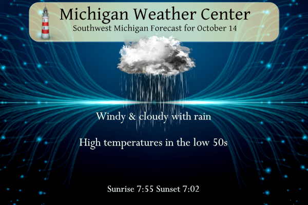
Saturday
Showers, mainly before 2pm. High near 53. Breezy, with a northeast wind around 22 mph, with gusts as high as 34 mph. Chance of precipitation is 90%. New precipitation amounts between a half and three quarters of an inch possible.
Saturday Night
A 10 percent chance of showers before 7pm. Mostly cloudy, with a low around 41. North wind 10 to 16 mph.
Sunday
Increasing clouds, with a high near 53. North wind 9 to 15 mph, with gusts as high as 23 mph.
Sunday Night
A slight chance of showers between 9pm and 3am. Mostly cloudy, with a low around 41. North wind 7 to 14 mph. Chance of precipitation is 20%.
Monday
Partly sunny, with a high near 55.
Monday Night
Partly cloudy, with a low around 38.
Tuesday
Mostly sunny, with a high near 55.
Tuesday Night
Partly cloudy, with a low around 39.
Wednesday
Partly sunny, with a high near 59.
Wednesday Night
A chance of showers. Mostly cloudy, with a low around 45.
Thursday
A chance of showers. Partly sunny, with a high near 60.
Thursday Night
A chance of showers. Mostly cloudy, with a low around 47.
Friday
A chance of showers. Mostly cloudy, with a high near 60.
Bring on a snowstorm! Let’s get this winter party rolling!
Wow, more lows in 30’s next week! What an incredible long term below normal temp pattern! Incredible!