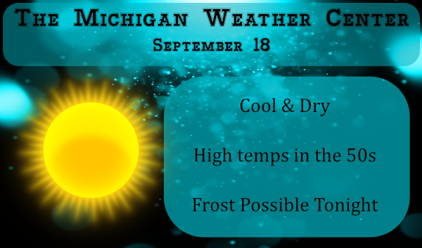
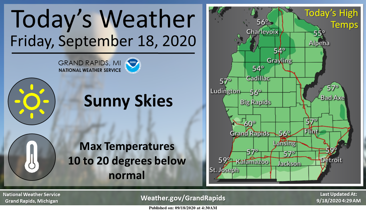
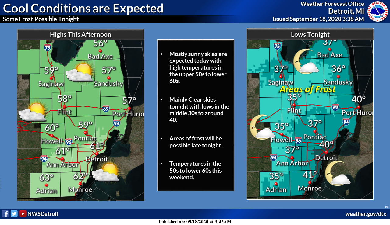
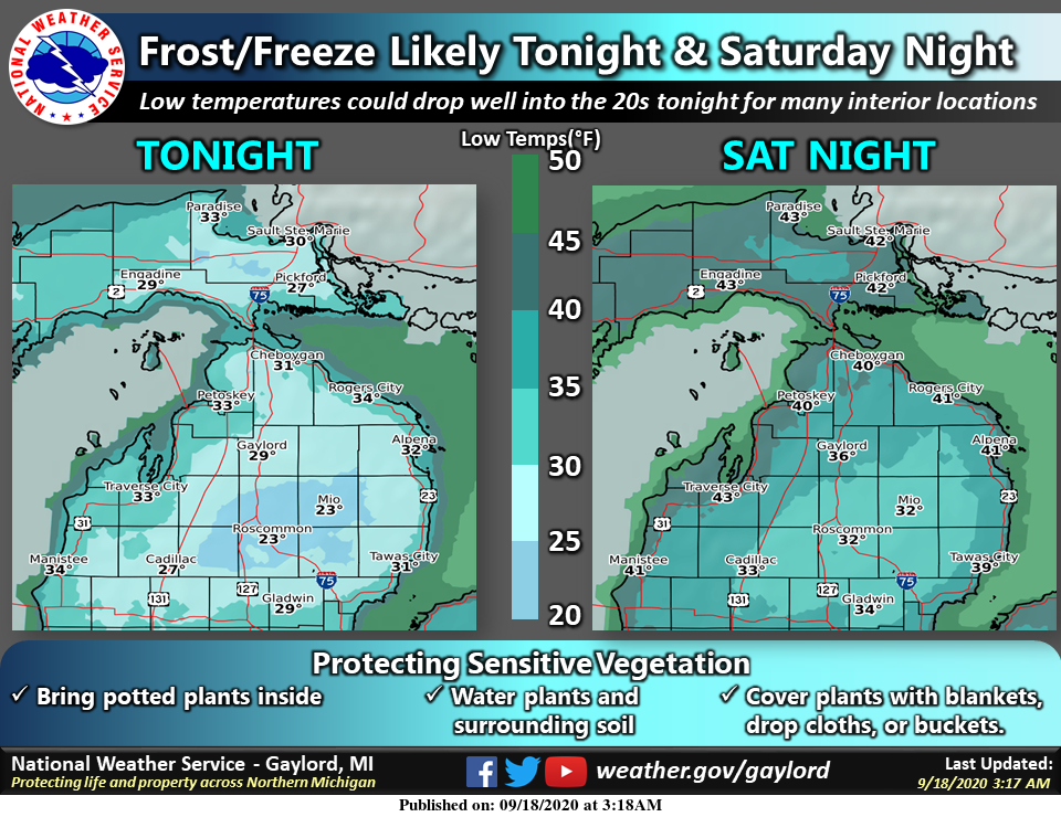
We definitely have a fall like pattern moving into place for today through the weekend with daytime highs struggling to reach 60° and low temps near or at freezing in some areas overnight.
Frost is likely Saturday morning over much of the area, with
freezing temperatures possible north of Big Rapids and Mt
Pleasant. A threat of frost will exist Saturday night into Sunday
morning as well.
If you have any tender vegetation you want to keep alive it will be a good idea to cover them the next couple nights. The current temp in Otsego this morning is 45° at 5:30. We expect the temps to fall into the mid-30s overnight tonight and tomorrow night. We can expect sunny skies through at least the next six days.
It would be a good idea to check your furnace filters. I have my furnace shut off during the summer. This is the first morning it has kicked in.
[columns] [span6]
SW
[/span6][span6]
SE
[/span6][/columns]
[columns] [span6]
North
[/span6][span6]
U.P.
[/span6][/columns]
Forecast Discussion
-- Widespread frost expected Tonight into Saturday Morning --

Cold air along with frost in the north has arrived this morning.
However, persistent wind and mid to low clouds has allowed for
much of the region to not decouple, thus stifling any widespread
frost formation.

  The cold air behind the front will continue through today as
northerly flow persists. Max temperatures today will be 10 to 15
degrees below normal.  This will set up for a very cold Friday
night, into Saturday morning. Tomorrow night will see clearer skies,
with latest model soundings have dry low to mid levels. Along
with the clear skies, this will also mean dewpoints will be much
lower then tonight. The inversion is expected to be much stronger,
with weaker winds which shouldn`t filter down tomorrow.

  These ingredients should allow for areas of frost across the
region into Saturday morning. The lower dewpoints should allow for
temperatures tomorrow night to be 10 to 20 degrees below normal
across southwest Michigan. This will make a freeze is possible near
Route 10.

-- Cooler than normal temperatures through the weekend --

A large upper level trough situated over Easter Canada will
continue to allow for northerly flow to bring cold air through
Michigan through the weekend. This will keep temperatures below
normal through Sunday.
 High pressure building into the upper mid west will cut off this
flow and bring warmer air early next week. This will bring normal
Max temperatures in the upper 60s to low 70s back into the region
Monday. This high pressure will continue through the week as it
positively tilts by Tuesday.

-- Warmer and drier through middle of next week --

 Dry and warm air will continue as high pressure will keep any
passing fronts to our north. this will finally ed mid to late
next week as a deepening trough passes through the upper midwest
Wednesday into Thursday.


-- Next chance for rain late next week --

Ensembles are in fair agreement on the passing of a upper level
trough Thursday. The best moisture will be in canada, though a
short wave extending from this system could bring a chance for
precipitation to southern lower Michigan Thursday afternoon.
What cold snap??
Mookie you are Hopeless!
So much for the short lived cold snap!
Unusual, unseasonable, potentially record cold have captured our current language. No worries though…I’m sure there are nothing but wonderful things heading our way…weatherwise 🙁
Fell to 38* around 420am this morning that’s pretty cold for mid September standards the leaves will really start changing now matter of fact you don’t even have to go that far north to see colors already Im heading to Lakeview this afternoon I will be watching …Have a super Friday enjoy the cool Fall weekend ahead ….INDY
I had a low here at my house of 41. It looks like the official low at Grand Rapids will be 40. That will be the coldest low at Grand Rapids since May 13 when the low dropped down to 31. Also I turned on the furnace for the first time since May a few minutes this morning to to take the chill off. Not to mention I have some family over from Florida. At this time it is clear and 42 here.
Slim
Of note for tomorrow morning is that the lows are foretasted to be in the mid 30″s and if that plays out we could be looking at near record lows. The record low here at Grand Rapids for September 19 is 36 set in 1979.
Slim