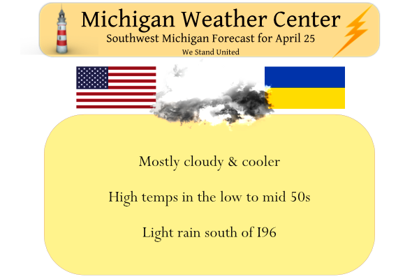
Yesterday we had a high of 77.5° and a low of 63°. Our rainfall for yesterday was .36 of an inch which totals 5.75 inches for the month. Today will be much cooler with highs around 50°. A strong cold front came through around midnight and brought in much cooler air that will remain with us most of this week. Tuesday will be the coolest day with highs only getting to the lower 40s. We could see mixed rain and snow showers Tuesday. A slow warming trend follows into the weekend.
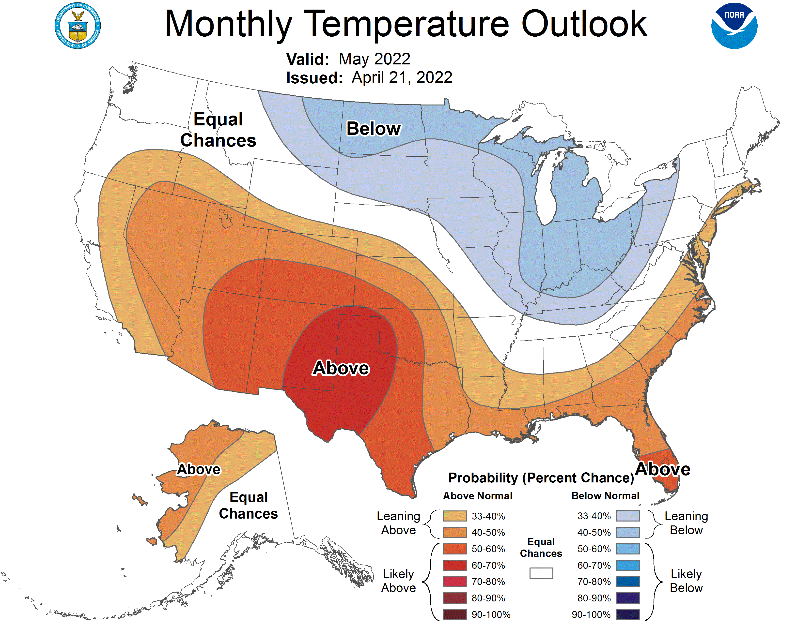
I believe we will continue to ride the roller coaster through much of May. Normal temps are from the low 60s in early May to the mid-70s by the end of the month. Below is the CPCs guess for May:
Forecast Discussion
-- Much cooler with some light rain today to the Southeast --

Latest sfc analysis and radar imagery as of 3 am indicates that the
cold front has just about exited the area this morning. Only the far
SE corner of Jackson County has yet to have it move through. This
front clearing the area has made the rain temporarily end for now.

We do expect that roughly the SE 1/3rd of the area will see some
light rain showers at times today. This will be the result of enough
moisture lingering, and interacting with an upper short wave lifting
NE through the northern part of the state. The wave and the moisture
will be a bit disjointed, which will be the main reason the rain
will be mainly light.

Another front also comes in, which will send 850 mb temps below
freezing by 00z tonight. Max temperatures have likely been reached
for today already, and will only slowly fall through the course of
the day.

-- Some rain and snow showers possible on Tuesday --

The long wave trough will remain over the region on Tuesday,
actually dipping over the area as a strong short wave helps to dig
the trough. The upper jet core will slide over the southern portion
of the forecast area. The cold pool aloft will help to produce some
snow showers, along with some help from Lake Michigan with over-lake
instability boosting.

Even though we have a fairly robust wave and instability in place,
we are not expecting a lot of accumulated precipitation. This is
because forecast soundings indicate that inversion heights are
around 5k ft (even with lake help), and moisture depth is shallow
and does not saturate the DGZ well. While there may be some light
accumulations of snow in the grassy areas up north over the higher
elevations, this should not be a big deal. Also, sfc temps during
the day will be in the upper 30s to mid 40s.

The instability showers should come to an end no later than mid-
Wednesday morning as the upper low moves out and temperatures aloft
modify.

-- Quiet the rest of the week with next rain chances next weekend --

There really isn`t a lot to discuss from Wednesday through Saturday,
as the weather should be quiet. Initially, we will have a ridge that
builds from here up to Hudson Bay. The flow around that ridge will
be from the NE initially. That will funnel dry and cool air over the
area. The upper ridge will then build over the area from the west.
As it does so, it will amplify a bit as the low out west digs
deeper, help to pump the ridge up more.

What looked like precipitation moving in on Thursday a couple of
days ago, now looks like it may take until almost Sunday for the
rain to reach the ground here. The building subsidence and dry air
advection will eat away at the leading edge of the moisture that
tries to come in.

For now, it appears that showers, and some storms would make it in
here around the next Sunday time frame after a warm up. We expect
that precipitation will not be become even more delayed too much
more as the models are likely catching up with the trends.
Temps in the 60’s aren’t bad! I’ll take it! Got my fill of 80’s and sun this week in Cabo!
https://weather.com/weather/tenday/l/b4ea0280869baa46799dc75eacef8904785ec43ad2f6fb098355fbc208a55e2c
Good looking golf weather on Saturday! The morels should start popping good with that weather too!
It is your story. at 10 am it will 45 degrees with a wind chill around 39 and then in the afternoon you will see winds up to 20 mph and a chance of showers! I will wait to golf when we see some actual nice weather!
Could not care less about temps on Tuesday & Wednesday, talking about the weekend. I don’t golf during the workweek!
The conditions that I am describing are for this Saturday! The day you say will be great for golf! No thank you!
Just another cloudy, cool Spring day! Many more below temp days will be coming for weeks on end! 2022 has been very cold and no change is in sight! Incredible?
Currently its 49 degrees in my area northeast of GR thats well below average for the end of April..Im getting worried about my beautiful lylacs coming soon ….INDY
Indy, Your Lylacs should be fine. There are Lylacs in upper Michigan and they do not bloom up there until June on many years and do just fine.
Slim
Shuuu thank you ..I was thinking about putting a sheet over them ..I love my lylacs …INDY
I have some of my plants like my butterfly bush and my clematis plant seem way behind this year. I am hoping that soon we will start to see something.
Yesterdays official high/low at Grand Rapids was 74/56. There was yet another 0.34″ of rain fall that brings the total for the 4.35″ that is some +1.18″ above average. For the year Grand Rapids has now reported 13.48″ of rain/melted snow. That is +3.28″ for the year so far. Here at my house I recorded 0.30″ of rain fall yesterday. The overnight low was just 50 both here and at GRR. At the current time it is cloudy ad 52 here at my house. The forecasted high for tomorrow is just 41. If that plays out it will be one… Read more »
Incredible cold is coming! Get ready!
Seeing more below average days ahead no sighn of any “real” warmth weather anytime soon but then again nothing new with the below average Spring we are having right? INDzy
No real nice spring warmth till the last week of May! Mark it down!
Have you ever wondered just where Mookie lives??? My guess is the far, far, far SE side. LOL
Slim
That is a fact and he is always trying to compare GR weather with Flint, Detroit, Lansing, etc! The weather over there has no bearing on GR weather, in fact it is totally different. His warm weather bias is off the charts and he will not face reality! In fact he has lost all credibility!
Wow, it looks like we are in for near record cold temps this weeK! Possible high temp around 40 degrees tomorrow and lows in the mid 20’s! The incredible cold start to 2022 is still taking hold and showing no signs of any let up! CPC gives below normal temps in May! Wow, just wow!
Don’t look now, but after a warm March, there are several reporting stations that are only slightly below average temps for April. In fact, Lansing is reporting a perfectly average April now after 83 on Saturday and 81 Sunday!
As always, GR seems to be the coldest of the major reporting stations relative to average.
Any issues you have with the reporting at the NWS office for Grand Rapids should be taken up with them. I am sure they will respond to you. If you think their equipment is not calibrated right that is the route to go.
Slim
The NWS weather equipment and reporting is spot on! Like I said some of the warm weather nuts are not facing reality and facts! 2022 is well below normal for temps! Those are the FACTS and the facts are incredible!
January was well below average and February was also below average March was near average and April will be below average. So yes it has been a cold start to 2022.
Slim
I posted this before last week. NWS GR said there could be many reasons for these differences but they are confident in their measurements where they currently are.
You are nuts and have lost your
Mind!