
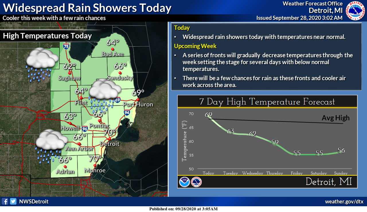
After an extended period of warm and dry conditions, we are plunged back to the reality of our changing Michigan weather. We had our first rain overnight after a two week dry period and it seems we will pay for the blessings of our extended summer this week. It is the end of September and I suppose it is to be expected.
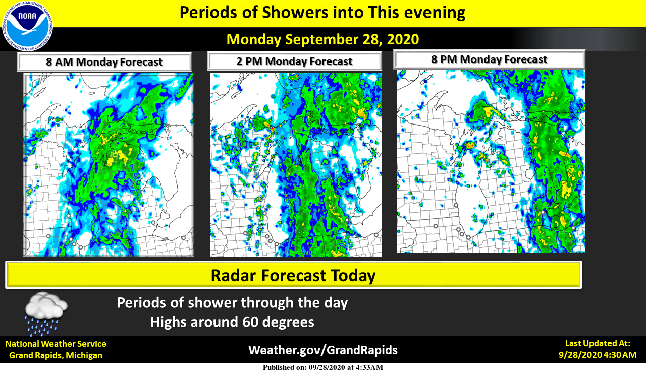
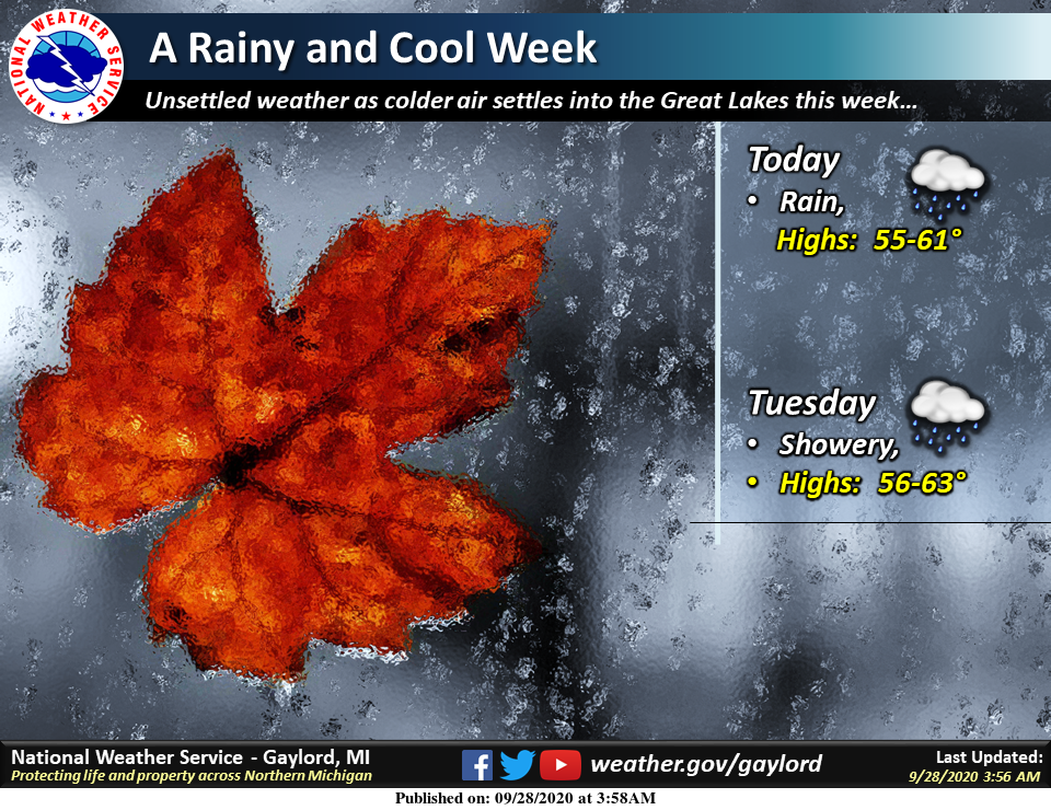
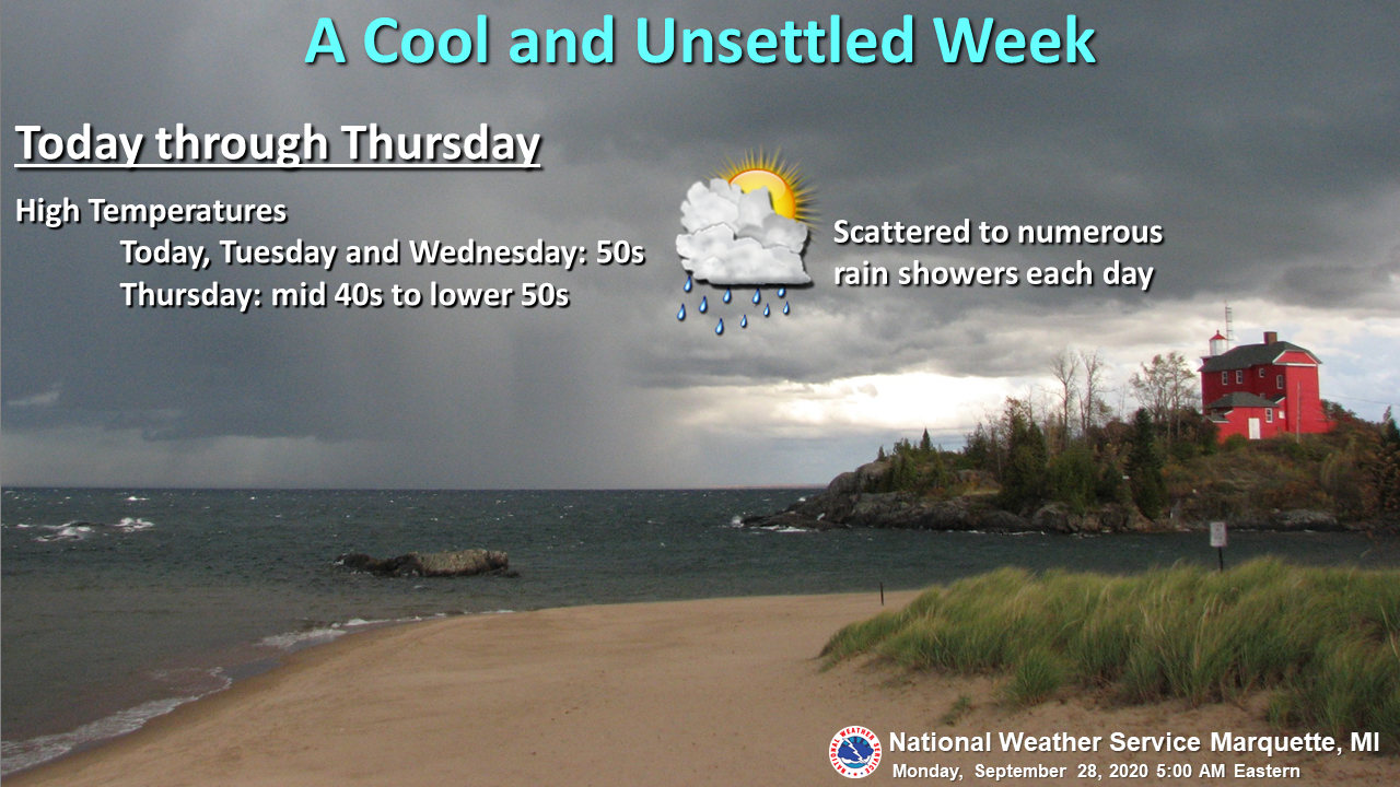
Periods of showers into this evening, then mostly cloudy. Highs will only be near 60 today. Tuesday should be mostly cloudy with highs near 60 once again. Even colder air arrives Wednesday with showers and isolated thunderstorms that will continue into Thursday evening. Showers are possible into Saturday afternoon. Highs will only be in the 50s Thursday through Saturday.
Michigan Forecast
[columns] [span6]
SW
[/span6][span6]
SE
[/span6][/columns]
[columns] [span6]
North
[/span6][span6]
U.P.
[/span6][/columns]
Forecast Discussion
-- Much cooler with beneficial rain showers today --

The rain showers that have been advertised over the past few days
are expanding over the area early this morning. It is kind of
interesting from a meteorological perspective with a weak ridge
overhead. This is the result of being behind the initial cold front
just about ready to finish exiting the SE portion of the state, and
ahead of the cold front over WI that will come through later today.

The rain showers are being driven by the upward motion ahead of the
strong incoming upper trough. This more widespread shower activity
will come to an end by early this evening as the upper trough and
associated surface front pass through.

A few showers will remain possible tonight through Tuesday night,
although they will be few and far between. The cyclonic nature of
the upper air pattern will work with the warmth and moisture from
the Great Lakes to keep that threat in.

-- Even colder air arrives on Wednesday with more showers and
a storm --

We will see rain chances increase once again on Wednesday, with even
a storm possible for most of the area. We will see an upper jet
streak/short wave dig SE during the daylight hours. The wave by
itself will be strong enough to develop some precipitation. Then you
factor in the warmer Great Lakes, cold air aloft, and a peak heating
timing, and get sufficient instability for plenty of showers and a
few storms.

Once the Wednesday wave moves through, it will bring the northern
branch of the upper jet south of the area, and bring the cold pool
aloft right overhead. We will not have the strong wave coming
through on Thursday, but we will have all of the aforementioned
factors to help generate showers and a possible storm once again.
The lake will be a little better contributor with over lake delta
t`s in the mid teens to help with lake effect rain showers. Things
will not be too different on Friday, although the core of the
coldest air aloft and best instability looks to shift south of the
area.

-- Cold and unsettled weather continues through much of next
weekend --

The rain chances will diminish a little bit for Saturday as the
cyclonic flow and cold pool aloft will lift out of the area. It
still will be cool, with plenty of clouds and a chance of a diurnal
shower. This will be better than would looks to come for Sunday. We
will see another strong upper trough come in with a reinforcing shot
of colder air, and a renewed threat of showers.
Current 56* degrees out at thee YARDofBRICKS NE of GR we have a party outside Saturday the fire will be be raging!! Perfect weather for a Fall party coming …INDY
What a week. Below normal temps and a lot of clouds and rain! One inch of rain last night! Incredible!
0.58” of rain here. Not a drought buster, but makes things less crispy. This air feels way better working in than the past week.
Mookei pointed out that he/she would not rule out some 70’s in October and that is a good bet as since 1892 there has only been one October when it did not reached at least 70 and that was in 2009 when the highest reading for that October was just 68. And there is a good chance that it still could reach 80 or better as there have been 60 Octobers since 1892 when Grand Rapids has reached 80 or better.
Slim
Currently a beautiful 53* cloudy degrees with spits of rain out at thee YARDofBRICKS such a beautiful below average day in September Fall is in the air ahhhhhhh love it!! is there anything better ??? No lol…Have a super Monday…INDY
CPC has us back to average temps in their 8-14 day and back to above average temps in their week 3-4.
Six well above average days in a row. It was a great last hurrah to a long summer! Although I wouldn’t rule out at least some 70’s in October.
6 days obove normal that’s it durring this below average month DDDD….Today is wonderful outside fresh air and hoodies ahhhhh….INDY …..
I would not rule out a 80 or better.
Slim
Here at my house I recorded 0.47″ of rain fall overnight that is the most rain to fall here since September 9th. At this time it is cloudy and 53 here.
Slim