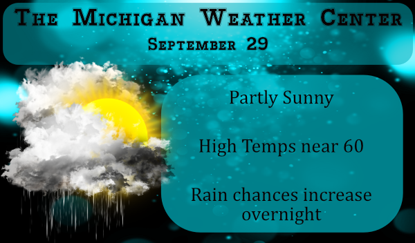
We had some sun as the day came to a close yesterday and the moon and stars overnight. It is currently 49° at 6 am this morning. We had .16 of rain overnight and .19 on Sunday night bringing our total to 3.04 inches for the month. Rainfall totals are taken at 7 am as I keep farmer hours and am in bed by 10 pm and can’t get a midnight reading. The high temp for yesterday was 59° – these are all Otsego readings.
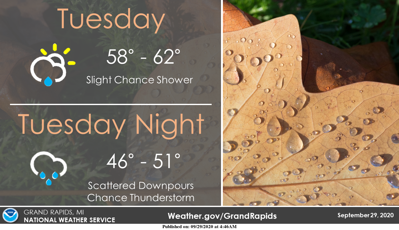
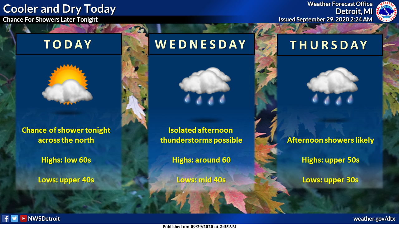
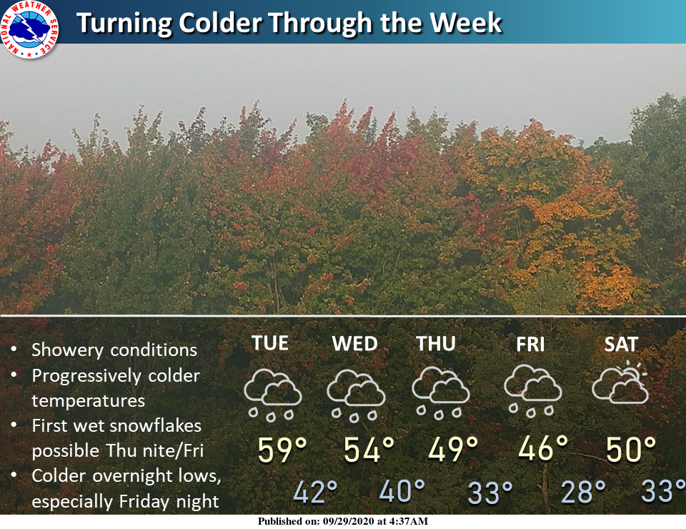
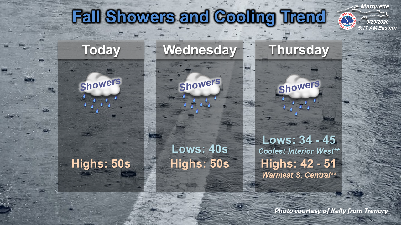
Today may be our best chance of seeing some sunshine until the end of the week. As the day progresses our chance of rain increases. September will wrap up with rainy conditions and cooler than normal temperatures. Even colder temperatures to start off October into this weekend. Some spots may see their first wet snowflakes of the season late Thursday night into Friday morning (northern lower and U.P.).
Michigan Forecast
[columns] [span6]
SW
[/span6][span6]
SE
[/span6][/columns]
[columns] [span6]
North
[/span6][span6]
U.P.
[/span6][/columns]
Forecast Discussion
- Progressively cooler into Friday

We will have a series of cold fronts come through this area, each
bringing colder air than what was over us prior to that front
coming through. There was a weak, secondary cold front, that came
through this area Monday evening. However there is a 170 knot 300
mb jet core topping the western North American upper ridge this
morning. That jet core dives into the deepening central CONUS
trough today. That in turn brings the next stronger cold front
through this area on Wednesday. Finally as the entire system
deepens a third cold front comes through Thursday during the day.
That brings in the coldest air since mid May.

- Showers today then showers and thunderstorms Wed into Thu

Today we are on the cyclonic side of the polar jet but we actually
are between shortwaves so all we have is cold unstable air over
Lake Michigan to help create showers today with. Inversion heights
are below 10000 ft most of the day today. Even so there is enough
shallow instability for a few showers. The high res models show
inland showers this afternoon, mostly from US-131 east into this
evening.

Tonight as the jet exit region of that 170 knot jet core moves
over Lake Michigan and Western Lower Michigan, the inversion
heights jump to near 20000 ft. That results in significant
instability so numerous showers and a few thunderstorm will move
into this area after dark. The frontal system comes through this
area during the day on Wednesday. We will see showers and
thunderstorms a good part of the day on Wednesday. Equilibrium
levels reach to near 25000 on Wednesday and NAM - MU cape reaches
over 1000 j/kg near lake Michigan and 600 j/kg inland. So I do
believe there will indeed be thunderstorms around. Given how cold
it is expect small hail from some of these storms too.

Once that front moves through there is that secondary cold front
on Thursday. I expect showers and isolated thunderstorm then too.
The instability is less on Thursday and equilibrium height are
not as high, but still get close to 20000 ft. MU capes are as high
as 600 j/kg. Which is enough for thunderstorms. Small hail should
be expected from some to those storms too.

Winds turn more to the north behind that secondary cold front so
the showers should be close to Lake Michigan Thursday into Friday.
The upper jet crosses this area on Friday afternoon so that will
kill the lake effect showers by evening.

- Frost/Freeze Saturday morning

We will be well entrenched in the cold air at the surface into
the weekend. With the upper jet to our east Friday night skies
should clear. That will set the stage for a widespread freeze. We
will have to watch this closely to see how it plays out.

- Next system Sunday into Monday

Yet another Pacific shortwave tops the western ridge Friday and
digs into the eastern trough. The latest model runs are stronger
with the system that develops so we would get a surface low that
would track into Ohio in the Sunday time frame. This would bring
rain to our CWA Sunday. There are timing issue through so the rain
may last into Monday depending on how this plays out.
Currently 55* degrees out at thee YARDofBRICKS NE of GR and down comes the leafs outside I’m thinking my color tour next weekend maybe little to late up north still will be worth some good bar hopping though cold Sprites never get old …INDY
Nothing “cold” about temps in the 50’s. Like I’ve always said, these are the perfect temps for being outside. Decent chance for the Northern Lights tonight. Been a while since we’ve had a good show.
https://spaceweather.com/
Currently 51* degrees out at thee YARDofBRICKS NE of GR with winds out of the north can’t say this beautiful sunny below average day is from the smoke out west enjoy the Fall weather ..Have a great Tuesday ..INDY ..
A whopping -2 degrees below average yesterday after a 6 day warm streak. Get ready, the CPC is turning red for Michigan.
I recorded 0.11″ of rain here for a two day total of 0.58″. At this time it is clear to the south but cloudy to the north. The current temperature is 51.
Slim
cold, cold, cold! Frost and freeze warning are imminent for later this week! Incredible cold!
Yes November cold in September love it!! INDY