After an extended heatwave, we will finally get to experience a more pleasant weather pattern for the next few days. Many areas around the state have seen some much-needed rain but much of SW Michigan are still suffering from the drought – we have had 1/4 inch of rain in Otsego thus far for the month and not much relief is in sight.
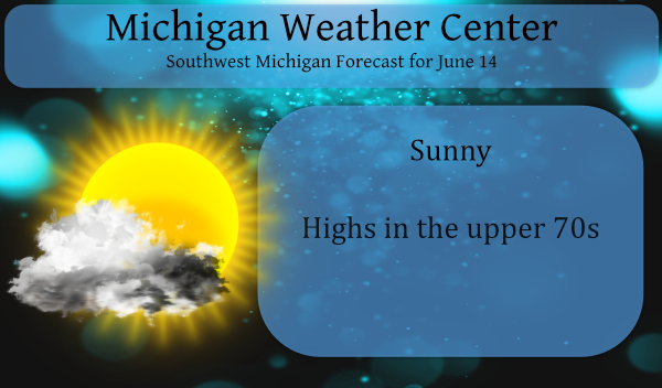
A cold front could bring some showers and an isolated thunderstorm early this morning then much cooler and less humid weather is on the way. Air conditioners will finally get a break this week with lows in the 40s and 50s and highs in the 70s through Wednesday.
My gardens are doing well, we have tomatoes, peppers, cucumbers, onions, melons and radishes which are surviving on well water though they prefer rain we are keeping them alive as well as our many flower gardens and most of the lawn.
The CPC is calling for normal to slightly below normal temps for the rest of the month with slightly above normal rainfall. Of course, the CPC has predicted above normal rain several times over the past couple of months and it hasn’t panned out for most of the state. We will need a lot of wet systems to move through the state as we near the seven inches below normal for the year for many areas.
We haven’t had a lot of severe weather in the state this spring and summer with the exception of the hit and miss storms as shown below.
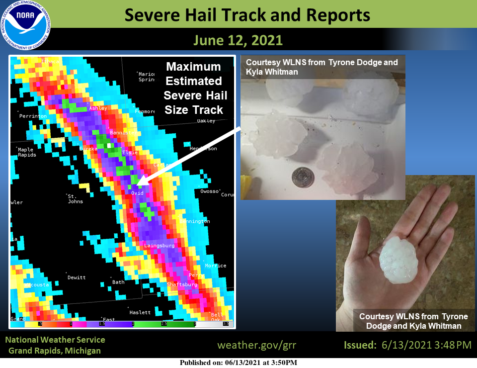
A long-track storm with large hail on Friday evening June 11th caused quite a bit of damage across eastern Clinton County. Baseball-sized hail fell near the town of Ovid, Michigan. Hail this size is unusual, but not unheard of in Michigan.
Forecast Discussion
- Showers and isolated storms moving through this morning

A mid level shortwave is seen plowing southeast through the Great
Lakes early this morning in water vapor imagery. Showers and
isolated thunderstorms have broken out ahead of the wave over
Central Lower Michigan. There is some instability in place this
morning on the order of 400-600 j/kg. This is pretty meager
instability and is resulting in fairly limited convection. Storm
tops this morning are only around 20,000ft with extremely limited
50 dbz cores that are staying mostly below the freezing level. So,
not expecting any severe weather as this activity translates to
the east and southeast through daybreak. By 800am expecting most
of the activity to be off to the east of the forecast area.

- Chance for scattered showers this afternoon

The focus moves from the early morning convection to the chance
for showers this afternoon. Feel scattered showers are certainly
possible given an upper trough in place and mid level temperatures
at 500mb`s that cool to -16C to -17C. Diurnal showers seems
plausible, but at this point thinking instability remains below
the chance for thunder.

- Dry mid week

High pressure builds in from mid week centered over the region
from Tuesday night through Wednesday night. 850mb temperatures
cool to around +8C which will provide pleasant mid summer
temperatures. In fact, beneath the high over Central Lower
Michigan Wednesday morning would not be surprised to see some
readings dip to around 40F. Leota MI, the typical cold spot in
Clare County may dip into the upper 30s.

- Showers and storms Thursday night into Friday

The next chance for more significant weather comes Thursday night
into Friday. Showers and thunderstorms are expected along and
ahead of a cold frontal passage. Strong wind fields are in place
for mid summer with a low level jet pushing 40 knots and a mid
level jet to near 60 knots. Winds are fairly unidirectional so
strong winds would be the main focus. That said, the front is
coming through at night and the better moisture and instability
looks to be south and west of our area. Plenty of time to watch
this time frame and we will be doing just that over the coming
days.
Temps in the low 50’s overnight wow no fans needed …INDY
76* degrees out in my area not sure how it feels hot out again today but ….Sky’s looking dark to my east maybe just maybe some rain lets do it ….From sitting on my deck with no fans on in the house loving this cooler air we have tonight ahhhhh INDY right!!!
It is great to see the CPC shows us entrenched in below normal temps for a while! Bring it!
Wood updated their weather app and I hate it? The radar is also, horrendous. Oh well, I have used them for years, but it is now time to find another app! Also Bills blog has never been the same once they refused to allow comments!
I agree Bills Blog is not as good as it used to without the comments but I have found this site to be just as good, if not better, since commenters need approval before commenting 😀
Great point.
I talk to Bill alot on messenger he’s doing good his blog was a trip just ask Fixer lol…INDY
Yes fixxxer was the most ridiculous person ever! Horrible!
ADA gets a four minute downpour…yay?
This air feels much better than last weeks heat wave. Still hot yesterday at 87, and still hot today in the sun and at work, but at least the sweat dries off faster. Those are some crazy hailstones above!
My cousin cooks breakfast on Sundays at the American Legion in Ovid. She said it was a mess there. Trees down, flags shredded. Hail damage to vehicles and roofs.
As expected the 10 day warm period is now over. As is the norm in our part of the world it generally dose not stay either very warm or very cold for real long periods of time. The upcoming week looks to have several days near and even below average. Now while generally the same can be said for rain fall in our area so far all major reporting locations are well below average rain fall. Not sure how long that will last but that too will come to a end at some point. The overnight low here at my… Read more »
Such a fantastic night no fans on just the windows wide open looks like that will be the case as far as the eye can see so long heat and humidity the refreshing air party has started … Enjoy the longest days of the year this week already wow time is flying!! INDY