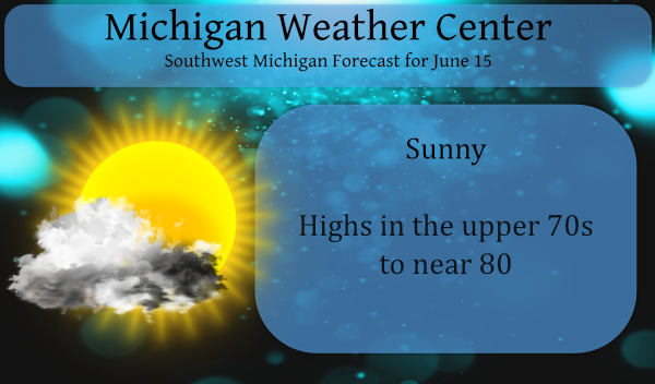
Well, here we are at midmonth for June and many areas in SW Michigan remain dry especially the lakeshore counties where showers have formed east of the lake breeze.
Lake breezes develop when the land becomes warmer than the water. The warm air over land rises and gets replaced by the relatively cool air which resides immediately above the lake surface. You can tell when a lake breeze forms when the wind abruptly becomes “onshore” (blowing from the water toward the shore). Lake breezes generally form several hours after sunrise and have speeds of around 10 mph. Lake breezes generally dissipate in the early evening as the sun begins to set. The spring and summer are the most common times of year for lake breezes.
Lake breezes can impact the weather in many ways. In addition to shifting the wind and cooling the temperature, under certain conditions lake breezes can help to initiate thunderstorms. Lake breezes are also responsible for keeping lake shores less cloudy, due to the fact that the cooler air found in a lake breeze tends to rise into cloud cover less readily.
Since the cooler air moving in to replace the rising warm air is much more stable, convective cloud development is minimized and a “shadow” is seen downwind from the body of water as an area of few clouds.
Yesterday was a good example with clear skies along the lakeshore counties and the development of cumulonimbus clouds east of US131.
There is a slight, I mean in the 10 to 20% range of rain today in southern Michigan however I wouldn’t hold my breath – if you get some consider yourself lucky. We have had a quarter-inch here in Otsego this month.
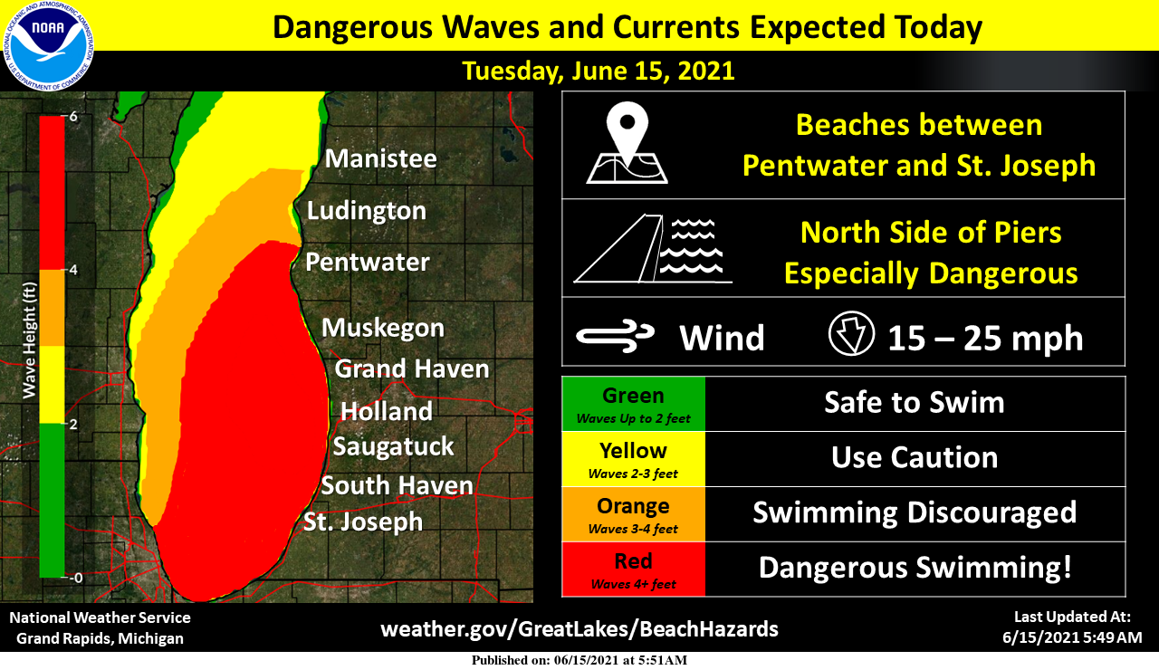
Waves and currents on Lake Michigan will be dangerous to swimmers Tuesday afternoon and evening. Strong currents in the water especially near the north piers can pull swimmers into deeper water.
Forecast DIscussion
-- Dry and seasonably warm air today and Wednesday --

North flow will continue to advect drier air into Michigan. While
temperatures will be right around summertime normals, humidity
will be much more comfortable. Perhaps the only downside to this
dry air (with afternoon relative humidity dropping into the 30s
and 20s percent today and Wednesday) would be the reinforcement of
drought and fire weather conditions especially in areas which did
not see much of a soaking over the past week.

Can`t rule out an afternoon shower in southern Michigan this
afternoon where low level moisture lingers longer into the
afternoon and confluent flow focuses deeper convection. But the
chance of rain today appears to be lower than Monday`s chance was
in hindsight. Most HREF member model soundings for Kalamazoo show
potential for only a 5,000 ft deep cumulus above the LFC, capped
off at about 10,000 feet where the environment is near 0 degrees
C. The HRRR has the cap a little higher at 12,000 feet and -5 C.
With such a low probability of cloud ice at those temperatures
(and no ice clouds present above to seed the cumulus), it seems
unlikely this shallow convection will produce much precip.

-- Warmer, increasing moisture, chance of storms late week --

The upper level pattern across North America transitions from
meridional to zonal after Wednesday. As the upper level ridge
progresses toward the Great Lakes while flattening out, warmer and
somewhat more humid air will advect in from the Plains Thursday
and Friday. We will be west of the ridge axis by Thursday night,
and more under the influence of shortwave troughs moving through
the flow amid an approaching upper level jet streak. Most GFS and
ECMWF ensemble members are advertising thunderstorms (most likely
in the form of a progressive MCS) late Thursday night / early
Friday morning. Lingering surface instability on Friday may
support additional thunderstorms south and east as the more
substantial shortwave trough approaches, but this is much lower
confidence and depends on the early morning storms and timing of
the trough.

Saturday`s air will most likely be cooler (or more pleasant)
behind the cold front, but on its heels will be another shortwave
ridge and trough on Sunday, bringing back warmer and more humid
air with another chance of storms Sunday night or Monday.
Currently 76* degrees out in my area and we can officially say with a cool breeze out of the north wooo woooo feels wonderful outside ahhhh and who likes it hot why ??? Lol…INDY
We are coming up to the half way mark for June and not far away for the half way mark for the year. Here are some rain fall totals from the major reporting locations here in west Michigan all are well below average as of this dated. Grand Rapids for June 0.63″ a departure of -1.25″ YTD 9.18″ departure of -7.72 (there has been even less rain fall here at my house) Muskegon June 0.49″ departure of -0.95″ YTD 7.95″ departure of -7.23″ Holland June 0.51″ departure of -1.22″ YTD 6.97″ departure of -7.73″ to the east at Lansing June… Read more »
Currently 64* degrees o ofut in my area feels so good outside lets keep the heat and humidity away as far as the natural eye can see!! DDDDDD..INDY
73 here but more importantly, the dew point is only 49. Gorgeous day!
Three downpours in Ada yesterday…each one lasted a few minutes, yet soaked the plants 😉
Currently 64* degrees out in my area feels so good outside lets keep the heat and humidity away as far as the natural eye can see!! DDDDDD..INDY
Yes we are in a great stretch of weather and the cpc shows below normal temps! How is that possible with all the warm weather hype on here? Incredible!
So the forecast discussion above is now warm weather hype? I bet they appreciate that.
Love the CPC…YES FORGET THE HEAT AND HUMIDITY!!! INDY
12 warm days in a row, including two 90’s. I love it!
No rain here yesterday either. Mowed the yard for the first time in over 2 weeks and just created a dust cloud. The lake breeze was in full effect yesterday as it was totally clear here, but all afternoon there were some impressive cloud formations with the rain to our East. Not looking forward to the humidity coming back in a couple days.
No rain here yesterday but there was rain not too far away and there was a nice rainbow late yesterday afternoon. There are now more areas that are showing more brown grass. The overnight low here at my house was 57 and it looks like it will be 59 at GRR. At this time it is clear and 61 here.
Slim