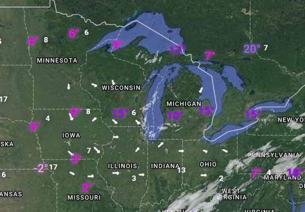
Another cold morning as this blast of Arctic air holds on for a couple more days. We have 7° in Otsego with a wind chill of 0. Grand Rapids is reporting 15°, Kalamazoo is at 7°, Lansing 13° and the low teens along the lakeshore. These are all reports from 7am.
Occasional light snow will persist today but will be followed by dry weather and gradually moderating temperatures the rest of the week. Highs over the coming weekend should be in the 40s, with increasing chances for rain late in the weekend. This will remove the layer of powdered snow we have on the ground now.
Zonal flow aloft (rather than the Arctic flow we have had the past couple days) Thursday night through Saturday will increase temperatures across the Great Lakes. High temperatures will be in the 40s Saturday through Monday. Models show a cold front trying to move south across Lower Michigan Saturday, but it looks like it will stall out over northern Lower due to strengthening south flow over the Midwest ahead of the next storm.
Precipitation chances will increase from Saturday night through Sunday night as a developing storm moves from the southern Plains northeast to the Great Lakes. Both the ecmwf and gfs show sfc cyclogenesis over the Texas panhandle in response to a strong short wave moving across the southern Rockies. This low is forecasted to move northeast along the aforementioned cold front and draw up abundant moisture from the Gulf.
Present storm tracks show lower Michigan being on the southern side of the system, which means rain beginning Saturday night and continuing through Sunday. It`s possible that we could see a mix of some freezing rain and/or snow over the the northern lower Sunday night as the low moves through.
Elevated lifted indices over Illinois are in the -1 to -2c range Sunday evening so some thunder might not be too far away. Heavy rain is a possibility with this system and could lead to localized flooding. Colder air will flow back into the cwa late Monday as the low moves east and northwest winds develop. This would lead to the rain mixing with and changing to light snow.
Today: Scattered snow showers, mainly before 1pm. Mostly cloudy, with a high near 22. Light and variable wind becoming northwest around 6 mph in the afternoon. Chance of precipitation is 40%.
Tonight: A 30 percent chance of snow showers after 4am. Mostly cloudy, with a low around 10. Wind chill values as low as -1. Calm wind becoming southwest around 6 mph after midnight.
Wednesday: A 30 percent chance of snow showers, mainly before 7am. Mostly cloudy, with a high near 25. Wind chill values as low as -1. West southwest wind 6 to 15 mph, with gusts as high as 25 mph.
Wednesday Night: Partly cloudy, with a low around 18. West southwest wind 15 to 17 mph, with gusts as high as 26 mph.
Thursday: Mostly sunny, with a high near 31. West southwest wind around 16 mph, with gusts as high as 25 mph.
Thursday Night: Partly cloudy, with a low around 23.
Friday: Mostly sunny, with a high near 36.
Friday Night: Mostly cloudy, with a low around 31.
Saturday: A slight chance of snow showers before 9am, then a slight chance of rain and snow showers between 9am and 10am, then a chance of rain showers after 10am. Mostly cloudy, with a high near 43.
Saturday Night: A chance of rain showers before 4am, then a chance of rain and snow showers. Cloudy, with a low around 36.
Sunday: A chance of rain and snow showers. Cloudy, with a high near 45.
Sunday Night: Showers. Cloudy, with a low around 34.
Monday: Rain and snow showers likely. Mostly cloudy, with a high near 41.
What a WINTER! The next two days will be perfect outdoor winter sports day! I absolutely love it! Then a brief warm up and then right back to winter! Get ready for some snowstorms the last 10 days of January! The JEM model is all over it!
Good Wasted Wendsday ….Moaning..
Share this video
https://youtu.be/nWlEsta4xS8
The OLD JEM Model Still Tracking A BIG BIG Snow Event Round The Last Week Of January.
& A Possible BLIZZARD in Febuary ….Stay Tuned OR..Better YET CUED!!!
http://www.cpc.ncep.noaa.gov/products/predictions/threats/hazards_d3_7_contours.png
The long term models still show warmth for some time. Thanks to a big shift in the jet stream, the east gets warm and the west cools down. I expect this pattern to hold on for at least the next 1-3 weeks, if not longer.
Here comes the next thaw! Better enjoy what little snow we have before temps get back above freezing later this week. It looks as though GR could be back in below average snowfall for the season soon.
South Texas is under a Wind Chill Warning for wind chills as cold as 10-20 degrees ABOVE zero. That’s cold for South Texas!
Wow another perfect winter day outside! I will be heading over to the Muskegon Winter Sports Park for some snowshoeing and skiing! Here are a couple facts for you – we are still above normal for seasonal snowfall and we have had far more excellent days for outdoor winter sports this year vs. last year! So far this is nothing like last year!
Climatology for today January 16th At Grand Rapids Mi
The average H/L 31/18
The record high is 58° in 1949 the coldest maximum is 9 in 1994
The record low is -16 in 1994 the warmest minimum is 39 in 1939
The most snow is reported as 5.5” in 1924
The most on the ground is 23” in 1979
Last year the H/L was 33/20 and there was no snow on the ground.
Slim
We will soon be on the road. The first part of the trip will with a lot of rush time traffic and lake snows. Here at my house picked up 4” of snow from midnight until cleared out the drive way. The good news is it’s very fluffy and easy to move. The temperature here is 15° with snow falling. We will be in Bowling Green KY tonight,
Slim
Have a safe journey
4 inches of SNOW = another RDB model bingo!