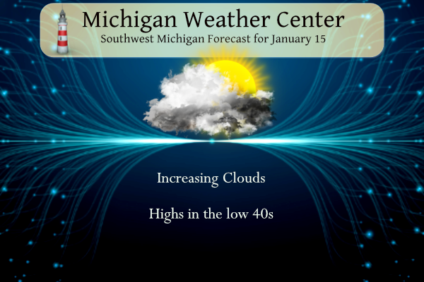
We can expect filtered sunshine through high-level cloudiness today as temperatures push toward a high near 40 degrees. This somewhat boring weather pattern should break into a more active tendency towards rain then perhaps some snow in the Thursday timeframe though the track of that system is still up in the air. With the exception of today, it appears most of the week will remain cloudy so we hope for at least some rain or snow events to break the monotony.
Grand Rapids Forecast
7-Day Forecast 42.94°N 85.61°W 1 15 grrLansing Forecast
7-Day Forecast 42.71°N 84.57°W 1 15 lanKalamazoo Forecast
7-Day Forecast 42.29°N 85.58°W 1 15 kzoForecast Discussion
-- High altitude clouds today --

Though there may be some sunshine today, it should be mostly
filtered through high clouds. Winds increasing to a moderate breeze
from the south-southeast will transport slightly warmer but dry air
back into the area.

-- Rain Monday with a chance of freezing rain in central Mich --

A developing Colorado Low on Sunday will move over Iowa on Monday.
Deep moisture transport and dynamic lifting ahead of this low will
develop precipitation over Lower Michigan during the day on Monday
into part of the night. Ensembles put the the most likely QPF in the
quarter to half inch range through Monday night. A several-thousand
foot deep warm layer above 2000 feet with temperatures between 0 and
5 C will be present through Monday night, eliminating any potential
for snow. The only remaining challenge is the freezing rain
potential north of Big Rapids and Mount Pleasant after precipitation
onset during the day.

This is a pretty marginal setup for freezing rain given the tendency
for warm air advection at the surface and expected temperatures
hovering near 32 early on. The NAMNest, NAM, and ARW do paint a
tenth to quarter inch of QPF falling as freezing rain in
Osceola/Clare counties, but the actual amount that may occur is
likely to be quite a bit lower than this for several reasons.

The potential for freezing rain comes almost entirely from the
antecedent dry air in the near-surface layer, which given a
sufficient rate of precipitation falling through it and evaporating,
may cool (wet-bulb) temperatures to just below 32 for a short time.
The notable differences in the antecedent dew points Monday morning
among the HREF member models can be attributed to how each model
handles the downward mixing of very dry air from just above the
boundary layer today into tonight upstream in Indiana/Ohio. The
onset of appreciable precip rates is still a little in question but
doesn`t appear likely until afternoon. Even if wet-bulb temperatures
do cool off below 32, the efficiency of rain freezing on contact
likely won`t be anywhere close to 100 percent. This efficiency would
be modulated by a balancing act of precipitation that is heavy
enough but not too heavy, air temperatures that likely won`t be much
colder than 32, and the extra wildcard of road surface temperatures
which will probably also be marginal depending on location and
material. Our official forecast is in favor of icing amounts
generally a few hundredths of an inch in central Michigan, likely to
melt Monday night. WPC probabilities for freezing rain
amounts greater than 0.10 inch is 10 to 20 percent.

Lingering light rain showers showers Tuesday may change to light
snow showers Tuesday night to Wednesday morning.
Lastest GFS MODEL slams lower Michigan with 3 system snowstorms now through the end of January followed by some artic air around the end month Winter is far from over folks .. Lets see how the cards play out ahead I would definitely get the snowpants back out …INDY
Hello MI? Can you say winter is returning! Incredible!
https://www.pivotalweather.com/model.php?p=snku_acc-imp&rh=2023011518&fh=384
Rock n Roll will never die …. Yeahhh INDY
The latest models are moving the heavier snow to our North, however plenty of time for the track to sag South! Stay tuned! Bring it!
Second half of January and still rain in the forecast. When was the last below average temp day we’ve had? This has been quite a stretch!
The mean for the day has been above average every day since December 27th
Slim
Going on 3 weeks, pretty impressive for what was supposed to be a “brief” warm up. Even more impressive that many of the days weren’t just barely over average, but way over average.
I remember last year there was a lot of discussion about the winter severity. Slim (I think) had found a link of a measurement of the winter severity that attempted to numerically index it. I am curious how this winter is turning out. I wonder how it would handle the few big snowstorms but mild temperatures in between. Personally I would rank this winter (so far) as extremely mild. And In the world of expensive energy that may be a blessing for some.
According to the index, GR is average due to lake effect snows while most other locations are having an extremely mild winter.
So it seems the index heavily weights snowfall, GR hasn’t had much days with snow coverage, just a good amount of snowfall in short periods.
First off it was Mookie that introduced me to the MRCC index. And as of January 14 Grand Rapids was extreme in late December and is now average but heading toward mild. In lower Michigan only Grand Rapids and Cheboygan are average with all other reporting locations being mild. In Michigan only Ironwood is severe. To the east Buffalo is still extreme but Rochester not far away is mild. Here is a link to the site.
https://mrcc.purdue.edu/research/awssi/indexAwssi.jsp
Slim
Our Weather has been cloudy for most of January with the lack of snow this month GR is still above snowfall
for the Winter season crazzy looking up stream seeing some old man Winter returning with increased snow chances and some bitter cold air around here abouts the 28th of the month with the lakes still warm great scott INDY says snow out or look out!! Have a good Sunday MV’s best …. I N D Y …
What? More cold and snow coming! You mean winter is not over and GR is still way above normal
for snowfall! Incredible!
Breaking Winter Weather>>>>>a big snowstorm is brewing for Thursday! Stay tuned for later updates and the official RDB snowfall prediction! Wow just wow!
Yes Increase chances everyday this definitely could be a Winter storm watch criteria close stay tuned… Racking stacking and tracking it all INDY
Yesterday was fantastic. So many people outside enjoying the sun. The local 10-day forecast here keeps highs above freezing in the 30s and 40s. This has certainly been an abnormal month. The talk around here is the lack of snow:
https://www.wilx.com/2023/01/13/where-is-snow/
And the talk on Mlive is the lack of ice:
https://www.mlive.com/weather/2023/01/ice-cover-on-great-lakes-at-near-record-low.html
Good morning! Well the sun finally came out yesterday and here in Grand Rapids there was a reported 91% of possible sunshine. The official H/L was 31/18 and that is exactly average for the date. There was no rain/snow and there was no snow on the ground. The overnight low this morning is the current temperature of 20. For today the average H/L is 31/18 the record high of 57 was set in 1949 and the record low of -15 was set in 1972 the record snow fall is 5.8” in 1997. This week should start off mild with a… Read more »