We have had an excessive supply of clouds over the past several weeks. We had no sun breaking through the clouds yesterday in SW Michigan and about five minutes worth on Saturday. Today may be our best chance of seeing the sun breaking through the clouds for most of the rest of the week. Lack of snow is another factor figuring into our weather pattern with the exception of the ski resorts. Bittersweet was making snow overnight as the temperatures dipped below 30°. The CPC is still consistent in giving us above normal temps and precipitation which would give us rain/snow/sleet and freezing rain over the next couple of weeks.
Grand Rapids Forecast
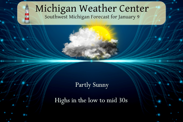
7-Day Forecast 42.96°N 85.67°W 1 9 grrKalamazoo Forecast
7-Day Forecast 42.31°N 85.67°W 1 9 kzoLansing Forecast
7-Day Forecast 42.75°N 84.5°W 1 9 lanForecast Discussion
-- Chances continue to increase for some mixed precip on Tue --

This morning, we are seeing some brief clearing taking place toward
the U.S.-127 corridor. This is in the wake of a elongated trough
that is sinking south of the state this morning. It appears that
this clearing will be short lived for now, with a WSW flow expected
to bring the lower clouds back in from the lake.

It does look like that the southern half of the area will have a
good chance of some clearing this afternoon. The reason for this is
because the flow becomes more southerly, and will not be coming off
of the lake. We expect the clouds to clear from South to North this
afternoon.

That clearing will also be short lived, with precipitation
developing as early as very late tonight, and more likely Tuesday
morning. As mentioned in the previous discussion, this is a more wet
trend over the last 24 hours for the area.

It appears what has changed is that a weak sfc low over WI is synced
up better with a mid level short wave, as compared to 24 hours ago.
There looks to be a weak sfc front nearby that almost acts as a warm
front. As the wave comes by, there is a slight ramp up of the
moisture transport over the boundary, and thus the better chances of
precipitation.

Even though the precipitation chances look better than they did 24
hours ago, this will be a light precipitation event at best. The low
levels of the column start out above freezing, and cool down due to
evaporative cooling as the precipitation begins. It looks like that
up north, the column will cool quickly so that just about all of the
precipitation is snow. Further South and West, the column stays a
little warmer and longer, and results in more rain. We do see a
potential for some brief light freezing rain in between the rain and
snow where sfc temps will be around freezing. This precipitation
will not last long with the upper wave and low level jet both
exiting to the East.

-- Better consensus developing regarding Thu-Fri system --

Wednesday looks rather quiet, with a non-zero chance of some light
precipitation. We will see some weak troughing embedded in the flow
move through the area. With this, there will be a subtle increase in
the low level jet trying to advect a little bit of moisture over the
area. The best forcing will be further south, as will be the better
moisture.

The main focus continues to be on the Thursday time frame, and how
much precipitation and the p-type expected. There is good agreement
that the initial precipitation out ahead of the system will be rain
as it moves overhead. The various model guidance and ensembles do
show differences in how far NW the initial rain is able to make it.

Differences show up then as far as the track of the low is
concerned. The results then are how is p-type affected, and how much
of each p-type occurs. There is good agreement that after the
initial rain comes in, precipitation changes over to snow relatively
quickly as phasing of the bigger southern stream, and cold air with
the northern stream. The exact timing of these systems phasing is
important to where the snow occurs and how much falls. We are honing
in on a solution, but can`t pin it down completely yet.

Cooler air will really filter in then by Friday as the system moves
East, and northerly winds bring the colder air in. This air will not
be too cold with 850 mb temps expected to only drop into the
negative single digits C. There may be a little lake effect, but it
will likely not impact our area much with the flow being from the
North. Any lake effect will then come to an end Friday night as
upper ridging builds over the area.

-- Quiet weather returns for next weekend --

In the wake of the system for Thursday and Friday, we will see a
pretty decent upper ridge build toward the area. This should squash
any precipitation chances. Temperatures will be moderating then for
next weekend as the flow eventually becomes more southerly.
Also this is really nice weather for mid-January. 38, no wind, and sunshine. It looks like mid-March
The sun is finally out here! We know we are desperate when even 10 minutes of sunshine is exciting 😂
The sun is finally out here in my area.
Slim
Almost blindingly bright out! Ready to put sun glasses on in the house. Perfect snow free January day!
Hey, what is that bright, beautiful orb in the sky shining down on us??
Right???
Will we melt?? Lol!!!
Love it… Good one Michael!!!
Sun? Totally cloudy here again!
Sorry for you. Hardly a cloud here.
The cats are beside themselves vying for a spot on the windowsills to bask in the sun.
Same. Our cat and dog are lying along side of each other in the sun coming through the window.
No sun up here in Mount Pleasant today. CMU weather group said cloud cover is split, northern half of the state under clouds.
I’m not sure what’s going on, but NWS GR has been horribly bad lately in their long-term forecast writeups. For basically two weeks non-stop, they have been inaccurately throwing a line or two at the end about some big cold and snow that has never even been close to materializing: December 29: However, on the back side there is a decent chance for lake effect with colder air that could bring snow back to the ground December 31: EXPECT COLDER TEMPERATURES TO RETURN WITH ANOTHER CHANCE FOR SNOW TO BE POSSIBLE NEXT WEEKEND. January 1: The question on many people’s… Read more »
The clouds are a drag but on the bright side, it is no longer dark at quitting time.
Yup I noticed that the other day. Having it light to 5:30 is WAY nicer than 5:00.
Thank God, winter just started and we have months of cold and snow coming! Bring it on! Rock n roll will never die!
The mid point of met Winter is just a few days away.
Good morning! Yesterday was yet another cloudy mild snowless January day. The official H/L at Grand Rapids was 32/28 there was no rain/snow fall. No sunshine. There was a reported trace of snow on the ground at GRR but here in the NW side of town there is only left over snow piles. Overnight temperatures held steady around 29 to 30 and at the current time it is 29 here in my yard. For today the average H/L is now at 31/19 the record high of 57 was in 1939 and the record low of -12 was in 1977. The… Read more »