Yesterday was like living in a whole new world with the sun being out all day. All of the cats and the dog found their places on the window sills or in sunbeams on the floor soaking up the rays. My wife and I drove to Kalamazoo for a doctor’s appointment, it was hard for the eyes to acclimatize to the brightness outside. I have heart arrhythmia and less than half the proper blood pumping through than should be so it is time to have some procedures done to get fixed up to hopefully return to a somewhat normal life. I should know later this week what my schedule will be – Slim is aware of this and will be filling in as needed.
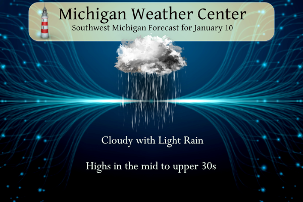
A weak low-pressure system moving through the area today will bring a light wintry mix of precipitation this morning. Rain, snow, and freezing rain will all be possible this morning trending to rain and coming to an end this afternoon. We are not expecting significant travel problems given the precipitation will be light and temperatures will be rising above freezing. We are watching another system coming for Wednesday night through Thursday night time frame which will bring another mix turning to snow.
Grand Rapids Forecast
7-Day Forecast 42.96°N 85.67°W 1 10 grrKalamazoo Forecast
7-Day Forecast 42.31°N 85.67°W 1 10 kzoLansing Forecast
7-Day Forecast 42.73°N 84.51°W 1 10 lanForecast Discussion
-- Light mixed precipitation event still on schedule for today --

There are really no changes to the expectations for the light
precipitation event coming through the area today. Main driver of
this event is a mid level wave near the MN/WI border that zips SE
toward Lake Erie just after 18z today. Helping this cause out is a
weak sfc low and front extending into NW Indiana. A weak low level
jet is helping to push some warmer and moist air over the front to
produce the precipitation.

As the precipitation develops and moves in, we will see a
temperature/thickness gradient from SW to NE across the area. The SW
portion of the area will see mainly rain with sufficiently warm air
to support this. It then cools off to the NE. As this rain moves NE,
it could encounter some near freezing sfc temps that supports a
mention of a small chance of freezing rain. Further North and East,
the column supports snow initially, then going to rain.

Impacts are expected to be quite limited with this light
precipitation. Even though it takes just a little freezing rain to
cause issues, the mild air of late has kept sfc ground temps in the
mid 30s. Also, any light freezing precipitation would be brief
before temps would warm above freezing at any one place. The
majority of precipitation will be ending by 18z. We will likely keep
lower clouds and some haze/mist/drizzle through the day with low
level moisture hanging around, but an unsaturated dgz.

-- A fair amount of uncertainty remains for the Thu-Fri system --

We continue to watch the latest trends of the various suites of data
concerning the system evolution. Run to run consistency is not as
good as one would hope, but it is to be expected with phasing
systems like this. We will say that some accumulating snow looks
very plausible for the area, with eastern areas probably favored a
bit more.

Looking at the various model solutions and ensemble means, the
northern and southern streams will phase at some point. It is just a
matter of when they will. The GFS and it ensemble members favor the
southern stream zipping by quickly, and phasing going on much
further east. The Euro and most of its ensembles indicate the
southern stream being slower, and phasing nearby. This set of
solutions would bring a better chance of snow to the area as the
cold coming in changes the better pcpn shield over to snow.

Our thinking at this time is that the slower southern stream system
seems more likely to occur. This is because the models tend to open
these types of systems up too quick. This thinking would allow the
phasing to occur over the area, vs further east. It is still too
tough to nail this forecast down at this point. The official
forecast will have some accumulation of snow, but nothing too wild.
This seems like a good middle of the road for now, and we can
gradually adjust the forecast without too many issues.

No matter how this system ends up evolving, we will have colder air
filtering in over the area behind the system. Lake effect potential
for our area does not look very good on Friday for a couple of
reasons. First of all, even though there is colder air coming in,
850 mb temps of around -7 to -9C are barely cold enough for lake
effect. Also, the flow looks to be from the NNE, before ridging
builds in quickly and shuts lake effect off.

-- Quiet weekend with another system early next week --

There is good confidence that we will see a dry weekend, with
moderating temperatures. The upper ridge axis will build over the
area Saturday night into Sunday morning. We will be warm advecting
already by sunset on Saturday with SSW flow setting up. Preliminary
RH progs show that there should be a decent amount of sunshine on
Saturday, with maybe more high clouds on Sunday. This will be
welcome news for many people with the amount of cloud cover we have
had over the last month.

We will see the next weather maker in the form of another strong
upper low emerge over the Plains around the Sunday-Monday time
frame. As this does so, we will see a feed of warm and moist air
from the Gulf make its way up our way. This will eventually result
in rain development over the area by the end of Monday.
Michael keeping you in my thoughts and prayers. I have to agree about the sun yesterday. My dog(that I adopted) worships the sun. I find it so bright even in the house but I love to see it.
Yesterday marks 8 years since the 193 car pileup on I-94. It occurred in a heavy snow band. You can still see the area where the pileup occurred even today in the newer paved spot not too far from the Calhoun County line. The winter of 2014-2015 was the second brutal winter in a row following 2013-2014. Bill said that they can come in pairs and he was correct.
https://m.youtube.com/watch?v=CP8OVHHv9ZQ
I’ve also contacted NCEI about the GR temp issue. Will let you know when I receive a response.
After a few “nothing is wrong” responses from NWS GR regarding their impossibly high temps compared to average compared to surrounding areas, it looks like they are now being more proactive about the reporting issues: “We are aware of the average temperature departures at Grand Rapids being different from surrounding stations. The changes began to occur with the latest 1991-2020 normals that were issued for all sites across the United States. The normals are not 30-year averages of the raw data. The process is highly complex and was created by NCEI. What is apparent with Grand Rapids is the 1991-2020… Read more »
That is in line with the response that I received.
Slim
Wow, that is very interesting. Thanks for posting the response.
Good glad to see they are looking into it
This clarifies the faulty equipment theory. They said the changes started occur when the 1991-2020 averages started, so it seems pretty clear there is an issue with that data to me (unless there is a huge coincidence). But we will see
I believe they also moved measuring sites in the last 30 years. Could be the issue as well.
I am currently in the Clarksville area and the ground is turning white here. Moderate snow with huge snowflakes.
Will be thinking of you MV! Prayers 🙏
It’s supposed to be even warmer next week than this week!
At this time it looks like January 2023 could be one of the warmest on record. We are now 10 day into the month and all location are much above above the reported past averages.
Slim
I’ll be thinking of you MV!
Prayer out to you right now that all goes well Michael.
We’ll be thinking of you, MV. 🙂
Prayers for you MV and your family!!!
Good morning! The sun did indeed come out yesterday. With 56% of possible sunshine the official H/L at Grand Rapids yesterday was 39/29 there was no rain or snow fall and of course there is no snow on the ground (other than the old snow piles) With clouds moving back in the overnight low was just 31 and at the current time it is 32 here in my yard. For today the average H/L is 31/19 the record high of 57 was set in 1975 and the record low of -19 was set in 1942. The record snow fall amount… Read more »