The definition of weather is the state of the air and atmosphere at a particular time and place: the temperature and other outside conditions (such as rain, cloudiness, etc.) at a particular time and place. It may not be what we need or desire, there will always be weather.
Big storms and lake-effect snows are out of the picture for a little while, though cloudy skies will usually hang tough. There is hope for a few locations to catch some rays of sunshine Monday, while others miss out. Temperatures will be a bit on the warmer side of average for this time of year.
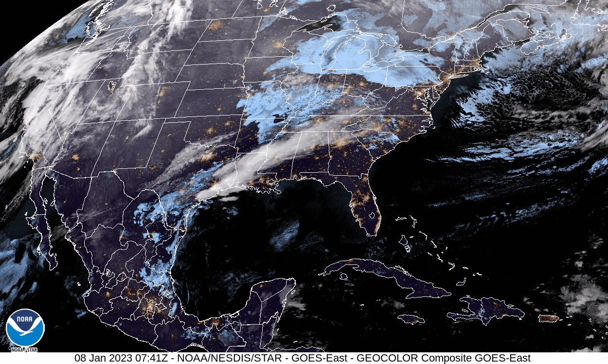
We saw about 5 minutes of sunshine yesterday from brief openings of the cloud cover. I am hoping for a chance of sunshine today looking at the latest satellite images from this morning. (click on the image to enlarge it to show animation). You can see fingers of clearing opening. I don’t know if it will last after the sun comes up.
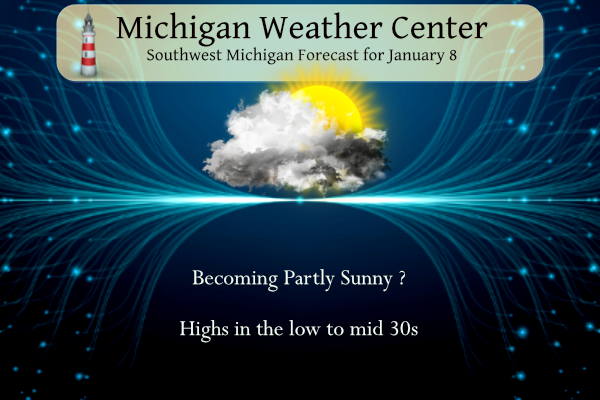
Forecast Discussion
-- Quiet and mild through Wednesday --

We are looking for very little to no impactful weather likely
through Wednesday. That does not mean that we will be seeing
sunshine and warm temperatures either. We will be in between the two
branches of the upper jet stream through Wednesday, keeping anything
in the area weak. There will be multiple weak systems that will keep
quite a bit of cloud cover in place, with very small chances for
light precipitation at times. The chances will be small enough in
most cases to not even mention in the official forecast.

The first of these weak systems will be an upper low over IA this
morning that will be moving south of the state today. There is good
agreement that the IA low will open up and the best energy with it
will move toward the Ohio River. In addition, the associated sfc low
and rich moisture will stay down toward the Ohio River. We will just
see the weak part of the trough move through the area, and we will
see the shallow low clouds just hang on.

The next of these weak systems will be trying to affect the area on
Tuesday. As ridging at the sfc and aloft moves through Monday, we
will see a frontal/baroclinic zone lift toward the area. The models
are not very excited about precipitation chances with this. A weak
sfc low lingers to our west, and a short wave in the mid levels
drops south of the area. These features are a bit disjointed for
organizing precipitation, and once again there is not real a
moisture feed from the Gulf that will help. Another weak low will
move by to the south on Wednesday with similar results.

-- Details still quite uncertain for late week system --

The main system of note in this forecast period remains the system
that will be in the region for the Thu-Fri time frame. As is usually
the case with multiple systems potentially phasing like this, a lot
of uncertainty exists yet, and details can not be pinned down yet.

What we do know is there will be a fairly strong southern stream
system that will be emerging from the Rockies and Plains states come
along about Thursday. This system will have a lot of strong forcing
with it, and will be absorbing good Gulf moisture into it. The
models are all latching on to a northern stream system that will be
trying to dig SE across the region with some colder air associated
with it.

The better consensus forecast the last few days had a nice slug of
mainly rain coming into the area ahead of the southern system, with
colder air eventually coming in toward next weekend behind that
system. There has been a trend in the various model and ensemble
solutions for the southern stream to stay south of the state. Also,
the northern stream has trended to become more of a factor, moving
into the area a little quicker.

The uncertainty is a bit high yet with the models adjusting the
track and timing of each system. This is two fold then, as that has
implications on if and when the two streams/systems might phase. We
have scenarios where the systems could produce very little, if any
precipitation, to different types of precipitation, to different
amounts of the types of precipitation. This system is worth
monitoring for possible impacts. We have still a bit of time to
monitor trends with it. It does look like cooler weather will settle
in behind the system as it exits the region by next weekend.
Great job Lions!! Above .500 and knocked GB out of playoffs!! Love it!!
Here is the list of the least snowy January’s at GR 1st. 1933–0.8″ 2nd 1921–1.2″ 3rd 1933–1.4″ 4th 1932–3.2″ 5th 1944 3.7″ 6th 1902–4.0″ 7th 2001–4.7″ in the winter of 2000/01 it was also a La Nina winter and November 2000 had 23.0″ and then December 2000 had 59.2″ This winter November had 28.0″ and December had 39.6″ so we could be in for a very low snow fall total this month.
Slim
I am curious about this warmth and the possibility of a spring drought. How much of spring ground moisture is dependent on ground thaw and how much is dependent on spring rain? I guess the only way to look at that is to look at other warm winters where the ground doesn’t freeze and observe the frequency of their spring droughts. And By the way, it’s kinda depressing that we are already in a drought or abnormally dry in half of the lower peninsula.
Wow, you’re right. I didn’t realize that much of Michigan was in a drought.
https://droughtmonitor.unl.edu/CurrentMap/StateDroughtMonitor.aspx?MI
Some of the January’s with the least amount of snow fall were in the 1930’s they were also some of the warmest January’s also so you get the general idea.
Slim
According to NWS Detroit, we just experienced our 3rd warmest start to a new year ever recorded.
The average February after a similar warm January start is +2.4 degrees above average.
If the current mean’s were to hold for the rest of the month this would end up being the warmest January. But even as it is with the rest of the month looking above average it could end up being one of the warmest and in a top least snowy as well. We shall see.
Slim
We seem to stuck in an unchanging weather pattern, but it’s not only us. Northern California is getting pounded with cyclone after cyclone. Another one will slam them tomorrow and three more are being monitored out in the Pacific.
I seen someone comment on the NWS Grand Rapids Facebook page asking when a pattern change could come and they seem convinced the third week of January could be the same story. NWS Gaylord think the end of January into February we may undergo a pattern change. We shall see.
“Signals are for late this month or early February that the polar jet will weaken on this side of the northern hemisphere, and spill some of the cold air onto our side.”
A pattern that lasts for a month (or more?) is quite odd.
I’ve seen some discussion about a sudden stratospheric warming event around the end of the month so that could signal a pattern change. I guess we will see
I was over in Oakland County near Rochester Hills and we had the sky open up big time with quite a bit of sunshine! Then the clouds moved back in. West Mi I see wasn’t so lucky. I enjoyed it while it lasted.
Good morning! Just to show how warm the first week of January 2023 has been, the overnight low here in my yard so far for today is 29 and that is the coldest it has been here since December 28th. The official H/L at Grand Rapids yesterday was 32/29 there was a trace of snow fall and at GRR there was a reported 1” of snow on the ground. Note there was no snow on the ground in my area. GRR reported no sunshine but the sun did come out here for a very short time. For today the average… Read more »
The most snow reported on the ground in Lower Michigan is up towards the tip where there is around 3 to 4 inches. However in the UP the Sault and Marquette have 22” and Munising has 25” so it is a different story once one gets north of the bridge. But even in the UP January has been much warmer than average.
Slim