Good morning. Here at Grand Rapids, it has been snowing since 2PM on Thursday. Here in MBY it is hard to get good snowfall measurements but of the 6 that I took the range is from 8” to 15” and I have a drift of just over 2 feet. Note this is the total on the ground not the amount that has fallen in the last 30 plus hours. The amount of snow has been held down by small snowflake size and the winds have blowen the snow around a lot. In last week’s snow event when there was around 14” of lake effect I had amount that much on my roof and I used the snow rake to pull down snow at the edge of the roof there is not much new snow on the roof this time.
Even with the small snowflake size Grand Rapids did set a new snow fall record yesterday with 7.5” of snow fall. The old record was 5.9” in 2008. The official H/L at Grand Rapids yesterday was 15/5 and officially at GRR there was 7” on the ground at 7 AM The temperature has been rising overnight and here in my yard the low was 9 but is now up to 14 with moderate snow falling. For today at Grand Rapids the average H/L is 34/23 the warmest Christmas eve at GR was the 59 in 2015 and the coldest was -9 in 1944. The most snow fall is 7.5 in 1993, the most on the ground is 19” in 1951 there was 17” on the ground in 2008. At Muskegon while they reported heavy snow most of yesterday they only reported 3.8” of snow fall and had 8” on the ground. At Lansing they reported 5.9” and had a reported 4” at 7 AM yesterday.
Here is today discussion From the NWS
AREA FORECAST DISCUSSION
NATIONAL WEATHER SERVICE GRAND RAPIDS MI
329 AM EST SAT DEC 24 2022
LATEST UPDATE…
DISCUSSION/MARINE
DISCUSSION
(TODAY THROUGH NEXT FRIDAY)
ISSUED AT 329 AM EST SAT DEC 24 2022
— IMPACTFUL WEATHER HOLDS THROUGH TONIGHT —
FIRST WITH HEADLINES: BLIZZARD WARNING (COUNTIES AND TIMING) WILL
REMAIN UNCHANGED AT THIS TIME, WINTER STORM WARNING EXTENDED FOR
EATON, INGHAM, CALHOUN, AND JACKSON COUNTIES, REST OF COUNTIES
DOWNGRADED TO WINTER WEATHER ADVISORY.
NOT MUCH CHANGE IN CONDITIONS GENERALLY SPEAKING WITH REGARDS TO THE
DEGREE OF IMPACTS FOR EACH RESPECTIVE AREA. SNOW HAS NOT BEEN PILING
UP TOO HEAVY WITH SMALL SNOWFLAKE SIZES, DUE TO A LOW DGZ THAT IS
BARELY IN THE CLOUD LAYER WITH THE EXTREME COLD AIR IN PLACE.
HOWEVER, THAT SMALL SNOWFLAKE SIZE CAUSES MORE RESTRICTION TO
VISIBILITY. THEN ADD THE STRONG WINDS CAUSING BLOWING AND DRIFTING
SNOW, AND YOU GET THE SIGNIFICANT IMPACTS.
WE HAVE SEEN AN UPTICK IN THE RADAR RETURNS OVER THE LAST COUPE OF
HOURS. THIS IS IN RESPONSE TO DEEPER MOISTURE MOVING IN, ASSOCIATED
WITH A SHORT WAVE HELPING TO LIFT INVERSION LEVELS A BIT. THE
GENERAL LOW LEVEL FLOW REMAINS ALMOST FROM DUE WEST, WITH THE
IMPACTS BEING THE GREATEST OVER THE WESTERN HALF OF THE FORECAST
AREA.
WE EXPECT THE BANDS TO BECOME MORE WNW-ENE ORIENTED TOWARD DAYBREAK
AND BEYOND. THIS IS LIKELY TO OCCUR IN THE WAKE OF THE STRONGER
SHORT WAVE THAT IS COMING THROUGH RIGHT NOW. THIS SHOULD SHIFT THE
HEAVIEST SNOW SHOWERS TO JUST SOUTH OF THE I-96 CORRIDOR, WITH
WESTERN AREAS STILL EXPECTING WIDESPREAD SNOW SHOWERS. INVERSION
HEIGHTS WILL LOWER A BIT BEHIND THE WAVE, MAYBE LIMITING THE
INTESNITY A LITTLE. THESE SNOW SHOWERS AND BLOWING AND DRIFTING SNOW
WILL KEEP TRAVEL IMPACTS SIGNIFICANT, THUS THE REASON FOR KEEPING
THE BIZZARD WARNING FOR THE WEST, AND EXTENDING THE WINTER STORM
WARNING FOR THE SE FOUR COUNTIES.
THE AREA EXPECTED TO HAVE THE LEAST IMPACTS WILL BE THE GENERAL AREA
EAST OF U.S.-131 AND NORTH OF I-96. THERE, THE SNOW SHOWERS WILL
CONTINUE, BUT WILL NOT BE AS INTENSE. WINDS WILL LIKELY NOT BE AS
STRONG THERE LIMITING THE BLOWING AND DRIFTING, RELATIVELY SPEAKING.
CONDITIONS WILL REMAIN HAZARDOUS FOR TRAVELLING WITH THE COLD TEMPS
AND SOME BLOWING AND DRIFTING SNOW. WE FELT LIKE THERE WILL BE
ENOUGH TO JUSTIFY KEEPING A HEADLINE OUT, AND DECIDED AN ADVISORY
WOULD BE MOST APPROPRIATE.
— IMPROVING CONDITIONS CHRISTMAS WITH SNOW SHOWERS INTO MONDAY —
THERE IS A CHANCE THAT HEADLINES WILL HAVE TO BE ADJUSTED AND
EXTENDED OUT A BIT INTO TONIGHT, AND MAYBE EVEN SUNDAY (CHRISTMAS)
MORNING. THE SYNOPTIC VIEW SHOWS THE JET CORE AND CYCLONIC FLOW
HOLDING OVER THE AREA THROUGH 12Z SUNDAY, BEFORE LIFTING OUT. SNOW
SHOWERS AND BLOWING AND DRIFTING SNOW SHOULD DIMINISH INLAND AS
WINDS RELAX TONIGHT. THEN, BY 18Z SUNDAY, SUBSIDENCE BUILDING STRONG
SHOULD RELALLY DIMINISH THE INTENSITY OF THE SNOW SHOWERS, AND WINDS
WILL COME DOWN NOTICEABLY.
SNOW SHOWERS ARE NOT EXPECTED TO COMPLETELY END THOUGH AS WE HEAD
INTO MONDAY. ANOTHER SHORT WAVE WILL BE DIVING SE, AND WILL TRACK
SOUTH OF THE STATE. THERE WILL BE MULTIPLE FACTORS THAT LOOK TO KEEP
THIS ROUND OF SNOW SHOWERS ON THE LIGHTER SIDE. FIRST, WINDS
INITIALLY WILL BE FROM THE SE. THIS WILL LIMIT THE LAKE BOOST
INITIALLY. ALSO, THE MAIN FORCING WITH THE SHORT WAVE WILL STAY
SOUTH OF THE AREA. WINDS DO BECOME ONSHORE, AND MOISTURE IS FORECAST
TO BE PRESENT UP THROUGH 15K FT MONDAY AFTERNOON. FORCING LOOKS WEAK
THOUGH, AND THE DGZ IS A BIT LIMITED. THIS SHOULD MOVE OUT MONDAY
EVENING, AND SNOW SHOULD END BY TUESDAY MORNING AS LOW LEVEL
MOISTURE IS SCOURED OUT.
— QUIET TUE/WED WITH WARMER AIR AND RAIN LATE WEEK —
CONFIDENCE IS FAIRLY HIGH AND GROWING THAT WE WILL SEE QUITE A
PATTERN FLIP FROM THIS CURRENT COLD AND SNOWY WEATHER IN PLACE. THE
EXIT OF THE SHORT WAVE ON MONDAY, WILL BE FOLLOWED BY A HIGH
AMPLITUDE RIDGE BUILDING IN FROM THE ROCKIES AND PLAINS. WE WILL SEE
A FEED OF WARMER AIR DEVELOP WITH A SOLID SW FLOW TAKING SHAPE.
TUESDAY WILL LIKELY STILL HAVE BELOW FREEZING HIGHS, BUT WE WILL
THEN LIKELY WARM TUESDAY NIGHT RIGHT ON THROUGH THURSDAY. THE MODELS
AND ENSEMBLE MEANS ARE SHOWING A HIGH LIKELIHOOD OF 50+ DEGREES FOR
A GOOD CHUNK OF THE AREA ON THURSDAY.
THIS WARMTH WILL EVENTUALLY BE ACCOMPANIED BY INCREASING MOISTURE,
AND EVENTUALLY RAIN ON THURSDAY, OUT AHEAD OF LOW PRESSURE MOVING
THROUGH THE NORTHERN PLAINS. THIS LOW MOVES UP INTO CANADA, AND WE
KEEP A DEEP SW FLOW IN PLACE AS LARGE SCALE TROUGHING DOMINATES IN
THE WESTERN U.S.. THIS MEANS MORE WARMER WEATHER, AND RAIN CHANCES
INTO NEW YEAR’S EVE, AND LIKELY BEYOND. THE THING WITH THIS SCENARIO
IS, IF WE GET TOO MUCH RAIN ON TOP OF ALL OF THE MELTING SNOWPACK,
WE COULD BE LOOKING AT SOME HYDRO ISSUES. PLENTY OF TIME TO MONITOR
THIS.
________________________________________
AVIATION
(FOR THE 06Z TAFS THROUGH 06Z SATURDAY NIGHT)
ISSUED AT 103 AM EST SAT DEC 24 2022
SIGNIFICANT IMPACTS TO CONTINUE THROUGH MUCH OF THIS FORECAST
PERIOD, WITH EXTREME IMPACTS TO CONTINUE AT THE TERMINALS CLOSER
TO LAKE MICHIGAN.
SNOW SHOWERS CONTINUE, WITH BLOWING SNOW LOWERING THE VISIBILITIES
DOWN TO LESS THAN 1/4SM AT KMKG AND KGRR. SMALLER FLAKE SIZE DUE
TO THE EXTREME COLD IS ALSO AIDING THE LOWER VISIBILITIES.
WE ARE STARTING OUT THE FORECAST WITH PERSISTENCE FOR THE TIME
BEING. ONE SUBTLE CHANGE WE SEE LIKELY HAPPENING IS THE WIND
VEERING SLIGHTLY TO A MORE GENERAL WNW-ESE FLOW. WITH THIS IN
MIND, WE EXPECT TO SEE THE HEAVIER SNOW SHOWERS SHIFT SLIGHTLY
SOUTH OVER THE NEXT FEW HOURS AS A WAVE MOVES BY. THIS WOULD TAKE
THE HEAVIER SNOW SHOWERS SOUTH OF KGRR FOR A BIT, AND START
AFFECTING KAZO AND KBTL MORE. EVEN WITH THIS, SNOW SHOWERS AND
BLOWING SNOW WILL KEEP CONDITIONS QUITE LOW, WITH JUST A SLIGHT
IMPROVEMENT.
THE NEXT MAJOR CHANGE WE SEE HAPPENING IS LIKELY THE WINDS
WEAKENING IN THE BOUNDARY LAYER AFTER DARK TONIGHT FOR INLAND
AREAS. THIS WOULD LIKELY RESULT IN SNOW SHOWERS MIGRATING A BIT
WEST, WITH LESS IMPACTS FOR KLAN AND KJXN. TOUGH TO SAY FOR KAZO
AND KBTL, AS THIS FLOW IS MORE FAVORABLE FOR THEM. WE WILL PLAY
THEM ON THE MORE PESSIMISTIC SIDE FOR NOW, AND MONITOR TRENDS.
WINDS SHOULD LIGHTEN UP EVERYWHERE EXCEPT AT KMKG, LESSENING THE
BLOWING SNOW SOME.
GRR AIRPORT DSS UPDATE
SNOW AND BLOWING SNOW OBVIOUSLY CONTINUE TO SIGNIFICANTLY AFFECT
THE AIRPORT EARLY THIS MORNING. THERE MAY BE A SLIGHT DIMINISHING
TREND TOWARD 7 AM AS THE HEAVIEST SNOW SHOWERS MAY SINK SOUTH OF
THE AIRPORT. WE STILL EXPECT SNOW SHOWERS AND BLOWING SNOW TO
CONTINUE, JUST MAYBE NOT AS INTENSE.
WINDS WILL AGAIN PICK UP BY NOON TO AROUND 40 MPH, AND BLOW THE
SNOW MORE, ALONG WITH ADDITIONAL FALLING SNOW. DRIFTING WILL
CONTINUE TO BE THE MAJOR PROBLEM, WITH WIND DIRECTION REMAINING
GENERALLY FROM WEST TO EAST. SMALLER SNOWFLAKE SIZE IS LIMITING
ACTUAL ACCUMULATIONS FROM BEING TOO HEAVY.
WE SHOULD SEE MORE SUBTLE IMPROVEMENTS BY LATE EVENING AS WINDS
SHOULD COME DOWN A BIT, AND THE HEAVIEST SNOW SHOWERS WILL MIGRATE
CLOSER TO THE LAKE AS A RESULT.
Here is the forecast for the week. It looks like there will be a major warmup and there is rain in the forecast.
Saturday
Saturday
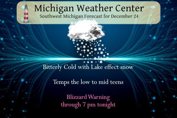
Snow. Patchy blowing snow. Steady temperature around 12. Wind chill values as low as -9. Breezy, with a west wind around 22 mph, with gusts as high as 39 mph. Chance of precipitation is 90%. New snow accumulation of around an inch possible.
Saturday Night
Snow likely, mainly before 1am. Patchy blowing snow before 7pm. Cloudy, with a low around 13. Wind chill values as low as -6. Breezy, with a west wind 17 to 21 mph, with gusts as high as 33 mph. Chance of precipitation is 60%. New snow accumulation of less than a half inch possible.
Christmas Day
A 30 percent chance of snow. Mostly cloudy, with a high near 18. Wind chill values as low as -4. West wind 13 to 16 mph, with gusts as high as 25 mph.
Sunday Night
A 30 percent chance of snow. Cloudy, with a low around 13. West wind 7 to 11 mph.
Monday
A 30 percent chance of snow before 1pm. Cloudy, with a high near 21.
Monday Night
Mostly cloudy, with a low around 10.
Tuesday
Mostly cloudy, with a high near 25.
Tuesday Night
Mostly cloudy, with a low around 18.
Wednesday
Mostly cloudy, with a high near 38.
Wednesday Night
A chance of rain. Mostly cloudy, with a low around 34.
Thursday
A chance of rain. Cloudy, with a high near 44.
Thursday Night
A chance of rain. Cloudy, with a low around 39.
Friday
A chance of rain. Cloudy, with a high near 46.
If you brave travel today use you winter driving skills. And have a great Christmas Eve.
Grand Rapids has had 20.1 inches of snow so far, with about 2-4 more expected (according to Ellen Bacca)
Breaking>>>>>storm total for GR so far is 18 inches!!!!!great job NWS and wood tv 8! Historic snowstorm!!!!!!!!!!!
Very heavy snow at my house now. Incredible lake effect bands today! Keep it coming.
Breaking News>>>>>GR is gettIng hammered with Snow! Where are the naysayers today? This is an epic snowstorm and despite Andy ‘s spewing rhetoric from yesterday, the Wood TV 8 snowfall forecast was excellent and yes Andy Kent county will end up with 14 to 20 inches of snowfall form this storm! Who knew?
The forecast has played out very well! Wish we could get more events like this.
You know it!
My dad was driving down Clintonia road which is the Ionia/Clinton line and almost got stuck in his truck. These back roads around here are even hard to navigate in a truck. Forget a sedan or SUV
Getting a classic lake effect snow shower here now. Large fluffy fakes. This is the kind of snow that adds up fast.
Slim
Yea this is adding up quick. I’d imagine a new snowfall record will be set at Grand Rapids today without much issue
It’s snowing harder now at my house than it did at any point yesterday. Love it!
Just cleared the driveway and took several snow depth measurements. In the back yard that is more protected from the wind I now have between 12 and 15″ on the ground. In the front yard were the wind is widespread I have between 8 and 13″ on the ground. Remember this is new and old snow. I had around 3 to 4″ before this system started. In looking back at past events this storm compares with the January 2 to 8 1999 ( 28.3″ at Grand Rapids) and the December 11-14 2000 (20.8″ at Grand Rapids) Will get a better… Read more »
Still snowing quite heavily here. The snow has still not shifted south of 1-96 yet (I think it was supposed to today). Definitely have over a foot of new snow here since the storm began
You know it and the GR official storm total from this storm will end up in the 14 to 18 inch range! And just think a lot of people did not think GR would get much lake effect from this event! Whoops!
The snow just keeps coming and coming! This is an epic winter storm! Wow, just wow!
Really nice snow band still over me. Highways looks terrible but main roads are definitely driveable with awd or an SUV
Talked to family in Florida and they reported 38 this morning.
GR is still getting pounded with snow! Who would have thought?
Happy Christmas Eve everyone. I hope you are all able to spend it with your families and stay warm.
As for the storm, I have been under that main 1-96 band most of the night but am still in bed. I’ll attempt to measure if I can find an accurate spot.
Currently 12 degrees at 6:50 am. Yesterday’s high was 15 at midnight which fell to the single-digit readings all of the daylight hours – our low here remained 4 degrees, sometimes creeping up to 6. After multiple snowfall measurements, I am ‘assuming’ around 8 inches but it is really hard to tell for sure.
Just took our old dog out. Like most humans, she dislikes the cold greatly. It’s 10 here but that wind is still kicking. I believe that this storm will be remembered mostly the long duration of strong winds. Looks like was may have received a bit more snow during my slumber. My best guess is 4, perhaps 5 inches. Still large areas of bare ground out back. Can’t believe it’s Christmas Eve already. We were ready early this year – even loaded up one groceries earlier than usual, but that was because of the impending storm. I am Catholic, so… Read more »
Only around 6 inches total at my homestead. I’m surrounded be trees and have a decent location for snow measurement on a deck so it’s fairly accurate. Although the weather has been cold, windy and nasty, I was hoping for something similar to the ’78 blizzard, which didn’t happen.
It is about time we started with some facts! 1. I was the first person to put out a snowfall forecast for GR and here it is : Rocky (Rockford) >>>>BREAKING WEATHER BULLETIN>>>>A dangerous storm is coming! Make preparations now! The preliminary 6Z RDB model snowfall estimate for GR is 12 to 18 inches with 4 to 5 foot drifts! Stay tuned for later storm track updates and updated RDB estimates! December 20, 2022 6:39 am 2. As of midnight last night GR a was up to 11.3 inches,, so by now they are over 12 inches, so another spot… Read more »