Looking at point forecasts for southwest Michigan I am not seeing an overwhelming amount of snow, maybe a foot or so for most of our forecast area through Sunday morning, however, point forecasts have to be taken with a grain of salt as they are the judgment of a computer at the NWS in Grand Rapids. The low is expected to move a bit further east than yesterday’s model runs so snowfall amounts will be less. Of course as with anything weather related this can be subject to change in future updates. That said, travel conditions will become frightful Friday and Saturday as the wind picks up and starts blowing the snow around.

Rain or snow will move into Lower Michigan today between 3 and 8 PM. Rain at the start is possible near and east of Grand Rapids and Kalamazoo, more likely and lasting longer toward the southeast side of the state. Temperatures plummet with snow falling this evening and overnight, which would form a crust of ice underneath the new snow in places that see some rain.
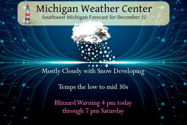
...BLIZZARD WARNING REMAINS IN EFFECT FROM 4 PM THIS AFTERNOON TO
7 PM EST SATURDAY...

* WHAT...Blizzard conditions expected. Total snow accumulations
  in excess of a foot in many areas. Winds gusting as high as 50
  mph.

* WHERE...Portions of southwest and west central Michigan.

* WHEN...From 4 PM Thursday to 7 PM EST Saturday.

* IMPACTS...Travel will likely become very difficult to
  impossible...especially on Friday. Widespread blowing snow
  will significantly reduce visibility. Gusty winds could bring
  down tree branches and cause power outages.

* ADDITIONAL DETAILS...Snow...blowing snow and cold temperatures
  are all expected between this afternoon and Saturday. Blizzard
  conditions will develop late tonight and continue into the
  weekend. The strongest winds and therefore the worst travel
  will come on Friday. Travel is not advised. Whiteout
  conditions will be frequent. Snow accumulations in excess of a
  foot will be possible in many areas. Given the variability of
  lake effect snow...which will dominate much of this event...
  you could very well see more or less snow depending on
  location.
...WINTER STORM WARNING REMAINS IN EFFECT FROM 4 PM THIS
AFTERNOON TO 1 AM EST SATURDAY...

* WHAT...Heavy snow expected. Total snow accumulations of 6 to
  10 inches. Winds gusting as high as 50 mph.

* WHERE...Portions of central and south central Michigan.

* WHEN...From 4 PM Thursday to 1 AM EST Saturday.

* IMPACTS...Travel could be very difficult. Widespread blowing
  snow could significantly reduce visibility. The hazardous
  conditions could impact the morning or evening commute. Gusty
  winds could bring down tree branches.

* ADDITIONAL DETAILS...The heaviest snow will likely fall
  tonight, but widespread wind driven lake effect snow will
  continue Friday into Saturday as well. Strong winds will loft
  the powdery snow easily and whiteout conditions are expected
  at times. Snow totals will vary across the area but many
  locations will see 6 to 10 inches by late Saturday night. The
  worst of the conditions will occur on Friday when travel is
  strongly discouraged.
Marine Warning for Saginaw Bay
...STORM WARNING IN EFFECT FROM 5 AM FRIDAY TO 4 AM EST
SATURDAY...
...LOW WATER ADVISORY IN EFFECT FROM 5 AM TO 10 PM EST FRIDAY...

* WHAT...During the Storm Warning, expect sustained winds up to
  34 knots from the west with gusts up to 51 knots. The largest
  significant waves will be 5 feet with a potential maximum wave
  height of 7 feet. During the Low Water Advisory, abnormally
  low water levels expected.

* WHERE...Inner Saginaw Bay SW of Point Au Gres to Bay Port MI.

* WHEN...The maximum winds are expected around 4 PM EST Friday
  with the largest waves expected around 4 PM EST Friday.

* IMPACTS...Very strong winds will cause hazardous waves which
  could capsize or damage vessels and reduce visibility. Below
  normal water levels will result in hazardous navigating
  conditions.

* ADDITIONAL DETAILS...Storm force winds will cause water levels
  to drop rapidly across inner Saginaw Bay. Water levels are
  forecast to reach 2 feet below low water datum, which is below
  the critical mark of minus 10 inches for safe navigation.
Grand Rapids Forecast
7-Day Forecast 42.98°N 85.61°W 12 22Kalamazoo Forecast
7-Day Forecast 42.27°N 85.64°W 12 22Lansing Forecast
7-Day Forecast 42.75°N 84.5°W LANSING 12 22Forecast Discussion
4 pm update
-- Blizzard Conditions Friday / Snow showers into Sunday

- 4 pm Thursday till 1 am Friday

We have been writing about this event for over a week now. The
bottom line is nothing much has changed in terms of the actual
forecast through the weekend. We have the snow from the warm
advection part of the system moving through the area from now
until late this evening. Since the 1000/850 moisture transport
vectors are aimed at eastern part of lower Michigan with this
event (late afternoon into early evening), it is that part of the
state that will likely have the greatest snowfall from this part
of the event. Based on HREF, NAMNEST, HRRR, RAP and just simple I
have been forecasting for 46 years, I am thinking 3 to 6 inches
from this part of the storm. This part of the system should
largely be done by early Friday morning.

- 1 am till 7 am Friday

The second part of the system will be the dangerous part of the
system for us. This is when the arctic air surges in we are
expecting an 5 to 10 degree temperature drop in one hour. This has
happened upstream, MKE fell from 28F to 19F in one hour (for
example). This is when the lake effect snow kicks in. So, there
may be a break in the snow near and east of US-131 after midnight
as a result of that. However for areas west of US-131 the snow
showers should follow the front quickly. In fact the area between
Holland and South Haven get into a strong convergence band after 1
am. This band will be aimed toward Kalamazoo. So in the period
between 1 am and 7 am, there could be another 2 to 4 inches in
that area. Here is the glitch through, this is behind the arctic
front, so winds will be kicking up with this part of the event. So
south of a line from Muskegon to Grand Rapids to Battle Creek
between 1 am an 7 am, there may already be near blizzard to
blizzard conditions in that area. Outside of that I would expect
mostly and inch of less after midnight.

- 7 am Friday through 7 pm Saturday

The boundary layer wind turns more westerly by mid morning Friday.
Inversion heights rise from around 5000 ft at sunrise to near 7000
by midday. The DGZ is nearly on the ground and there is strong
lift in the cloud bearing layer. There is also the I-94 and I-96
convergence bands wiggling around some but not much through this
time period. Winds in between 1000 ft and 5000 ft will be in the
40 to 50 knot range from the west. Air temperatures will be near
10F. All of this leads to mostly small be densely falling
snowflakes on very strong winds. Hence a blizzard (3 hours or more
with visibilities near or under 1/4 mile and frequent wind gusts
to 35 mph our more). This will lead to two bands of heaver snow
accumulations, one near I-94 and one near I-96. As for where the
heaviest snowfall will be remember we have 40 to 50 knot winds in
the cloud bearing layer. During the event in mid November we had
20 to 30 knot winds in the cloud bearing layer, that resulted in
the heaviest snowfall near US-131. With winds 10 to 20 knots
stronger, I would have to believe the heaviest snow will be EAST
of US-131. Seems a good 6 to 12 inches could fall during this time
in the heaver snow bands.

Outside this area we will have snow showers but not all that
heavy. There will still be winds gusting to 40 to 50 mph and
temperatures near 10F. So wind chill values will be near -10F most
of the time from mid morning Friday into the day on Saturday.
So I do not believe that area will have real blizzard conditions
but being outside for any lenght of time will still be dangerous.
That is why to keep the Winter Storm Warning.

One large scale through on all of this, we have a 170 knot polar
jet core crossing a baroclinic zone with a strong shortwave today.
That happens well south of us. This does lead to a surface wave on
the cold front that runs into very difluent winds aloft over
southeastern Canada (Ontario and Quebec) tonight into Friday.
This causes rapid deepening of the surface low. It is that
deepening of the surface low with an upstream 1050+ mb high that
leads to the strong winds Friday into Saturday.

- Warm up and melting snow follow for mid to late next week

While all this is happening we have one of those 170 to 180 knot
east Asia jet features crossing the mid Pacific by early next
week. That will do what it always does, create a deep trough over
the western CONUS and large upstream ridge over the eastern CONUS.
That means by mid week we get booted out of the cold air and go
back into warm air. This is one more system that takes southeast
from MN to KT early next week. Currently we expect that to miss us
to the south Mon/Tue but if it shifts a touch north we could see
a little light snow from that Mon/Tue.

The ridge building gives milder by dry weather mid week, but
toward the weekend (New Years) we get that western trough to move
east into the central CONUS. That will kick out a series of
southern stream system so we likely will see rain from that or
rain to snow if one of those systems can pull down Just enough
cold air as it scoots by us. We will have to watch how this plays
out for possible ice jams etc..
Getting chilly! The dogs spent much less time outside. See you all in the morning!
Just took a snow fall measurement and there is now around 3.5″ of new snow on the ground here in MBY with a current temperature of 16 there is a NW wind it looks like the system snow has ended and there is some light lake effect snow falling but with a NW wind that is not a good wind direction for lake snow here at my location.
Slim
Some lake effect bands coming off Holland from the NW as the synoptic snow moves from the SW. Looks really cool on RadarScope.
Looks like we are down to 23… should be in the teens within the hour
What could be more fun that a blizzard in MI? Glad it’s finally our turn!
We are getting pounded with snow as we speak! Bring it!
TWC is doing live cuts along the lake shore check it out on cable tv how often do we see the weather channel in our backyards ….INDY
Good call Indy!
35 here for the moment and it is now snowing. Big heavy wet flakes.
Now this is one beautiful map and right in line with the ever trusted RDB model! So much for all the naysayers that keep saying the low is moving East and we will be getting less snow! Incredible!
https://www.weather.gov/grr/weatherstory
Looking GREAT!
2 inches of snow already! Keep it coming!
I’ve got about the same here. I got 1 inch of snow in just 30 minutes at one point. Incredible!
Yes, things are progressing as planned so far!
Cold front is thru MBY the temperature the wind is now out of the NW and the temperature has fallen from 32 to 30 in just a few minutes. While not windy there is now a little wind and not calm. There is still some light snow falling.
We are down to 24 degrees
NWS just put out a messo for northen Indian for 1 inch snowfall per hour and its moving north into Michigan not offen we see messos in Winter probably some lightning with it …Storm low pressure is deeping guys about ready to fleck its muscles over lower Michigan…. INDY
I’m getting 1 inch every half hour rates currently
I’m up to about an inch in the past half hour. The flake size is huge
The cold front it close I have calm winds and 32. I now have 1.75″ of new snow. Just to the west the winds pick up and it is just 25 at Muskegon and 27 at Holland.
Slim
Casper, WY: In less than 18 hours, the temp dropped 70 degrees – including a 25-degree drop in just 20 minutes. At 1:35 a.m., the temperature on Thursday was negative 42 degrees (record low), and by 6:00 a.m. the temperature was negative 35 degrees, with a wind chill of negative 76 degrees.
-76 DEGREES
Slow down out there. A car narrowly missed my back right rear bumper as it was unable to stop and plunged into the ditch next to me on the freeway off-ramp
Precisely why I’m not leaving the house until at least Saturday.
Interstate 90 between South Dakota’s largest cities has been closed due to “blizzard-like conditions” and stuck or stranded vehicles, according to the state’s Department of Transportation.
Roads starting to get slush buildup on them. When the real cold air roars in they will turn incredibly icy.
updated forecast discussion in Post…
I just skimmed the new discussion, but from what I see, it looks like around mid morning Friday the winds turn more westerly and 1-94 and 1-96 get impacted. Between 1-7AM Friday it seems the heaviest snow will be SW of Grand Rapids. That’s been my main concern- that the snow would mainly be SW of Grand Rapids. This does not seem to be the case after 7am (the person who wrote the discussion has 46+ year experience apparently, so I certainly trust him/her)
Yet another well written discussion by Marino. Here’s the link:
https://forecast.weather.gov/product.php?site=GRR&issuedby=GRR&product=AFD&format=CI&version=1&glossary=1
Here you go! The low pressure track has moved back to the West and will be cutting up closer to us as it tracks to the Northeast! Can you say deformation zone? The RDB still shows 12+ For GGR! Wow, just wow!
added radar to the bottom of the post…
The lake effect snow should have very small flake size at least that has been the case in the past. If the winds were not real strong then near the lake there would be a better chance of larger flakes and thus more snow. One event that did have a lot of lake effect snow was the January 2 to the 6th 1999 event that had a storm total at Grand Rapids of 25.8″ At Muskegon the total was 28.5″ and 11.8″ at Lansing that was a system snow then lake effect snow event. I do not recall just how… Read more »
On a side note, my son was just promoted to crew chief for Servpro

That’s great, good for him!
Good for him!!
Nice promotion.
Slim
They do great work, we used them 15 years ago to clean up damage from a burst pipe in the house.
Thumbs up!
Light-moderate snow here in South Haven where I am at. Roads are just wet but not for much longer. Conditions will go downhill quick. The NWS still holding to a foot or more with 6-10 inches inland. Regardless should be a fun one.
Updated post for pm forecasts
Light snow has just started here.
Slim
Radar indicates that light snow will start soon here in the Grand Rapids metro area. The snow is ornated in a NE to SW line but not heavy as of yet. It is much warmer on our side of the lake then on the other side. At this time it is 33 to 35 on our side of the lake. On the other side it is now 19 at Milwaukee, 27 at Chicago, 9 at Rockford, IL 4 at Madison, WI and well below zero to the west of there. There is light snow fall at several locations. The visibilities… Read more »
Breaking news>>>>>we are in a Blizzard Warning and will be seeing tons of snow! Don’t let your guard down because of a few roque comments on here about less snow! 6 inches or 8 or 10 or 12 or 14 inches, won’t matter! Still a big, bad windy, snowy, COLD storm!
It sure is cold on the other side of the lake. It will be a shock to the system if it gets that cold here.
Slim
You’re down to 6″ now?! LOL
My NWS point forecast from now til Sunday is now down to around 6 inches total for northern Kent County. Snow totals keep dwindling with the Eastward progression of the low.
Andy came out of the woodwork! Where have you been? Your comment is interesting because my point forecast still gives me 10+ inches by Sunday afternoon And the GR point forecast is still 12+ inches! Bring it!
Rocky, is Indy OK have not seen much from him the last few days.
Slim
INDY did post late last night. Must be on a different sleep schedule or busy during the day
He will be here once the storm hits. I think he may be busy workin and getting ready for Christmas!!
Thanks Slim for asking just fighting a terrible cold come down with it yesterday Im trying my best to finish my day out at work .. I most definitely will be on later ❤ INDY
Take care.
Slim
Sorry maybe 7 inches. Tonight Snow. Patchy blowing snow after 3am. Low around 12. Wind chill values as low as -6. Breezy, with an east southeast wind 5 to 10 mph becoming west 18 to 23 mph in the evening. Winds could gust as high as 32 mph. Chance of precipitation is 100%. New snow accumulation of around 3 inches. Friday Snow. Areas of blowing snow. Steady temperature around 12. Wind chill values as low as -10. Breezy, with a west wind 25 to 28 mph, with gusts as high as 46 mph. Chance of precipitation is 100%. New snow… Read more »
I’m just upset that I can’t find hashbrowns anywhere! 🙂 I’m ready for this one, we will probably close the distillery tomorrow to keep our employees safe, and I’m loaded up with gas, the generator, food, and fine spirits! Stay safe everyone!
Ohhh, what Distillery do you run?? I could use a good bourbon for Christmas Eve!
It’s Wise Men Distillery in Kentwood, we will for sure be closed tomorrow but my business partner will be there on Saturday until about 6 for bottle sales.
Torregrossa’s update:
https://www.mlive.com/weather/2022/12/pre-christmas-blizzard-whats-changed-overnight.html
Great news>>>>we will be getting hammered with cold and snow for multiple days, then after a BREIF mini warm up it will be right back to winter weather with tons or cold and snow! we are right on track for about 90 inches of snow this season! Wow, just wow!
At the moment both WOODTV and the NWS are forecasting over a foot of snow, so I’m just going to stick with that as the forecast. But either way, even a few inches of snow will be enough for blizzard conditions. So traveling will surely be impacted no matter what
You know it Nathan, the NWS, Wood TV, the RDB model and even the latest NAM model gives GR 12 plus inches! Wow!
https://www.pivotalweather.com/model.php?m=nam&p=snku_acc&rh=2022122212&fh=84
I see we are still in a BLIZZARD warning for a lot of snow and wind! What a storm!
I see a more easterly storm track this morning by 50-80 miles which means less snow for Southern Lower MI. I also see warmer temps today than previously forecasted which means a longer period of rain.
Once again, not much of a synoptic snow event outside of the lake effect belts.
A week from now, we could be talking 45 or 50 degrees. Huge warm up upcoming after the snow.
There are some hints of +50 around New Year’s eve and day. So we shall see. But there looks like a big time warm up.
Slim
I’ll be making deliveries down in Van Buren County. Hoping to get the day done before the snow moves in and gets nasty.
Denver International Airport saw a 37-degree drop in temperature over one hour Wednesday, which officials said is the biggest ever drop recorded at that location. That same day, Cheyenne, Wyoming, also saw a 30-degree drop in temperature in just 10 minutes.
Wow, that is huge drop is such a short time.
Slim
There sure is a lot of talk on here about less snow! BREAKING NEWS! GR will be seeing at least 10 to 12 inches of snow with 4 to 5 foot drifts! This thing will be exploding right over West MI! Yes we will be seeing accumulating lake effect snow in the GR area! Get prepared now!
Unlike one poster (who has been missing) if I am wrong I will admit that I am wrong. I am not saying we can not get 10 to 12 inches of snow just saying it looks to harder to get that much (mostly lake effect) with high winds and very cold temperatures. I think there is a good chance that there will be very low visibilities and whiteout conditions. Remember a Blizzard has more to do with cold and low visibilities that total snow fall amounts. and we have a name for the event Elliott
Slim
Rock on!
I am merely relaying what was said by people whom actually do this for a living. Don’t shoot the messenger!
BTW for anyone keeping track this weekends storm is named Elliott.
Slim
Now for yesterday the official H/L at Grand Rapids was 24/13 there was a trace of snow fall and 30% of possible sunshine. GRR reported 3” of snow on the ground here in MBY I have 5” on the ground this morning. The overnight low here in MBY fell to 22 before rising to the current temperature of 27. For today the average H/L is 34/23 the record high of 57 was set in 1941 and the record low of -11 was set in 1989. The record snow fall amount of 8.5” fell in 1951. Here are the snow depths… Read more »
WOODTV is still going with 15-20 inches… I really don’t see how that is possible with a mostly lake effect event and high winds. The wind usually makes the bands narrow and fluctuate, so it is only snowing for brief periods of time. The NWS is also going with a foot or more. So they still haven’t publicly backed off much on the totals yet. I think they may be concerned that if they bring down the totals the public will take this less seriously, and they want to really focus on impacts
With the winds and how cold it is expected to be I don’t see getting that much snow either. This looks to be a bad weekend to travel due to the possible white outs but I am thinking the total snow all amounts will not be as bad. But then again I could be wrong I have been wrong before.
Slim
Yep I agree. And I could be wrong too… hopefully I am. Although last weekend WOOD forecasted 4-8 and I got 14, so no disrespect to them but lake effect can be really hard to nail down. We will find out soon enough
Last weekend was completely different setup. A lot of lift and much lower winds and not as cold.
Slim
Good morning! First off it now looks like this weather event will mostly be a wind and lake effect event. I would look for much less snow fall than is being forecast at this time. The reason for that is that with the winds the time over the lake will be much shorter and thus less of a chance for as much lake effect. Also with the cold that should make the flake size much smaller that too should lead to less snow fall. But that said if the winds are strong there will be a lot of blowing snow… Read more »
Our local TV met said something similar this morning. He said there are hints that the snowfall amounts may be lower than expected but with the wind, it really won’t make much of a difference in regards to the impacts of this storm.
Who wouldn’t want snow in MI this time of year?
“the blizzard and winter storm warning headlines are largely for the lake effect portion of
this event since the synoptic snow will already be out of our area by 12Z Fri”
This is precisely what our local TV met said, as I posted yesterday morning. Computers are great tools but it takes an expert to interpret the data. It is impressive when a met with 30+ years of local experience can nail a forecast 48+ hours out.
Rock on Mark!
I can not remember the dates, but this weeks event reminds me of a event that happened many years ago with very cold temperatures some snow and a lot of winds. That time on the east side of the state there was maybe two inches of snow and windy. Visibilities were bad but travel was still very not really affected.
We shall see.
Slim
The dates for that past event were January 7-8 1968. There were blizzard conditions with very little snow fall (around 1 to 2 inches) but very bad visibilities with high winds and cold temperatures as highs stayed near and below 10.
Slim
Still a good storm track for us, even though it is showing a slight shift to the East! Get prepared now!!