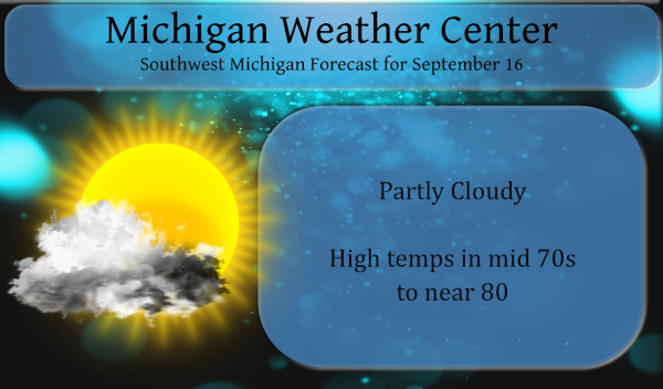
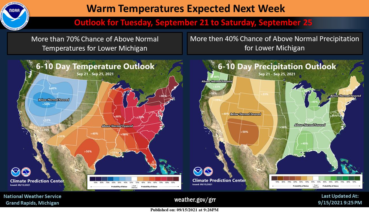
We have 48° this morning at 7:30. Yesterday’s high temp was 75° with a low of 53°. We have had only .16 of an inch of rain so far this month as hit and miss showers and frontal systems have pretty much avoided our area and most of Allegan County. Our last decent rain was way back on August 26th. I hesitate to think when we have a pattern switch the rain will return with a vengeance and cooler air will make for wet and miserable conditions. That said I am not seeing this happening any time soon. Below is the six to 10-day outlook from the CPC with continued warmth and the promise of above-normal rainfall (hopefully some falls in Allegan County).
Sunrise today was 7:23 and sunset tonight is 7:50.
Forecast Discussion
-- Dry through Friday --

High pressure will continue to build over the region today into
tomorrow. This will allow for a mild and dry pattern through the
rest of the work week.

-- Showers/storms possible Friday night into Saturday --

As the ridge of high pressure moves eastward, a trough will trek
through the region. This will bring a frontal pattern that the NAM
is showing to have a slightly better chance of precipitation then
previous model runs. There is better surface convergence, along
with mid to upper level instability. Model soundings continue to
show a dry layer aloft. This should stall incoming precipitation.
However, the line of showers and storms should move into the
region Friday night into Saturday morning. NAEFS mean PWATS
continue to show the trend of decreasing moisture as the system
reaches SW and central Michigan. So while POPS will be increased
there is still little QPF associated with this system.

-- Warmer Then Normal Temperatures Ahead --

The southerly flow will continue with an entrainment of warm,
moist air through next week. This will bring max temperatures of
10 to 20 degrees above normal Sunday into mid week. It will also
bring an increase in shower and storm potential by Tuesday due to
the tropical air mass. NAEFS shows +1 to +2 anomaly across the
Great Lakes Monday into Tuesday. So there is a greater potential
for widespread showers Monday night into mid week.
The cpc 6 to 10:day temp outlook is wrong! Get ready for a cool down!
Starting next Wednesday highs in the 60’s and lows in the 40’s. That is chilly. 🙂
Rock on Sandy and winter is right around the corner!
winter is the best, beside that you have to shovel the snow
I see there is a new look to the CPC’s long range guess maps. The maps have a little different look to them but the long range guess if mostly the same. Here is their guess for October
https://www.cpc.ncep.noaa.gov/products/predictions/long_range/lead14/index.php
and their new look updated long range guess for the rest of the fall season.
https://www.cpc.ncep.noaa.gov/products/predictions/long_range/seasonal.php?lead=1
and for the upcoming meteorological winter
https://www.cpc.ncep.noaa.gov/products/predictions/long_range/seasonal.php?lead=3
I will toss this up again tomorrow.
Slim
All signs point towards a cold and snowy winter. The COC has the precip part of the winter outlook correct, however we will have near to below normal temps this winter! Mark it down and take it to the bank!
Did I just see temps in the 60’s next week on the 8 day forecast?? Maybe it was a glitch..INDY …
Get ready for a cold front!
No glitch. Also a few lows in the 40’s
The overnight low here was 51 and it looks like the official overnight low at GRR was 52. At this time it is clear and 57 here at my house.
Slim
Max temperatures 10 to 20 degrees above normal?! That would be 85 to 95 degrees coming up! Starting to look like 2017 all over again.
At this time it looks like highs this year should be in the low to mid 80’s (there is a chance of maybe of some upper 80’s) In 2017 there were 4 days with highs in the mid 90’s then 2 days with highs in the low 90’s all record highs for the dates from September 21 to the 26th. The current last day for any day with a high of 90 or better is September 29th 1953.
Slim