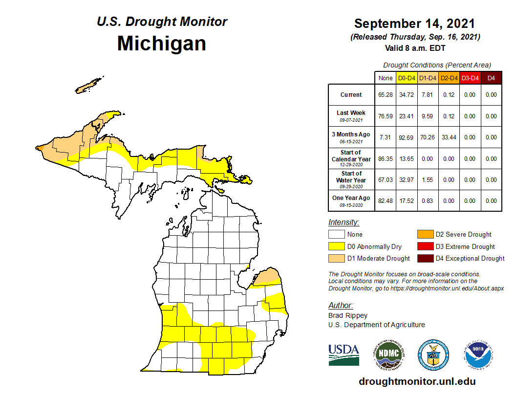
We have had tendencies towards warm and dry conditions in SW Michigan which may or may not continue into October. Seems outlook maps change almost daily from the CPC. The warmer than normal outlooks have been spot on however the guesses for wetter than normal conditions seem to have fallen by the wayside. Temperature outlooks had guessed near 90° temps for early next week these have changed also. Just goes to show how hard it is to forecast with both the human mind and computer with our ever-changing ocean of atmosphere. One thing is for sure is that it has been dry in the southern portions of the lower peninsula. I can attest to that as we have had little to no rain over the past three weeks in Allegan County.
Outlooks for October look similar to September
[columns] [span6]
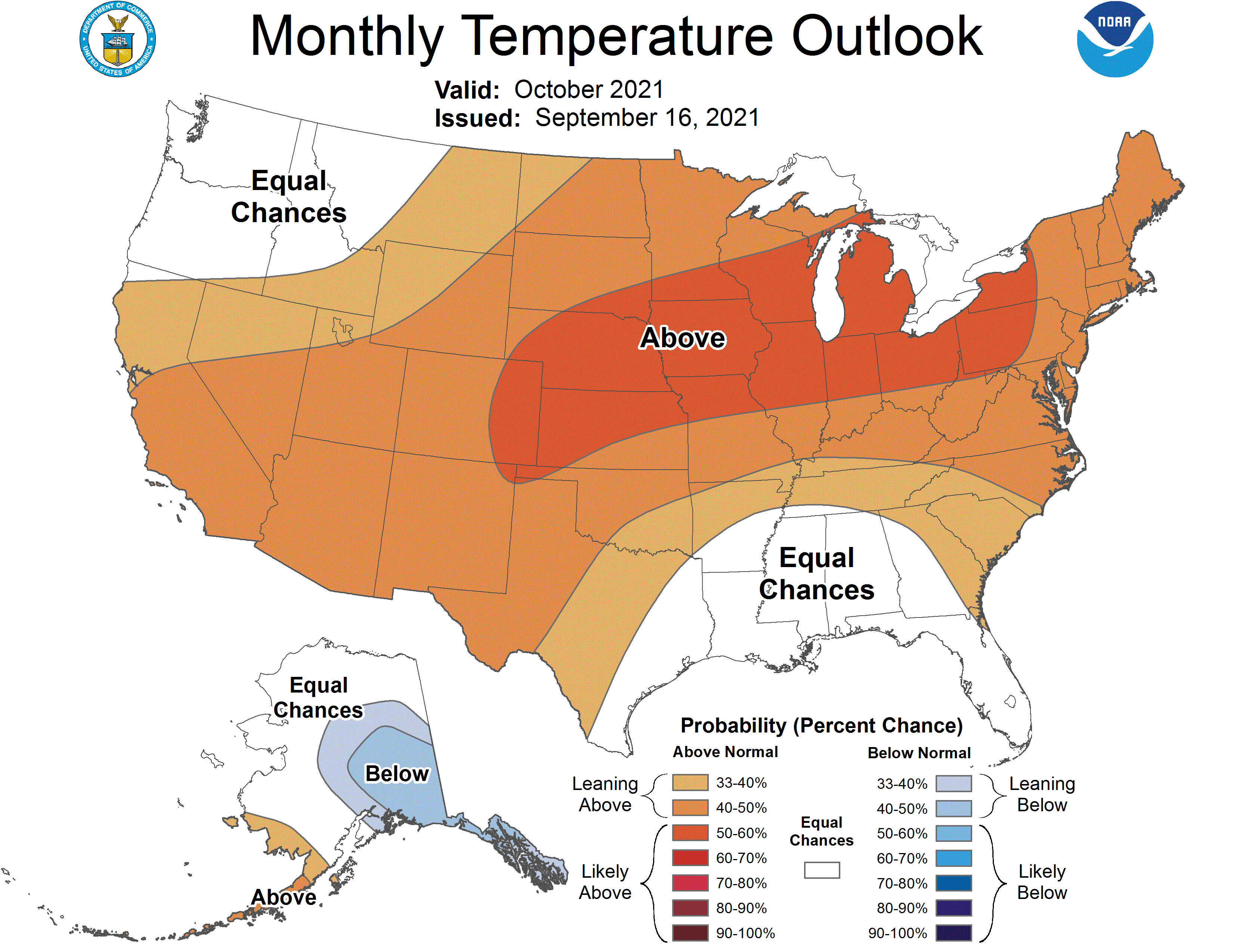
OCTOBER TEMP OUTLOOK
[/span6][span6]
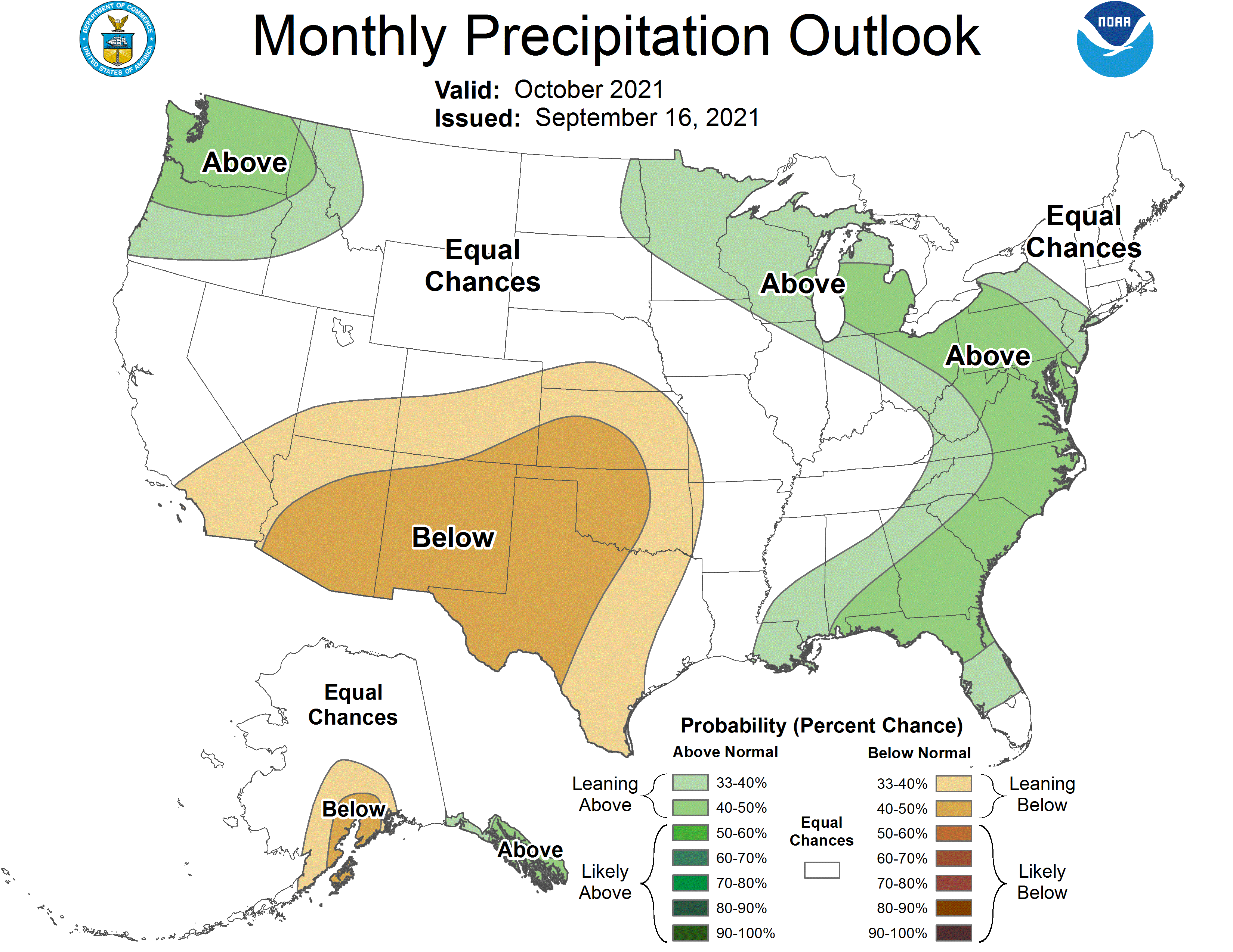
OCTOBER PRECIP OUTLOOK
[/span6][/columns]
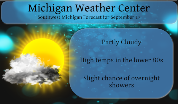
We have a slight chance for rainfall overnight (20%). Temps will remain above normal through at least Monday before a cold front knocks them back into the 60s which will seem like a shock to many.
Our current temp is 55° at 6 am – yesterday’s high was 79° and the low was 49°.
Sunrise today is 7:25, sunset is 7:48.
Forecast Discussion
- Weakening front with showers into Saturday morning

Today will be a nice day and it will be warmer than the past two
days. We will have considerable sunshine too. However we do have
northern stream cold front dropping south into Michigan tonight.
The front will stall once it gets south of I-80 on Saturday. Most
of the mid level dynamics supporting this front stay north of the
Canadian boarder. Every model run since Wednesday`s 12z run have
made the temperatures colder behind the front on Saturday and the
recovery on Sunday not as much. It would seem we would not warm
out of the 70s Saturday and on Sunday we may get to 80 but not
much more than that.

As for showers with the front, there is decent surface convergence
on the front through Saturday morning. There is also a wedge of
500 to 900 j/kg of MU cape with the front that increases to near
1000 j/kg by I-94 around sunrise on Saturday. On the other hand
the upper level divergence is lacking over this front Friday
night into Saturday morning. There is a narrow wedge of 1.5 inches
of precipitable water along the front but the moisture transport
in the 1000/850 layer is feeble at best. So my spin on this is
there will be scattered showers and isolated thunderstorms on the
front as it drops south but the coverage will decrease as the
front drops south of Route 20.

- Warmer Sunday into Monday

Upper level ridging builds over this area into Monday as the next
upstream Pacific system heads this way. There will be a Canadian
surface high pressure system centered north of this area Saturday
into Sunday. I would imagine skies should be mostly clear once the
front gets south of Michigan by mid morning Saturday. This will be
shallow cool air, which will help to limit clouds too.

By Monday, the surface high moves east of this area and upper
heights rise from the building upper ridge. That will allow our
surface temperatures should get warmer. Sunday will not warm so
much, relative to Saturday, since we will still have that shallow
cool air over us yet. By Monday however, the upper ridge is well
east of us and we are in deep southerly flow. This will bring
temperatures into the 80s Monday. It will be more humid. Monday
could well be the warmest day for the rest of September. That is
based on the ensembles forecasts from the GFS, ECMWF and Canadian
models from the 00z run last night.

That same deep southerly flow will bring the remnant moisture
from Nicholas into our area. The NAM, GFS and ECMWF are now doing
this (they were not showing this 24 hours ago). That would bring
layered clouds to us for Monday which would in turn limit how
warm we get and also bring the risk of afternoon showers and
thunderstorms. At this point, it is questionable if that moisture
heads just east of Michigan or actually heads into this area. We
will have to watch how this plays out. For now we can just put a
chance of showers for Monday and call that good.

- Stormy period late Monday into Tuesday

There are many questions to be answered with this system mid week.
The ECMWF creates quiet the closes upper low over us by late in
the day Wednesday. Remember the front is coming through Tuesday.
Both the GFS and ECMWF we would have frontal convection on
Tuesday. The real question is what happens behind the cold front.

There could be strong thunderstorms Tuesday as we are in the jet
entrance region of a 130 knot jet core (good for strong storms).
We would have deep moisture too. Since the front is coming through
during the day, that would mean some surface based instability
too. Model instability shows this too (500 to 1000 j/kg of MU
cape).


- Fall Starts on Wednesday

Fall officially starts on the September 22nd at 320 pm. It will
feel like fall too. As an aside, the ensembles of the GFS, ECMWF
and Canadian models keep us cold the rest of the month of
September! Yes, no highs over 70 from the 22nd through the 30th on
any of the 3 models.

Both the GFS and ECMWF bring the 850 temps to near 0c during the
day Wednesday over our northern CWA. That is more than cold enough
for lake effect rain showers. Given the deep upper trough over us
on the GFS (which has has surface high building in but that makes
no sense given the deep trough over us then) and closed low on the
ECMWF we would surely have enough moisture below 700 mb for rain
showers into Thursday morning. These would be very chilly showers
too, I could see temperatures mostly in the 50s given the 850
temps and 1000/850 thickness and clouds that would be around with
this system.
Great bomb fire weather is about to get started here in west Michigan..Love Fall..INDY
Fall is the best season
I posted this late yesterday as there is a new look to the CPC’s long range guess maps.
I see there is a new look to the CPC’s long range guess maps. The maps have a little different look to them but the long range guess if mostly the same. Here is their guess for October
https://www.cpc.ncep.noaa.gov/products/predictions/long_range/lead14/index.php
and their new look updated long range guess for the rest of the fall season.
https://www.cpc.ncep.noaa.gov/products/predictions/long_range/seasonal.php?lead=1
and for the upcoming meteorological winter
https://www.cpc.ncep.noaa.gov/products/predictions/long_range/seasonal.php?lead=3
Slim
A warm fall and a warm winter? What could be better?
First off there is a new look to the CPC’s long range guess maps. As MV mentioned there is now a back off on how warm it looks to get early next week and then there looks to be a major cool down. The average highs/lows for the next week start out today at 73.7/52.6 and fall to 70.7/49.8 by next Friday. The overnight low here both at my house and at GRR was 57. At this time with sunny skies it is 64.
Slim
So longgg Summer in other words ….Take it all in this weekend the cooll weather will really start bringing out the best in leaf colors around west Michigan…Love Fall …INDY
A nother nice cool morning no matter how warm it gets during the day this time of year always gives us beautiful cool nights wide open window’s and great sleeping weather who doesn’t love Fall …INDY
Until last week it has been extremely dry here as well. We happened to get a couple showers which amounted to just over an inch, but otherwise there has been nothing but drips since early August. Looks like October will just continue the months and years long trend of mostly above average temps.