Even though we had a thunderstorm warning for Allegan County yesterday we had no severe weather. There was a gust of wind before the storm front moved through then a bit of rain and thunder. We picked up .56 of an inch between the morning and evening storms. This brings our total for August to 1.80 inches.
These are the power outage reports as of 5 am this morning:
Allegan: 640
Barry: 450
Calhoun: 709
Kalamazoo: 4,254
Ottawa: 259
St. Joseph: 441
Van Buren: 402
You can find the power outage map here.
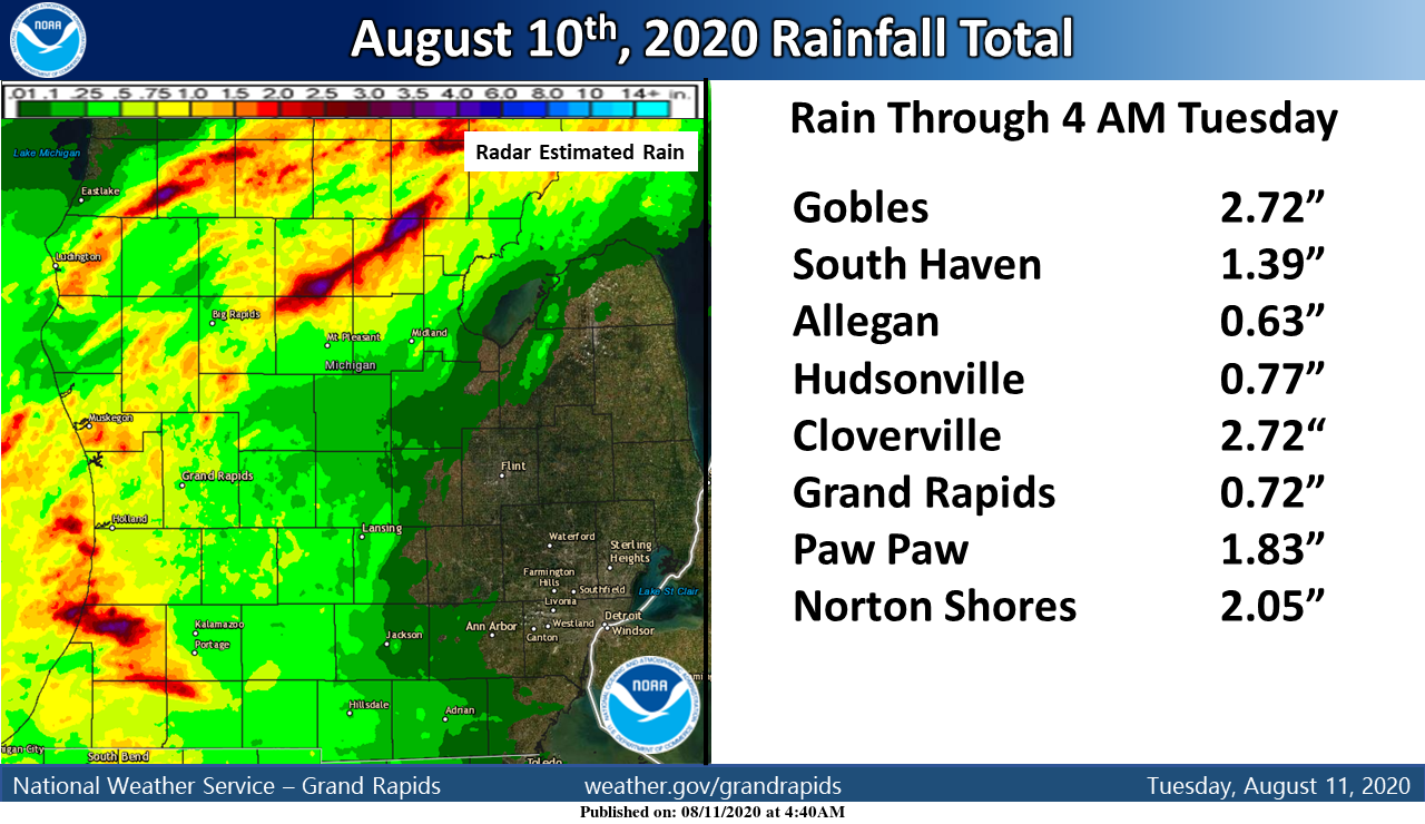
West Michigan saw quite a bit of rainfall yesterday. Here are the rainfall totals for the last 24 hours along with a map of the Radar estimated rainfall for the last 24 hours.
Forecast Discussion
--Clearing by mid morning and not as humid as yesterday--

Once the cyclonic flow around the departing cold front exits the
area during the mid morning hours, skies should clear across the
area. High pressure moves into the area behind the cold front
today. That brings surface anticyclonic flow with it. As typical
with this sort of pattern, the low clouds should clear out.
Eastern sections will of course take the longest to see clearing.
The cold front beings with it drier air, not really air that much
cooler than we have been in for the past few day. Dew points
should fall into the 50s by mid to late morning and remain there
most of the rest of the week.

-- Warm and dry most of the rest of the week--

For most of the rest of this week, the polar jet will remain north
of 55N the rest of this week. That puts southwest Michigan on the
anticyclonic side of the polar jet. We in turn will see mid level
subsidence, which results in warm, dry air near the surface. 500
heights do fall to near 580 dm by this evening but rise back to
around 586 dm by Wednesday morning. This suggests highs in the mid
80s (old forecasting rule with the 500 heights). With all that
subsidence I do not see much risk for afternoon convection
either.

-- Storms return next weekend but then it gets much cooler --

As I have been writing about recently, we have a developing
closed upper low over British Columbia by this evening. Helping
this to happen is a developing system over the Bering Sea, moving
eastward. As that gets closer the the Aleutian Islands it cause`s
upstream high rises that in turn help our British Columbia system
deepen. That in turn causes height rises over central Canada and
the northern Plains. Which of course helps us warm up later in the
week. By late week the wave length between the two systems gets
to short and it causes the British Columbia system to be booted
east. The lead shortwave from that tracks through Michigan on
Friday. We still have to much anticyclonic low level flow for much
to happen through but I do believe some upstream convection is
possible over MN and WI. As that British Columbia system tracks
north of the Great Lakes Sunday we get enough height falls to
allow for convection. We get jet entrance region lift Sunday
night into early Monday so we should get some precipitation in
that time frame. If the system slows down, than that convection
may wait till Monday.

With the trailing system helping to deepen the system over eastern
Canada by then, this will allow the polar jet to just get far
enough south to put is on the cyclonic side of the polar jet.
That would allow for convection on Monday and bring in cooler air,
limiting highs to the 70s. This will lead to a cool start to next
week. It will warm up by midweek as the upper heights rise again
as that system departs to the east.
Update on Watching Meteor Shower. I saw 25 Total. 5 of them with Awesome Contrails ( look like sparks) flying.
Those 5 Made say WOW WEEE! lol….Hope everyone had a opportunity to see them , and they will be visible for the next few days as well. SIDE NOTE — Irene saw OVER 50 of them On The LIVE LINK below.
Have Wonderful WENDSDAY Aug.12 2020
Or this Link….
https://m.youtube.com/watch?v=73p7yb11OqU
Good Morning My Weather Hobos and Space Freaks. Im heading Back Out again…to Look for some Meteors .
While Inside I found This LIVE LINK for Irene You can’t Get Outside. So……For Those of OTHERS that Can NOT get Outside To WATCH . PS …Saw more on this LINK than I DID outside. However it’s not the Same in My Book…LOL.
ENJOY and Share if You So Desire. GOD BLESS,,,,Keep Lookng UP!
https://youtu.be/73p7yb11OqU
In Search of FIREBALLS ? Hear is a Classic tune from The Fireballs. Cut called Bottle of Wine.
https://m.youtube.com/watch?v=FZynyHW2hfw
Saw 3 Little ones about 20 minutes ago….gonnna head back out after a snack and some Smokey Treats.
https://mobile.twitter.com/AccuAstronomy/status/1293346219767533568?ref_src=twsrc%5Egoogle%7Ctwcamp%5Eserp%7Ctwgr%5Etweet
Currently 79* degrees out at thee YARDofBRICKS NE of GR we can call this a perfect Summer day in west Michigan ….INDY
84 here. It was really pleasant until about 2:00 and then it seemed to warm up quickly.
Received 0.74” of rain yesterday but no strong winds or severe weather. Boy that was some thick air yesterday, thought it might make the storms stronger than they ended up being. Get outside tonight to watch the Perseid Meteor Shower! Should be perfect skies for viewing!
I am hoping to see it as well. After 11pm best time?? Or do you think earlier than that?
Over the years I’ve seen the best fireballs between 10pm and midnight, but there are usually more regular meteors between 2 and 4 am.
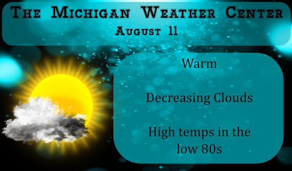
Another sunny day and a cooler day love this time of year cold fronts come alot faster to put the heat out no more long lasting heat days is fine with me all the way into September …Have a super Tuesday ..INDY
I had a total of 0.61″ of rain fall from yesterdays storm. There was some wind and of course some lightning and thunder. All in all just a typical summer storm. It is clear and 67 here at this time.
Slim
We didn’t receive as much rain as I had hoped. The storms were not at severe levels here, thankfully. However, it was really cool as they steamrolled through.