We have been blessed with a warm and sunny summer this year which may go down in the record books as one of the sunniest. I can’t help but think we will pay for this later when autumn and winter come around…
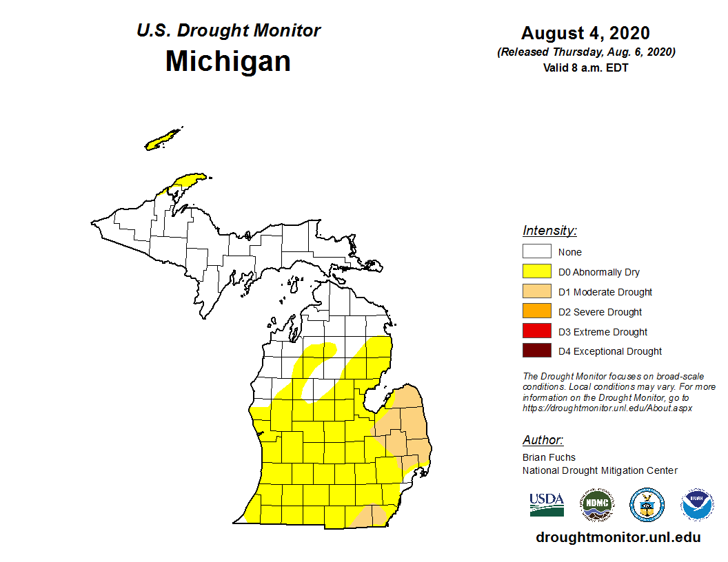
I do like a day of rain once in a while to get things done inside, I am thinking we had only one of those days all summer. We had a dry July and are starting out slightly below normal in the rain department for August and of course, we have had no tornados and very little severe weather.
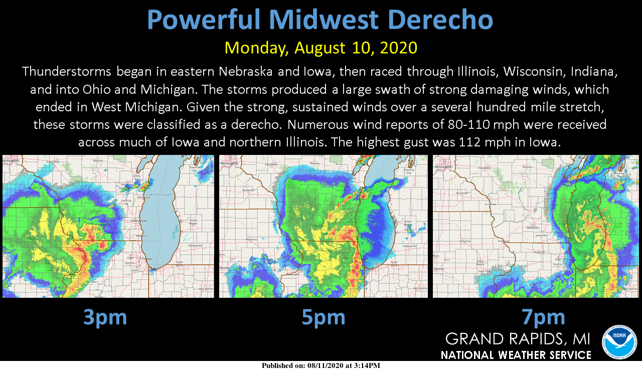
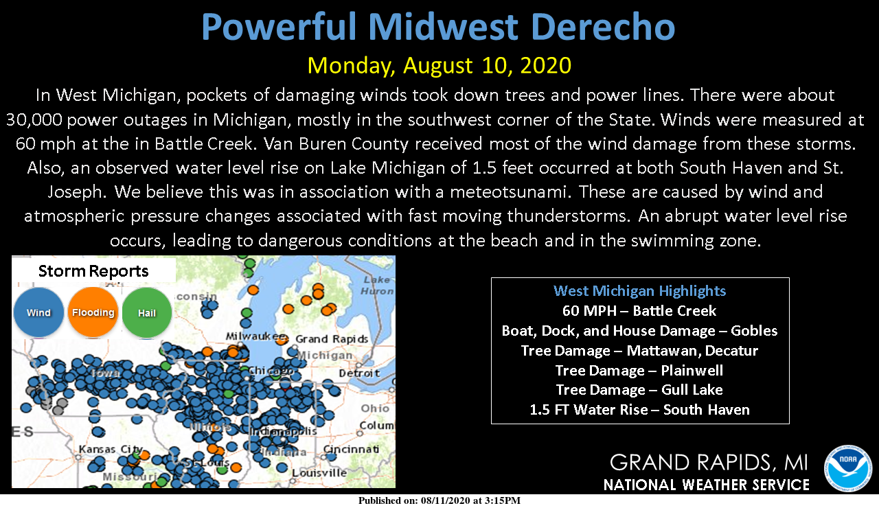
Here is a wrap up of the derecho:
[columns] [span6]
[/span6][span6]
[/span6][/columns]
Weather History:
August 9
1964: Less than a week after hitting 100 degrees the temperature plummets to a record cold 38 degrees at Lansing and 43 at Grand Rapids. Muskegon went from 99 degrees on the 3rd to a low of 40 degrees this morning.
1994: Cool weather prevails for several days with low humidity and high temperatures only in the 60s. Record cool maximum temperatures are observed at Grand Rapids and Lansing, where the high on this date is only 64 degrees.
2009: A thunderstorm brings damaging downburst winds estimated at 70 to 75 mph to Muskegon County. The storm strikes Hoffmaster State Park and Fruitport, downing dozens of trees and causing some damage to homes. The storms continue into Kent County, hitting Kent City and Sparta. Another severe thunderstorm produces a downburst that blows part of the roof off a school in Jackson.
August 10
1944: The first half of August produces seven days in the 90s, peaking with a record high of 98 degrees at Grand Rapids and 95 at Muskegon on this date.
1971: A tornado damages some cottages near Croton Dam in Newaygo County.
1972: High pressure from Canada brings record low temperatures, including the 40 degrees at Lansing, 45 at Grand Rapids, and 47 at Muskegon.
August 11
1864: Lansing hits 101 degrees. This was the all-time high temperature record for Lansing before being broken by a reading of 102 in 1894.
1941: It was a soggy day as Grand Rapids and Muskegon set daily rainfall records of about an inch and a half.
2004: Cool and cloudy weather was observed with high temperatures only in the 60s. Record low maximum temperatures occur at Grand Rapids with 63 degrees, 64 at Lansing and 61 at Muskegon.
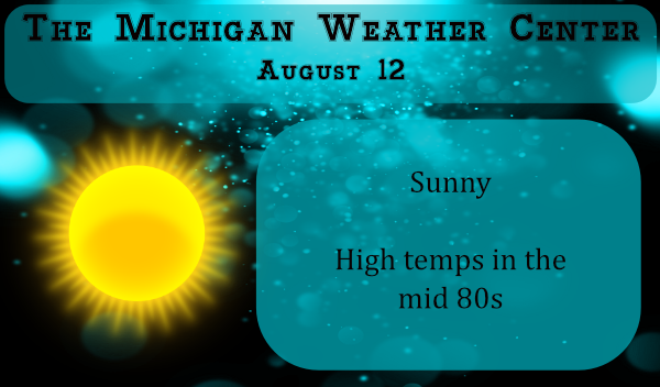
August 12
1864: The temperature hits 96 degrees at Lansing for a record high. The record for the coolest high temperature is set exactly one hundred years later in 1964 when the high is only 62 degrees at Lansing
1979: A summer cool spell sets several record lows over the course of a week. On this date, Muskegon falls to 45 degrees for a record low.
2016: Record rains fall at Grand Rapids with 2.61 inches for the day. A small tornado destroys an outbuilding and takes down a few trees east of Douglas, Michigan.
August 13
2002: Severe weather produces widespread wind damage across southwest Lower Michigan. A tornado struck near Rockford in Kent County, causing minor damage to several homes and vehicles.
August 14
1987: A total of 3.61 inches of rain falls at Grand Rapids, making this the second wettest August day on record and contributing to a record monthly total of 8.46 inches.
1988: A tornado struck East Lansing and then proceeded southeast, leaving an intermittent damage path south of Okemos to Gregory. A man camping near Stockbridge was killed when a tree fell on him.
1995: Lightning struck and killed a 33-year old man walking through his campsite in Coldbrook Park in Kalamazoo County.
August 15
1951: Tornadoes hit near Grand Ledge in Eaton County, Fowlerville in Livingston County and Kings Mill in Lapeer County. Several barns were destroyed.
1978: A waterspout moved inland off Lake Michigan just south of Little Sable Point, about 8 miles west of Shelby in Oceana County. Several cottages were damaged and Scenic Drive was blocked by falling trees. One person was injured when a picture window was blown in.
Forecast Discussion
-- Nice Vacation Weather into Friday --

With the polar jet parked near 55N and the southern stream jet
parked near 38N, that puts Southwest Michigan in a zone with
little very low precipitation potential. That is thanks to the
subsidence associated with being on the equatorward side of the
polar jet (anticyclonic). The result of that is little in the way
of clouds are expected with the exception of some cirrus from
southern stream shortwaves passing south of Michigan and the
typical afternoon cumulus clouds.

That being said, we will be on the warm side of the polar jet. We
should expect high temperatures to be warmer than normal but
getting to 90 degrees would at this point seem rather unlikely.
My 1000/850 thickness tools say mid to upper 80s. So we will go
with that for our forecast highs.

Now a climate note you may find worth knowing. The warmest part
of the summer is over, the overall trend will be cooler from this
point forward. In Grand Rapids the warmest part of the summer is
in July. To make this point, at Grand Rapids the daily frequency
of high temperatures of 90 degrees or more peaks out at 20% on
July 18th. by the 12th of August the frequency tails off to 9%.
So one should not expect to see 90 degrees nearly as frequently in
mid August as in mid July. In fact in the past 10 years from
August 12th through August 31st, there have only been 8 days with
highs of 90 or more, that is less then one a year. This of course
does not say we can not get to 90 after mid August, just that the
frequency is much less often.


- Thunderstorms possible over the weekend

We have been tracking our next cold front, which should come
through this area late Sunday or early Monday. That is thanks to a
rather significant closed upper low over British Columbia, that
gets booted east toward the weekend as the next upstream Pacific
system moves east.

So, if you want rain there is a glitch with this setup. The
southern stream stays south and the northern stream does not dig
far enough south. So, will it rain this weekend? That is a very
good question but I would say at this point the odds at any one
location getting rain by Monday is below 50 percent. The most
likely time frame would be Sunday afternoon and evening ahead of
the cold front.

- Decent cold front comes through early Monday, then cooler

The polar jet does dig into Michigan briefly Monday afternoon. so
we should have highs only in the 70s then. That lifts out by
Tuesday afternoon, so warming returns Tuesday. Do not expect much
rain with this either. Maybe a few instability showers Monday
afternoon, if the polar jet really digs as far south as the ECMWF
forecasts it to. Otherwise next week will largely be dry and
mild.
Seen
Sheesh….Have only two so far tonight. Smoke break and munchie time . Then I’ll head back outside and search the skies for more meteors. Ps….one of the two I saw was Green my first green one .
Song Original By Jack Edward Mellema ( Untitled) Verse1- The Sky is Full of Gods Stars and HIS Full Moon Tonight. Looking Just Like a Picture Book as I Write. Why Does God Chose To Keep Loving and Blessing Me? Each and Every Day & Night His Marvelous Mercies I See. Chorus His Grace & Love is Free For Everyone. So Reach Out Your Heart and Hands and Let Him set You Free. His Eyes are Full of Dreams Yet To Be dreamt . So Close Your Eyes and Let The Master Paint Your Dreams. V2- The Quitetness of The… Read more »
Well I’m halfway to 100 today. Great night last night watching meteors! Hope to see a bunch tonight again.
Congratulations on you 50th What time did you go out last night? I went out for a while at 1 AM while it was clear to the north and south there was a haze overhead and I did not see any meteors in the 10 minutes or so I was out. Tonight I will take another look. At this time it is sunny and 86 here.
Slim
Thanks Slim! We were out from about 11 till 1, and then I went out before work this morning around 5. There was a drifting haze/high clouds going by, but the bright ones were still visible through it.
Happy Birthday!!!!
Happy birthday! Welcome to the club, old boy.
Happy Birthday Barry !!
Happy Nifty Fifty young fellow.
I got ya by 15 years..lol
Happy Birthday!!
Good Morning MV ….You are correct Super SUNNY Summer Day ON TAP!
I have BEEN Very Pleased with This Summer Temps. Ect.
Have GrEat Day ….hAPPy hUMp dAy
hi – please check your email address 🙂