We received .41 of an inch of rain from the system which moved through which brings us to .84 of an inch for June thus far. Driving around Allegan County yesterday with my wife we saw the corn and soybeans were looking a lot better than last week though their height was about a foot shorter than they should be. I was surprised by how healthy they looked with the lack of rain, the new hybrids can take the lack of moisture better than they did back in the old days. There we a few dry spots with brown corn but not as bad as I thought it would be, still, they are going to struggle to get knee-high by the fourth of July without a more sufficient rainfall.

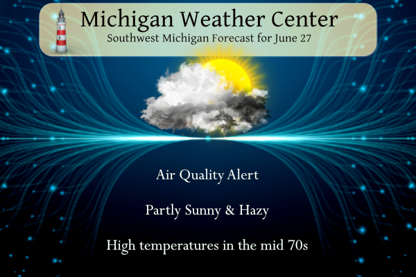
An Air Quality Alert has been issued statewide for Tuesday, June 27th due to concentrations of smoke from Quebec wildfires. Pollutants will be at the Unhealthy for Sensitive Groups level occasionally reaching the Unhealthy level. People with vulnerable lungs are encouraged to limit outdoor activities.
U.S.A and Global Events for June 27th:
1915: The temperature at Fort Yukon, Alaska soared to 100 degrees to establish a state record.
1995: The Madison County Flood on June 27, 1995, was the worst flash flood Virginia had seen since the remnants of Camille dropped up to 30 inches of rain one night in Nelson County in August 1969. The Nelson County flood ranked as one of the nation’s worst flash floods of this century and resulted in the deaths of 117 people. The Madison County flood killed one person.
2011: Polar temperatures and unusual snowfall chill several cities in Brazil’s southern states. Four cities in Santa Catarina state are blanketed in snow. The town of Urubici reported a temperature of 23.9 degrees Fahrenheit with a wind chill of 16.6 degrees below zero. In Florianopolis, the capital of Santa Catarina and a renowned sea resort, thermometers registered 21.2 degrees. Click HERE for more information from MercoPress.
Grand Rapids Forecast
6 27 grrForecast Discussion
SHORT TERM...(Today through Wednesday)
Issued at 310 AM EDT Tue Jun 27 2023

The vertically stacked low pressure system will slowly loosen its
grip on Lower Michigan throughout the day. Abundant low level
moisture this morning will gradually erode from NW to SE, per the
RAP13 925 RH forecast. Thus, a general clearing trend will occur.
However, what is making this situation unusual and a bit more
complicated is that near surface smoke in assocation with Canadian
wildfires in the Quebec province is getting wrapped into the
northwest section of this low pressure system. This is resulting in
the unusual combination this morning of abundant stratus along with
reduced visibilities in haze due to the smoke. The HRRR smoke model
is showing elevated values of near surface smoke especially near and
west of a Mt. Pleasant to Battle Creek line today. Poor air quality
has already materialized across the region, with some sites (such as
Grand Rapids and Kalamazoo) ranking in the worst possible category
for air quality as defined by the Michigan Department of EGLE. With
these types of readings, EGLE is advising the avoidance of prolonged
outdoor exposure today.

As such, we have kept haze in the forecast today, and it could be
thick at times, reducing visibility to 2 or 3 miles potentially,
even after the cloud cover exits the region. Expect warmer
temperatures today, but we are chopping several degrees off
numerical model guidance in anticipation of the haze keeping
readings a bit cooler than we would normally experience. By
Wednesday, however, the 80s should return to the region.

.LONG TERM...(Wednesday night through Monday)
Issued at 310 AM EDT Tue Jun 27 2023

Weak ridging Wednesday night will quickly give way to a short
wave riding east along the northern tier of states. This wave will
flatten the ridge Thursday and also bring the chance of showers.
Precipitable water values increase to north of 1.5 inches
Thursday. And so while the wave isn`t strong, there will be some
instability at play to tap into along with a feed of moisture to
the south to generate scattered showers and thunderstorms. We have
finally gotten rid of the upper blocky pattern which means we`ll
see continued regular chances at precipitation.

Additional short waves move through Friday and Saturday, each
bringing the chance of showers and thunderstorms. There may be a few
lingering showers early Sunday over the southeast cwa, but the main
trough will be moving east of the area by then. However, another
weak wave is seen in the models for Monday, but not much of a
surface reflection, so isolated PoPs at best then.

Temperatures are expected to be typical for late June/early July
with highs in the 80s and dewpoints around 60. So, not too terribly
humid, but noticeable, especially compared to the dewpoints in the
40s we`ve seen recently.
930pm and its just about dark already must be the smoke or we allre losing daylight faster then ever already lol..INDY
Latest sunset of the year was actually today, not last week. Daylight lost is in the morning at sunrise.
https://www.farmersalmanac.com/latest-sunset-2
Looks like our cool down is over and it’s nothing but 80s and maybe even some temps close to 90 ahead. I love it!
Just another below normal temp day!
AQI here is up to 240. It’s the worst I’ve seen. The Mackinac Bridge was unseen from the shore earlier. Crazy.
Sneak peak at this weekend’s weather. Upper 80s to low 90s. Should be a good one:
https://www.mlive.com/weather/2023/06/early-look-at-fourth-of-july-weekend-weather-screams-classic-michigan-summer.html
Bring on the heat!
Side note: it’s nice not seeing a week dominated by eastern winds.
+100
Looks like the pattern has finally shifted and it looks like there are more rain *chances* ahead thankfully.
Please stay in the house if you don’t haft to go outside very unhealthy breathing this air overhead ..INDY
The AQI is officially at 373 in Muskegon which falls well within the “hazardous” range. Visibility last checked there was 0.25 mile.
Super smoky here. Even at the tree line it is smoky. The AQI is 151 here.
There’s a statewide military flyover today. I don’t think anyone will be able to see it.
https://m.facebook.com/127thWing
They flew overhead. I could hear them, but no way could they be seen. How disappointing.
AQI is at 215 in GR, officially in the “Very Unhealthy” range. Be a good idea to stay inside today as much as you can.
MBY ended up getting a total of 0.7”. Far better than the 0.12 we had on Sunday, but a far cry from a “drought buster”. If we can get regular rain back, we should be in a better place. However, another dry spell would put us quickly right back in the same position.
Fingers crossed for more rain!
Can’t say I’ve ever seen smoke this thick, visibility is down to a mile or two at best. Cut my morning walk/run short because the smell is just overwhelming. Disgusting.
Kalkaska, Charleviox, and Sault Ste Marie are currently in the “Hazardous” category. It’s a AQI of 321 in Sault Ste Marie.
The AQI index in Grand Rapids is 197. That is borderline “Very Unhealthy” air quality.
Wow the smoke is thick this morning. Reducing visibility pretty good at my house. It’s amazing how long we are having these smoke issues I’ve never seen it this bad
It’s insane. I thought it was fog at first, but then the smell hit me. Even indoors now smells like heavy smoke.
I was thinking fog at first to but then I seen the air quality alert and the locals meteorologist say it’s all smoke.
The official H/L yesterday at Grand Rapids was 71/61. There was 0.38” of rain fall and officially at GR there has been 0.82” for the month. There was no sunshine yesterday. Here in MBY I recorded 0.17” of rain fall to go along with the 0.71” on Sunday. Just goes to show you how the rain fall has been kind of hit and miss. It looks like Muskegon has missed the most on the rain fall department and has only had 0.56” for the month so far.
Slim
At the current time there is a good amount of smoke in the air with a temperature of 59.
Slim
For today the average H/L at Grand Rapids is 82/61 the record high of 97 was set in 1933 and 1944 and the record low of 45 was set in 1902 and 1905. In more recent years this date has not seen many hot reading the recent years with highs of 90 or better being 2012 with 90, 2005 with 93, 1991 with 91. Last year the H/L was 73/52. The next several days leading up to the 4th look to be very near average for this time of the year. With highs in the upper 70’s to low 80’s… Read more »