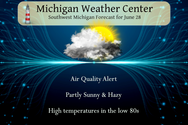
We have another air quality alert for today. Yesterday the smoke from Canadian wildfires caused the worse smog conditions in Michigan since records began in 1980. Area baseball games were postponed due to smokey conditions along with other outdoor events. More info can be found at https://www.michigan.gov/EGLE

Grand Rapids Forecast
6 28 grr
Day two SPC Outlook (Thursday)
Weather History for SW Michigan
June 25
1870: The monthly record high for June of 99 degrees for Lansing was set on this day. This record would be tied on June 25 in 1895 and again in 1988.
1969: A tornado begins near Cedar Springs in Kent County and moves east for seven miles, damaging a store and destroying a barn, chicken coop, and 14 camper trailers.
June 26
1956: A tornado struck Gratiot County near Perrinton. Two homes and five barns were destroyed and fifty other buildings were damaged. Two people were injured.
June 27
1875: Tornadoes struck Detroit and Jackson during the late afternoon and early evening. The Detroit tornado killed two people and injured 25 others.
1914: A tornado struck Gratiot County, destroying several buildings as it moved from North Star to three miles north of Edgewood. A barn door was carried nearly a mile.
1944: A three-day heat wave peaked with high temperatures of 97 degrees in Grand Rapids and 93 degrees at Lansing.
1968: Cool and cloudy weather prevailed with high temperatures only in the upper 50s to lower 60s.
June 28
1959: Hot weather prevailed with a high temperature of 92 degrees at Grand Rapids and Lansing. At Grand Rapids, the low temperature was 78 degrees, second only to the 79-degree low on June 20, 1953, for the warmest low temperature on record for the month of June.
June 29
1930: Severe weather struck Lower Michigan. A tornado and downburst event destroyed a church and several barns with an intermittent path of damage from Scottville to Cadillac.
1943: Very cool summer weather prevailed with a record low temperature of 43 degrees and a record cool high temperature of 61 degrees at Grand Rapids. Another record low of 40 degrees would follow on the morning of the 30th.
1995: As much as four inches of rain within an hour left streets and basements flooded in the city of East Grand Rapids and in southeast sections of the city of Grand Rapids. Water standing two to three feet deep stranded cars along one street, but most damage was due to flooded basements.
2005: A weak tornado moved across rural areas of Newaygo County, causing no damage. The tornado was a type known as a landspout. Several photos captured its brief but impressive existence.
June 30
1931: June ended on a hot note with highs in the upper 90s after morning lows in the mid-70s.
July 1
1999: A weak tornado made intermittent touchdowns during the early afternoon in Newaygo County. A few tree limbs were downed, but otherwise, there were no damage reports, as the tornado remained over rural areas.
2009: The coolest July in Grand Rapids history begins with a record cool high of only 64 degrees as clouds and scattered showers prevail.
Weather History for SE Michigan
June 25
On June 25, 2009, A weak low-pressure system coupled with high instability triggered several severe thunderstorms along and south of I 69 during the afternoon hours and early evening hours. Southern Macomb County was hardest hit, as the majority of the 80,000 DTE customers who lost power resided in Macomb County.
Also on June 25, 1988, the second-highest temperature ever recorded in Detroit was reached: 104 degrees! This tied with the previous second-highest temperature, set on June 28, 1934.
June 26
On June 26, 2021, overnight training showers and storms dumped 6 to 8 inches of rain over areas from Ann Arbor to Dearborn to Grosse Pointe. This led to extensive flash flooding with dozens of cars and trucks abandoned on flooded freeways including I-94. Flooded basements and streets occurred throughout the Metro Detroit area and the governor declared a State of Emergency. Later that day, another round of storms produced an EF2 tornado in Port Austin, leaving six people injured and numerous homes damaged.
On June 26, 1973, A severe thunderstorm wind gust of 94 mph occurred at Detroit Metro Airport at 4:58 PM EDT.
June 27
On June 27, 2010, a warm front lifting north through Southeast Michigan spawned three tornadoes. The community of Willow in southwest Wayne County was hit with an EF1 tornado. Later another EF1 tornado hit a campground outside of Wadhams in St. Clair County. Unfortunately, there was one death and four injuries as a result of that tornado. Finally, a brief EF0 tornado touched down on the far southeast side of Marlette in Sanilac County.
Also on June 27, 2007, thunderstorms anchored themselves over northern Shiawassee County. Estimates of around 8 inches of rain fell near Henderson, washing out several gravel roads.
June 28
On June 28, 1934, the temperature soared to a high of 104 degrees in Detroit! Many were treated for heat exhaustion and three people died from the hot temperatures.
June 29
On June 29, 2000, lightning struck our National Weather Service office in White Lake, damaging computers and electrical equipment.
June 30
On June 30, 1927, the overnight temperature dropped to only 75 degrees in Detroit.
July 1
On July 1, 2014, a derecho produced a swath of wind damage across Southeast Michigan during the pre-dawn hours. The damage mainly consisted of downed trees. A wind gust of 74 mph was measured in Wixom.
Also on July 1, 1965, the temperature bottomed at 40 degrees for the lowest reading of the month. This is shared with a low of 40 degrees on the 2nd in 2001 for lowest temperature in the month.
Forecast Discussion
.SHORT TERM...(Today through Thursday)
Issued at 327 AM EDT Wed Jun 28 2023

Smoke trends continue to be monitored across the region. Referring
to both the HRRR smoke model as well as Environment Canada`s
National Wildfire Smoke Model, the surface smoke parameter shows
elevated levels this morning for most areas near and south of a
Muskegon to Alma line. The concentration slowly declines into the
afternoon. However, smoke concentration is shown to increase once
again on Thursday especially near and east of US 131. Thus, we
will likely continue dealing with surface smoke on and off right
through Thursday unfortunately. Air quality this morning is still
very poor in some places according to various monitoring stations
in Michigan.

Beyond the smoke issue, we have a couple periods to assess for
precipitation potential: early Thursday morning and then again
throughout the day on Thursday. A fading low level jet moves into
Wisconsin late tonight and early Thursday morning ahead of a weak
500 mb shortwave. Elevated instability edges into eastern
Wisconsin, Lake Michigan, and far western Lower Michigan early
Thursday morning. Any storms that develop across Wisconsin will
ride the instability gradient and could sneak into the western
half of our forecast area Thursday morning in the 08z-12z time
frame. Depending on where the outflow of these potential storms
sets up, additional scattered to numerous showers and
thunderstorms may develop during the daytime Thursday as higher
dew points advect into the region and, consequently, SB CAPE
values increase into the 1000-2000 J/kg range. It is during this
time that some storms could produce hail and gusty winds. Model
soundings are showing good directional shear throughout the
column on Thursday. Predictability on where these showers and
thunderstorms develop is not very high at this point, and it is
still plausible that many locations won`t get rain on Thursday,
but the current thinking is locations near and south of I-96 may
stand the best chance at getting some showers and thunderstorms
later Thursday morning into late afternoon/evening, some of which
could be on the strong to severe side especially later in the day.

.LONG TERM...(Thursday night through Tuesday)
Issued at 241 AM EDT Wed Jun 28 2023

Typical summertime weather is expected during the period. Highs in
the 85-90 degree range and dewpoints in the 60s will be enough to
create muggy conditions.

Several chances for rain exist during the period. However, the
southern cwa will generally have the highest chances.

Thursday night looks interesting. A ridge over the south central US
gets flattened by a short wave moving east across the Corn Belt. The
Fv3 shows a band of convection firing late Thursday afternoon and
continuing Thursday night beginning over northern Lake MI and moving
southeast across the cwa. The Nam3km shows a hint of that, but is a
bit earlier and farther east. The HRRR lends some credence to the
Fv3 in both timing and location. The HREF also supports this but
begins the convection over northwest WI and then moves it across the
cwa Thursday night after 06z. NBM doesn`t support the timing that
the HREF suggests, so the details of this are still to be worked
out. Bulk shear in the 40-45kt range points toward the possibility
of some convective organization too, so that`s something we`ll watch
for. Given the little pieces of vorticity seen in the models Friday
moving across the Great Lakes , we`ll have to keep small PoPs in the
forecast.

A stronger waves moves in Saturday afternoon across IA/IL/IN. This
could be another decent MCS that brushes our southern cwa. It`s a
little early to pin down those details too, but the signal has been
there for a day or so and precipitation chances linger through the
weekend as the upper trough moves across the state and then decrease
Monday afternoon.

So, overall, several chances for some beneficial rain and a strong
to severe threat Thursday night.
Less smoky this evening. We even saw some blue skies earlier.
Today was yet another of many below normal temp days! Wow, just wow! WOW!
So no 6 days of 90’s or more coming ncredible…INDY
Dense Smoke Advisories for Lake Michigan. I don’t think I’ve ever seen that headline issued here before.
From NWS Grand Rapids:
“Taking a look through our records, this is the first marine dense smoke advisory our office has ever issued.”
Oh wow, that’s a first. I’ve heard of a dense fog advisory… but for smoke, that’s new to me!
Lots of air quality days sofar do to smoke and not heat has to be a first … There is some talk about a possible Derachio Thursday in the great lakes we will haft to moderate it ….Breath well INDY
This has been the “least sunny” start to summer I remember- either we have clouds or we have clear skies with smoke. I’d really appreciate some sunlight before we head back into fall.
Yes it will be nice to get a bright blue sky again.
Anyone else getting headaches or throat irritation from this smoke? Because I sure did just from the small lengths of time outside yesterday.
No headache, but it has made my throat scratchy and achy.
I’ve had a scratchy throat. Which I never have… so assuming it’s due to the smoke
Good to know I’m not the only one
AQI reads 207 this morning at my house. Still have the reduced visibility. This smoke from Canada is beginning to become a joke it’s been going on forever it seems like.
It was mentioned yesterday that we are losing daylight in the evening already. Fun fact not many people know, latest sunsets of the year are actually today and yesterday, not on the solstice last week:
https://aa.usno.navy.mil/faq/rs_solstices
AQI is 220 here – significantly higher than yesterday morning. Last month’s smoke smelled like wood burning. This round is different. Smells like plastic or maybe a chemical smell. Things that make you go hmmm….
My wife and I said the same thing yesterday about the smell. Might have been a good night to have the windows open but not with this stench.
I think this summer will be remembered for the smoke. I just hope this isn’t a sign of things to come.
The smoke before did smell more like a camp fire. This did have more of a chemical smell. We had a fox in our yard just laying around, pretty much all day. We were wondering if the smoke was too much (it was kind of in a valley of a hill) and that spot it was lower than others, so smoke wasn’t as bad. It is gone this morning.
Kinda makes you wonder that is actually burning up in the Great White North.
The smoky air quality problem is ridiculous! Who would have thought we need to check the air quality before we decide our outdoor plans? Horrendous!