We have an anniversary here at The Weather Center, a whole six years of providing the weather and of course the blog. I have a Twitter and Facebook account where I link to this site when severe weather is in the state. Slim has been with me for the duration providing historical information and his Saturday posts (thanks Slim). Thanks to all for hanging out here for the period of fun and providing local weather information.
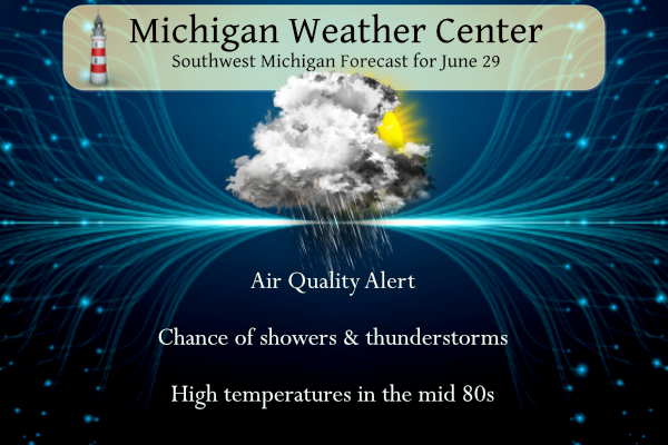
Scattered showers and thunderstorms could impact portions of the region today. The threat of severe weather is not high, but a few of the strongest storms could produce large hail and damaging wind gusts.

 ...Air Quality Alert continues for Today Thursday June 29th...
The Michigan Department of Environment, Great Lakes, and Energy
has declared Thursday June 29th to be an Action Day for elevated
levels of fine particulate for all of West Michigan. Pollutants are
expected to range from the Unhealthy for Sensitive Groups to
Unhealthy range with some hourly concentrations reaching the Very
Unhealthy range.
The Action Day is in effect for the following Michigan counties...
Mason, Lake, Osceola, Clare, Oceana, Newaygo, Mecosta, Isabella,
Muskegon, Montcalm, Gratiot, Ottawa, Kent, Ionia, Clinton, Allegan,
Barry, Eaton, Ingham, Van Buren, Kalamazoo, Calhoun, and Jackson.
Smoke originating from wildfires in Quebec, Canada is currently
impacting PM2.5 concentrations at the surface across the state of
Michigan this morning and this will continue through the rest of
today. The Air Quality Index is expected to range from the Unhealthy
for Sensitive Groups to Unhealthy range with some hourly
concentrations reaching the Very Unhealthy range.
Sensitive groups, such as people with lung disease (including
asthma), heart disease, and children and older adults, should limit
prolonged and heavy exertion.
Reduce or eliminate activities that contribute to air pollution, such
as outdoor burning, and use of residential wood burning devices.
Reduce vehicle trips and vehicle idling as much as possible.
Keep windows closed overnight to keep smoke from getting indoors and,
if possible, run central air conditioning with MERV-13 or higher rated
filters.
...Air Quality Alert continues for Today Thursday June 29th...

The Michigan Department of Environment, Great Lakes, and Energy
has declared Thursday June 29th to be an Action Day for elevated
levels of fine particulate for all of West Michigan. Pollutants are
expected to range from the Unhealthy for Sensitive Groups to
Unhealthy range with some hourly concentrations reaching the Very
Unhealthy range.

The Action Day is in effect for the following Michigan counties...

Mason, Lake, Osceola, Clare, Oceana, Newaygo, Mecosta, Isabella,
Muskegon, Montcalm, Gratiot, Ottawa, Kent, Ionia, Clinton, Allegan,
Barry, Eaton, Ingham, Van Buren, Kalamazoo, Calhoun, and Jackson.

Smoke originating from wildfires in Quebec, Canada is currently
impacting PM2.5 concentrations at the surface across the state of
Michigan this morning and this will continue through the rest of
today. The Air Quality Index is expected to range from the Unhealthy
for Sensitive Groups to Unhealthy range with some hourly
concentrations reaching the Very Unhealthy range.

Sensitive groups, such as people with lung disease (including
asthma), heart disease, and children and older adults, should limit
prolonged and heavy exertion.

Reduce or eliminate activities that contribute to air pollution, such
as outdoor burning, and use of residential wood burning devices.

Reduce vehicle trips and vehicle idling as much as possible.

Keep windows closed overnight to keep smoke from getting indoors and,
if possible, run central air conditioning with MERV-13 or higher rated
filters.
6 29 grr
U.S.A and Global Events for June 29th:
1826: Thomas Jefferson made his last entry in his weather observation log on this date, just six days before he died. The weather held a fascination for Jefferson as he made regular weather observations. He bought his first thermometer while working on the Declaration of Independence and his first barometer shortly after that.
1904: Tornado hits Karacharov Village area of Moscow killing about 24 people. Click HERE for more information from englishrussia.com
1998: “The Corn Belt Derecho of 1998” in the following states NE, IA, IL, IN, KY. A derecho that originated in far southeast South Dakota moved across Illinois during the afternoon and evening and continued as far east as Ohio the next morning. Every county in central Illinois sustained some damage, as these severe thunderstorms passed. Winds gusted in the 60 to 80 mph range, with some localized microbursts producing winds more than 100 mph. Significant damage occurred in the microburst areas, including the towns of Morton, McLean, LeRoy, and Tolono. In Tolono, 22 cars of a southbound 101-car Illinois Central freight train were blown off the tracks. It was unknown how many vehicles were picked up by the wind, but 16 cars were turned over, and another six derailed but remained upright. The train was en route to Centralia from Chicago with a load of mixed freight, including plastic pellets and meal. The freight cars empty weighed about 60,000 pounds, while a full one weighs about 260,000 pounds. Overall, 12 people were injured, and damage was estimated at around $16 million. Click HERE for more information from the Storm Prediction Center.
Forecast Discussion
.SHORT TERM...(Today through Friday)
Issued at 354 AM EDT Thu Jun 29 2023

The smoke remains in place per the 2.5M nowcast AQI off the AirNow
website. All of the sites in our area are still reporting values
of 150-200. We were up above 250 two days ago. South and southwest
winds should advect higher concentrations back our direction today
so the haze/smoke will continue to be very apparent when looking
at a distance. An Air Quality Alert continues today for the entire
area, see AQAGRR for details. Improving conditions should occur
tonight into Friday per the HRRR smoke model.

The next item to focus on is the chance for showers and
thunderstorms through the short term. First threat of
showers/storms will occur this morning with thunderstorms out over
Lake Michigan already as we approach 400am. This activity is
occurring on the edge of the 925mb moisture transport zone seen
via the SPC mesoanalysis page. We expect this activity to make
inroads into Western Lower Michigan this morning per the HREF 4hr
max reflectivity progs. Areas most likely to see scattered
activity will be along and west of U.S. Highway 131. HRRR
soundings would suggest that there is some potential early this
morning and for that matter into the daylight morning hours for
hail. There is favorable deep layer shear and given a continued
influx of low level moisture, it is not out of the realm of
possibilities for the strongest storms to produce hail.

The activity looks to fade a bit into the late morning hours. A
refiring of the convection looks to occur this afternoon and
evening with the highest concentration occurring this evening over
our northeast CWA towards Mt. Pleasant. Shear is not as strong
this afternoon and evening. We are not expecting severe weather,
but an isolated wind or hail event is not out of the question. The
low level jet is overall quite weak through today and tonight on
the order of 20 knots or less. It usually takes a bit more in
terms of the LLJ to produce severe weather.

We look to be mainly dry on Friday as the flow turns westerly
behind a weak surface trough passage. This will bring in a
stabilizing wind off of Lake Michigan. The 4hr max reflectivity is
telling off of the HREF showing a large area of no precipitation
downwind of the lake. Any potential for showers and storms on
Friday would be in the far east towards Mt. Pleasant, Lansing and
Jackson.

.LONG TERM...(Friday night through Wednesday)
Issued at 354 AM EDT Thu Jun 29 2023

The initial 24-36 hours of the long term period from Friday night
through Saturday night/Sunday morning will feature primarily dry
conditions across central and southern Lower Michigan with some
spotty showers and a few storms possible. Both the GFS and GEM are
showing some subtle vorticity enhancements at 500 mb periodically
moving through the region during this time frame. From the surface
up to 850mb, weak westerly to southwesterly flow is expected. With
the GFS and ECMWF showing 1000-2000 J/kg of SB CAPE near and south
of I-96, some support for a few pulse variety showers and
thunderstorms is possible. Absent synoptic forcing, coverage of any
precipitation is likely to be quite low, though with PWATs pushing
into the 1.50"-1.80" range near and south of I-96, isolated heavy
downpours would be possible should any showers/storms form.

Better synoptic forcing arrives for Sunday as a shortwave trough
moves through the Great Lakes. Both the GFS and GEM suggest the
trough may try to strengthen into a near closed upper low as it
migrates from IA to northern IL and northern IN Sunday. If that were
to occur, the southern half of our forecast area could see better
coverage of showers and a few thunderstorms potentially. If this
strengthening does not materialize, most of the rainfall will likely
end up near and south of I-94 and particularly south of the
Michigan/Indiana border on Sunday.

Beyond this weekend, upper heights build and 850 mb warm advection
will be underway again. One or more days in the 90s are possible
from Tuesday into Thursday. For Monday into the 4th of July, most
locations should be dry though low chances for precipitation do
exist, with a few spotty showers and (less likely) thunderstorms
potentially forming on a lake breeze boundary. Ensemble guidance
suggests the possibility of a weak front trying to move in sometime
mid to late week, though that is pretty far out to talk specifics.
What does appear likely at this point is rising PWAT values mid
week. With any sort of weak forcing moving into what should be a
destabilizing air mass, we could pop some showers and thunderstorms
primarily late next week.
Well we are getting some much needed rain. It is coming down pretty good. Even a little thunder.. Looking at the radar it won’t last long.
Yep! That storm just popped up… I hear thunder in the distance
Happy Anniversary!! Six years sure has flew fast!! Thanks for all you do MV and Slim.
Just picked up another 2.2 inches of rain today! Most of this was this evening with very, very, very heavy rain! Incredible rainfall? Almost up to 5 inches in a week! Wow just wow, WOW!!!
Rain missed me, but enjoy to the north!
Yay! Rain!
I’m in Greenville this evening and wow it’s pouring here and lots of lightning.
Looks like back home in Portland it’s high and dry. Bummer.
Thank you for all the work you put into this site MV.! Can’t believe it’s been 6 years already.
Not a nice day to be outside at all. Way more humid today, heat index over 90, and this crazy smoke that won’t go away. Felt suffocating being outside for just 20 minutes.
Wow. Six years! Congrats
Chance of storms firing up this afternoon:
https://www.mlive.com/weather/2023/06/todays-storms-could-become-severe-heres-look-at-timing-strength.html?utm_campaign=mlive_sf&utm_medium=social&utm_source=twitter
While there have had near normal temps in the Great Lakes area during the past week, a good portion of the country has been dealing with major league heat. Twelve states had Excessive Heat Warnings yesterday. Yes, 25% of the lower 48 states had Excessive Heat Warnings.
The drought update is out. Not any relief- the severe drought area remains the same. There is a new severe drought area along the border as well. The moderate drought has not subsided either: https://droughtmonitor.unl.edu/CurrentMap/StateDroughtMonitor.aspx?MI
What a weird summer. Severe drought and constant thick smoke from wildfires. This is not the “typical” Michigan summer that I remember. I think of blue skies, sunlight, greenery, and being able to do physical activity outside. Hopefully things change soon!
No drought here, in fact lots of flooded roads right now!
Happy Anniversary! Six years already?? That’s hard to believe.
Getting some thunder here, but no rain yet.
Wohoo! Happy Anniversary to the blog!
Yet another morning of smoke, reduced visibility, and very unhealthy air quality! I have a thunderstorm popping up overhead. Weird having the thunder and smoky reduced visibility at the same time.
Happy anniversary! It’s been great to see everyone from Bills Blog have a place to continue talking all these years (and any new ppl too)!
Thank you for all of your good work and love of the weather 😊
Happy Anniversary!!! It is a fun place to learn, talk about life and support each other. Thanks Michael for all you do. Hope you are feeling better too!
The official H/L yesterday at Grand Rapids was 82/53 there was no rain fall and the sun was out 68% of the time. There was once again smoke in the air and the sky had a white look to it. For today the average H/L is 83/61 the record high of 97 was set in 1913 and the record low of 43 was set in 1943 the record rain fall amount of 2.08” fell in 1972. It has been a fun 6 years
Slim
At the current time it is cloudy with smoke in the air the 7 AM air quality was at 195 for Grand Rapids. The temperature in MBY is now at 66. To get the air quality for your area here is a link for that.
https://www.airnow.gov/?city=Grand%20Rapids&state=MI&country=USA
Slim
239 here. I’ve had it with the smoke and yucky air.