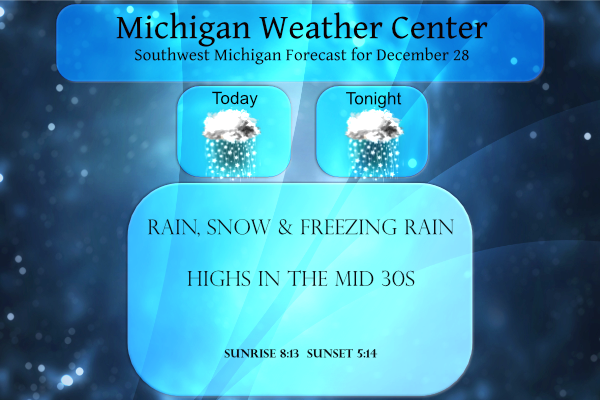
Yesterday was a fun day with multiple forms of precip then a heavy fog from the saturated air. Our high was 41° and the low 31°. Our total snow since November is up to 11.6 inches, 3.7 inches for December. We have had 2.19 inches of liquid precip for this month with more on the way.

Today will be like yesterday with a mixed bag of precip. It appears we will have a couple more systems move through the area as the week progresses as our active weather pattern continues.
Hazardous Weather Outlook
Snow will break out across the area this afternoon and evening,
likely arriving just in time for the evening commute. Snow will
be heaviest between 500 PM and 800 PM. Snow amounts will generally
be between 1 and 2 inches.
Forecast Discussion
- Snow arrives for the evening commute today -

Another burst of snow will slide in today from the southwest. The
snow will be associated with a shortwave that is currently racing
our direction from the Southern Rockies. The wave will shortly
move into the Plains and push into our area this afternoon and
evening. A surface low moves our direction, but it will be
weakening with time. The main impetus for the snow will be warm
air advection once again, best seen on the 295K surface. Upglide
is not as strong as two night ago and is shorter in duration as
well.

As for the particulars, snow looks to break out in the afternoon
in the far southwest corner of the state and overspread much of
our area during the evening commute. The main time frame looks to
be between 400 PM and 1000 PM, centered/peaking around 700 PM. As
for accumulations generally a 1 to 2 inch snow is expected. Around
an inch possible up towards U.S. 10, with more solid 1-2 inch
amounts from I-96 to the south. Not out of the question to see
some 3 inch totals near and south of I-96, but we are more
confident in the 1-2. Question the is does this rise to the level
of an advisory. We have opted to not issue an advisory given the
lower snow totals and the fact that we will be starting out well
above freezing in the upper 30s in the areas of "heavier" snows.
We will diabatically cool back to 33-34 degrees once the snow
starts. So, there may be some impacts for the evening commute, but
likely not widespread enough to warrant a headline. The snow
quickly ends in the late evening as the lift weakens/heads east.

- Another potential for some light snow Wednesday night -

Models show another weak shortwave in southwest flow moving
through our region Wednesday night. The GFS is more bullish on
precipitation occuring in our forecast area, with the ECMWF being
almost dry. Given this level of model disparity in period 4 of the
forecast confidence is fairly low in what transpires. At this
point we have a somewhat middle of the road forecast with 40 pct
pops in the forecast across Southern Lower MI. QPF differences
range from around 0.20 inches near I-94 from the GFS and almost
nothing (Trace to 0.02) via the ECMWF.

- System over the weekend still less than certain -

The main shift in the models with the weekend system over the last
24 hours is that the GFS has latched on to a more southern track
as well. Quite a bit of model disparity exists still though with
the ECMWF tracking an elongated surface low through Indiana and
Ohio in fairly close proximity to our area. The GFS has flipped
from a deep low up in the Great Lakes from model runs a couple of
days ago to now having the low south of the Ohio River. Feel the
ECMWF is the model to follow here given the wide variability in
the GFS. Looking at the ensemble mean low positions as well as all
of the individual members show low centers spread out from the
Eastern Great Lakes all the way back to MO/AR. So, the jury is
still out on the weekend system. If we went solely with the
operational ECMWF we could be looking at a stripe of snow across
our CWA on the order of 3-6 inches potentially. Stay tuned...
The GFS model gives west Michigan 8 inches of snow a hour probably over done but I have never saw that before for Saturday one thing for sure the GFS and Euro modles as of now are only 15 to 16 miles apart something definitely is brewing could this storm be bigger then the blizzard of 78?? Prepare now …InDY
+1
Check out the latest 5 day snowfall map! Possible storm this weekend! Get prepared now and the the rock n roll party begin!
https://www.tropicaltidbits.com/analysis/models/?model=gfs®ion=us&pkg=asnow&runtime=2021122818&fh=120
Here is another view!
http://wxcaster4.com/gfs/CONUS2_GFS0P5_SFC_ACCUM-SNOW_120HR.gif
We are getting moderate snow and up to 1/2 inch already!
Off and on flurries today, but the grass is still visible. The street was snow covered earlier but is now just wet.
Local TV met just said Saturday’s system bears watching, but he’s not confident that we will see all snow from it. His forecasted temps for next week show 30s and even one 40.
Currently Conditions SNOW! InDY
Yes, the last week of December is turning into a winter wonderland! This is just a warm up for the big snows and arctic air in January! Incredible!
Current Conditions = COLD and SNOW! So much for all the warm weather hype!
This just in>>>the 12z RDB model gives GR 2 to 3 inches of snow this evening! There will be a burst of heavy wet snow and a possible advisory may be coming! Incredible!
There is still about a inch of snow on the ground here my area. There was some clearing here overnight and with that the low fell to 25 here. It looks like the official overnight low at GRR was a warmer 28. At this time it is cloudy here and 28.
Slim
What more snow coming no way I love long Winters lol…InDY
They are the absolute BEST!!
Nice snow map! Now get ready for the the wild winter weather! Snowstorm for
late weekend is still on track! Colder, snowier weather is also on track for January! Stay tuned, because we may just get hammered with snow!