2013 Flood. Record Highs
There was some flooding at LMCU Ballpark on opening weekend. But that was nothing like the flooding that took place in April 2013. While this past weekend flooding caused some water to enter the north parking lot back in 2013 the water reached the hill on the river side of the park.
In February 2013 Grand Rapids had 33.1” of snow fall and Lansing had 14.1” March was cold with a mean of 31.5 at Grand Rapids and 30.9 at Lansing. The cold continued into April but April also had several periods of heavy rain fall. For the month Grand Rapids had 11.10”. Between April 9th to the 19th a total of 9.76” of rain fell. The rain fall saturation of the ground. The Grand River rose dramatically reaching a crest of 21.85 feet on April 21st At Comstock Park on April 21st the river level reached 17.8 feet that was 5.8 feet above the 12 foot flood level. The 21.85 feet reached at Grand Rapids was 3.85 feet above the 18 foot flood level at Grand Rapids. I know it is a long link but it looks like it works.
Pictures of 2013 flood at Grand Rapids.
https://www.google.com/search?sxsrf=APwXEdfrbNW0fGaoPhiTCSmymunnYgz4Cg:1681210968640&q=grand+river+flood+2013&tbm=isch&source=univ&fir=UwOlCJpFGKJ17M%252Cdyl4HyigWcF_VM%252C_%253BI8ZyFzJlq6LJFM%252Coa97oK2tNYNDIM%252C_%253BFDaTW2i75DQK4M%252CiZ–Qw-nUX1oBM%252C_%253BR5V0IVtrUj474M%252ChYDETCcsr8zILM%252C_&usg=AI4_-kRWSblcQYpy-iFcqC6s62ya-ENRSQ&sa=X&ved=2ahUKEwj28M_01qH-AhWQjIkEHXYvDowQiR56BAhaEAI&biw=1280&bih=601&dpr=1.5
If you have any stories on the flood of 2013 feel free to post them.
Now for the record high temperatures. Record highs were set yesterday all across southern Lower Michigan. The official H/L at Grand Rapids was 83/48 there was 97% of possible sunshine. That 83 is a new record for the day. Other records set 85 at Lansing, 82 at Muskegon, No record but it was also 82 at Holland the record there is 85 set in 1941. Other records across Michigan. 82 Detroit and Flint, 83 Saginaw, 82 Houghton Lake, 86 Traverse City and in the UP 78 at Ironwood.
AREA FORECAST DISCUSSION
NATIONAL WEATHER SERVICE GRAND RAPIDS MI
353 AM EDT SAT APR 15 2023
LATEST UPDATE…
DISCUSSION/MARINE/HYDRO/CLIMATE
DISCUSSION
(TODAY THROUGH NEXT FRIDAY)
ISSUED AT 353 AM EDT SAT APR 15 2023
– ONE MORE DAY OF NEAR-RECORD WARMTH –
RECORDS WERE SET FOR A 2ND STRAIGHT DAY ON FRIDAY. WE’LL MAKE
A RUN AT A 3RD STRAIGHT DAY OF RECORDS TODAY AS WEST MICHIGAN
CONTINUES TO BASK IN A VERY SUMMER-LIKE AIRMASS. IT’S GOING TO BE
A BIT HARDER TO BREAK THE HIGH TEMPERATURE RECORDS TODAY FOR TWO
REASONS. FIRST, THERE WILL BE A FEW CLOUDS AROUND TO PERHAPS LIMIT
THE SUNSHINE SLIGHTLY. SECONDLY, AND MORE IMPORTANTLY, THE RECORDS
ARE SEVERAL DEGREES HIGHER TODAY THAN THEY WERE YESTERDAY, SO IT
WILL BE A HIGHER BAR WE NEED TO REACH. REGARDLESS, IT WILL BE
ANOTHER OVERALL AMAZING APRIL DAY IN WEST MICHIGAN. WE DO HAVE A
RELATIVELY LOW CHANCE FOR SOME SHOWERS THIS AFTERNOON ACROSS THE
AREA, AHEAD OF A DEVELOPING LOW PRESSURE CENTER MOVING TOWARD US
FROM THE PLAINS. MOSTLY IT WOULD BE A FEW SHOWERS WITH
ACCOMPANYING GUSTY WINDS TODAY, AS WINDS THROUGHOUT THE COLUMN
ARE QUITE LOW TO SUSTAIN AN UPDRAFT FOR TOO LONG. A RUMBLE OF
THUNDER CAN’T BE RULED OUT. HOWEVER, WHEN THE DUST SETTLES, MOST
PLACES WILL PROBABLY STAY COMPLETELY DRY TODAY.
– RAIN AND STORMS ON SUNDAY –
OUR WEATHER BECOMES MUCH MORE ACTIVE ON SUNDAY, AS THE
AFOREMENTIONED STORM IN THE PLAINS BECOMES VERTICALLY STACKED AND
MOVES ACROSS SOUTHERN WISCONSIN/CENTRAL LAKE MICHIGAN BY SUNDAY
EVENING. THIS LOW WILL DRIVE A STRONG COLD FRONT ACROSS OUR AREA
EARLY SUNDAY AFTERNOON, WITH 1 OR MORE ROUNDS OF SHOWERS/STORMS
AHEAD OF THIS FRONT. DEEP LAYER SHEAR BECOMES MORE IMPRESSIVE
COMPARED TO SATURDAY, SO ORGANIZED CONVECTION IS EXPECTED. THE
MAIN LIMITING FACTOR FOR STORMS ON SUNDAY WILL BE THE TIMING OF
THE COLD FRONT, AS CLOUDS/RAIN CAN BE EXPECTED IN MANY AREAS BY
LATE MORNING, WHICH WILL LIMIT THE ABILITY OF THE ATMOSPHERE TO
FULLY DESTABILIZE. FOR THIS REASON, ANY MARGINAL SEVERE RISK IS
CONCENTRATED IN THE EASTERN SECTIONS OF THE CWA (GENERALLY EAST OF
US-127) WHERE THE SLOWER COLD FRONT ARRIVAL MAY ALLOW FOR MORE
INSTABILITY TO DEVELOP.
– BRIEF RETURN TO WINTRY MESS ON MONDAY, THEN IMPROVING –
BEHIND THE COLD FRONT, LINGERING RAIN SHOWERS WILL TURN TO MIXED
RAIN AND SNOW SHOWERS AFTER MIDNIGHT ON SUNDAY NIGHT. WITH GUSTY
NORTHWEST WINDS (GENERALLY 25-35 MPH), LAKE-ENHANCED SNOW SHOWERS,
AND TEMPERATURES STUCK IN THE 30S FOR MOST PLACES ON MONDAY, IT’S
GOING TO FEEL LIKE WE TURNED THE CLOCK BACK A MONTH. BELIEVE IT OR
NOT, WE COULD SEE AN INCH OR TWO OF WET SNOW ACCUMULATION –
MAINLY ON GRASSY SURFACES – BEFORE WE START TO DRY OUT MONDAY
EVENING.
TEMPERATURES DO MODERATE BEGINNING TUESDAY, AND WE SHOULD
SEE HIGHS REACHING INTO THE 60S FOR THE 2ND HALF OF THE WORKWEEK.
A FAIRLY ZONAL JET WILL STAY PRETTY ACTIVE ACROSS THE HEARTLAND
LATE NEXT WEEK, WITH A WARM FRONT GENERALLY DRAPED ACROSS NORTHERN
LOWER MICHIGAN. THIS WOULD KEEP US VULNERABLE TO MULTIPLE CHANCES
FOR RAIN LATE NEXT WEEK AND INTO NEXT WEEKEND. BOTTOM LINE: AFTER
A WEEK-LONG RESPITE FROM THE ROUNDS OF RAIN, IT’S TIME TO GET
RIGHT BACK INTO AN ACTIVE WEATHER PATTERN.
Detailed Forecast for Grand Rapids
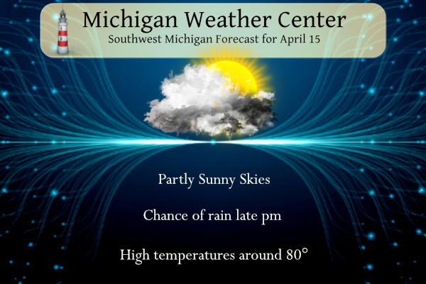
Today
A 20 percent chance of showers after 3pm. Partly sunny, with a high near 81. Light south wind becoming south southwest 5 to 10 mph in the morning.
Tonight
A 40 percent chance of showers and thunderstorms, mainly after 2am. Mostly cloudy, with a low around 60. South southeast wind 6 to 10 mph.
Sunday
A chance of showers and thunderstorms before 8am, then showers and possibly a thunderstorm between 8am and 5pm, then showers after 5pm. Temperature rising to near 67 by 11am, then falling to around 57 during the remainder of the day. Breezy, with a south southeast wind 13 to 20 mph, with gusts as high as 31 mph. Chance of precipitation is 90%. New rainfall amounts between a half and three quarters of an inch possible.
Sunday Night
Rain showers likely before 5am, then rain and snow showers likely. Some thunder is also possible. Mostly cloudy, with a low around 36. Breezy, with a southwest wind 20 to 22 mph, with gusts as high as 31 mph. Chance of precipitation is 70%. Little or no snow accumulation expected.
Monday
Rain and snow showers. High near 39. Breezy, with a west wind 17 to 24 mph, with gusts as high as 37 mph. Chance of precipitation is 80%. New snow accumulation of less than a half inch possible.
Monday Night
A 40 percent chance of snow showers before 2am. Mostly cloudy, with a low around 34. Breezy.
Detailed Forecast for Holland
Today
A 20 percent chance of showers after 3pm. Partly sunny, with a high near 76. Southwest wind 5 to 10 mph.
Tonight
A 40 percent chance of showers and thunderstorms, mainly after 11pm. Mostly cloudy, with a low around 56. South wind 6 to 10 mph.
Sunday
Showers and possibly a thunderstorm. Temperature rising to near 65 by 11am, then falling to around 53 during the remainder of the day. Breezy, with a south southeast wind 10 to 20 mph, with gusts as high as 29 mph. Chance of precipitation is 90%. New rainfall amounts between a half and three quarters of an inch possible.
Sunday Night
Rain showers likely before 5am, then rain and snow showers likely. Some thunder is also possible. Mostly cloudy, with a low around 36. Breezy, with a southwest wind around 22 mph, with gusts as high as 33 mph. Chance of precipitation is 70%. Little or no snow accumulation expected.
Monday
Rain and snow showers. High near 40. Breezy, with a west wind 18 to 25 mph, with gusts as high as 37 mph. Chance of precipitation is 80%. New snow accumulation of less than a half inch possible.
Monday Night
A 40 percent chance of snow showers before 2am. Mostly cloudy, with a low around 35. Breezy.
Detailed Forecast For Lansing
Today
A 10 percent chance of showers and thunderstorms after 5pm. Mostly sunny, with a high near 82. South southwest wind 5 to 7 mph becoming west in the afternoon.
Tonight
A 30 percent chance of showers and thunderstorms, mainly before 8pm. Partly cloudy, with a low around 59. South wind 6 to 8 mph.
Sunday
A chance of showers and thunderstorms before 2pm, then showers and possibly a thunderstorm between 2pm and 5pm, then showers after 5pm. High near 72. Breezy, with a south southeast wind 10 to 20 mph, with gusts as high as 28 mph. Chance of precipitation is 90%. New rainfall amounts between a half and three quarters of an inch possible.
Sunday Night
Rain showers before 5am, then a chance of rain and snow showers. Some thunder is also possible. Low around 37. Southwest wind around 18 mph, with gusts as high as 28 mph. Chance of precipitation is 80%. Little or no snow accumulation expected.
Monday
Rain and snow showers. High near 40. Breezy, with a west southwest wind 15 to 20 mph, with gusts as high as 30 mph. Chance of precipitation is 80%. New snow accumulation of less than a half inch possible.
Monday Night
Rain and snow showers before 11pm, then a chance of snow showers between 11pm and 2am. Low around 33. Breezy. Chance of precipitation is 80%. New snow accumulation of less than a half inch possible.
Highs next weekend only in the 40’s! How is that possible with all the warm weather hype on here! Wow just wow, WOW!
Cold and Snow rocks! Bring it on baby!
https://www.pivotalweather.com/model.php?m=ecmwf_full&p=sn10_acc-imp&rh=2023041600&fh=120
Everyone hates snow, it’s white trash falling from the sky.
Do everything you can to accelerate global warming! Cold weather SUCKS!! You should get a frontal lobotomy if you want snow this time of year or just do us all a favor and spend the rest of your life in an insane asylum!
The latest CPC is trending colder and colder! We will be going right back to the persistent cool Spring pattern! Incredible!
For a day?? KMA!
https://www.cpc.ncep.noaa.gov/products/predictions/814day/
Rocky, hopefully you don’t mind Andy’s constant rude comments to you. I personally would have blocked Andy from posting at this point, but that’s just my opinion.
Rock on Nathan, I simply ignore anything he says! He has lost all credibility!
Great weather today over here in Rochester Hills. I Like that there’s a little more humidity in the air. Let the good times roll!
The current temperature here in MBY is now 82 with a DP of 59 so it is a little more humid then it has been.
Slim
March had below normal temps in GR and now a major cold from will be coming through! Just the facts people! Wow just wow!
For a day?? WGAF!!
Epic flooding tis was the gulkers wouldn’t leave our street the YARDofBRICKS back was under water for days … Today will be another great weather the sprites day maybe get a little fire going definitely enjoy it before we roll back to Winter in the middle of April I suspect record lows and record snowfall Monday and Tuesday and now a another possible snowstorm the GFS is showing for Friday put the shorts away I must say lol….INDY
Incredible cold is coming and then we settle into a cool pattern again! The cool pattern has been the overriding trend this Spring! Wow!
What are you even talking about at this point? It’s been the second warmest start to the year ever recorded.
This Storm Team 8 broadcast is from April 18th 2013. Captures the event pretty nicely. You can see all the streets that were flooding scrolling across the screen. Interesting to note we even had a tornado watch during all of it as well.
https://m.youtube.com/watch?v=5FXV9A_4qPo&pp=ygUdU3Rvcm0gdGVhbSA4IEFwcmlsIDIwMTMgZmxvb2Q%3D
I’ll never forget the 2013 flooding. Never seen anything like it. The town of Hopkins in Allegan County was essentially underwater. I think I remember them piling sand bags to save the gas station from flooding.
Back to back to back record highs?!
64 at 6am. This is unbelievable. We’re going for four consecutive days in the 80s and possibly three consecutive days with record highs. The last five days have been +10, +17, +23, +24, +22. Lansing is +8.9 for the month and even GR is +7.8 for the month.
We’re going to the MSU spring football game this afternoon. Usually, we have to bundle up. This year it will be shorts, t-shirt, and flip-flops. Don’t forget the sunscreen!
Have a great Saturday friends, and make someone smile. 😃
Let’s add to the already impressive seasonal snow totals and our snowy long winter! Cold and snow is coming! Who would have thought? Wow, just wow, WOW!
https://www.pivotalweather.com/model.php?m=gfs&p=sn10_acc-imp&rh=2023041500&fh=120
For flood pictures, here is the link
https://www.google.com/search?sxsrf=APwXEdfrbNW0fGaoPhiTCSmymunnYgz4Cg:1681210968640&q=grand+river+flood+2013&tbm=isch&source=univ&fir=UwOlCJpFGKJ17M%252Cdyl4HyigWcF_VM%252C_%253BI8ZyFzJlq6LJFM%252Coa97oK2tNYNDIM%252C_%253BFDaTW2i75DQK4M%252CiZ–Qw-nUX1oBM%252C_%253BR5V0IVtrUj474M%252ChYDETCcsr8zILM%252C_&usg=AI4_-kRWSblcQYpy-iFcqC6s62ya-ENRSQ&sa=X&ved=2ahUKEwj28M_01qH-AhWQjIkEHXYvDowQiR56BAhaEAI&biw=1280&bih=601&dpr=1.5
Slim
]
Horrendous flooding!
Hard to believe it’s been ten years. That was an incredible event.