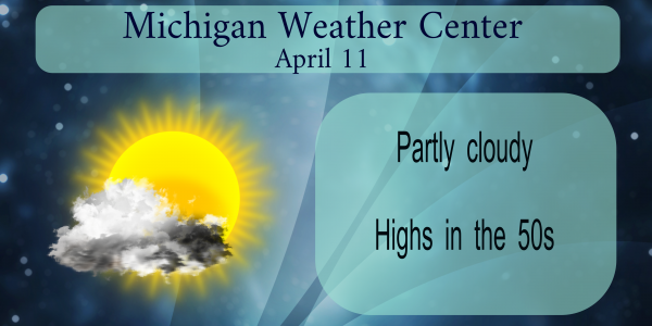
The winter and early spring of 1965 was colder then average with March come in with a mean of just 26.9° that was a departure of -9.5° and there was a record snow fall of 36.0” There was 15” of snow on the ground on the 24th That March had snow on the ground every day. April did not start out much better as there was a snow fall of 3.9” on the 1st and there was a total of 6” on the ground on the 2nd It did warm up to more spring like temperatures by the 6th and on April 11th the temperature shot all the way up to 72 at Grand Rapids. 75 at Kalamazoo, 70 at Muskegon thus setting the stage for one of the largest tornado outbreaks in Michigan history.
At least twelve tornadoes touched down and raced across Michigan on Palm Sunday, April 11, 1965, carving several paths of destruction. In Michigan, 53 people were killed and 800 injured. Ernie Ostuno, a meteorologist at the National Weather Service , explained all the ingredients necessary for a classic, destructive outbreak came together that day. And following the event, terminology evolved — including the present-day “watch” and “warning” — to better communicate the threat of severe weather.
Western and central Michigan experienced most of the tornado touchdowns that day. Eight spawned from supercell thunderstorms, impacting several counties. Five people were killed In a powerful F-4 with winds estimated in excess of 207 mph, which formed near Allendale in Ottawa County and tracked east to Comstock Park to the Cedar Springs area. About 35 homes were destroyed and nearly 200 others damaged. One of the injured died days later. The tornado created about $15 million in damage. One person was killed in an F-1 tornado that formed in Allegan County and moved into Barry County. Five homes were destroyed and another 25 were damaged. Barry County experienced, an F-3 with winds estimated in excess of 158 mph. Kalamazoo County also saw an F-3 tornado. It destroyed four homes and injured 17 people. An F-4 tornado was recorded in Clinton and Shiawassee counties. One person was killed, and several homes were damaged or destroyed. Three F-2 tornadoes moved across Montcalm and Gratiot counties. As the survivors of one F-4 tornado emerged from their shelters, most had no idea another F-4 twister was on its way.. They tracked about 30 minutes apart through Branch, Hillsdale, Lenawee, Monroe and Washtenaw counties, killing at least 35 people. About $32 million in property was destroyed. An F-2 tornado near Bay City tore roofs off homes and an auto A second F-2 twister near Tuscola damaged a lumberyard and destroyed a few barns.
I lived in Bay City at the time and I still remember how the sky turned a blue green color that day.
Slim
Well day 3 of this supposed long cold stretch just was not to be as it’s currently 59 degrees out, which is above the daily average high of 56. Maybe tomorrow will start a new 2 day stretch? Although forecasts highs for tomorrow are also around 60. Perfect day out!
Weather blogs pretty quiet today I would imagine this will be for awhile as the below temps are here could you imagine on here if it was in the 80’s lol….. enjoying the sunshine today getting ready to crack a Sprite and sit out in my back yard tonight fire pit is still smokein a little we had a hot one last night… loving this Fall weather pattern we are in …. INDY
About 5 years before my time as well. I can’t imagine that many large tornadoes in this area as nowadays we seem to go years with hardly a severe thunderstorm. I do remember when I was really young my parents were always terrified of thunderstorms, probably stemming from having lived through that time fairly recently.
I grew up in Bay City and Alpena. And in Bay City we listened to the Flint radio and watched the Flint TV station. Yes just the one. And for many years the 1953 Flint tornado would come up and they took the warnings there very seriously.
Slim
Five years before my time too. 🍻
Posting on the weather blog we have a major storm coming the lastest GFS shows major snows and winds over west Michigan nows the time to start preparing not sure how much cold air is going to get rapped around it yet but some places may get the highest one day snowfall total of the year amazing we are talking about a major snow storm coming in mid April i hope MV’s headlines will be about the storm tomorrow this is something we cant over look major power outages a possibility with winds approaching 60 miles an hour from on… Read more »
Morning INDY! They are talking maybe 2 feet of snow up in Marquette! At least that’s what Kirkwood was saying yesterday. Is Rocky getting car ready to head up north??
Lol road trip but probably the time he gets there it will be melted … snow don’t last long in mid April but it’s sure pretty when it falls …had a beautiful fire last night knocked down a few sprites shuhh what else can you do..INDY
At the last report there was still 13″ of snow on the ground at Marquette. Of course that is at the airport that is west of the town. The Sault only reported a trace and that in probably closer to what is now in the city of Marquette. And it now looks like most of the snow is now gone in Houghton.
https://www.mtu.edu/webcams/
Slim
This looks more like a November set up then an April set up. We will have to see how this all plays out. There could be a lot of power outages and of course there is a chance of some damages to buildings as well.
Slim
That was several years before my time. I hope we never have a repeat performance.
I was 10 years old – I vaguely remember being rushed to the basement during the warning in Allegan county.
Boy now you are making me feel old.
Slim