Woke up to an unexpected 4 inches of new snow on the ground this morning and the snow is still falling at 5:00 am. We have a winter weather advisory until 9 am for Allegan, Van Buren and Kalamazoo counties. We needed some fresh snow to cover up the frozen snowpack which has been on the ground for the last 12 days. We have had snow on the ground for most of the month due to the cold temps. We have had 14.2 inches of snow so far for January and 27.3 inches for the season. Looking ahead we have snow chances again tomorrow and Thursday after our extended snow drought this month.
Yesterday we reached a high of 28° with a low of 12°.
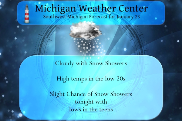
Forecast Discussion
- Arctic air with snow chances Today, Monday and Thursday

Strong westerly flow across the lake will enhance the synoptic
flow of a clipper moving through lower Michigan this morning. The
light to moderate snow will continue along snow bands from the
I-96 corridor southward. The best moisture and dendritic grown is
Allegan county south where 2 to 4 inches is expected. As the
clipper moves eastward the winds will shift northward, cutting off
the flow and the snowfall will diminish quickly late this
morning. The clippers that have been moving through the region all
stem from a large upper level low over Hudson bay continues to
roll colder air and instability across Southern Canada and the
midwest.

Drier air will allow for a brief reprieve this afternoon before
another ripple of instability brings flow across the lake and
through lower Michigan. This next clipper will have a short wave
trough that will be dominated by southwesterly flow that will
bring decent fgen for snow band generation Monday. The overall
wave is deeper with a larger swath of moisture. So more widespread
snowfall is expected. The south westerly flow will persist longer
with the lakeshore receive the highest snowfall totals.
 Another round of colder, dry air will infiltrate Monday night into
Tuesday which will diminish snowfall, though a pressure gradient
along the lakeshore could allow for light snow bands to linger.

Cold air will remain over the region through the week with a
deeper elongated trough extending across Canada and across the
midwest Thursday into Friday. This will bring a late week
opportunity for more snow.
Great news>>>>the last CPC outlooks show above normal snowfall on the way! Get ready to rock n roll! Winter is the best!
>>>>>Late Breaking Weather Alert>>>>>>the latest RDB model gives GR 2 to 3 inches of snow through tomorrow night! Get ready for more slippery roads and shoveling! Winter at its finest!
What a great winter day! Great skiing conditions! And for that matter great for ice fishing, ice skating, snowmobiling, luge, sledding and basically anything outdoors! Who wouldn’t love cold and snow with conditions like these! Incredible!
55* degrees in Tampa Florida for the kick off of the big game thats pretty cold for down there like everywhere els I would Imagine Go Rams Matt Stafford all the way to the Superbowl..InDY..
We received 2” – just enough for me to break out the shovel for the 2nd time this year.
5 inches of snow yesterday into very early this morning out in my area I have lost count on my seasonal totals still short of 90 inches though
could you imagine if this was a warmer then normal Winter everyday we would be getting reminded of that and if it was a below normal in snowfall the repeated information would be happening but I am pretty sure this month January is running a goood 5 or 6 degrees below normal… This is by far one of the best Winters in a few years we are enjoying…InDY
With a mean of 21.8° at Grand Rapids this winter is on track to be as cold if not colder than January 2019 when the mean was also 21.8. The mean was 21.2 in 2015 and 18.1 in 2014. as for snow fall we will have to see what GRR official numbers are but GR will go over 20.0″ for January. There was 30.5″ in of snow fall in January 2019. So yes it has been awhile but not that long ago.
Slim
It sure feels like we are in the “dead of winter” right now. I wonder how long this will last until we enter the “end of winter” phase. I always like analyzing this every season. Last year it took a while with the really cold February. Other years, like 2017, things improve around mid-February.
Here just NW of Grand Rapids I recorded 2.7″ of new snow fall and there is now 5.5″ on the ground. While not real deep it now looks more like mid winter than it did. There is some clearing here now with clouds still to the south and west. With that clearing it is now down to 14 here.
Slim
My official total is 4.5 inches and the clouds are trying to break up – temp is 16.
What a storm, what a winter and what a cold spell! This is an unbelievable run of cold and snow! I love it!