 Here in Otsego we already have an inch of snow on the ground – makes all the Christmas lights look much better. I always wondered if our southern states ever miss the beauty of the snow – probably not.
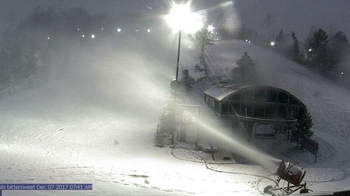
The feature image is from the Bittersweet webcam a mile down the road from me – a good shot of the snow canons making snow on top of what they are getting today.
At this point it appears the snow may stick around through Christmas. Monday it will get above freezing bringing us a sloppy mess of rain and snow which will pack down the snow we have on the ground.
The winter weather advisory continues through 4pm today for Mason-Lake-Oceana-Muskegon-Ottawa-Allegan-Van Buren-Kalamazoo counties. Additional snow accumulations of 2 to 4 inches are expected.
Charlevoix County to the north continues with their winter storm warning until 4pm with additional snow accumulations of 2 to 5 inches expected. In the U.P. Keweenaw-Ontonagon-Northern Houghton-Baraga-Southern Houghton counties have a winter weather advisory starting at 3pm this afternoon continuing through 10am Friday. Total snow accumulations of 4 to 7 inches, with localized amounts up to 10 inches are expected. The most snow will occur from Calumet and Houghton to Rockland and Mass City. The least snow of less than 3 inches will occur along and south
of M-28 in southern Houghton and Baraga counties.
So, welcome to winter. I remember the old license plates for Michigan with winter wonderland stamped on them. My grandfather had every license plate he owned in a shed on his farm going back to 1920 I believe. Quite a variety of colors and styles. I started driving in 1972 and had plates from Maine and Michigan – the only plate I own now are on my car and truck plus a 1955 Michigan plate (the year I was born.)
Getting back to the weather snow will continue to fall across much of West Michigan through the morning before tapering off to just a few showers by late this afternoon. Motorists should anticipate slick road conditions today, especially for the morning commute. Another round of widespread snow is expected Friday evening into Saturday. This next round may bring slightly higher snow accumulations.
Today: Snow showers. High near 29. West northwest wind 8 to 14 mph, with gusts as high as 22 mph. Chance of precipitation is 90%. Total daytime snow accumulation of around 2 inches.
Tonight: A 30 percent chance of snow showers. Mostly cloudy, with a steady temperature around 25. West wind around 11 mph, with gusts as high as 20 mph.
Friday: A 40 percent chance of snow showers, mainly after 1pm. Mostly cloudy, with a high near 31. West southwest wind 11 to 17 mph, with gusts as high as 28 mph.
Friday Night: Snow. Low around 25. Southwest wind 8 to 10 mph. Chance of precipitation is 100%. New snow accumulation of around 2 inches.
Saturday: Snow, mainly before 1pm. High near 29. West wind 7 to 13 mph becoming north northwest in the morning. Winds could gust as high as 22 mph. Chance of precipitation is 80%. New snow accumulation of around an inch possible.
Saturday Night: A 40 percent chance of snow showers. Mostly cloudy, with a low around 18.
Sunday: Scattered snow showers before 5pm, then a chance of freezing rain. Mostly cloudy, with a high near 29. Chance of precipitation is 30%.
Sunday Night: A chance of freezing rain before 7pm, then a slight chance of snow showers. Mostly cloudy, with a low around 24.
Monday: Scattered snow showers before noon, then rain and snow showers likely between noon and 3pm, then snow showers likely after 3pm. Cloudy, with a high near 35.
Monday Night: Scattered snow showers. Cloudy, with a low around 19.
Tuesday: Scattered snow showers. Mostly cloudy, with a high near 28.
Tuesday Night: Scattered snow showers. Mostly cloudy, with a low around 18.
Wednesday: Scattered snow showers. Mostly cloudy, with a high near 31.
A reinforcing shot of arctic air moves in today leading to unseasonably cold temperatures and lake effect snow showers. Slick travel conditions will be possible. An area of high pressure builds up the Ohio Valley for tonight into Friday diminishing the snow showers. A widespread accumulating snow event is expected for Friday night into Saturday as an area of low pressure tracks through.
What a beautiful site! Rock Roll will live forever!
http://www.weather.gov/images/erh/gis/LP_state_Snow.png
I absolutely love it!
http://www.instantweathermaps.com/GFS-php/showmap-conussfc.php?run=2017120718&time=PER&var=ASNOWI&hour=384
Snowing very hard out at thee YARDofBRICKS over 3 inches now stat tuned .. INDYDOG
Snowing very hard at thee YARDofBRICKS . INDYDOG..
6+ inches coming Saturday … Winter is rocking ..2 inches of new snow out at thee YARDofBRICKS ..stay tuned INDYDOG!
+1000
Just measured the snow in the yard & I have 6 inches on the ground. Looks really pretty if you have no where to go. If you are out on the roads take it slow.
Nice! I have been watching the radar, and Hudsonville/Jenison areas have been getting pounded all morning. Working on 5 inches here.
I have over 4 inches on the ground here now, with large flakes falling. We have been under the heavy banding all morning. Looks beautiful!
Winter weather advisory has been extended to the Inland counties till 4 p.m. Thursday. Roads are terrible! Stay Tuned INDYDOG
A little late on this as I stayed up too late last night. I just took a measurement and here at my house I now have 2” of snow. I was getting large flakes but now just a light fine snow falling. temperature here is now 27°
Slim
First of all… I want to remember those at Pearl Harbor and those who had to witness it. We did visit in the 90s, but President Clinton was there the days we went so it was closed to the public. This year we went to DC to see the WWII Memorial… words just can’t describe it.
It is beginning to look a lot like Christmas.
When I was a kid Pearl Harbor day was always a big day of remembrance, not so much now.
Slim
We received like three snowflakes this morning, but the salt trucks are out in full force. LOL