Why Is GRR Cooler Now?
As has been the case for some time now Grand Rapids continues to be cooler relative to average than many other locations in Michigan. As I live just NW of Grand Rapids and I have two outside temperature sensors in my yard. I have a high degree of confidence in the readings I get overnight readings. My daytime readings are affected by the sun and many times read too high.
Of course, the question is why it seems to be cooler compared to average at Grand Rapids than Muskegon, Lansing and to a lesser extent Holland. I know we have one poster who seems to think there is some great conspiracy by the NWS office in Grand Rapids but remember the Grand Rapids office is the home office for Lansing, Muskegon, and Holland so what would their point in that? Now one thing we do not know is if they have moved the location of the sensors? If the sensors were moved it would not have to been by that much as between the two I have in my yard I can have a two degree difference between then. And on my daily walks there is a location on my walk that is very much noticeable cooler than other locations on clear calm nights. Of course, another reason may be that new sensors were put in use and that would be another possible reason. Any way I have posted this before but will post it again just for everyone’s information. This is a response from the NWS office on the issue. I would also like to point out that no matter what one thinks of the issue the records that are from the NWS office are the official readings.
NWS Office Grand Rapids response.
Hi James,
We believe the issuance of the 1991-2020 normals data plays a role in this since we noticed that these changes are happening more since the latest 30-year normals period was issued by NCEI in 2021. However, other factors may be occurring such as station siting, microclimatology, and differences in the period of record. For example, we moved the Lansing ASOS in 2004 because a cool bias was noticed with the ASOS’s minimum temperatures given the sensor’s proximity to a low elevation area on the airfield. Some of those cooler readings from the mid 1990s-2004 would have been factored into the 1991-2020 normals data, which may partially explain why it doesn’t take as much warmth with respect to Grand Rapids to achieve a larger departure from normal. Over the years, various ASOS locations have had their temperature sensor aspirators replaced or entire temperature systems replaced due to wear and tear. Worn or inoperable aspirators cause warmer readings because air is not circulating properly. We usually notice this pretty quickly and our technicians make repairs. It is not really possible for us to quantify whether factor X or Y played a greater role in explaining why some stations have an easier time reaching greater departures from normal than others.
Recently we performed a regional analysis of departures from normal. This issue you raise is seen on a regional scale as well and is difficult to fully explain. You would think that given similar weather conditions between relatively nearby cities over the course of time, the cities would rank relatively similarly in terms of temperature statistics. This isn’t always the case.
Muskegon and Lansing rank close together, and Grand Rapids / Flint / Detroit rank fairly close together. We have no reason to believe that Grand Rapids is reporting bad data, or that Lansing is reporting bad data. I think the question of why we’re seeing differences in departures from normal is complex and due to multiple factors. It may be better to assess departures from normal across a broader area as opposed to one point, which would be a better representation of the region since the differences in departure would be smoothed out. Areal averages are something that climate scientists would be looking at versus one station’s data.
Hope that helps!
Brandon Hoving, PEM
Observing Program Leader
Meteorologist
National Weather Service
Grand Rapids, MI
I hope this at least lets you know the official response to the issue.
This has been a very warm start to November. While a very warm start to November this year was not the warmest first 10 days to any November. I have not checked all past Novembers but the mean this year for the first 10 days of November are. Grand Rapids 53.6°, Lansing 55.1, Muskegon 56.1, Holland 55.2. In 2020 the mean for the 1st 10 days that November was Grand Rapids 55.7, Lansing 55.6, Muskegon 56.5. Holland 56.8. 1975 also had a very warm start to November with a mean for the 1st 10 days at Grand Rapids 58.3, Lansing 58.1. Muskegon 57.5 and Holland 57.2. But none the less this was a very warm start to November. We will have to see if the cold that looks to be coming will off set this warm start.
Slim
Let it snow let it snow let snow ….INDY
Wow, just wow! Winter is here and in full force! A very cold week is on tap! Get your winter gear ready and enjoy the cold and snow baby! Rock n roll will never die!
There is an area of heavy snow that is clipping far SE Michigan. The snow moved across much of northern Indiana and NW Ohio. Here is west Michigan there has yet to be much snow fall today and here in GR it is now up into the low 40’s
Slim
We’re heading up to TC today. Just checked their forecast. Most areas 1-3″ with some areas getting 5-8″. We had better take some boots…just in case.
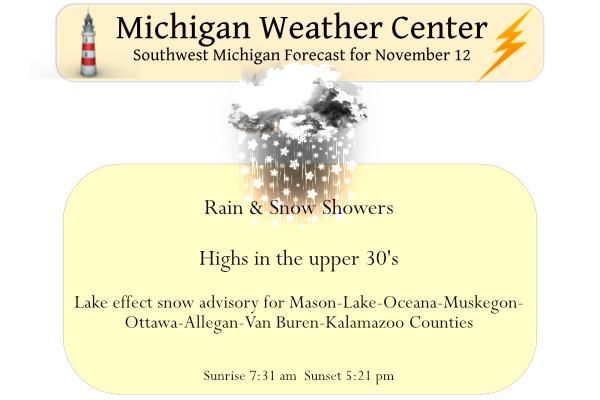
As happens occasionally in the cold seasons the high yesterday was just after midnight and the low was just before midnight. That official H/L at Grand Rapids was 59/34 there was no rain fall and just 6% of possible sunshine. The overnight low was that 34 at the current time both here and at GRR is 35. For today the average H/L is 49/34, the record high is 68 in 1902 and the record low is 15 set in 1911 and 1986. The record snow fall amount for today is 3.6” in 1997. November 12th is the 1st day that… Read more »
The first Winter Weather Advisories of the season have arrived in West MI. Bring it!