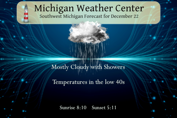
Seems we have our seasons mixed up this year with rain and warmish air in the forecast. Most of the country doesn’t have expectations of a white Christmas this year unless you want to go to Alaska or some spots in the higher elevations of the Rockies. A few light rain showers will be possible today, with more widespread rain overnight tonight. Highs will be in the upper 30s to mid-40s. We will become milder as we head into Christmas Day with highs in the 50s. Additional chances for rainfall will occur on Christmas Day and through most of next week.
Forecast
Weather History
1957: Balmy weather prevails with highs in the mid-50s. Muskegon sets a record high of 55 degrees.
2000: A long siege of arctic air and lake effect snow continues across Lower Michigan. The high temperature at Lansing is only 9 degrees with lake-effect snow showers swirling. It will be the coldest December of the 20th century at Lansing.
On December 22, 2013, an ice storm impacted locations from the northern Detroit suburbs to the Saginaw area as significant moisture became entrained along a frontal boundary. Widespread ice accretions of 0.5 to 0.75 inches were reported and numerous trees and power lines were downed. The ice storm even prompted Shiawassee County to declare a state of emergency due to unsafe traveling conditions. Further south, the precipitation fell as heavy rain while Bay, Midland, and Huron counties saw 2 to 4 inches of snow.
Also, on December 22, 1872, the temperature dropped to -24 degrees overnight in Detroit. This temperature reading is unofficially the lowest temperature ever recorded in the city of Detroit.
U.S.A and Global Events for December 22nd:
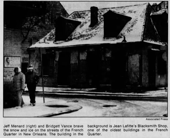
1989: The most significant cold spell of the century for the Deep South occurred from the 22 to the 26. New Orleans experienced 64 consecutive hours at or below 32 degrees Fahrenheit and a total of 81 out of 82 hours below freezing. A total of 15 hours was below 15 degrees with the lowest reading of 11 degrees on the morning of the 23rd. A low temperature of 8 degrees was recorded at Baton Rouge. Snow and sleet paralyzed transportation systems and as much as two to four inches of snow accumulated in Lafourche and Terrebonne Parishes. Snow and ice covered the ground in New Orleans. The most significant impact was the breaking of water pipes in homes and businesses. Over 100 fires resulted in the New Orleans area within 24 hours due to a loss of water pressure and improperly utilized heating sources. Ice formed over shallow lakes and waterways where commercial fishing took heavy losses. Five weather-related deaths occurred in the service area during this rare Arctic outbreak.
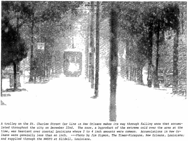
1989: Between December 22 and December 24, 1989, deepening low pressure pulled a frigid arctic air mass into the southeastern United States. This sequence of events produced a historic snowstorm and a rare white Christmas across the region. At Charleston, South Carolina, the storm deposited 8 inches of snow – the greatest snowfall in modern history. At Savannah, Georgia, the storm’s total accumulation of 3.6 inches tied for the greatest snowfall in modern history. Click HERE for more information from the NWS Office in Charleston, South Carolina.
2002: Heavy rains prompted flooding in the mountain city of Teresopolis, located about 90 km north of Rio de Janeiro in Brazil. A mudslide was responsible for 9 deaths and 50 injuries.2004: Tremendous snows occurred in the Ohio Valley. The following cities set new records for their most significant snowstorm ever: Evansville, Indiana 22.3 inches, Dayton, Ohio 16.4 inches, and Paducah, Kentucky 14.2 inches. Other big snowfall totals were 31 inches at Liberty, Indiana, 28 inches at Buena Vista, Indiana, 24 inches at Greenville, Ohio, and 23 inches at Mansfield, Ohio. Click HERE for more information from the NWS Office in Paducah, Kentucky.
Forecast Discussion
On this first full day of winter, regional radar shows light rain
showers moving eastward across IL/IN/OH and just clipping far
southern Lower; little if any precipitation has been seen north of
I-96.

Forecast concerns today revolve around precipitation chances
through the period.

Forecast reasoning remains consistent from previous forecasts and
only minor tweaks were made to the grids.

Latest water vapor imagery shows a weak wave over far southeast
Lower moving away from the cwa. Another more pronounced waves was
over Kansas moving in this direction and regional radar shows
quite a bit of rain associated with it as far northeast as
Missouri.

Much of today will likely be dry as we sit in between waves.
However, by the end of the afternoon we/ll see light rain spread
into far southwest Lower and continue to move northeast across the
rest of the cwa during the evening. Everyone will see rain with
this event with QPF ranging from around two tenths near US-10 to
around a half inch near I-94 and the bulk of it will fall tonight.

The rain will taper off from west to east late tonight/Saturday
morning leaving cloudy skies behind.

Very mild conditions will continue through the period with highs
in the 40s today and Saturday.

.LONG TERM...(Saturday night through Thursday)
Issued at 248 AM EST Fri Dec 22 2023

We are looking at relatively quiet weather for the beginning of the
long term period, before unsettled weather settles in for later
Christmas Day and likely through the end of the forecast period next
Thursday.

The system bring in the rain in the short term is expected to be
long gone by Saturday night. High pressure will be building in aloft
will help to keep things quiet and mild. The flow in the lower
levels will be from the South, tapping low level Gulf moisture and
keeping mainly cloudy skies over the region. There may be a brief
break in the clouds late Sunday and Sunday night in the wake of a
warm front moving through. We can not rule out a shower on Sunday
with the front, but moisture will not be all that deep.

Christmas Day will see dry and warm conditions early, owing to rain
moving in later in the day. The upper low complex will emerge over
the Plains on Sunday, and help to organize a sfc low on Monday that
will bring in rain later. This rain will last into Tuesday morning
when the front moves through, and we become under the influence of
the dry slot. Thunder chances in the forecast are just a tad too low
at this time to mention. If the instability near the nose of the dry
slot can become just a little more favorable, thunder would be
possible Monday night/Tuesday morning.

Once the front moves through early Tuesday, the area will see an
unsettled weather pattern likely persist through the remainder of
the period through next Thursday. There is good agreement amongst
the models and ensemble means that the low cuts off, and persists
through the long term. This would mean periodic chances for
showers with short waves around the low, and diurnal instability
showers.

Snow chances with this low are almost zero until you get late next
week, if it happens. That is because the system is a southern stream
system with a lack of sufficiently cold air. Things could
interesting late in the period to beyond the forecast period as
there are some solutions bringing a northern stream system and
colder air down from Canada, and phasing it with the main low.
Might have to see if I can get a Christmas Eve round of golf in?!?! ABSOLUTELY INCREDIBLE!!!
This will be the fifth year in a row that we get into the 50s during holiday season. That is so wild.
Note: I can only see back to 2019 on NWS GR’s website.
It has been depressing the last 5 years I f you enjoy winter sports and need sustained cold temps. All my ice fishing buddies have almost given up.
Blowtorch warning remains in effect!
Absolutely!! BRING IT!!
Get ready Starting Sunday, for 3 days in a row with high temps near or above 50 degrees! Incredible!!! Wow!!!
No arctic blasts and above normal temps! What could be better???
I’ve hears some talk of a SSW event occurring. This can lead to colder air ~2 weeks in the future… we will see. I’m still thinking an overall mild January with the El Nino, but possibly 2-4 day bursts of arctic air mixed in.
In the meantime, sure feels warm out! Almost 40 and it’s only 9AM
The official H/L yesterday at Grand Rapids was 39/27 there was no rain/snow and no sunshine. December snowfall is now a foot below average and for the season it is now -17.5” For today the average H/L is 34/23 the record high of 57 was set in 1941 and the record low of -11 was set in 1989. The wettest was 1.07” in 1920 the most snowfall of 8.5” was set in 1951 and that year also had the most on the ground with 19” Last year the H/L was 34/15 there was 3.8” of snowfall and there was 3”… Read more »
I actually said that a few days ago. Why am I doing spring cleanup ..sticks that fell, in December? Lol