We have finished the first half of 2024. As a side note, we still had no mosquitoes here in Otsego. Down here by the Kalamazoo River, we generally have enough to suck the blood out of a person. This is the first year in the 28 years I have been down here that we have none. Entomologists believe it is due to the lack of snowfall this year which creates the puddles of snow melt for them to lay their eggs. At least we don’t have to spray ourselves with deet. It is pleasant walking through our woods this year.
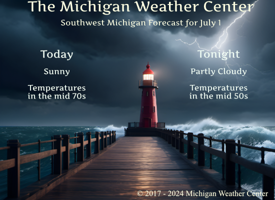
Our low for last night was 47°, and our high for yesterday was 74°.
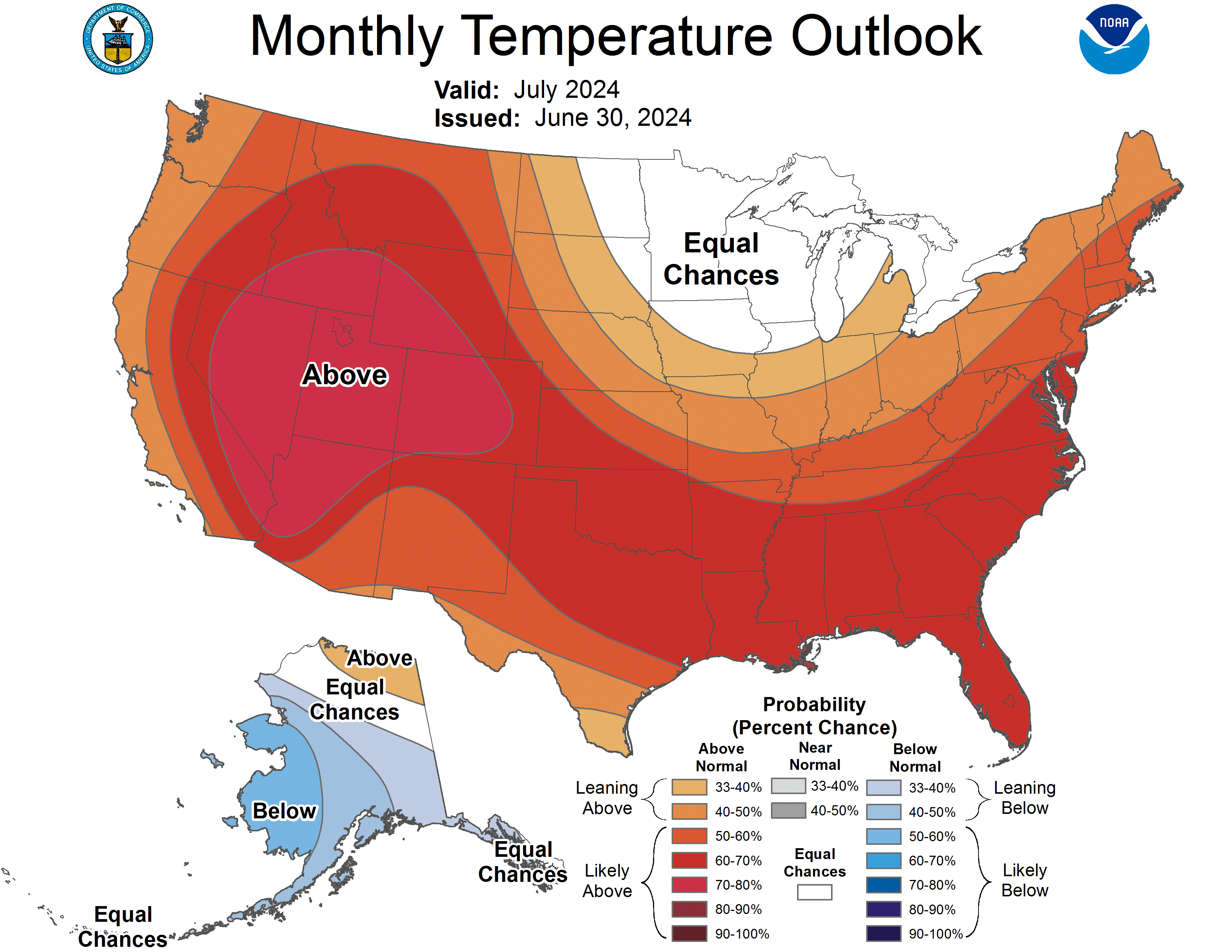
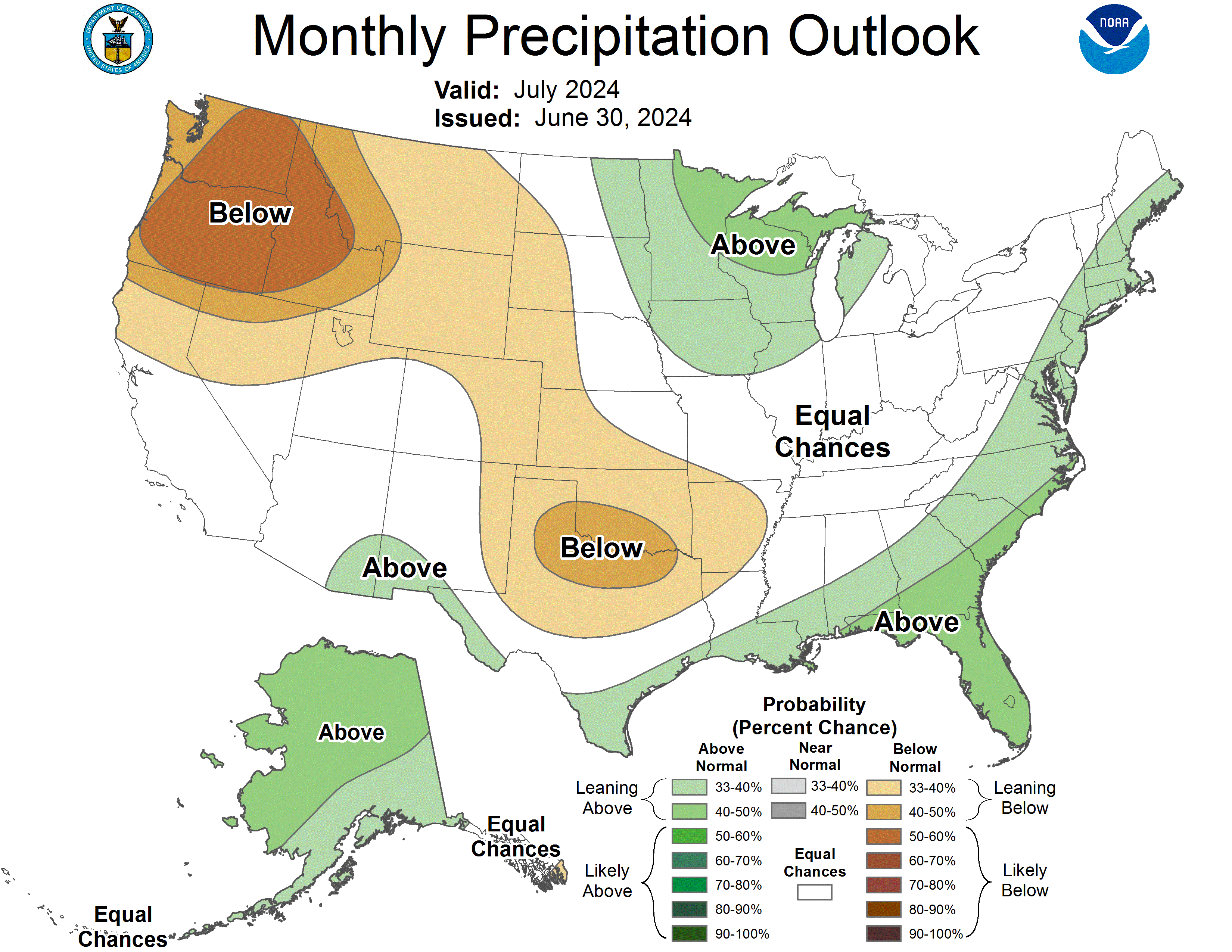
The CPC changed their month of July forecast between yesterday morning and afternoon.
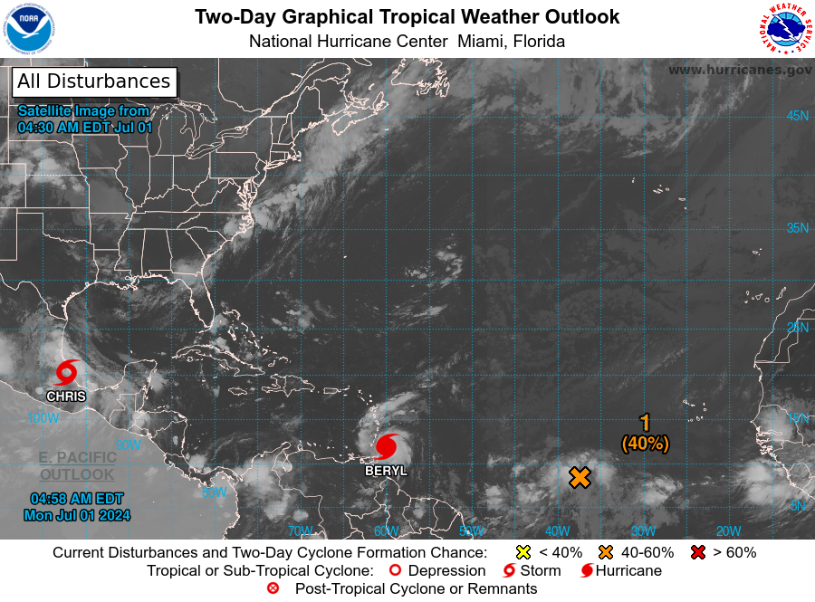
The hurricane season has started early this year. We have Hurricane Beryl and Tropical Storm Chris. The waters in the Atlantic are warm.
NWS Forecast
Weather History
1999: A weak tornado made intermittent touchdowns during the early afternoon in Newaygo County. A few tree limbs were downed, but otherwise, there were no damage reports, as the tornado remained over rural areas.
2009: The coolest July in Grand Rapids history begins with a record cool high of only 64 degrees as clouds and scattered showers prevail.
On July 1, 2014, a derecho produced a swath of wind damage across Southeast Michigan during the pre-dawn hours. The damage mainly consisted of downed trees. A wind gust of 74 mph was measured in Wixom!
Also on July 1, 1965, the temperature bottomed at 40 degrees for the lowest reading of the month. This is shared with a low of 40 degrees on the 2nd in 2001 for lowest temperature in the month.
Forecast Discussion
- Sunny, Dry, Relatively Cool Today

Center of surface high pressure will be over Lower Michigan
during the middle of today. Temperatures start off rather cool,
about 10-15 degrees below normal, but should warm up into the mid
70s (still a little below normal) with abundant sunshine. Dew
points will be on the dry side for summer, around or even below 50
degrees.

- Shower/Thunderstorm Chances Tuesday into Wednesday

As high pressure moves east of the region, southerly low-level
winds bring returning warm air on Tuesday. Cirrus and altostratus
clouds will stream in within the southwesterly upper-level flow in
advance of the next shortwave trough. There is a chance of rain
showers during the day, particularly north of Grand Rapids toward
Ludington, though initially any precip from the midlevels will
have to overcome dry low-level air on the way down. MUCAPE
appears meager but perhaps just enough for a slight chance
thunderstorm mention during the day. Rain showers become more
likely Tuesday night, especially north of GR toward Ludington,
where there may some repeating thunderstorms and narrow swaths of
rain totals over an inch.

A weakening cold front enters the CWA from the northwest and
dissipates over the area early on Wednesday. The main low level
jet pivots through the region during this time with the axis of
instability and highest PWATs pushing through as well. Ensemble
QPF plots capture this weakening trend to the system as it arrives
by showing lowering 24 hr value from Ludington to Jackson along
with decreasing number of members having measurable values. This
will be reflected in the POP forecasts for this period.

- Another Round of Storms Friday

A southwesterly upper level jet streak arrives in the Great Lakes
Region during this period. In the mid levels an associated
deepening wave tracks in during the day. From the ECMWF, the
combination of deep layer shear and instability would support some
organized convection during the day. The surface wave reflects a
warm front in the CWA, so that will need to be monitored. Modeled
ensemble QPF values show a lot of spread in the various models so
some uncertainty exists with this system. Overall though enough
confidence exists to feature a risk for thunderstorms associated
with this wave that moves in.
Just another cool great weather day! Wow just wow, WOW!!!!!!
Low 70’s in July love it happy October 😊…INDY
This is great bonfire weather! Great Day!! INDY WEATHER!!
The best !! I have been burning love it! ❤️ INDY
I am in a Great Mood with some decisions that have been made today! Actually I’ve been in a Great Mood since last Thursday Night! Great time to be alive and we are enjoying some great weather these past couple days! WOW!!!
Pathetic innuendos! Get real!
Outside of a handful of days, it’s been a pretty comfortable summer so far.
Only one bad week so far despite the warm weather hype!
Welcome to July 2024. I cut the grass yesterday for the first time in a while and here in my yard I did find a mosquito or should I day a couple found me. Not sure why there would be so few this year. A mosquito virus??
Slim
A quick summary for June 2024 the mean at Grand Rapids was 70.5 that is a departure of +1.6 the high for the month was 94 on the 17th the low was 45 on the 11th all days had highs of 71 or better with 3 days at 90 or better and 6 days at 88 or better. There were 4 nights with low of more than 70. The month had 4.85” of rainfall that is a departure of +0.91”
Slim
When is the last time we had a below average month? Seems like it was sometime last Fall, unless there was one more recently?
November was barely below average (-0.3). August was also below average.
Below average months are few and far between nowadays.
The overnight low both here in MBY and at GRR was 48. That was the coldest low since 2001 with it got down to 47. There was no rainfall and at the current time it is clear and 49 here in MBY.
Slim
The official H/L yesterday was 71/54 that 71 was the 8th coldest high for any June 30th at Grand Rapids. There was no rainfall, and the sun was out 78% of the time. The peak wind gust was a cool 29MPH out of the N. For today the average H/L is 83/62 the record high and the warmest low was set in 1931 at 101/78. The record low of 44 was set in 1982 and the coldest high was 64 in 2009. The most rainfall of 1.43” fell in 1915.
Slim
No high heat in sight! I absolutely love it! Keep it rocking!