 Eeyore: “Spring is good I guess, even if it lasts all summer then winter will be here in September and we will be tail deep in snow until next May…”
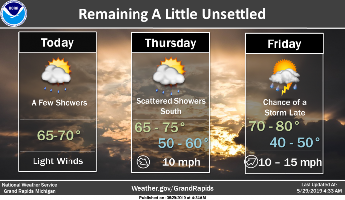
I just made that up, of course Eeyore may be right in some respects because we generally go from winter right into summer most of the past few years and we haven’t been able to experience an extended spring. Keep in mind the warm air and storm lines have moved from the deep south to the central plains into the southern Midwest over the past few weeks and are bound to get into the Great Lakes eventually.
Soil moisture can help keep temperatures down. I believe we will see summer-like weather next month with warmer temps, however July and August may end up slightly cooler to near normal – I guess we will just have to wait and see.
Weather History
May 26
1961: Snow flurries are observed across Lower Michigan as record cold air moves in. Temperatures fall well below freezing the next morning, wiping out much of the fruit crop.
May 27
1907: Wet snowflakes fall at Grand Rapids and Muskegon. It is the latest snow on record at Grand Rapids.
1912: A tornado destroys barns and kills livestock near East Leroy in Calhoun County.
1960: Several farm buildings were damaged or destroyed by a tornado four miles east of Ionia.
1973: A tornado destroyed a barn and silo near Saranac in Ionia County. Another tornado did minor damage near Gun Lake in Barry County.
May 28
1955: A series of tornadoes put down an intermittent damage path more than 60 miles long from near Schoolcraft in Kalamazoo County to east of Grand Ledge in Eaton County. One person was injured northwest of Charlotte as a barn was destroyed. Two homes were unroofed and total damage was estimated at 150,000 dollars.
1991: A tornado damaged homes and destroyed outbuildings near Hart in Oceana County.
May 29
1895: The second heat wave of the month gets underway with record highs of 94 degrees at Grand Rapids and Lansing.
1947: Muskegon records its latest snow on record as some wet snowflakes mix in with a cold rain. The high temperature for the day is only 47 degrees after a low of 35.
May 30
1972: A tornado damaged a building under construction five miles west of Jackson.
1989: A tornado struck Van Buren County, moving from east of South Haven to south of Pearl. Several grain elevators were destroyed and windows were blown out of buildings.
May 31
1943: A tornado outbreak hit southern Lower Michigan. Ten people were injured as homes were swept away by a powerful tornado that moved southeast of Morrice in Shiawassee County. A tornado killed livestock and destroyed a barn near Morley in Mecosta County. A home near Coopersville in Ottawa County was unroofed by a tornado and three people were injured. Another tornado struck near Bath in Clinton County destroying one barn.
1954: A tornado struck north of Bangor in Van Buren County. Forty barns were damaged or destroyed and one home was unroofed. Damage totaled about half a million dollars.
1998: A squall line of severe thunderstorms moves across Lower Michigan in the early morning with wind gusts between 90 and 120 mph. Thousands of trees are knocked down and hundreds of homes and businesses suffer damage. Sections of the state are declared a major disaster area and thousands are without power, some for several days.

Eleven-hour composite radar base reflectivity loop showing development and evolution of the May 30-31, 1998 derecho-producing convective system. “Ping-pong” animation begins at 7:00 p.m. CDT Saturday, May 30 (0000 UTC May 31) and ends at 6:15 a.m. CDT (1115 UTC) Sunday, May 31. Reflectivity intensity scale at left (dBZ).

Area of Lower Michigan affected by the worst damage from the May 30-31, 1998 derecho. Red numbers are maximum measured wind gusts in mph. Orange numbers are estimated maximum gusts in mph, based on a damage survey by Grand Rapids NWS Forecast Office meteorologists. Thirteen Michigan counties (noted in black lettering and within light blue border) together were declared a Federal Disaster Area by the Federal Emergency Managers Association. The purple “S” represents where a “seiche” took place on the eastern shore of Lake Michigan.
June 1
1934: Blistering heat begins the month in one of the Dust Bowl summers of the 1930s. The mercury soared to 102 degrees at Grand Rapids and 97 degrees at Lansing. The 102 degree reading at Grand Rapids is tied for the highest June temperature with June 20, 1953.
1943: A violent tornado inured ten people as it moved from Ingham to Shiawassee County and left a path of destruction 20 miles long. Over 250 farm buildings were damaged or destroyed, including 39 homes and 52 barns. Another tornado hit between Lansing and Bath, causing damage to several farms.
1998: West Michigan was cleaning up from the tremendous destruction caused by the squall line of the day before. Meanwhile on Lake Michigan, water levels continued to rise and fall several feet at some locations through the day as seiches generated by the extreme winds of the squall line continued more than 24 hours after its passage.
Seven Day Forecast
Pollen Forecast

Fun stats:
Local met at 6pm said that 76% of the days this month have had rain. However, Lansing is a 1/2″ below average for the month.
Only 7 dry days this month and only 10 dry days in April.
3 months till September less then a month away we start losing daylight a cooler summer yes bring it!! INDY!!
Frost sometime this summer. I am not feeling a hot summer. Ran the furnace last night. That’s late for this time of the year.
Crazzy weather Jeff I’m thinking if we can get some warm weather we may just see some strong Tornadoes thats been the norm just to our south ..INDY!
Great Sprites! INDY!
For what it is worth here are some guesses for the summer 2019
https://weather.com/forecast/national/news/2019-05-15-summer-temperature-outlook-may-2019-update
https://www.accuweather.com/en/weather-news/accuweather-2019-us-summer-forecast/70008124
and
https://www.theweathernetwork.com/ca/news/article/summer-forecast-2019-canada-ontario-quebec-prairies-british-columbia-maritimes-newfoundland-alberta-northwest-territories-yukon-nunavut
My guess is more of what we have had this spring I would think that sometime this summer into fall we will see a warmer than average month or two. Looking way ahead into next winter I would expect a warmer then average winter with less snow.
Slim
Bring on a cool summer! As for next winter need I remind you about all the experts and most of the bloggers predicting a warmer and less snowy winter this past winter and the total opposite played out! Rock n roll will never die!
Pretty much everyone’s predictions for last Winter were half right and half wrong. We saw records broken for the first half of met Winter with minuscule snow fall, then about a month of Winter. Met Winter ended up just below normal snow fall, and all the seasons combined were just above except for the lakeshore areas which ended up well below because of the winds. Personally I’d prefer that type of Winter every year where it is condensed into 3 to 4 weeks.
You are totally incorrect! Virtually every expert predicted less snow and warmer and the complete opposite happened! Get your facts straight!
Nope. Everything I stated is actual fact. Look it up, or ask the resident stat man. Looks like today you need to get a grip.
You are worse than a politician? And that is pretty darn horrible!
And you are delusional. Go ahead, show everyone here what part of the post is wrong. You’re going to accuse, back it up. Problem is you can’t because everything is correct.
Yep typical politician won’t admit when wrong and spins hype!
Still waiting to hear what part of the post was wrong. Typical troll, can’t back anything up he/she says.
Will we get out of the 60*s today? I have to say Rocky has been spot on about a cool Spring I thought for sure now we would of had some hot weather nothing like last year at this time when it was hot and into the 90*s!! Slim also brought up another good point along with the cool temps this month of May maybe the cloudiest on record in the books..Have a super Wednesday..INDY.
Yes a cool, cloudy, wet Spring despite the warm weather hype!
The average H/L for Grand Rapids is now at 74/52. Here at my house I recorded another 0.11″ of rain overnight that brings the May total to 5.79″ here and the official amount at GRR is now up to 5.52″ This has also been a rather cloudy month as well as GRR has only recorded 2 clear days so far this month and there have been 10 cloudy days and 16 partly cloudy days. Rain has fallen on 17 of the days this month.
Slim