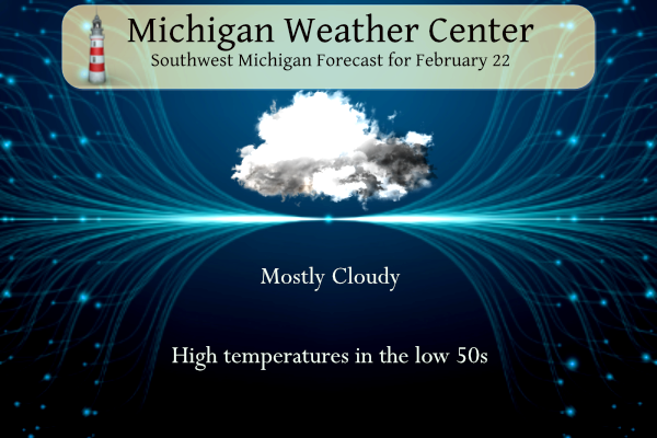
Our roller coaster winter continues to finish out the week. We will see mostly cloudy skies today with highs in the lower 50s. A cold front will bring a few flurries or snow showers Friday but mostly fair weather can be expected through the weekend with high temperatures rebounding back to around 50° by Sunday. Yesterday we reached 64° in Otsego.
NWS Forecast
Weather History
On February 22, 2023, a major winter storm brought heavy snow of 6 to 8 inches across the Tri-Cities and Thumb and widespread freezing rain across areas south of I-69. Close to 500,000 customers lost power due to widespread downed tree limbs and wires, which also made some roads impassable. Ann Arbor and surrounding areas were hit the hardest, where over a half inch of ice accumulation occurred.
On February 22, 2010, low pressure moved out of the Central Plains and tracked northeast through the Ohio River Valley. Snowfall totals were generally in the 2 to 8-inch range, with the higher totals occurring along and south of I-69. There were isolated totals of up to 9 inches reported across Washtenaw County. Some of the higher snowfall totals across the area included Ann Arbor reporting 9.0 inches, Saline with 8.5 inches, West Bloomfield had 8.0 inches, Wyandotte with 7.7 inches, and Macomb Township receiving 7.5 inches.
Also on February 22, 1930, the daytime temperature soared to 67 degrees in Saginaw, which is the record high for the month of February in this city. This day also marked the fourth day in a row (February 19-22) of daily record high temperatures in Saginaw.
1930: Record warmth prevails with highs in the upper 60s across much of southern Lower Michigan. At Grand Rapids, highs are in the upper 50s or 60s every day from the 19th to the 25th.
1773: According to David Ludlum, “The memorable Cold Sabbath in New England history” took place on February 22, 1773. “Many persons froze extremities while going to church.” Click HERE for more information from weather historian Scott Doering.
1971: One of the worst snowstorms in Oklahoma history dumped up to 3 feet of snow on northwest Oklahoma from February 20nd to February 22. By the time the snow ended on the 22nd, the city of Buffalo had 36 inches of snow on the ground, setting the state record for storm-total snowfall. Winds of 30 to 50 mph caused snowdrifts up to 20 feet high. Follett, Texas, picked up 26 inches while Amarillo recorded 14 inches.
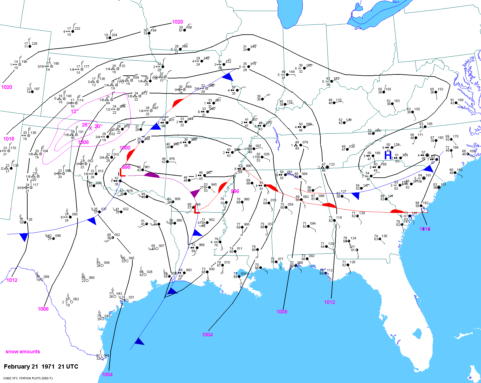
The surface map above is from Jonathan D. Finch, a meteorologist at the NWS Office in Dodge City, Kansas.

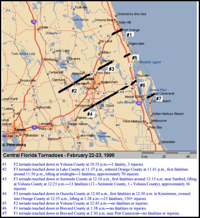
1998: Seven tornadoes struck east-central Florida late on this day and early on the 23rd. Three of the tornadoes were rated F3 on the Fujita scale. Twenty-four people were killed in Kissimmee alone. A total of 42 people were killed, and 265 were injured, and the total damage was $106 million.

Forecast Discussion
- Chance of showers south this morning, then clearing

Low pressure northwest of STL is moving east toward northern
Indiana. Regional radar shows showers and thunderstorms moving
along I-80 and slowly moving across the IN/MI border. Lift over
the attendant warm front is resulting in the precipitation to
the south. Short range models continue to show light
precipitation moving across the southern portion of the I-94
corridor where perhaps a tenth of an inch of rain will fall with
much less north of there.

Today will be mostly cloudy this morning with considerable mid
and high clouds. Once the low moves by this afternoon, the
clouds cover will begin to decrease and we should see some
sunshine by late in the day. Temperatures will be cooler today
than yesterday, but quite a bit cooler Friday as colder air
moves south behind the departing low. h85 temps are progd to
cool from +2c today to -8c by Friday afternoon.


- Low chances for snow showers Friday night

Upper Low centered over James Bay with cyclonic flow and trough axis
swinging through will bring a chance of lake-enhanced snow showers
or flurries into Saturday morning. A limiting factor is very shallow
moisture with model soundings showing the inversion heights below 5
kft and dry profiles.North to northeast flow would limit activity to
near the coast where we will have slight chance POPs.

- Medium/High Confidence in rain moving in by Tuesday

Surface high moves east over the weekend with quickly moderating
temperatures in quasi-zonal flow regime, then we wait for moisture
return early next week along with warm advection/isentropic lift
bringing increasing chances for rain breaking out by Tuesday. The
NBM likely POPs for Tuesday afternoon were not changed, although
there are still some model differences with the details of a
shortwave trough minoring out across Lower Michigan. At this point
it appears highest POPs will be across southern Lower Michigan.
Areas just to our south are already under a severe thunderstorm risk for Days 6/7. One has to wonder as we get closer if maybe southern parts of MI could be added. Guess we shall see. If I remember right we had warm air to end February in 2017 and even had i believe 3 tornadoes occur down in far south MI near the IN border. Not saying the same will happen but I believe that was also a warm February.
First tick on our dog’s paw last night!! UGH!!!
The official H/L yesterday at Grand Rapids was 62/38 that 62 was the 2nd warmest high for the dated. There was no rain/snowfall. The sun was out 45% of the possible time. The highest wind speed was 33 MPH out of the W. For today the average H/L is 36/21 the record high of 67 was set in 1930 and the record low of -7 was in 1936. The most rain fall of 1.06” fell in 1980 the most snow fall of 4.9” was in 2010. The most snow on the ground was 18” in 1936. Last year the H/L… Read more »
Mid teens for Friday night! WOW!
It will be nice for you to get outside at 2 am to enjoy the frost on the grass and cold temps! Good times!!