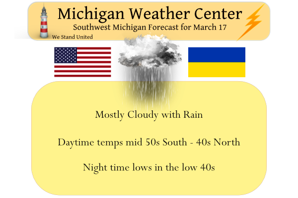
Yesterday we reached 72° down here in the valley after a low of 38°, very nice indeed. We are currently at 47° at 7 am. Widespread rain will develop later today and continue tonight. Cool temperatures and showers will linger through Saturday, before sunny and somewhat milder conditions return for Sunday. Temps will range from the mid-50s south of Grand Rapids to the low to mid 40s north. Rainfall totals could be half an inch to three-quarters, we may even have a storm around the area late tonight early tomorrow morning.
Looking back on the March 2012 Heat Wave

Kalamazoo and Lansing climbed into the lower 70s on Thursday, about 25 degrees warmer than average. But 10 years ago, Michigan and the Midwest were in the midst of one of the most significant spring heat waves on record.
Forecast Discussion
...Warm today, then rain Friday and next Tuesday...

Surface analysis shows a cold front stretching from the central UP
southwest to eastern Iowa. This front is going to move through the
cwa today. Highs will be stratified due to the front with cooler
highs in the 40s in the northwest cwa and warmer temps near 70 in
the far southeast.

There isn`t a lot of moisture for the front to interact with and so
regional radar shows little in the way of precipitation along the
front.

Developing low pressure in the southern Plains will ride northeast
along the front later tonight and Friday and the low will pass by to
the south. We should see rain develop from southwest to northeast by
late morning. We`ll see a decent amount of rain from this low. Total
qpf near 0.8 is expected south of I-95...around three quarters of an
inch near I-96 and around a half inch near US-10. The northern half
of the cwa is abnormally dry and so any rainfall would be helpful
there.

The far southeast cwa may see a small window Friday night where
elevated instability increases as the warm sector noses northward
when the low approaches. In this region, mainly southeast of a
Battle Creek to Mason line, thunderstorms may develop but will
quickly move out of the cwa as the low moves through.

As the low moves east, there is a chance that the rain will mix with
some wet snow over the northern cwa as it ends late Saturday.

High pressure moves in Sunday and we should see quite a bit of
sunshine and highs in the mid 50s.
Well…that was loud. Thunder in Ada?
Yes I heard that too around a half hour ago
57 and cloudy here. A far cry from yesterday but still a nice spring day.
Yesterdays official high of 67 at Grand Rapids was the 6th warmest on record at GR. On March 17th the record is 78 set in 2012 it was 73 in 1966, 71 in 2009, 70 in 1945, 68 in 2011, 2003 and 1894. That means 5 of the warmest March 17ths were in the last 20 years. It was a mild overnight low and the official overnight low at GRR was 42 here at my house it was 44. At the current time it is cloudy and 46 here.
Slim
Yes a few warm days in March is normal, just as getting accumulating snow is expected! Who would have thought?
Lots of 70’s around yesterday! The outdoor patios and golf courses were packed!
Sunday looks like another very nice day. Sunny and 55.