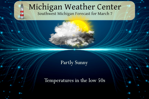
Yesterday we reached 51° for our high temperature with partly sunny skies. Variably cloudy skies are expected today with more sunshine in the forecast over Central Lower Michigan. Southern Lower Michigan will see mainly cloudy skies. Highs will be above normal around the 50-degree mark today. Rain will spread in Friday morning with periods of rain continuing into Saturday.
NWS Forecast
Weather History
1908: After heavy snow in February, heavy rains and warmer conditions set in, setting the stage for a disastrous flood. The Kalamazoo River flooded the town of Albion when the Homer Dam broke around 3 p.m. By midnight, the bridges surrounding the town were underwater. Six buildings in Albion collapsed.
1999: Arctic air and several inches of fresh snow on the ground combine to drop temperatures to a record low of 13 below zero at Lansing.
2000: Temperatures reach the 70s during a record early season warm spell. Grand Rapids hits 72 degrees and Lansing 74 degrees.
On March 7, 2000, the temperature rose to 75 degrees in Flint and 73 degrees in Saginaw. These are the earliest 70-degree days recorded in the cities of Flint and Saginaw.
1717: A series of snowstorms between February 27 and March 7 blanketed the New England colonies with five or more feet of snow. Click HERE for more information from the New England Historical Society. Click HERE for additional information from Weather Historian Tom Moore.
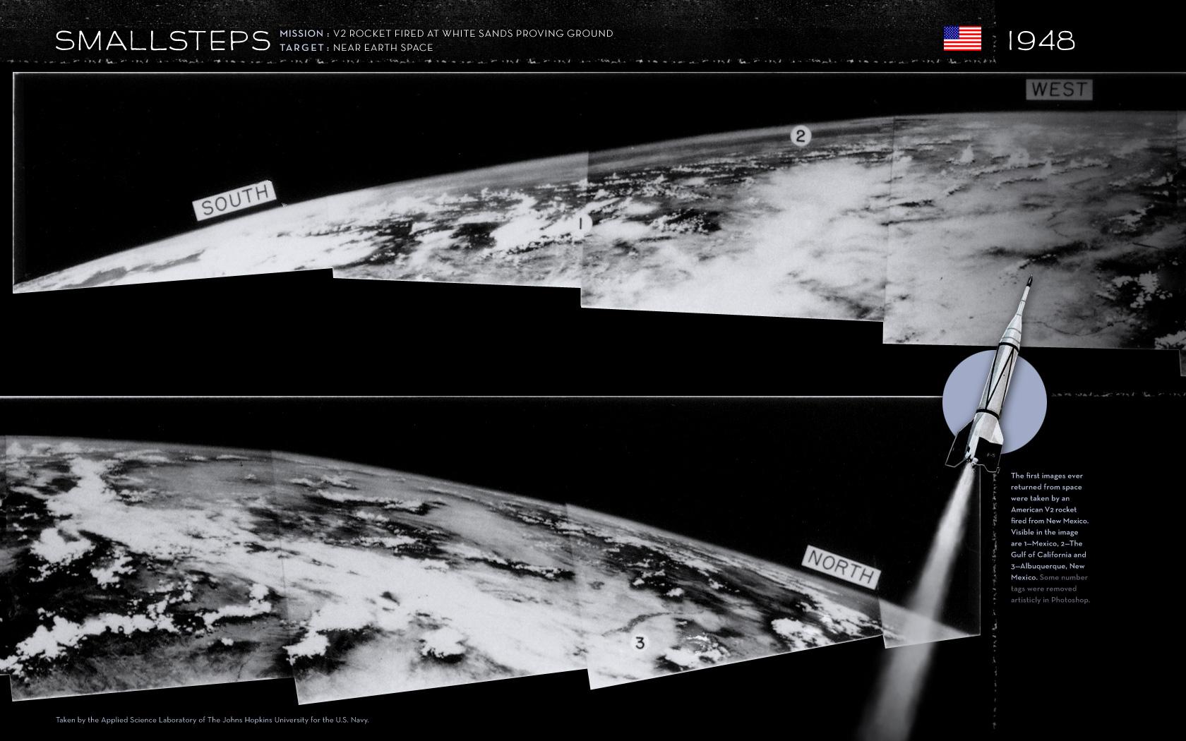
1947: On March 7, 1947, not long after the end of World War II and years before Sputnik ushered in the space age, a group of soldiers and scientists in the New Mexico desert saw something new and wonderful in this grainy black-and-white-photos – the first pictures of Earth as seen from an altitude greater than 100 miles in space. The image below is courtesy of NASA.
1970: Last near-total eclipse of the sun in Washington, DC, in this century. Sun was 95% eclipsed. A total eclipse passed over NASA’s Wallops Station (now Wallops Flight Facility) on the coast of Virginia. Click HERE for more information from NASA.gov

1997: The worst was finally over for states hit hard by the flooding Ohio River. The river crested on the 6th at Louisville, Kentucky, 15 feet above flood stage, after topping out at nearly 13 feet at Cincinnati, Ohio, and more than 7 feet at Huntington, West Virginia.
2018: A teacher was struck by lightning outside an Ocean County, New Jersey middle school during a rare weather phenomenon known as thundersnow. Click HERE for more information.
Forecast Discussion
- High Confidence in Rain Friday and Friday Night

High pressure with persistent northeast flow brings more dry weather
today. Cloud cover increases today as temps warm into the 50s
then rain chances increase Friday and Friday night. Starting
Friday morning, deep layer moisture will build as a strong
subtropical jet noses into southern Michigan ahead of an
approaching upper low. Widespread soaking rain is likely Friday
early afternoon and evening.

- Rain mixing with some snow on Saturday

A complex interaction of shortwaves remains the question mark in
regard to Saturday`s weather. The two shortwaves in question are
located over Northern British Columbia and Southern California
tonight. Over the next 48 hours these shortwaves will converge on
the Great Lakes. The timing and amount of phasing will dictate
things like duration of precipitation and precipitation type. In
tonight`s model runs the phasing of the shortwaves seems to occur a
bit later on Saturday so the result is in a weaker secondary low
moving through as compared to last night`s models. Also, surface
temperatures seem to be slightly warmer with the GFS showing 34+ F
temps all the way through 400pm on Saturday. The temperature drop
occurs into Saturday night when the precipitation will be winding
down. Bottom line we are looking at rain continuing into Saturday
possibly mixing with some snow late in the day as the precipitation
is winding down. The most likely scenario is for little in the way
of snow accumulation. We will know more as Saturday draws closer as
the details of the degree of phasing of the two upper shortwaves
becomes more clear.

Some light lake effect snow is expected Saturday night in a
northwest flow. Delta T`s will be in the middle teens C with fairly
deep moisture (around 90 percent in the 1000-700mb layer). Light
accumulations towards Lake Michigan of around an inch will not be
out of the question.

The colder air will be confined to the weekend on the backside of
the Saturday system. Temperatures rebound into next week.

- Another chance for rain mid next week

Rather quiet weather is expected early to mid next week with
temperatures rebounding back into the 50s to around 60 degrees.
Monday and Tuesday look to be dry days with upper ridging building
over the Great Lakes. Our next chance for rain will come mid week.
The operational runs of the GFS and the ECWMF have different
timing for rain chances which is not surprising out on day six of
the forecast. A pretty low confidence in this precipitation
forecast as the upper shortwave in question driving the
precipitation is in much different locations in the plains between
the GFS and ECMWF. At this point we are carrying 20-30 percent
chances for precipitation Wednesday into Thursday.
Lows in the mid 20’s this weekend! Hard freeze!
Get ready for another cold, windy weekend! If anyone is planning to golf this weekend they need to have their head examined! Wind chills around 20 degrees on Sunday! WOW!!!
Get ready for another big warm up early next week!! I’ll just wait for Tuesday, Wednesday and Thursday when it’s 60 and sunny to golf! No big deal! WOW!!!
It is incredible to me that we had nearly 20″ of snow on the ground 10 years ago today. And today we have no snow or ice anywhere in the area. Definitely the warmest end of winter and start to March I ever remember
Despite all the calls for a turn to cold and snowy, we’ve only seen a handful of below average days over the last 6 weeks. Unrelenting warmth!
The official H/L yesterday at Grand Rapids was 52/35 there was no rainfall. The sun was out 82% of the possible time. The highest wind speed was 31 MPH out of the NE. For today the average H/L is up to 41/24 the record high of 72 was set in 2000. The record low of -3 was set in 1986. The wettest was 1.37” on 1903 the most snowfall of 5.2” fell in 1935. The most snow on the ground was 19” in 2014. Last year the H/L was 44/27 and there was a trace of snowfall.
Slim
1997 Ohio River flood: a friend of mine lived near Louisville along the river then. His house incurred major damage. It was horrible.
We went to Florida a little later in March that year. And the rivers were still high and the fields were still flooded.
Slim