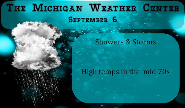
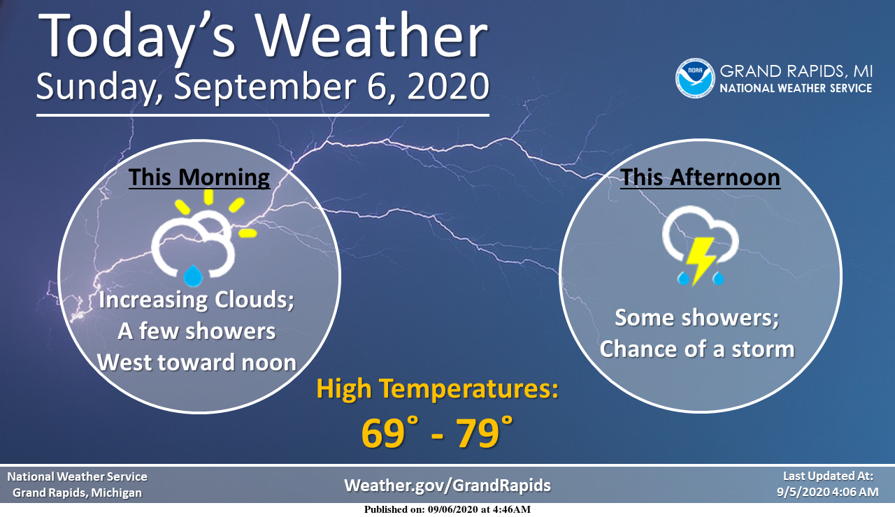
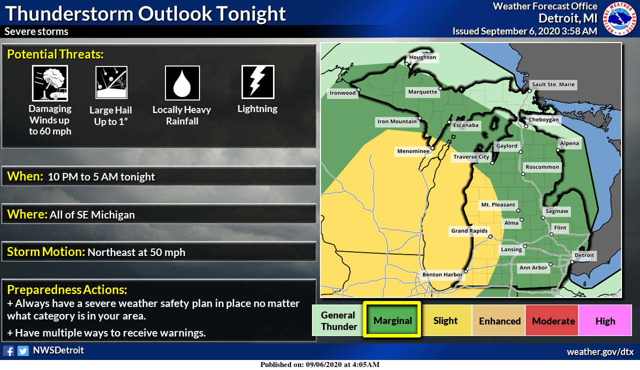
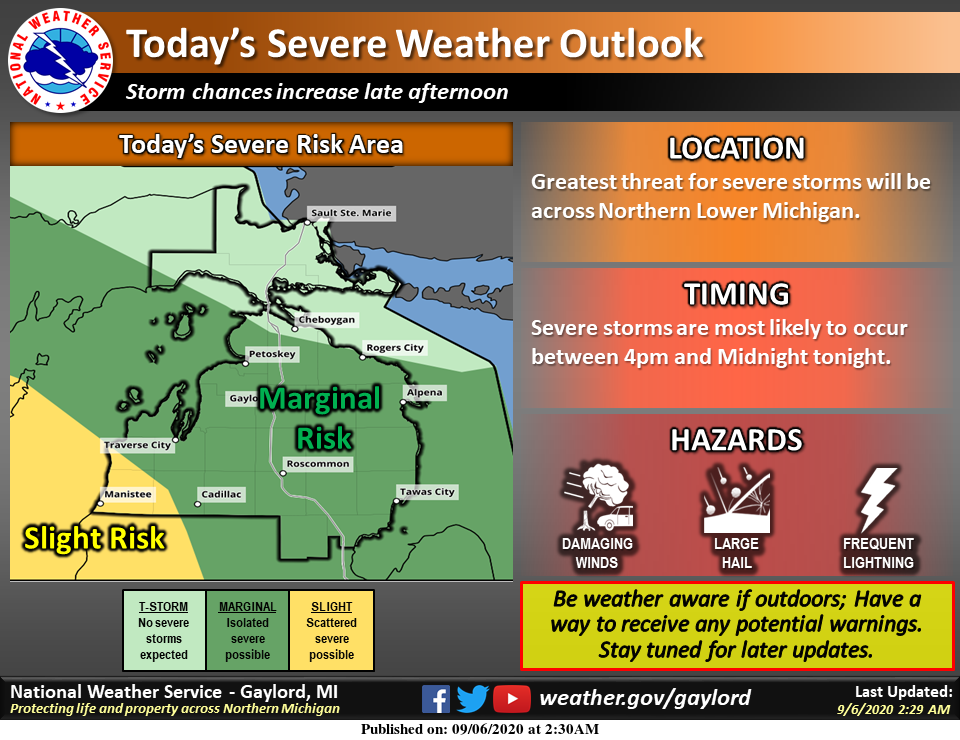
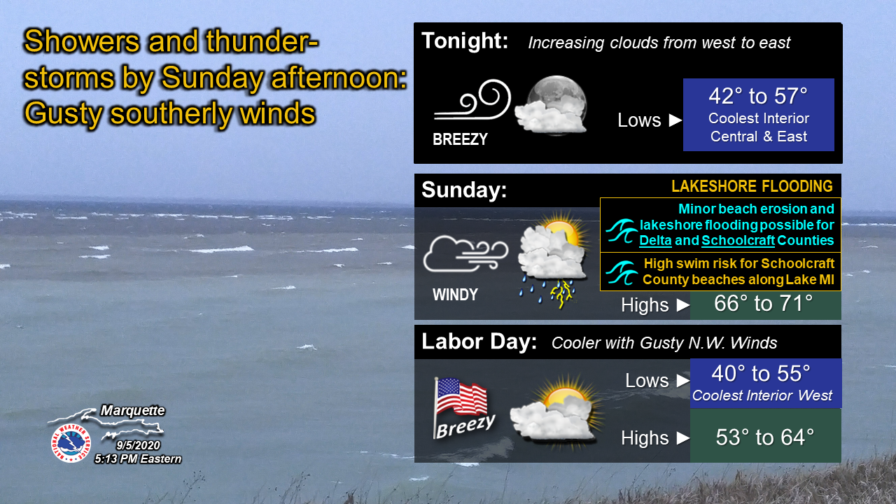
This week we will begin our roller-coaster pattern through our early fall as the climate patterns try to sort themselves out. It appears we will have a wet pattern off and on through the week. Rain chances increase throughout the day with a 90% chance of showers and storms this evening through the night. We are in the slight risk area for storms mainly overnight in western Michigan.
Temps have been pleasant the past few days with a breath of fresh Canadian air keeping temps in the 70s rather than the 80s we have seen most of the summer.
[columns] [span6]
Southwest
[/span6][span6]
Southeast
[/span6][/columns]
[columns] [span6]
North
[/span6][span6]
U.P.
[/span6][/columns]
Forecast Discussion
-Slight Risk of Severe Weather this evening

Weakening convection brings a low chance of showers and
thunderstorms into western Lower Michigan this morning. These
storms are expected to dissipates as LLJ veers towards the
southeast and weakens by late morning, with convection
redeveloping across Wisconsin in the afternoon as instability
increases ahead of a southeast advancing cold front.

Clusters of thunderstorms are then expected to move into Lower
Michigan late this afternoon and severe threat increases with a
50 to 55 knot low level jet and potential for surface based as
well as elevated instability. Slight risk for severe across
western zones per current SPC Day 1 outlook with marginal risk
elsewhere. There should also be a heavy rain threat through the
evening as precipitable water values spike up to 1.75 inches.

We will also have to watch storm mode as strongly veering wind
profiles show high helicity values in the afternoon and evening
and supercell storms are possible before transitioning to more
unidirectional shear and bowing line segments later in the
evening.

-Periods of Rain Tuesday through Saturday

Upper low cuts off across the Southern Plains and slowly
approaches the Great Lakes late next week with plenty of moisture
streaming up from the Gulf and pooling along stalled front. A
wave of low pressure moves along the front Thursday before the
main low arrives Friday. Turning cooler by Sunday as Canadian
high builds in behind the departing low.
It is very windy outside now. I was out with the dog and retrieved some of my potted plants that tumbled. All in the garage now.
We have had a little rain, some thunder and a little lightning.
Simply the saddest, most weather dysfunctional spot on the plant.
I’d say we’re a close second. Few drops a half an hour ago, now nothing.
What a storm! Incredible!!
Get ready! Rain, wind and storms are popping up all over sw. lower MI! Get ready now!
Bust,,,,,,Magic,,,,,,, BUST!!
Not surprising, no rain at all. We haven’t had a decent rain since the remnants of that tropical storm at the beginning of August. Gorgeous afternoon though! Clear and sunny skies, almost 80 degrees, and no sweaty hoodies anywhere around here! Perfect Summer evening!
Routine…storm free, storm proof.
The sun has now been out for a while. And with clear skies the temperature here is now at 77. I know rain and storms are still in the forecast. But I don’t see much in the way of storms at this time. It might be hard just to get any rain tonight.
Slim
Nothing but 20 degrees below normal from tomorrow on…The Southern Arctic.
58* degrees out at thee YARDofBRICKS NE of GR grey sky’s cool refreshing air It’s called Fall someone tell the mokkie berry 90’s show to put a hoodiee on this is great hoodiee weather outside lol have a super Sunday funday more sprites for INDY tonight… PARTY…INDY ..
Cloudy and a cool 52 here at this time. The overnight low here was 50. The average H/L is now at 77/56 and by next Sunday it will be 74/54.
Slim
Hoping For a Kick Ass,’,,,Ground Zero STORMS here in The Metropolis of Allendale, Later Tonight,,,,,
I don’t see much in the way of storms at this time. It might be hard just to get any rain tonight.
Slim