We had some very active weather yesterday afternoon into the early evening with squall lines and spin-up tornadoes, something we haven’t seen in several years. The first tornado was near the town of Sylvester in Mecosta County and the second just west and north of Lake Odessa in Ionia County. The NWS crews will be out today to confirm the damage path and EF ratings.
Another thing of note was that there was very little thunder and lightning from these storms.
Rainfall totals are the other big story. We added another 1.57 inches to our total which brings us to 8.48 inches for the month and 4.36 from this system. Most of the rain has fallen since the 18th. Below are my CoCoRaHS readings and report summary for June.
| 06/01/2021 | 0.00 |
| 06/02/2021 | 0.00 |
| 06/03/2021 | 0.00 |
| 06/04/2021 | 0.00 |
| 06/05/2021 | 0.00 |
| 06/06/2021 | 0.00 |
| 06/07/2021 | 0.00 |
| 06/08/2021 | 0.05 |
| 06/09/2021 | 0.00 |
| 06/10/2021 | 0.16 |
| 06/11/2021 | 0.04 |
| 06/12/2021 | 0.00 |
| 06/13/2021 | 0.00 |
| 06/14/2021 | 0.00 |
| 06/15/2021 | 0.00 |
| 06/16/2021 | 0.00 |
| 06/17/2021 | 0.00 |
| 06/18/2021 | 1.15 |
| 06/19/2021 | 0.83 |
| 06/20/2021 | 0.00 |
| 06/21/2021 | 1.76 |
| 06/22/2021 | 0.00 |
| 06/23/2021 | 0.13 |
| 06/24/2021 | 0.00 |
| 06/25/2021 | 1.12 |
| 06/26/2021 | 1.67 |
| 06/27/2021 | 1.57 |
| Totals : | 8.48 in. |
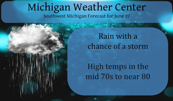
We have a chance of rain once again today though coverage won’t be quite as widespread as Saturday. The most likely time and place for showers and storms will be during the mid-late afternoon in areas south and east of Grand Rapids.
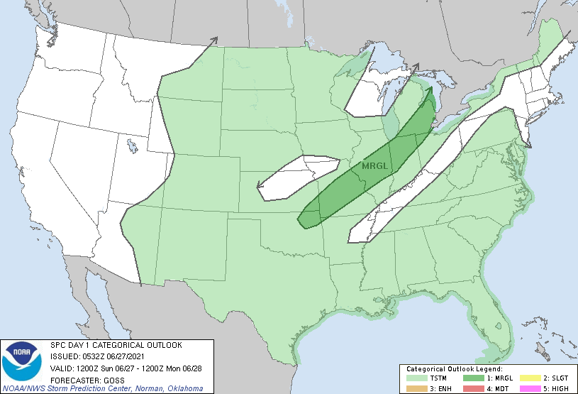
Scattered strong thunderstorms are possible Sunday afternoon and evening from the Ozark Plateau northeastward into portions of the Ohio Valley and Lower Michigan. Locally damaging winds are expected to be the primary threat.
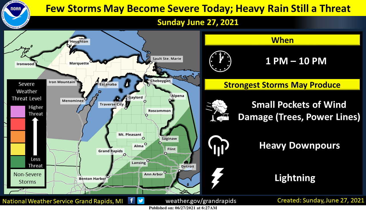
We are not expecting as much severe weather today, or even as many thunderstorms. There is however the risk a few storms could become severe this afternoon and evening, mainly south and east of a line from Benton Harbor to Saginaw. This is also where the best chance for storms will be today. The main threat from severe storms will be small pockets of damaging winds. Heavy downpours will accompany any thunderstorm and could worsen or prolong flooding.
Forecast Discussion
- Marginal risk for severe weather this afternoon

Deep layer bulk shear is shown to remain up around 40 knots. As
the instability builds during the day today...especially along and
east of a Lansing to Kalamazoo line...thunderstorms could develop.
With decent deep layer shear to work with...they could become
organized leading to a few severe cells. However the low level jet
is centered off to the east of the CWA and our area is generally
in the divergent part of that feature...so some uncertainty exists
as far as the coverage goes. Strong wind gusts are the main risk
with the storms.

Looking at Monday afternoon...a similar setup with decent deep
layer shear and building instability. PWAT values will be on the
climb once again. Thus we would not rule out a few stronger storms
then as well.


- Potential for more heavy rain especially Mon Aftn-Tue

The axis of highest PWAT air shifts slightly east of the CWA
today. However...well above normal values exist and any showers
could produce isolated heavy downpours. Overall though...it is
looking like today into tonight will generally be a break in the
soaking rains. However...looking at the Monday afternoon into
Tuesday period...that could change. The axis of high PWAT
air...around 2 inches...backs up into the CWA. At the same time a
mid to upper level wave will be lifting northeastward through the
Western Great Lakes region. Upper level diffluence increases over
the CWA. Meanwhile a low level jet of 20 to 30 knots builds just
upstream of the CWA Monday afternoon and crosses the area
Tuesday. Soundings look saturated so it will not take much forcing
to generate showers and thunderstorms with heavy rain. We will
feature high POPs for this period and mention the risks in the HWO
and social media. Too early to say with a lot of confidence how
much rain will fall...but a potential for locally excessive rain
appears to be coming together again.
It is a beautiful evening outside. The sun is out and a slight breeze helps with the humidity.
Grand river is on the rise …INDY
ADA – 2.4 inches for Saturday. Can’t remember the front yard going under water during our time here. Also, our tree trunks were “waterfalls” as the heavy rain overwhelmed runoff. A wet day. I still haven’t seen a legitimate lightning show this year 🙁
I’m looking forward to the official storm reports for 6/26/2021… seems there were also some storms in Allegan county with rotation, but perhaps only elevated rotation that didn’t make it to the ground. With all of the tornadoes that developed just to the east, it does make me wonder if some quick spinups were missed.
The storm that dropped the tornado in Bellevue and Eaton Rapids went directly overhead of the school we were in. It was exciting and scary. Some people went to the bathrooms and some went outside to watch. The sirens in Okemos went off for a hour. There were four storms in a row with tight rotation. I’ve never seen anything like it. So much flooding rain between Charlotte and the Lansing area. My dad’s rain gauge in Holt registered more than three inches yesterday.
I was watching the radar on here and honestly it kept me peaceful. All of my sons friends were hunkering in their basements and texting him while he was just studying for his summer class :). I was very confused to all the sirens because it wasn’t hardly raining when all the warnings were being blasted. My mom was freaked out and thanks to the radar… was trying to calm her down. The activity was NW of me near Charlotte, therefore just grateful nothing major hit. Many years ago there was a touchdown in Williamston and that cloud went directly… Read more »
The other big thing has been the horrendous humidity. Dew point hit 75 yesterday and that just feels downright terrible. The floors at work were treacherous all day to walk on being damp and wet and not drying out at all. Dew point this morning is still 71.
Put in an AC at work!
Lol….INDY
Sure. You going to donate the 30k I would need? Having been shut down 7 of the past 15 months doesn’t leave us with much extra cash.
Registered 2.21” of rain yesterday, however I think it is prob more than that. When it pours as hard as it did yesterday afternoon I think it overwhelms the catch basin and overflows. Can’t compare it to my standard gauge because that was smashed by a golf ball. Don’t ask. Anyways, at least 4 and a half inches for the past 3 days but I’m guessing more like 5 to 5 and a half.
Let it rain let it rain let it rain!! INDY
As MV stated there has been almost NO thunder with the rain event the last 3 days.
Slim
For the 2nd day in a row a new rain fall record was recorded at GRR 2.81″ yesterday and 2.17″ on Friday. The total for this rain event is now at 6.26″ For the month of June at Grand Rapids the official rain fall amount is now at 8.40″ That is good for the 2rd wettest June on record for Grand Rapids. At Lansing the total for June is now at 7.38″ Kalamazoo 9.74″ Holland 6.45″ Muskegon 6.89″ It was a another warm night here at my house the low was just 71 while the official low at the airport… Read more »