As has been noted for about the last two years Grand Rapids has seemed to be cooler compared to average in our area so, I went back to see just when that started. What I found is that yes Grand Rapids has been cooler compared to the averages at several other locations in west Michigan but that said Lansing has been warmer compared to average to other locations in west Michigan. Up to June 2021 the departures from average would vary with some months Grand Rapids have a warmer departure than Lansing and some months Lansing have a warmer departure than Grand Rapids. Then starting in June of 2021 the trend has held that Grand Rapids has been cooler compared to average than Lansing. But also starting in June 2021 Lansing the departure has became warmer. So compared to the 30 year period 1991 to 2020 Grand Rapids is more cooler compared to average. At Lansing they has became warmer compared to average in that 30 year time span. We will have to see if that continues in the months ahead. I don’t think it is bad equipment. But there is a chance that Lansing is getting warmer faster than Grand Rapids.
Looking outside it sure does not look or feel like a typical west Michigan January. But none the less it is January, and it is now time to look at some weather history for January. Typically, January is the coldest month of the year (that may or may not be the case this year) The average mean temperature at GR for January is 24.8° on average 2.52” of rain and melted snow fall and on average 22.6” of snow fall. The daily H/L starts out at 32.4/21.0 on the 1st it falls to 30.7/17.4 between the 21st and 25th and ends the month at 30.7/17.4 on the 31st
The top 5 warmest January’s to date are 1st . 1933 with a mean of 34.2. 2nd . 1933 with a mean of 34.0 3rd. 2006 with a mean of 33.2 4th. 1990 with a mean of 32.0 5th. 1906 with a mean of 31.6 in 6th place is 2006 with a mean of 31.3. The top 5 coldest are 1st 1912 with a mean of 11.8. 2nd 1918 with a mean of 12.5 3rd 1977 with a mean of 12.7 4th 1994 with a mean of 14.5 5th 1963 with a mean of 15.8 more recently 13th 2009 with a mean of 17.5 15th 2014 with a mean of 18.1.
Snow fall the top 5 least snowy January’s are 1st 1933 with 0.8” 2nd 1921 with 1.2” 3rd 1934 with 1.4” 4th 1932 with 3.2” 5th 1944 with 3.7” and more recent 7th 2001 with 4.1” Most snow fall in January are 1st 1999 with 46.8” 2nd 1997 with 45.5” 3rd 1979 with 45.3” 4th 1918 with 45.0” 5th 2004 with 44.2”
The least total precipitation are 1st 1956 with just 0.29” 2nd 1919 with 0.30” 3rd 1945 with 0.35” 4th 1902 with 0.40” and 5th 1981 with 0.47” The most are 1st 2005 with 4.67” 2nd 1895 with 4.42” 3rd 1975 with 4.36” 4th 2006 with4.30” and 5th 1993 with 4.21”.
The record high in January is 66 on January 25. 1950 The record low of -22 was set on January 30th 1951 and again on January 19, 1994. In January of 1912 the highest for the month was just 29 and in 1977 the highest for the month was 30.
Slim
AREA FORECAST DISCUSSION
NATIONAL WEATHER SERVICE GRAND RAPIDS MI
353 AM EST SAT JAN 7 2023
LATEST UPDATE…
DISCUSSION/MARINE
DISCUSSION
(TODAY THROUGH NEXT FRIDAY)
ISSUED AT 353 AM EST SAT JAN 7 2023
— QUIET AND MILD THROUGH WEDNESDAY —
THE PERSISTENT UPPER LOW/TROUGH THAT HAS PLAGUED THE AREA FOR MOST
OF THIS PAST WEEK WILL FINALLY EXIT THE STATE TODAY. BEFORE IT DOES
SO HOWEVER, WE WILL CONTINUE TO SEE SOME PATCHES OF LIGHT SNOW
AND/OR DRIZZLE/FREEZING DRIZZLE EARLY THIS MORNING. WE WILL SEE HIGH
PRESSURE BUILD IN WITH PLENTY OF SUBSIDENCE ENDING THE PCPN.
UNFORTUNATELY FOR THOSE WANTING TO SEE SUNSHINE, SOME MOISTURE MAY
GET TRAPPED UNDERNEATH THE BUILDING INVERSION AND KEEP MORE CLOUDS
THAN SUNSHINE FOR TODAY WITH THE WEAK JANUARY SUN ANGLE. THERE IS
SOME HOPE LATE IN THE DAY BEFORE SUNSET THAT BETTER BREAKS IN THE
CLOUDS MAY OPEN UP.
THERE IS NOT REALLY MUCH WEATHER TO SPEAK OF THROUGH WEDNESDAY OF
THIS COMING WEEK. WE WILL BE IN BETWEEN THE TWO BRANCHES OF THE JET
STREAM THROUGH THE WEEK, WITH LITTLE TO NO MOISTURE WITH THE GULF
SHUT OFF FROM THE AREA FOR THAT TIME FRAME.
THE LAST COUPLE OF DAYS THERE WERE INDICATIONS THAT A MID LEVEL LOW
OVER NE THIS MORNING WOULD CLIP THE SOUTHERN PORTION OF THE STATE
WITH SOME LIGHT PRECIPITATION ON SUNDAY. THE LATEST TREND FOR THIS
SYSTEM AND ITS MOISTURE IS TO STAY SOUTH OF THE STATE, WITH JUST
SOME WEAK TROUGHING MOVING ACROSS THE STATE. HIGH PRESSURE WILL
RETURN FOR MONDAY.
THERE WILL BE A REPLAY ON TUESDAY OF THIS SUNDAY SCENARIO. LEE SIDE
TROUGHING WILL MOVE OUT OF THE PLAINS, AND LOOK TO MOVE ALONG THE
OHIO RIVER VALLEY. THIS SYSTEM WILL BE MORE OF AN OPEN WAVE MUCH OF
ITS LIFE, AS COMPARED TO THE SUNDAY LOW. ALSO, THERE LOOKS TO BE
MUCH LESS MOISTURE AVAILABLE WITH THIS SYSTEM AS THE GULF WILL BE
CUT OFF FROM IT. THE BOTTOM LINE FOR LOWER MICHIGAN IS WE SHOULD
STAY DRY AND MILD FOR TUESDAY, BEFORE FLAT RIDGING BUILDS IN FOR
WEDNESDAY.
— WET SYSTEM THU-FRI THEN COOLER WITH SOME SNOW CHANCES —
THE MODELS AND ENSEMBLE MEANS ARE IN GOOD GENERAL AGREEMENT IN
BRINGING ONE OF THE STRONGER WET SYSTEMS FROM THE PACIFIC ACROSS THE
SOUTHERN ROCKIES AND PLAINS FROM TUESDAY INTO WEDNESDAY. THEY ARE
ALSO IN GOOD AGREEMENT IN KEEPING THE AREA ON THE WARM SIDE OF THE
SYSTEM UNTIL LATER ON FRIDAY.
MOSTLY RAIN SHOULD MOVE OVER THE AREA SOMETIME IN THE WEDNESDAY
NIGHT/THURSDAY TIME FRAME. AS MENTIONED BEFORE, THIS SHOULD BE
MOSTLY RAIN. IT CAN NOT BE RULED OUT THAT IF JUST ENOUGH COLD AIR
HANGS ON AT THE ONSET AT NIGHT UP NORTH, THAT SOME FREEZING RAIN
COULD BE POSSIBLE. THAT IS TOO FINE OF A DETAIL TO PIN DOWN THIS FAR
OUT FROM THE EVENT. BUT, IT IS SOMETHING WORTH KEEPING AN EYE ON FOR
POTENTIAL IMPACTS.
THE EVOLUTION OF THE EXACT TRACK OF THE SYSTEM, AND PRECIPITATION
TYPES AND CHANGEOVER IS VERY MUCH IN FLUX AT THIS TIME. THIS BIGGER
SOUTHERN STREAM SYSTEM COULD BE INTERACTING WITH A NORTHERN STREAM
SYSTEM THAT IS SHOWN TO BE TRYING TO DIVE INTO THE COUNTRY FROM
CANADA. IT DOES SEEM THAT SOME COOLER AIR WITH SOME POSSIBLE SNOW AS
THE SYSTEM MOVES OUT IS VERY POSSIBLE.
MIZ057-072115-
KENT-
INCLUDING THE CITY OF GRAND RAPIDS
350 AM EST SAT JAN 7 2023
TODAY
MOSTLY CLOUDY. HIGHS IN THE MID 30S. LIGHT WINDS.
TONIGHT
PARTLY CLOUDY. LOWS IN THE LOWER 20S. LIGHT WINDS.
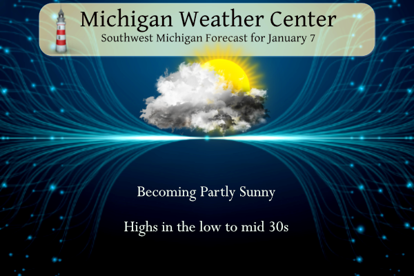
SUNDAY
PARTLY SUNNY. HIGHS IN THE MID 30S. LIGHT WINDS.
SUNDAY NIGHT
PARTLY CLOUDY. LOWS IN THE MID 20S. WEST WINDS 5 TO
10 MPH.
MONDAY
MOSTLY SUNNY UNTIL MIDDAY THEN BECOMING PARTLY SUNNY.
HIGHS IN THE UPPER 30S. WEST WINDS 5 TO 15 MPH WITH GUSTS TO AROUND
25 MPH.
MONDAY NIGHT
PARTLY CLOUDY IN THE EVENING THEN BECOMING MOSTLY
CLOUDY. LOWS IN THE UPPER 20S.
TUESDAY
MOSTLY CLOUDY. HIGHS IN THE UPPER 30S.
TUESDAY NIGHT
MOSTLY CLOUDY. LOWS AROUND 30.
WEDNESDAY
MOSTLY CLOUDY. HIGHS IN THE UPPER 30S.
WEDNESDAY NIGHT
MOSTLY CLOUDY. LOWS AROUND 30.
THURSDAY
CLOUDY WITH A 40 PERCENT CHANCE OF RAIN SHOWERS,
POSSIBLY MIXED WITH SNOW SHOWERS. HIGHS IN THE UPPER 30S.
THURSDAY NIGHT
CLOUDY WITH A 50 PERCENT CHANCE OF RAIN AND SNOW
SHOWERS. LOWS AROUND 30.
FRIDAY
MOSTLY CLOUDY WITH A CHANCE OF SNOW SHOWERS, POSSIBLY
MIXED WITH RAIN SHOWERS. HIGHS IN THE MID 30S. CHANCE OF
PRECIPITATION 40 PERCENT.
I am currently in Rochester Hills and we are getting intervals of sunshine. Nice treat.
Here is a quick theory why Grand Rapids has been warming more slowly than Muskegon or Lansing: The distance each of these cities are from Lake Michigan makes a big difference. Over the past decade Lake Michigan has been warming. Additionally, areas away from Lake Michigan not under the influence (to a degree) of its microclimate have been warming. Muskegon falls into the first category. Lansing falls into the second category. Grand Rapids falls in between. Muskegon is right next to Lake Michigan and sees more warmer days in the winter than Grand Rapids due to the warm lake (which… Read more »
I doubt the equipment is faulty. So that leaves other options: 1. microclimate (as you stated), 2. Historical average is wrong due to bad equipment (unlikely), or 3. Reading locations or conditions changed. In terms of microclimate, it could have also been a persistent weather pattern change, something like wind off of Lake Michigan, cloud cover, etc.
Appreciate your insight, Nathan. I have no idea, honestly.
As per usual this winter to date, what little snow fell is gone.
Go Green!
20 months in a row that GR temps are suddenly much colder than average? I doubt that could be spelled by long term micro climate changes.
The temp has been hovering near freezing since last night. We received a dusting last night. The roofs and greens on the course are white.
Kind of a bummer there isn’t as much sun as expected, but it is going to be a high of 35, which I certainly won’t complain about for mid-January
What do you know, even with the incessant warm weather rants, GR picked up .6 inches of snow yesterday! The totals keep going up and up and up! Wow, just wow!
Now they are pulling most of the sun out of today’s forecast… typical. Why don’t they just say, “we may see some peeks of sun on Saturday” , instead of the “mostly sunny” that they had predicted for the last few days for today.
Good morning! Our mild mostly snowless start to January continues. The official H/L at Grand Rapids yesterday was 35/31 there was a total of 0.14” of rain and melted snow. 0.6” of snow fall was officially reported. There were some cars with snow on them last night not sure where they were with that snow fell onto the cars. Here in MBY there was a trace of snow on the ground for the 2nd night in a row. There was no sunshine officially yesterday but once again there was a few minutes of thin clouds here that the sun could… Read more »
There was a VERY narrow band that set up from Grand Haven to just south of downtown GR around 28th street to over the airport and southeast from there. A special weather statement was issued for it and it did cause slower traffic in the narrow band that was probably only a few miles wide.
Thanks for that information. I did see the special weather statement and there were cars with snow on them downtown last night but only a trace on the ground here at my house.
Slim
Yup that band passed by my house last night. Everything is coated in a thin layer of snow/ice. Seems more like ice to me
Breaking news>>>>GR has been cooler than average, so get used to it! Facts are facts!
Rocky, GR has been above average now for 10 days in a row. Not sure what the rest of the month will bring but at least the next week will continue to be above average as well2
Slim
I am referring to last year!!!!!
Last year GR had 6 months above, 5 below, and 1 at average. 6 months is more than 5.
Last year Grand Rapids was -0.6F below average, -1.67″ below average in precip, and +41.2″ in snowfall. I don’t get why there is so much discussion about this, these are the facts by the NWS. Regardless, most of the county and world are trending warmer. We just focus on this one specific city which exists in a microclimate by Lake Michigan.
Rock on Nathan and yes you confirmed my statement of FACT! GR was below normal for temps last year!! Facts are Facts!