After the wet gloomy days we have had the sun will be a welcome change as the clouds begin to break up later today. Along with the sunshine we will begin a warming trend with perhaps 70° by next weekend. We have a better than 60% chance of above-normal temps over the next couple weeks and near 50/50 chance of below-normal precip. Normal temps for this period are in the low to mid-60s.
Michigan Forecast
[columns] [span6]
SW
[/span6][span6]
SE
[/span6][/columns]
[columns] [span6]
North
[/span6][span6]
U.P.
[/span6][/columns]
Your Local Forecast
Forecast Discussion
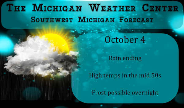
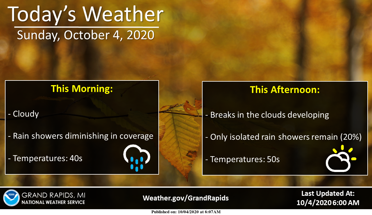
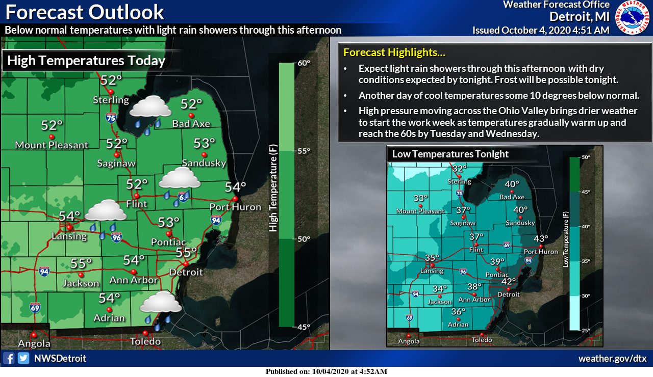
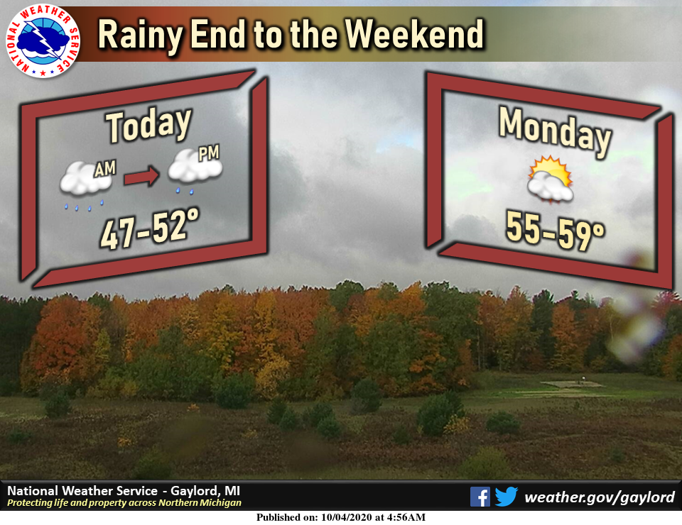
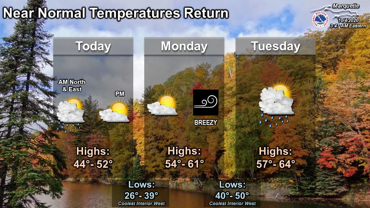
-- Rain ending today, then clearing and cold tonight --

Radar shows an increasing area of light rain showers covering much of
Lower Michigan early this morning. This rain extends southwest to
near St Louis. A deep upper trough is moving across the Great Lakes
and it`s axis will pass across the cwa during the early afternoon.
We`ll see the rain diminish as the trough moves east and skies will
eventually clear late in the day. As high pressure builds in tonight
and winds become light, radiational cooling will help temperatures
fall into the lower to mid 30s by Monday morning. We issued a Freeze
Warning for Newaygo, Mecosta, Isabella and a Frost Advisory south of
there tonight.

Wind will kick back up Monday ahead of the next cold front that will
move through Tuesday night. There won`t be much cold air behind it
though as it will be pushed off to the northeast.

-- Warming trend this week --

High temperatures will climb into the mid 60s Tuesday and Wednesday
and climb into the lower 70s by next weekend as upper ridging moves
over the Great Lakes. After the frontal boundary moves through
Tuesday night, the rest of the week will be mostly dry.
Just heard a “squadron” of Sand Hill Cranes fly over head…time to get “outta here” 🙁