
As the title of the post suggests the end of our warm weather pattern is about to fade away into a cooler more Autumn like pattern. As we get into the first week of October temperature norms would be in the mid-60s for SW Michigan. Looking at long ranges guesses we may be looking at the mid-50s for next week with shots of lake effect rain in the forecast.
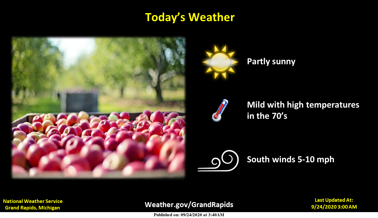
Before we get ahead of ourselves I would suggest we all enjoy the next few days of sunshine and warm temps – we may see another run at 80° tomorrow and Saturday. As far as chances of showers the NWS now has a 40% chance on Saturday night and partly sunny for Sunday. As we all now forecasts change daily so stay tuned.
Forecast
[columns] [span6]
SW
[/span6][span6]
SE
[/span6][/columns]
[columns] [span6]

North
[/span6][span6]
U.P.
[/span6][/columns]
Forecast Discussion
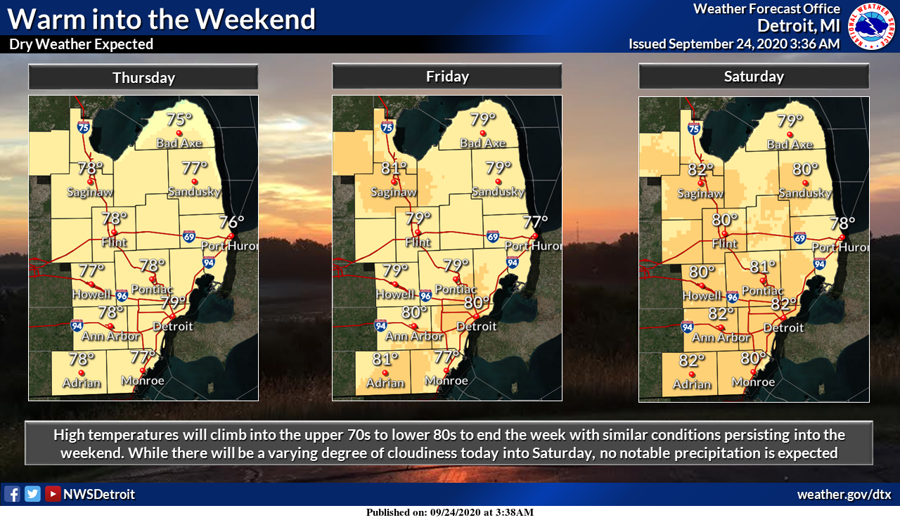
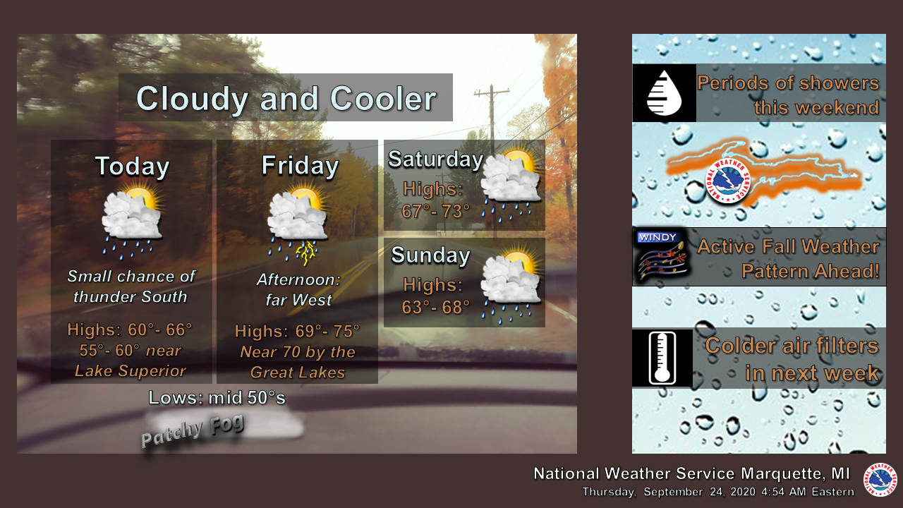
- Warm and mostly dry through Friday evening -

Fair and mild wx will continue across the vast majority
of our fcst area today. However an isolated shower may clip
our far northern fcst area this afternoon and evening in
closer proximity to stalled out frontal boundary across
northern lower Michigan.

It will be very mild Friday with partly sunny skies and
high temperatures reaching into the upper 70s to lower 80s
across most of our area.

- Warm Saturday and a few showers Sunday -

High temps will easily reach the lower 80s across most of
our fcst area Saturday due to quite a bit of sun and strong
sw flow warm air advection. A shower or storm may develop by
late Saturday afternoon mainly over our far nw fcst area, but
the upper level pattern and dynamics favor areas north of
our area for showers and storms through Saturday night.

A cold front will bring scattered showers Sunday, but
overall precipitation chances through the weekend do not
look that great with the relatively best chance for some
showers coming Sunday morning and afternoon.

- Much cooler with showers next week -

Much cooler air will move into our area by Tuesday and Wednesday
as an upper level trough amplifies over the Great Lakes region.
Lake induced instability with h8 temps falling to 2 to 4 C by
Wednesday will also support potential for lake effect rain
showers.

It is noted that overall medium range guidance trends the
past 24 hours are delaying timing of the arrival of the coolest
air. H8 temps off the 00Z deterministic ECMWF do not look as
cold as a consensus of previous latest medium range guidance
suggested, but the 00Z deterministic GFS still looks colder
by midweek.
The sun was hot yesterday. I had to again close up the windows and turn on the A/C. That doesn’t happen very often this late in the year. This week has been a microcosm of our summer – above average temps, below average precipitation, and lots and lots of sunshine.
Not to often you see people at the beach swimming in the last week of September, but today there’s been people out in the water all day.
https://cityofholland.com/645/MIHollandCAM
Just checking the Fall colors most of the upper peninsula is at peak from about Baldwin north to the bridge moderate and in our area patchy very early colors this this Fall my little color tour north on the 11th of October maybe not so good now ……INDY
Such a beautiful Indian summer week we are having nothing hot just warm and lots of sunshine best in a few years that I can remember….I have gotten a lot of stuff done around the house thank you Mother nature! INDY
No AC in use here at my house. I take advantage of all the don’t have to days I can. If you leave the windows open at night and then close them in the morning that should keep the house cool for most if not all the day. But even then with reading outside in the mid to upper 70’s that is not too bad. At this time it is 78 outside and 72 here in the house.
Slim
Very dry in our area. I think I’ve only mowed twice in the past 6 weeks, nothing is really growing. I have noticed trees dropping leaves that haven’t even changed, they’re still greenish. That’s what happens when it’s exceptionally dry for a long period. And as Mark said, AC is still running as we head into October.
I have noticed some leaves dropping but they seem to have some color in them. I would guess it all depends on the tree. There is some nice color on some Maple trees and a lot of yellow on the Ash trees. You know other trees I am not sure what kind they are.
Slim
The post title is so apocalyptic. Considering how insane our country/world is right now, I wasn’t exactly sure what to think when I first saw it.
I know this happens each year. But in my walks and drives around the area it looks like in the last week a lot of the trees have now started to change. That may be due to the sunny dry days we have had. At this time it is clear and 58 here at my house.
Slim
The trees have changed dramatically in the past week in these parts too.
Looking ahead possibility of highs in the 40’s and lake effect rain showers I’m so glad I took advantage of our Indian summer this week to get my house prepared for the Winter happy guy right here let it snow let it snow let it snow ….INDY
Now the last time Grand Rapids had a high in the 40’s in the first week of October was on October 4th 2014. With a high that day of 47.
Slim
Slim wow that’s a long time ago just goes to show you that we are having a colder Fall then normal around west Michigan sofar …INDY ..
Hit 79 degrees yesterday! Not bad for almost October in Michigan.
The mean last 80° day at Grand Rapids is September 30th. If Grand Rapids reaches 80 anytime in the next 3 days that is not all that unusual. If there is a warm up in mid October we still could reach 80 or better once again. But after the first week in October it is more unusual. As for 75 that mean last day for that is October 13.
Slim
Even better is a whole week near 80 degrees! Average high is only 70 now and dropping. My pool is still open 🙂
I needed to close the windows yesterday and turn on the A/C. It got hot inside.