
After an active hurricane season in the Atlantic over the past couple weeks things have calmed down. The remnants of Beta continue to soak the southeast the rest of the Atlantic is quiet with no tropical storms. Tropical storm Lowell is meandering in the eastern Pacific and is expected to weaken.
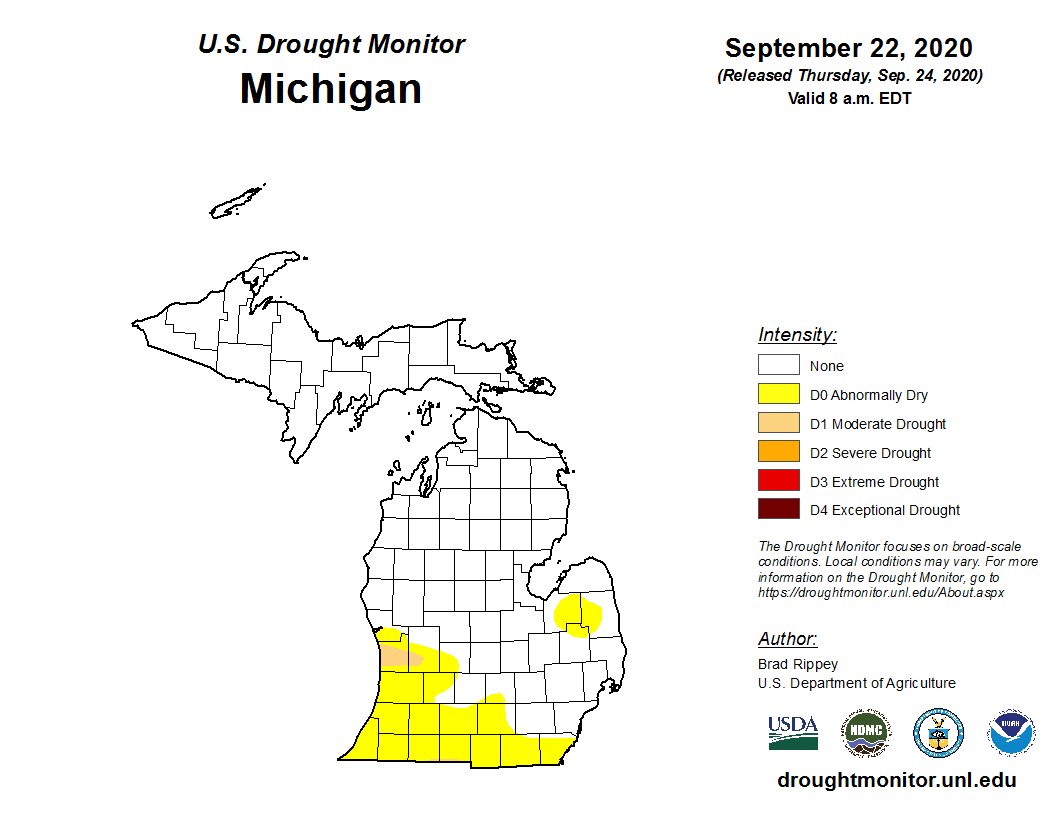
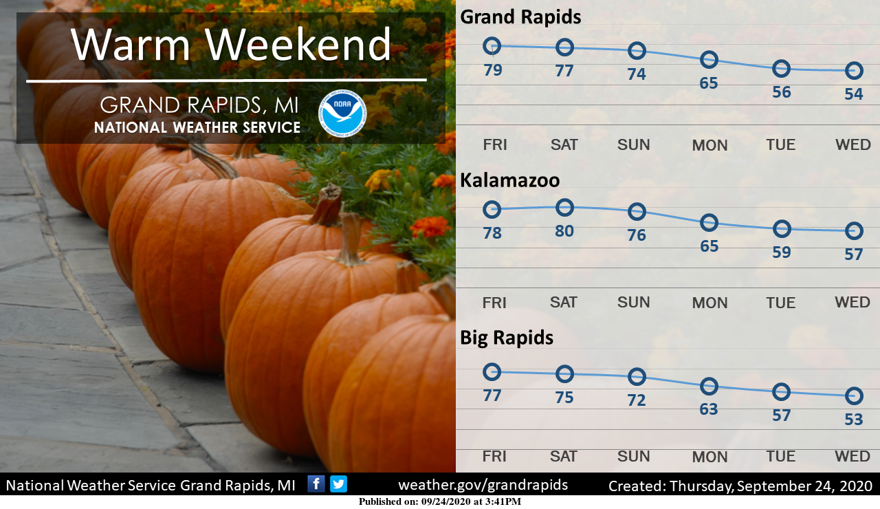
For us here in SW Michigan we will continue with our warm sunny pattern right on through most of the weekend with our first chance of rain coming late Sunday. We are getting dry once again – here in Otsego our last rain was on the 13th. The driest is through Ottawa County into Kent:
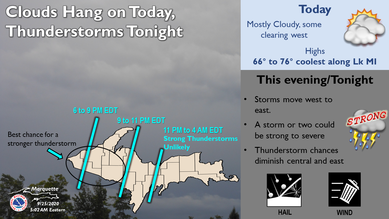
Forecast
[columns] [span6]
SW
[/span6][span6]
SE
[/span6][/columns]
[columns] [span6]
North
[/span6][span6]
U.P.
[/span6][/columns]
Forecast Discussion
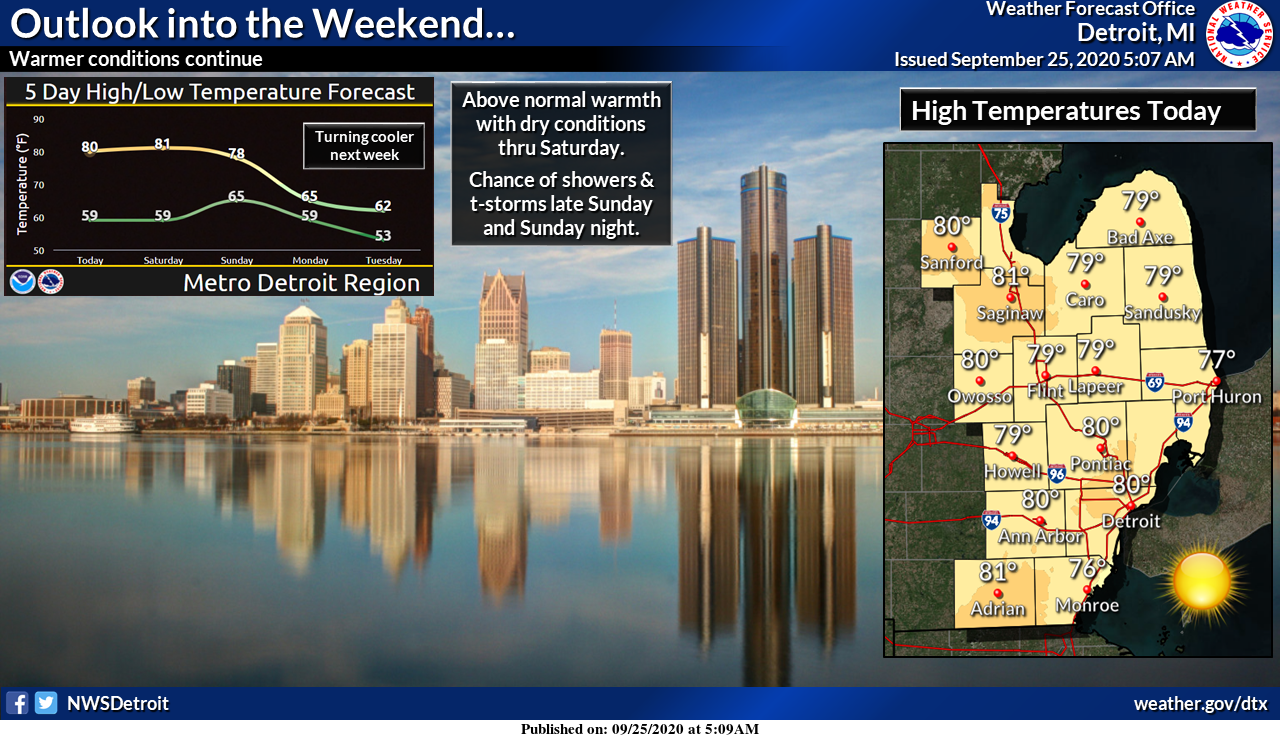
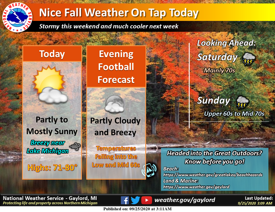
-- Remaining mostly dry and mild through Sunday --

The trend for the cold front moving in, and the associated chances
of rain have continued to be delayed until late this coming weekend,
and more toward early next week.

The delay is due to development of the long wave upper low taking a
little longer to become established. A couple of the lead short
waves stay north and west of the area, taking the best forcing north
and west of the area also. That leaves the area under a dry and warm
air mass for people to enjoy much of the weekend. We do have some
small rain chances up north on Saturday. We do not expect much, if
anything to occur as the bulk of the rain will be across the Tip of
the Mitt and the U.P..

The front will push over the area on Sunday, however the lingering
dry air mass, and the upper forcing with the developing upper low
staying west, will keep the first half of Sunday dry. Slowly, but
surely, the upper jet, and its associated forcing will inch closer
toward the area later Sunday, increasing the chance for rain. With
this occuring during the warmest part of the day, we do have
sufficient instability to justify a chance of thunder.

-- Best chance for rain Monday Night/Tuesday --

The front will be holding over the area Sunday night into Monday,
keeping a chance of rain showers over the area. The front holds up
as the upper low takes shape, and waves of low pressure start to
ride NE along the front.

The best chance of rain now looks to come in Monday night and early
Tuesday. This is when the area is under the best upper divergence
ahead of the upper low, and best moisture transport takes place
ahead of the associated surface low riding NE along the front. The
trough axis is expected to move east of the area Tuesday afternoon,
which should diminish the rain shower activity temporarily.

-- Much cooler with occasional chances for rain beyond Tuesday --

It looks like we will likely have a break in rain later Tuesday and
into much of Wednesday. The upper jet does not really dive south of
the area through this time frame. We will likely be in between lows,
which will bring cooler, and some drier air in.

The coldest air with this pattern looks to potentially come in for
Thursday and beyond. The lower heights will remain in place for most
of the eastern portion of the country. Another strong jet max/short
wave will dive down, and could take the upper jet core south of the
area. This would bring the core of the colder air overhead, which
would cause some possible lake effect rain showers near the lake,
and instability showers over the land areas. Highs late in the week
may struggle to rise out of the 50s.
Get ready – major cool down is on the way! Rock n roll baby!
Yawn…
Today looks to be another fantastic late September day. I know it has been getting a little dry but hey the days are warm the nights are cool who could ask for anything more? The low here at my house was 53 and at this time it is clear and 55.
Slim
I’m hitting th road taking a country ride to Lakeview Michigan today I definitely will be checking out the colors boy ohh boy they are popping everywhere love it …..Have a super Friday …FALL INDY
You are so right. It’s been so dry that the leaves are changing much earlier than usual. The change in the past week is remarkable.
Cold front keeps getting pushed back. Looks like at least 3 more summer days around 80 degrees. I love it!
Like the map above shows, moderate drought conditions in our area. I would hate to see a fire get out of control around here as everything is crispy and would spread rapidly. Between all the sun and now the heat again it’s only getting worse. Put those sweaty hoodies away for awhile again.
While it has been dry this past few weeks it has been nothing compared to 1979 when only a trace of rain fell in the whole month of September. Or just back in 2017 when just 0.66″ fell.
Slim
It is hard to gauge how much rain has fallen in any one area. The totals at the airport are greatly different from areas just 20 or 30 miles away. I know a few weeks ago we were surrounded by rain in every direction, but in our area very little fell. I’ll have to go back on my PWS and add up the totals for the past couple months.